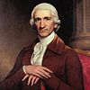
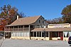
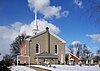
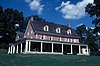
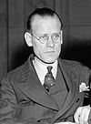
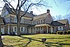
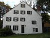
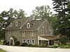
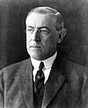
Marker title Image Date dedicated Location Marker type Topics Abington Presbyterian Church May 24, 1992 Old York & Susquehanna Sts., Abington 40°06′51″N 75°07′19″W / 40.11418°N 75.1219°W / 40.11418; -75.1219 (Abington Presbyterian Church ) City Religion Ashbridge Memorial Park 1700's Near Shipley Roadside Civil War, Rebecca Emily Augustus Lutheran Church September 3, 1947 Main St. (old U.S. 422) in Trappe 40°12′04″N 75°28′52″W / 40.20115°N 75.4812°W / 40.20115; -75.4812 (Augustus Lutheran Church ) Roadside Religion Baldwin School April 11, 2000 701 Montgomery Ave., Bryn Mawr Roadside Buildings, Education, Railroads Bert Bell November 22, 1997 224-226 Haverford Ave., Narberth 40°00′19″N 75°15′40″W / 40.00537°N 75.26103°W / 40.00537; -75.26103 (Bert Bell ) City Football, Sports Beth Sholom Synagogue September 21, 2008 8231 Old York Rd., Elkins Park 40°04′54″N 75°07′36″W / 40.0818°N 75.1268°W / 40.0818; -75.1268 (Beth Sholom Synagogue ) City Buildings, Religion Betzwood Motion Picture Studio June 3, 2003 Near Route 363 and Route 422 expressway, Norristown City Business & Industry, Invention, Motion Pictures & Television Bryn Athyn Cathedral September 10, 1947 Pa. 232 in Bryn Athyn at Cathedral Roadside Religion Bryn Mawr Summer School for Women Workers in Industry October 13, 2001 Bryn Mawr Campus, Corner of Morris Road and Yarrow Streets 40°01′27″N 75°18′50″W / 40.0241°N 75.31388°W / 40.0241; -75.31388 (Bryn Mawr Summer School for Women Workers in Industry ) Roadside African American, Civil Rights, Education, Ethnic & Immigration, Labor, Women Camp William Penn May 15, 1999 7322 Sycamore Ave., LaMott 40°03′59″N 75°08′32″W / 40.06635°N 75.1423°W / 40.06635; -75.1423 (Camp William Penn ) Roadside African American, Civil War, Military Charles Thomson September 10, 1947 SR 3034 (Morris Ave. at Harriton Rd.), NE, of Bryn Mawr (Missing) Roadside Ethnic & Immigration, Government & Politics, Government & Politics 18th Century Crooked Billet May 1, 1965 Meadowbrook Ave. at Crooked Billet Elem. School in Hatboro Roadside American Revolution, Military, Inns & Taverns Cyrus H. K. Curtis (1850-1933) November 7, 2005 1250 W Church Rd., Wyncote (SR73) 40°05′13″N 75°08′58″W / 40.08693°N 75.14942°W / 40.08693; -75.14942 (Cyrus H. K. Curtis ) Roadside Entrepreneurs, Environment, Publishing Early Grist Mill May 2, 1955 Pa. 320 at Gulph Mills (Missing) City Buildings, Business & Industry, Mills Early Tavern September 14, 1972 General Wayne Inn, 625 Montgomery Ave., Narberth Roadside Business & Industry, George Washington, Inns & Taverns, William Penn Edward Hector September 19, 1967 Intersection SR 3016 & 3013 (Fayette & Hector Sts.), Conshohocken 40°04′24″N 75°18′24″W / 40.07328°N 75.30668°W / 40.07328; -75.30668 (Edward Hector ) Roadside African American, American Revolution, Military Falkner Swamp Reformed Church October 9, 1960 Swamp Pike (county highway, Limerick to Gilbertsville), .5 mile SE of New Hanover 40°17′46″N 75°34′48″W / 40.2961°N 75.58013°W / 40.2961; -75.58013 (Falkner Swamp Reformed Church ) Roadside Buildings, Ethnic & Immigration, Religion First Iron Bridge May 21, 1953 SE corner, High & York Sts., Pottstown 40°14′45″N 75°39′09″W / 40.24588°N 75.65263°W / 40.24588; -75.65263 (First Iron Bridge ) City Bridges, Iron, Railroads, Transportation Frank N.D. Buchman October 19, 1991 772 Main St. (Pa. 29), Pennsburg Roadside Professions & Vocations, Religion Frederick A. C. Muhlenberg (1750-1801) April 12, 2008 151 W Main St., Trappe Roadside Government & Politics, Government & Politics 18th Century, Religion Gen. Andrew Porter March 11, 1949 W. Main & Selma Sts., Norristown 40°07′21″N 75°21′38″W / 40.12258°N 75.36063°W / 40.12258; -75.36063 (Gen. Andrew Porter ) Roadside American Revolution, Military Graeme Park n/a At site, SR 2038 (County Line Road), 1 mile NW of Pa. 611, Hatboro (Missing) Roadside Environment, Government & Politics 18th Century Gulph Mills Encampment May 2, 1955 Pa. 320 near intersection SR 3030 at Gulph Mills (Missing) City American Revolution, Military Gulph Mills Village November 9, 1982 Intersection Pa. 320 & SR 3039 (Gulph Rd.), Gulph Mills 40°03′47″N 75°20′29″W / 40.06293°N 75.34125°W / 40.06293; -75.34125 (Gulph Mills Village ) City Buildings, Houses & Homesteads, Inns & Taverns Harold F. Pitcairn April 29, 1972 Buck & Paper Mill Rds., Bryn Athyn 40°07′55″N 75°03′30″W / 40.132°N 75.05835°W / 40.132; -75.05835 (Harold F. Pitcairn ) Roadside Invention, Medicine & Science, Professions & Vocations, Transportation Harriton June 12, 1963 SR 3034 (Morris Ave. at Harriton Rd.), NE of Bryn Mawr City Government & Politics, Government & Politics 18th Century, Houses & Homesteads Hope Lodge February 16, 1966 At site, Old Bethlehem Pike (SR 2018), Fort Washington 40°07′30″N 75°13′03″W / 40.12495°N 75.21753°W / 40.12495; -75.21753 (Hope Lodge ) Roadside Buildings, Houses & Homesteads James A. Bland September 26, 1961 Pa. 23 (Conshohocken State Rd.), Bala Cynwyd City African American, Music & Theater, Performers John Dickinson September 23, 2001 Montgomery Avenue & Meetinghouse Lane, Merion (MISSING) Roadside American Revolution, Government & Politics 18th Century, Military John F. Hartranft May 6, 1947 Sanatoga Rd., SW of Fagleysville 40°16′17″N 75°34′24″W / 40.27137°N 75.57325°W / 40.27137; -75.57325 (John F. Hartranft ) Roadside Civil War, Government & Politics, Government & Politics 19th Century, Governors, Military John F. Hartranft September 4, 1947 SR 4031 (High St., old U.S. 422), Sanatoga (Missing) Roadside Civil War, Government & Politics, Government & Politics 19th Century, Governors, Military Keith House 1947 At Graeme Park, County Line Rd., 1 mile NW of Pa. 611, Hatboro 40°13′07″N 75°09′02″W / 40.21854°N 75.15049°W / 40.21854; -75.15049 (Keith House ) Roadside Government & Politics, Government & Politics 18th Century, Houses & Homesteads Lafayette October 7, 1980 801 Ridge Pike, Barren Hill, E of Conshohocken 40°46′56″N 75°14′59″W / 40.7823°N 75.24968°W / 40.7823; -75.24968 (Lafayette ) Roadside American Revolution, Military Lucretia C. Mott May 1, 1974 Pa. 611 N of Cheltenham Ave., Elkins Park 40°03′52″N 75°08′08″W / 40.06442°N 75.13548°W / 40.06442; -75.13548 (Lucretia C. Mott ) Roadside Civil Rights, Government & Politics, Government & Politics 19th Century, Religion, Underground Railroad, Women Merion Friends Meeting September 15, 1967 651 Montgomery Ave., Narberth 40°00′33″N 75°15′15″W / 40.0093°N 75.25418°W / 40.0093; -75.25418 (Merion Friends Meeting ) City Buildings, Ethnic & Immigration, Religion, William Penn Mill Grove October 9, 1970 Entrance to Audubon Wildlife Sanctuary, Audubon & Pawlings Rds. (SR 4041 & 4004), Audubon 40°07′24″N 75°26′13″W / 40.12337°N 75.43708°W / 40.12337; -75.43708 (Mill Grove ) Roadside Artists, Buildings, Environment, Mansions & Manors, Writers Muhlenberg Home October 3, 1963 E. 7th Ave., .3 mile from Main St. (old U.S. 422), Trappe (Missing) 40°11′47″N 75°28′12″W / 40.1963°N 75.46987°W / 40.1963; -75.46987 (Muhlenberg Home ) Roadside Education, Government & Politics, Government & Politics 18th Century Muhlenberg House April 28, 1960 201 Main St. (old U.S. 422), Trappe City American Revolution, Religion New Goschenhoppen Reformed Church August 26, 1952 SR 1042 (Church Rd.), W of East Greenville Roadside Buildings, Religion New Hanover Lutheran Church September 8, 1950 Swamp Pike (county highway), at Lutheran Rd., near Gilbertsville Golf Course, .2 mile SE of New Hanover 40°17′53″N 75°34′54″W / 40.29793°N 75.58173°W / 40.29793; -75.58173 (New Hanover Lutheran Church ) Roadside Buildings, Ethnic & Immigration, Religion Pennsylvania School of Horticulture for Women, The September 20, 2002 580 Meetinghouse Road, Ambler Roadside Agriculture, Education, Military, Women Pennypacker's Mill & Mansion September 24, 1946 At site, Skippack Pike (PA 73) and Haldeman Rd., Schwenksville 40°15′10″N 75°27′31″W / 40.25267°N 75.45862°W / 40.25267; -75.45862 (Pennypacker's Mill & Mansion ) Roadside George Washington, Government & Politics, Government & Politics 18th Century, Governors Perkiomen Bridge September 4, 1947 E Main St. / Ridge Pike (SR 4031 / old U.S. 422) at bridge, E end of Collegeville 40°11′03″N 75°26′50″W / 40.18428°N 75.44717°W / 40.18428; -75.44717 (Perkiomen Bridge ) Roadside Bridges, Transportation Philo T. Farnsworth (1906-1971) September 15, 2006 1260 E Mermaid Lane, Wyndmoor 40°04′59″N 75°10′55″W / 40.08318°N 75.18202°W / 40.08318; -75.18202 (Philo T. Farnsworth ) City Business & Industry, Invention Plymouth Friends Meetinghouse May 15, 1955 Germantown Pike (old U.S. 422) & Butler Pike at Plymouth Meeting 40°06′10″N 75°16′44″W / 40.10272°N 75.27882°W / 40.10272; -75.27882 (Plymouth Friends Meetinghouse ) Roadside African American, American Revolution, Buildings, George Washington, Religion Porter Home September 3, 1947 U.S. 422 at Norristown (Missing) Roadside American Revolution, Government & Politics 19th Century, Military Pottsgrove Manor September 25, 2000 At site, 100 W. King St., Pottstown 40°14′52″N 75°39′36″W / 40.24788°N 75.65995°W / 40.24788; -75.65995 (Pottsgrove Manor ) Roadside Buildings, Business & Industry, Iron, Mansions & Manors Rittenhouse Farm September 3, 1947 Pa. 363 E of Eagleville, intersection SR 3009 (Ridge Pike) & 3002 (Trooper Rd.), Norristown 40°08′31″N 75°23′21″W / 40.14187°N 75.38915°W / 40.14187; -75.38915 (Rittenhouse Farm ) Roadside Medicine & Science, Professions & Vocations Rittenhouse Farm March 14, 1949 Germantown Pike (former U.S. 422) at Valley Forge Medical Ctr., 6 miles SE of Collegeville (Missing) Roadside Medicine & Science, Professions & Vocations Selma March 15, 1949 1301 W. Airy St., Norristown 40°07′24″N 75°21′36″W / 40.12328°N 75.36°W / 40.12328; -75.36 (Selma ) Roadside American Revolution, Military St. Paul's Episcopal Church October 1, 1992 Old York Rd. (PA 611) at Asbourne Rd., Elkins Park 40°04′17″N 75°08′00″W / 40.07148°N 75.13347°W / 40.07148; -75.13347 (St. Paul's Episcopal Church ) Roadside Buildings, Civil War, Religion St. Peter's Church November 9, 1963 Church Rd., off Germantown Pike (old U.S. 422) 5 miles E of Norristown 40°04′58″N 75°15′03″W / 40.08287°N 75.25095°W / 40.08287; -75.25095 (St. Peter's Church ) Roadside American Revolution, Buildings, Religion Thomas Rowland & Sons Shovel Works October 21, 2006 300 Ashbourne Rd., Cheltenham Roadside Business & Industry, Mills Timothy Matlack June 4, 1969 Pawlings Rd. (SR 4004) near Audubon Rd. (SR 4041) at Audubon 40°07′19″N 75°26′23″W / 40.122°N 75.43975°W / 40.122; -75.43975 (Timothy Matlack ) Roadside American Revolution, Government & Politics, Government & Politics 18th Century, Religion Village of La Mott June 1973 PA 309 (Cheltenham Ave.) just NW of Pa. 611 Roadside African American, Cities & Towns, Civil War, Military, William Penn Wall House (The Ivy) November 21, 1982 Wall Park Dr. & Church Rd., Elkins Park Roadside Houses & Homesteads, Religion, William Penn Whitemarsh December 22, 1947 SR 2027 (Pennsylvania Ave.) just E of Pa. 309, SE of Fort Washington 40°07′27″N 75°11′33″W / 40.12425°N 75.19247°W / 40.12425; -75.19247 (Whitemarsh ) Roadside American Revolution, George Washington, Houses & Homesteads, Military William B. T. Trego (1858-1909) September 20, 2008 509 E Montgomery Ave., North Wales 40°12′48″N 75°16′29″W / 40.21345°N 75.2748°W / 40.21345; -75.2748 (William B. T. Trego ) City Artists, Military Winfield S. Hancock September 11, 1947 Pa. 309 S of Montgomeryville Roadside Civil War, Military Woodrow Wilson November 1, 1958 New Gulph Rd. at entrance to college, near Caversham Rd., Bryn Mawr 40°01′42″N 75°18′45″W / 40.0282°N 75.31242°W / 40.0282; -75.31242 (Woodrow Wilson ) City Education, Government & Politics, Government & Politics 19th Century, Government & Politics 20th Century