Bligh Island Marine Provincial Park is a provincial park in British Columbia, Canada.
Catala Island Marine Provincial Park is a provincial park in British Columbia, Canada, located on the west coast of Vancouver Island at the mouth of Esperanza Inlet, between Kyuquot Sound (N) and Nootka Sound (S). The park is 955 ha. in size and was established in July 1995.

Quatsino Provincial Park is a provincial park in British Columbia, Canada, located on Quatsino Sound on northern Vancouver Island.
Cormorant Channel Marine Provincial Park is a provincial park in British Columbia, Canada, located in the Pearse Islands, a small archipelago to the east of Cormorant Island and the Village of Alert Bay at the western end of Johnstone Strait.

Copeland Islands Marine Provincial Park is a provincial park in British Columbia, Canada, located in Desolation Sound to the northwest of Lund on the northern Sunshine Coast off the west coast of the Malaspina Peninsula.
Dixie Cove Marine Provincial Park, originally Dixie Cove Provincial Park, is a provincial park in British Columbia, Canada, located on the east side of Hohoae Island, which is just west of Fair Harbour in Kyuquot Sound on the West Coast of Vancouver Island.
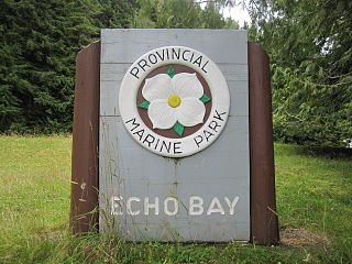
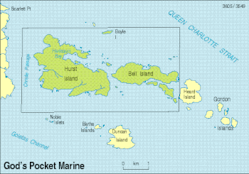
Echo Bay Marine Provincial Park is a provincial park in British Columbia, Canada, established in 1971 and containing 1.5 hectares. It is located at the bay of the same name, offshore from the community of the same name, which is the location of the Simoom Sound post office and is on the west side of Gilford Island.
Háthayim Marine Provincial Park, formerly Von Donop Marine Provincial Park, is a provincial park in British Columbia, Canada, located on the north end of Cortes Island in the Discovery Islands.
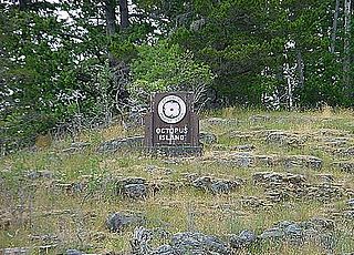
Octopus Islands Marine Provincial Park is a provincial park in British Columbia, Canada. It is located between Quadra Island and Maurelle Island in Okisollo Channel.
Lawn Point Provincial Park is a provincial park in British Columbia, Canada.
Nimpkish Lake Provincial Park is a provincial park on northern Vancouver Island, British Columbia, Canada on Vancouver Island. The park is 3,949 ha. in area and was established on 1995. It is 32 km south of Port McNeill and on the southwest side of Nimpkish Lake. Primary access is by boat launch, though radio-controlled logging roads lead to the edge of the park. Western Forest Products in Woss, British Columbia should be contacted for road advisories. The park is in the traditional territory of the Namgis First Nation.
Princess Louisa Marine Provincial Park is a provincial park in British Columbia, Canada surrounding Princess Louisa Inlet.

Rebecca Spit Marine Provincial Park is a provincial park in British Columbia, Canada, located on the east side of Quadra Island, near the city of Campbell River.
Rock Bay Marine Provincial Park is a provincial park in British Columbia, Canada, located on the Inside Passage at the junction of Johnstone Strait and Discovery Passage. The park contains approximately 525 ha. Rock Bay is located on the shore of Vancouver Island, immediately south of East Thurlow Island.

Rugged Point Marine Provincial Park is a provincial park in British Columbia, Canada, located at the southeast entrance to Kyuquot Sound on the west coast of Vancouver Island. It is remote and largely visited by kayakers.
Sabine Channel Provincial Park, also known as Sabine Channel Marine Provincial Park, is a provincial park in British Columbia, Canada, in the waters surrounding Jervis Island in Sabine Channel, which separates Texada Island (N) from Lasqueti Island (S). Established in 2001, the parks is approximately 2,254 ha. in size.
Thurston Bay Marine Provincial Park is a provincial park on the northwest side of Sonora Island in British Columbia, Canada.
Kyuquot Sound is a complex of coastal inlets, bays and islands on northwestern Vancouver Island in the Canadian province of British Columbia.
Allison Harbour, also formerly known as False Bay and False Schooner Passage, is a natural harbour on the Central Coast of British Columbia, Canada, extending north from Queen Charlotte Strait to the southeast of Bramham Island. It is the site of the former post office and steamer landing of Allison Harbour, British Columbia. The Allison Reefs lie in the entrance to the sound; Allison Cone (185m), which is nearby between Shelter Bay and Cape Caution, was named in association with Allison Harbour. It is now protected as part of Allison Harbour Marine Provincial Park.

Solander Island Ecological Reserve is a 7.7 ha protected area on an island 1.5 km (0.9 mi) west of Brooks Peninsula Provincial Park off the northwest coast of Vancouver Island in British Columbia, Canada. It was established in 1971. The reserve is closed to the public to protect the habitat of nesting seabirds.