
Arab al-Samniyya, also known as Khirbat al-Suwwana, was a Palestinian village in the Western Galilee that was captured and depopulated by Israel during the 1948 Arab-Israeli war. It was located in the Acre District of the British Mandate of Palestine, 19.5 km northeast of the city of Acre. In 1945 the, village had a population of 200 Arab and a total land area of 1,872 dunums.

Khirbat Zalafa was a small Palestinian Arab village in the Tulkarm Subdistrict, located about 15 kilometers (9.3 mi) northwest of Tulkarm. It was depopulated during the 1948 Palestine war. It was occupied by Yishuv forces on April 15, 1948 as a part of operation "Coastal Clearing."

Arab al-'Arida, is a depopulated former Palestinian Arab village and 6 kilometers (3.7 mi) south of the city of Beit She'an.
Arab al-Bawati, was a Palestinian Arab village in the District of Baysan. It was depopulated during the 1948 Arab-Israeli War.

Al-Hamidiyya, was a Palestinian village in the District of Baysan. It was depopulated by the Jewish militias, precursors of the Israel Defense Forces, during the 1947–1948 Civil War in Mandatory Palestine on May 12, 1948. It was located five kilometres north of Baysan. It was attacked as part of Operation Gideon. The population in 1922 was 193, expanding to 255 in 1948.

Al-Sakhina, was a Palestinian Arab village in the District of Baysan. It was located five kilometres west of Baysan on the Jalud River on its way to the Jordan River. It was depopulated by the Israel Defense Forces during the 1947–1948 Civil War in Mandatory Palestine on May 12, 1948, as part of Operation Gideon.

Al-Samiriyya, was a Palestinian Arab village in the District of Baysan. It was depopulated by the Israel Defense Forces during the 1948 Arab-Israeli War on May 27, 1948, as part of Operation Gideon. It was located 7 km southeast of Baysan.
Tall al-Shawk, was a Palestinian village in the District of Baysan. It was depopulated by the Israel Defense Forces during the 1947–1948 Civil War in Mandatory Palestine on May 12, 1948, as part of Operation Gideon. It was located five km west of Baysan between the al-Januna'in River to the north and Wadi al-Jawsaq to the south. The village was built above an ancient archeological site and granite columns remain.

Zab'a, was a Palestinian Arab village in the District of Baysan. It was depopulated by the Israel Defense Forces during the 1947–1948 Civil War in Mandatory Palestine on May 12, 1948, as part of Operation Gideon. It was located 5.5 km northeast of Baysan on Wadi Yubla or Wadi al-'Ashsha.

Al-Rihaniyya was a Palestinian Arab village in the Haifa Subdistrict. It was depopulated during the 1947–1948 Civil War in Mandatory Palestine on 30 April 1948 as part of the battle of Mishmar HaEmek. It was located 25 km southeast of Haifa and 3 km northwest of Wadi al-Mileh.

Bayt Umm al-Mays was a small Palestinian Arab village in the Jerusalem Sub-district, located 14 km west of Jerusalem..

Jilya was a Palestinian Arab village in the Ramle Subdistrict of Mandatory Palestine. The Romans referred to it as Jilya by Galla. It was depopulated during the 1948 Arab–Israeli War by the Givati Brigade of the first stage of Operation Dani on July 9, 1948. It was located 17 km south of Ramla.

Al-Khayma was a Palestinian Arab village in the Ramle Subdistrict of Mandatory Palestine. It was depopulated during the 1948 Arab–Israeli War on July 9, 1948, by the Givati Brigade of Operation An-Far. It was located 18.5 km south of Ramla.

Al-Butayha was a Palestinian Arab village in the Safad Subdistrict. It was depopulated during the 1947–1948 Civil War in Mandatory Palestine on May 4, 1948, by the Palmach's First Battalion during Operation Matateh. It was located 13 km southeast of Safad, quarter of a mile east of the Jordan River, a little northeast of the northern tip of the Sea of Galilee. Many of the inhabitants were forced into Syria.

Al-Buwayziyya was a Palestinian Arab village in the Safad Subdistrict. It was depopulated during the 1947–1948 Civil War in Mandatory Palestine on May 11, 1948, by the Palmach's First Battalion of Operation Yiftach. It was located 22 km northeast of Safad.

Al-Zuq al-Tahtani was a Palestinian Arab village in the Safad Subdistrict. It was depopulated during the 1947–1948 Civil War in Mandatory Palestine on May 11, 1948, by the Palmach's First Battalion of Operation Yiftach. It was located 30 km northeast of Safad.
Al-Zawiya was a Palestinian Arab village in the Safad Subdistrict. It was depopulated during the 1947–1948 Civil War in Mandatory Palestine on May 24, 1948, by the Palmach's First Battalion of Operation Yiftach. It was located 23 km northeast of Safad.

Al-Qudayriyya was a Palestinian Arab village in the Safad Subdistrict. It was depopulated during the 1947–1948 Civil War in Mandatory Palestine on May 4, 1948, by the Haganah and the Palmach's First Battalion of Operation Matate, a sub-operation of Operation Yiftach. It was located 6.5 km south of Safad, situated 1 km east of Wadi al-'Amud.

Al-Wayziyya was a Palestinian village in the Safad Subdistrict, located south east of Yarda. It was depopulated during the 1947–48 Civil War in Mandatory Palestine on May 1, 1948, by the Palmach's First Battalion of Operation Yiftach. It was located 8.5 km northeast of Safad.

Wadi Qabbani, also known as Khirbat ash Sheik Husein was a Palestinian Arab village in the Tulkarm Subdistrict. It was probably depopulated during the 1947–48 Civil War in Mandatory Palestine on March 1, 1948, as part of Operation Coastal Clearing. It was located 12 km northwest of Tulkarm. The name, Qabbani came from the Lebanese family who owned most of the land.

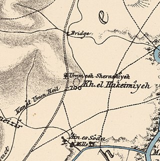
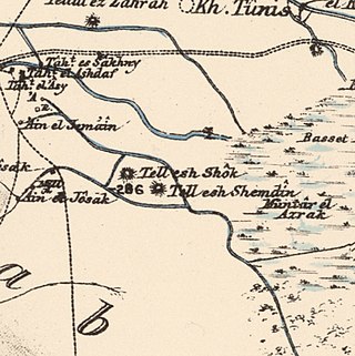
 1870s map
  1940s map
 modern map
  1940s with modern overlay map


