
Baqa al-Gharbiyye is a predominantly Arab city in the "Triangle" region of Israel near the Green Line. In 2003, Baqa al-Gharbiyye united with the Jatt local council to form Baqa-Jatt, a unification that was dissolved a few years later. The city had a population of 31,397 in 2022.

'Iraq Suwaydan was a Palestinian Arab village located 27 km (17 mi) northeast of Gaza City. It was captured by Israeli forces in Operation Yoav against the defending Egyptian Army during the 1948 Arab-Israeli War. The village infrastructure, with the exception of the police station built by the British Mandate authorities, was destroyed.

Sa'sa' was a Palestinian village, located 12 kilometres northwest of Safed, that was depopulated by Israeli forces during the 1948 Arab-Israeli war. The village suffered two massacres committed by Haganah forces: one in mid-February 1948 and the other at the end of October the same year. Its place has been taken since 1949 by Sasa, an Israeli kibbutz.

Al-Malkiyya, also known as Al-Malikiyah, was a Palestinian village located in the Jabal Amil region. In a 1920s census, the village was registered as part of Greater Lebanon. It was later placed under the British Mandate of Palestine. Its population was mostly Metawali Shiite.
Bayt Jirja or Beit Jerja was a Palestinian Arab village 15.5 km Northeast of Gaza. In 1931 the village consisted of 115 houses. It was overrun by Israeli forces during operation Yo'av in the 1948 Arab-Israeli war. Bayt Jirja was found depopulated in November 1948, during "clean up sweeps" to expel any partial inhabited villages and destroy village housing to prevent any possible re-occupation in the area. The village was completely destroyed after the occupation and only one tomb remains.

Barbara was a Palestinian Arab village in the Gaza Subdistrict located 17 km northeast of Gaza city, in the vicinity of modern Ashkelon. It had an entirely Arab population of 2,410 in 1945. The village consisted of nearly 14,000 dunums of which approximately 12,700 dunums was able to be cultivated. It was captured by Israel during the 1948 Arab–Israeli War.
Barqa was a Palestinian Arab village located 37 km north of Gaza near the modern-day Israeli city of Ashdod. It was referred to as Barka by the Greeks and Bareca by the Romans during their rule over the ancient Philistine city. In 1945, the village had a population of 890 and total land area of 5,206 dunums.

Tur'an is an Arab local council in the Northern District of Israel. It is located at the foot of Mount Tur'an and the Tur'an Valley, near the main road from Haifa to Tiberias, and about 17 kilometres (11 mi) north of Nazareth. In 2022 it had a population of 14,809, most of whom are Israeli Arabs.

Al-Jura was a Palestinian village that was depopulated during the 1948 Arab-Israeli war, located immediately adjacent to the towns of Ashkelon and the ruins of ancient Ascalon. In 1945, the village had a population of approximately 2,420 mostly Muslim inhabitants. Though defended by the Egyptian Army, al-Jura was nevertheless captured by Israel's Givati Brigade in a November 4, 1948, offensive as part of Operation Yoav.

Al-Muzayri'a was a Palestinian village in the Ramle Subdistrict. It was depopulated in 1948. In 1998 the new Israeli city of El'ad was built over the ruins.
Bu'eine Nujeidat is an Arab local council in the Northern District of Israel. Made up of two villages, Bu'eine and Nujeidat, they merged in 1987 and were recognized as one local council in 1996. In 2022 its population was 10,289, the majority of which is Muslim.
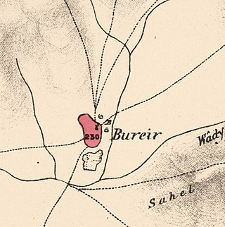
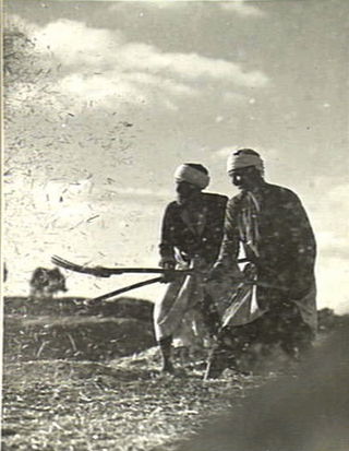
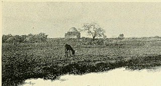
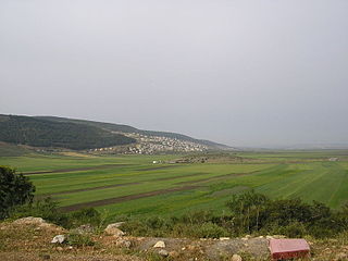
Burayr was a Palestinian Arab village in the Gaza Subdistrict, 18 kilometers (11 mi) northeast of Gaza City. Its population in 1945 was 2,740 and it was depopulated during the 1948 Palestine war as part of the 1948 Palestinian expulsion and flight. It had an average elevation of 100 meters (330 ft).

Al-Sawafir al-Shamaliyya was a Palestinian Arab village in the Gaza Subdistrict, located 33 kilometers (21 mi) northeast of Gaza situated along the southern coastal plain of Palestine 50 meters (160 ft) above sea level. It was one of three namesake villages, alongside Al-Sawafir al-Sharqiyya and Al-Sawafir al-Gharbiyya.

Al-Batani al-Sharqi was a Palestinian Arab village in the Gaza Subdistrict, located 36.5 kilometers (22.7 mi) northeast of Gaza situated in the flat terrain on the southern coastal plain of Palestine. It had a population of 650 in 1945. Al-Batani al-Sharqi was depopulated during the 1948 Arab-Israeli War.

Al-Sawafir al-Sharqiyya was a Palestinian Arab village in the Gaza Subdistrict. It was depopulated during the 1948 War on May 18, 1948, as part of the second stage of Operation Barak. The village was located 32 km northeast of Gaza. It is one of three namesake villages, alongside Al-Sawafir al-Gharbiyya and Al-Sawafir al-Shamaliyya.

Kasla was a Palestinian village in the Jerusalem Subdistrict. It was depopulated during the 1948 Arab–Israeli War on July 17, 1948, by the Harel Brigade of Operation Dani. It was located 17 km west of Jerusalem.

Al-Qubab was a Palestinian Arab village in the Ramle Subdistrict. It was depopulated in July 1948 during the Operation Dani led by the Yiftach Brigade.

Al-Tira was a Palestinian village in the Ramle Subdistrict. It was depopulated during the 1948 Arab–Israeli War on July 10, 1948, by the Alexandroni and Armored (Eighth) brigades under Operation Dani. It was located 12 km northeast of Ramla. al-Tira was mostly destroyed with the exception of a few houses survived destruction.

Jahula was a Palestinian Arab village in the Safad Subdistrict. It was depopulated during the 1947–1948 civil war in Mandatory Palestine on May 1, 1948, by the Palmach's First Battalion of Operation Yiftach. It was located 11 km northeast of Safad.

Yaquq was a Palestinian Arab village, which was depopulated during the 1947–1948 Civil War in Mandatory Palestine on May 1, 1948. It was located 12.5 km north of Tiberias and was built at the site of the ancient Jewish village of Huqoq.
 1870s map
  1940s map
 modern map
  1940s with modern overlay map


