
Suruh, was a Palestinian Arab hamlet, located 28.5 kilometers (17.7 mi) northeast of Acre. It became depopulated in the 1948 Arab-Israeli war.
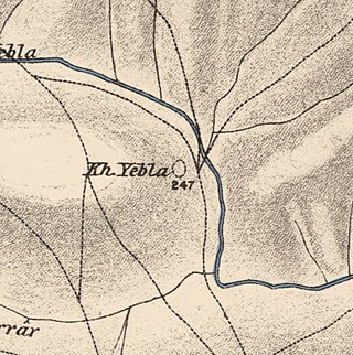
Yubla, was a Palestinian village, located 9 kilometers north of Bisan in present-day Israel. It was depopulated during the 1948 Arab-Israeli war.

Miska was a Palestinian village, located fifteen kilometers southwest of Tulkarm, depopulated in 1948.

Al-Shajara was a Palestinian Arab village depopulated by Israel during the 1948 Arab-Israeli War when its residents were forcefully evacuated and became refugees. It was located 14 kilometers west of Tiberias on the main highway to Nazareth near the villages of Lubya and Hittin. The village was very close to the city of Nazareth, about 5 kilometers away.
Arab al-Bawati, was a Palestinian Arab village in the District of Baysan. It was depopulated during the 1948 Arab-Israeli War.

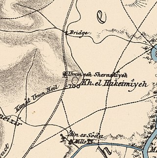
Al-Khunayzir, was a Palestinian Arab village in the District of Baysan. It was depopulated during the 1948 Arab-Israeli War on May 20, 1948.
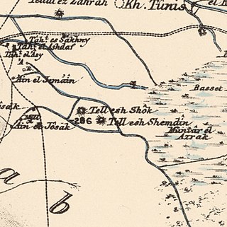
Tall al-Shawk, was a Palestinian village in the District of Baysan. It was depopulated by the Israel Defense Forces during the 1947–1948 Civil War in Mandatory Palestine on May 12, 1948, as part of Operation Gideon. It was located five km west of Baysan between the al-Januna'in River to the north and Wadi al-Jawsaq to the south. The village was built above an ancient archeological site and granite columns remain.

Bil'in was a Palestinian Arab village in the Gaza Subdistrict. It was depopulated by the Israel Defense Forces during the 1948 Arab–Israeli War on July 8, 1948, under Operation An-Far. It was located 39 km northeast of Gaza and the village contained two wells which supplied it with drinking water.

Khubbayza was a Palestinian Arab village in the Haifa Subdistrict, located 29.5 kilometers (18.3 mi) southeast of Haifa. It was situated on hilly terrain, south of Wadi al-Sindiyana, between the Jezreel Valley with the Mediterranean coast. In 1945, it had a population of 290. Khubbayza was depopulated during the 1948 War on May 12, 1948, in the Battle of Mishmar HaEmek.
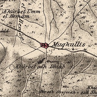
Mughallis was a Palestinian Arab village located 30.5 kilometers (19.0 mi) northwest of Hebron. It was depopulated during the 1948 Arab-Israeli War between July 9–10, 1948 as part of Operation An-Far.

Bayt Umm al-Mays was a small Palestinian Arab village in the Jerusalem Sub-district, located 14 km west of Jerusalem..

Sufla was a Palestinian Arab village in the Jerusalem Subdistrict. It was depopulated during the 1948 Arab–Israeli War on October 19, 1948, by the Sixth Battalion of the Harel Brigade under Operation Ha-Har. It was located 18.5 km west of Jerusalem.

Dayr Muhaysin was a Palestinian village in the Ramle Subdistrict of Mandatory Palestine, located 12 km southeast of Ramla and 4 km west of Latrun. It was depopulated during the 1948 Palestine war.

Al-Haditha was a Palestinian village in the Ramle Subdistrict. It was located 8 km northeast of Ramla, on the bank of Wadi al-Natuf. The site, now known as Tel Hadid, has yielded significant archaeological remains from many periods. Al-Haditha was depopulated during the 1948 Arab-Israeli War on July 12, 1948, under the first stage of Operation Dani.

Al-Kunayyisa was a small Palestinian Arab village in the Ramle Subdistrict. It was depopulated during the 1948 Arab–Israeli War on July 10, 1948, under the first stage of Operation Dani. It was located 12 km southeast of Ramla.

Al-Mukhayzin was a Palestinian village in the Ramle Subdistrict. It was ethnically cleansed during the Nakba on April 20, 1948, by the Givati Brigade of Operation Har'el. It was located 10 km southwest of Ramla.

Al-Qubayba was a Palestinian Arab village in the Ramle Subdistrict. It was depopulated during the 1948 Arab-Israeli War on May 27, 1948, by the Givati Brigade as part of the Second stage of Operation Barak. It was located 10.5 km southeast of Ramla near the Rubin River which provided the village with water and irrigation for agriculture. Al-Qubayba was mostly destroyed with the exception of a few houses, and Kfar Gevirol was built in its place, now a suburb in the west of Rehovot.

Arab al-Shamalina also known as Khirbat Abu Zayna was a Palestinian Arab village in the Safad Subdistrict. It was depopulated during the 1947–1948 Civil War in Mandatory Palestine on May 4, 1948, under Operation Matate (Broom), a sub operation of Operation Yiftach. It was located 13 km southeast of Safad near the Jordan River.

Al-Zuq al-Tahtani was a Palestinian Arab village in the Safad Subdistrict. It was depopulated during the 1947–1948 Civil War in Mandatory Palestine on May 11, 1948, by the Palmach's First Battalion of Operation Yiftach. It was located 30 km northeast of Safad.

Al-Sanbariyya was a Palestinian village in the Safad Subdistrict. It was depopulated during the 1947–1948 Civil War in Mandatory Palestine on May 1, 1948, by Palmach's First Battalion under Operation Yiftach. It was located 31.5 km northeast of Safad, near Wadi Hasibani.
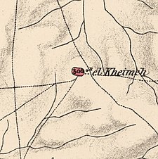 1870s map
 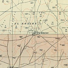 1940s map
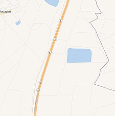 modern map
 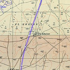 1940s with modern overlay map
