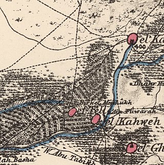
al-Nahr, was a Palestinian village 14 km (8.7 mi) northeast of Acre. It was depopulated in May 1948 after a military assault carried out by the Carmeli Brigade as part of the Israel Defense Forces's Operation Ben-Ami. Immediately after the assault, the village of al-Nahr was razed.
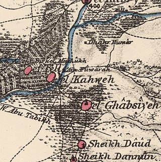
Al-Ghabisiyya was a Palestinian Arab village in northern Palestine, 16 km north-east of Acre in present-day Israel. It was depopulated by the Israel Defense Forces during the 1948 Palestinian expulsion and remains deserted.

Khirbat Jiddin, known in the Kingdom of Jerusalem as Judin, was an Ottoman fortress in the western Upper Galilee, originally built by the Teutonic Order after 1220 as a crusader castle, 16 km northeast of the city of Acre, which at the time was the capital of the Kingdom of Jerusalem. The castle was destroyed by the Mamluk sultan Baibars sometime between 1268-1271 and lay in ruins until being rebuilt and expanded by the Arab ruler Zahir al-Umar as Qal'at Jiddin in the 1760s, only to be destroyed again around 1775 by Jazzar Pasha. The ruined fortress, known as Khirbat Jiddin, was later inhabited by the al-Suwaytat Bedouin tribe.

Qalansawe or Qalansuwa is an Arab city in the Central District of Israel. Part of the Triangle, in 2022 it had a population of 24,205.

Ijzim was a Palestinian village in the Haifa Subdistrict of British Mandate Palestine, 19.5 kilometers south of Haifa, that was depopulated during the 1948 Arab-Israeli war. Many residents resettled in Jenin after Operation Shoter on 24 July 1948.
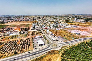
Jaljulia, officially also spelled Jaljulye, is an Arab town in Israel near Kfar Saba. In 2022 it had a population of 10,609.

Qaqun was a Palestinian Arab village located 6 kilometers (3.7 mi) northwest of the city of Tulkarm at the only entrance to Mount Nablus from the coastal Sharon plain.
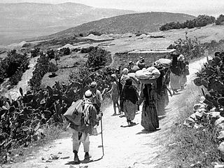
Qumya, was a Palestinian village of 510 inhabitants when it was depopulated prior to the 1948 Arab-Israeli war.
Deir al-Ghusun is a Palestinian town in the Tulkarm Governorate, located eight kilometers northeast of the city of Tulkarm in the northern West Bank, Palestine. The town is near the Green Line. The town had a population of 9,936 in 2017. Its altitude is 200 meters.

al-Tira was a Palestinian town located 7 kilometres south of Haifa. It was made up of five khirbets, including Khirbat al-Dayr where lie the ruins of St. Brocardus monastery and a cave complex with vaulted tunnels.

Indur was a Palestinian village, located 10.5 kilometres (6.5 mi) southeast of Nazareth. Its name preserves that of ancient Endor, a Canaanite city state thought to have been located 1 kilometre (0.62 mi) to the northeast. The village was depopulated during the 1948 Arab–Israeli War and its inhabitants became refugees, some of whom were internally displaced. In Israel today, there are a few thousand internally displaced Palestinians who hail from Indur, and continue to demand their right of return.

Qaffin is a Palestinian town located 22 kilometers (14 mi) northeast of Tulkarm in the Tulkarm Governorate in the northwestern West Bank. The town is an agricultural town. According to the Palestinian Central Bureau of Statistics, its population consisted over 8,387 inhabitants in 2007 and 10,690 in 2017. The built-up area of the town is 1,000 dunams.

Far'un is a Palestinian town in the Tulkarm Governorate in the northwestern West Bank, located four kilometers south of Tulkarm near the border with Israel. According to the Palestinian Central Bureau of Statistics, Far'un had a population of 3,100 inhabitants in 2007 and 4,131 by 2017.
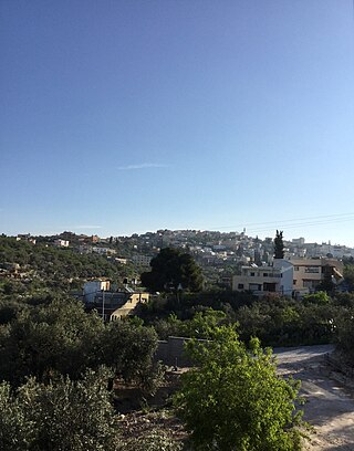
'Illar is a Palestinian town in the Tulkarm Governorate in the northern West Bank, located 10 kilometers northeast of Tulkarm, and 25 kilometers east of the Israeli city of Netanya. It is bordered by Attil to the west, Kafr Ra'i to the east, and the Israeli settlement of Hermesh to the north. According to the Palestinian Central Bureau of Statistics, 'Illar had a population of approximately 7,456 inhabitants in 2017. 6.6% of the population of 'Illar were refugees in 1997. The healthcare facilities for the surrounding villages are based in 'Illar, the facilities are designated as MOH level 2.

Zeita is a Palestinian town in the Tulkarm Governorate in the western West Bank, located 11 kilometers North-east of Tulkarm. According to the Palestinian Central Bureau of Statistics, Zeita had a population of 3,078 inhabitants in 2017. 21.5% of the population of Zeita were refugees in 1997. The healthcare facilities for Zeita are designated as MOH level 2.

Kawkab al-Hawa, is a depopulated former Palestinian village located 11 km north of Baysan. It was built within the ruins of the Crusader fortress of Belvoir, from which it expanded. The Crusader names for the Frankish settlement at Kawkab al-Hawa were Beauvoir, Belvoir, Bellum videre, Coquet, Cuschet and Coket. During Operation Gideon in 1948, the village was occupied by the Golani Brigade and depopulated.
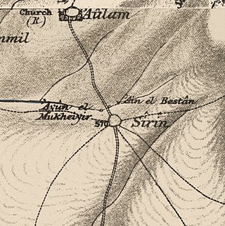
Sirin, was a Palestinian Arab village located 17 kilometers (11 mi) north of Beisan. The village was depopulated and destroyed in 1948. Only the village cemetery and one house remain standing, along with the remains of a mosaic pavement and a vaulted spring dating to the Byzantine period. Mentioned in historical documents, the 1596 census indicated it had 45 households; by 1945, the number of inhabitants had risen to 810.

Ayn Ghazal was a Palestinian Arab village located 21 kilometers (13 mi) south of Haifa. Depopulated during the 1948 Arab-Israeli War as a result of an Israeli military assault during Operation Shoter, the village was then completely destroyed. Incorporated into the State of Israel, it is now mostly a forested area. The Israeli moshav of Ofer ("fawn") was established in 1950 on part of the former village's lands. Ein Ayala, a moshav established in 1949, lies just adjacent; its name being the Hebrew translation of Ayn Ghazal.

Burayka was a Palestinian Arab village in the Haifa Subdistrict. It was depopulated during the 1947–1948 Civil War in Mandatory Palestine on May 5, 1948. It was located 29 km south of Haifa.

Fardisya was a Palestinian Arab hamlet in the Tulkarm Subdistrict, 2.5 kilometres (1.6 mi) south of Tulkarm.


