
Ammuqa was a Palestinian village, located five kilometres northeast of Safed.

Qaddita was a Palestinian Arab village of 240, located 4.5 kilometers (2.8 mi) northwest of Safad. It was captured and depopulated in the 1948 Arab-Israeli War, with some of its inhabitants expelled or fleeing to nearby 'Akbara where they live as internally displaced Palestinians and others to refugee camps in Lebanon or Syria.

Arab al-Shamalina also known as Khirbat Abu Zayna was a Palestinian Arab village in the Safad Subdistrict. It was depopulated during the 1947–1948 Civil War in Mandatory Palestine on May 4, 1948, under Operation Matate (Broom), a sub operation of Operation Yiftach. It was located 13 km southeast of Safad near the Jordan River.
Arab al-Zubayd was a Palestinian village in the Safad Subdistrict. It was depopulated during the 1947–1948 Civil War in Mandatory Palestine on April 20, 1948, when the villagers fled on hearing the intentions of The Palmach's First Battalion of Operation Yiftach. It was located 15 km northeast of Safad, near the al-Mutilla-Safad—Tiberias highway.

Biriyya was a Palestinian Arab village in the Safad Subdistrict. It was depopulated during the 1947–1948 Civil War in Mandatory Palestine on May 2, 1948, by The Palmach's First Battalion of Operation Yiftach. It was located 1.5 kilometres (0.9 mi) northeast of Safad. Today the Israeli moshav of Birya includes the village site.
Al-Dawwara was a Palestinian Arab village in the Safad Subdistrict. It was depopulated during the 1948 War on May 25, 1948, by the Palmach's First Battalion of Operation Yiftach. It was located 27 km northeast of Safad, bordering three rivers that flowed into lake al-Hula: the al-Hasbani, Banyas, and Dan rivers.

Al-Dirbashiyya was a Palestinian Arab village in the Safad Subdistrict. It was depopulated during the 1947–1948 Civil War in Mandatory Palestine on May 10, 1948, by the Palmach's First Battalion of Operation Yiftach. It was located 20 km northeast of Safad in the Hula Valley, bordering Hula Lake.
Al-Dirdara, also known as Mazari ed Daraja, was a Palestinian Arab village in the Safad Subdistrict. It was depopulated during the 1947–1948 Civil War in Mandatory Palestine on May 1, 1948, under Operation Yiftach. It was located 13 km east of Safad.

Harrawi was a Palestinian Arab village in the Safad Subdistrict. It was depopulated during the 1948 Arab-Israeli War on May 25, 1948, by the Palmach's First Battalion of Operation Yiftach. It was located 18 km northeast of Safad.

Jahula was a Palestinian Arab village in the Safad Subdistrict. It was depopulated during the 1947–1948 civil war in Mandatory Palestine on May 1, 1948, by the Palmach's First Battalion of Operation Yiftach. It was located 11 km northeast of Safad.

Al-Na'ima was a Palestinian Arab village in the Safad Subdistrict of Mandatory Palestine located 26 kilometres (16 mi) northeast of Safad, near the al-Hula Plain. The settlement was depopulated during the 1947-1948 civil war on May 14, 1948 by the Israeli Palmach's First Battalion as part of Operation Yiftach.

Al-Zuq al-Tahtani was a Palestinian Arab village in the Safad Subdistrict. It was depopulated during the 1947–1948 Civil War in Mandatory Palestine on May 11, 1948, by the Palmach's First Battalion of Operation Yiftach. It was located 30 km northeast of Safad.
Khiyam al-Walid was a Palestinian Arab village in the Safad Subdistrict located 25.5 kilometers (15.8 mi) northeast of Safad along the Syrian border. It was on situated on a hill 150 meters (490 ft) above sea level on the eastern edge of the Hula Valley. In 1945, there were 280 predominantly Muslim inhabitants. It was depopulated during the 1948 Palestine War.
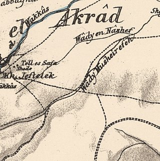
Kirad al-Baqqara was a Palestinian Arab village in the Safad Subdistrict. It was depopulated during the 1947–1948 Civil War in Mandatory Palestine on April 22, 1948, by the Palmach's First Battalion of Operation Yiftach. It was located 11 km northwest of Safad and Wadi Mushayrifa ran between the two Kirad villages.

Qabba'a was a Palestinian Arab village in the District of Safad. It was depopulated during the 1948 War on May 26, 1948, by the Palmach's First Battalion of Operation Yiftach. It was located 6 km northeast of Safad.

Al-Shuna was a Palestinian Arab village in the Safad Subdistrict. It was ethnically cleansed and depopulated during the 1947–1948 Civil War in Mandatory Palestine on April 30, 1948, by the Palmach's First Battalion of Operation Yiftach. It was located 6 km south of Safad, overlooking the deep gorge of Wadi al-'Amud.

Qaytiyya was a Palestinian Arab village in the Safad Subdistrict. It was depopulated during the 1948 War on May 19, 1948, by the Palmach's First Battalion of Operation Yiftach. It was located 28 km northeast of Safad, bordering both the Hasibani and the Dan Rivers.
Al-Zawiya was a Palestinian Arab village in the Safad Subdistrict. It was depopulated during the 1947–1948 Civil War in Mandatory Palestine on May 24, 1948, by the Palmach's First Battalion of Operation Yiftach. It was located 23 km northeast of Safad.

Al-Qudayriyya was a Palestinian Arab village in the Safad Subdistrict. It was depopulated during the 1947–1948 Civil War in Mandatory Palestine on May 4, 1948, by the Haganah and the Palmach's First Battalion of Operation Matate, a sub-operation of Operation Yiftach. It was located 6.5 km south of Safad, situated 1 km east of Wadi al-'Amud.

Al-Wayziyya was a Palestinian village in the Safad Subdistrict, located south east of Yarda. It was depopulated during the 1947–48 Civil War in Mandatory Palestine on May 1, 1948, by the Palmach's First Battalion of Operation Yiftach. It was located 8.5 km northeast of Safad.
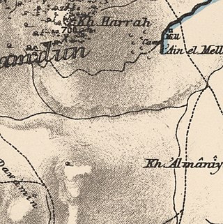
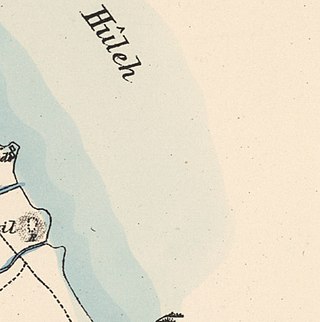
 1870s map
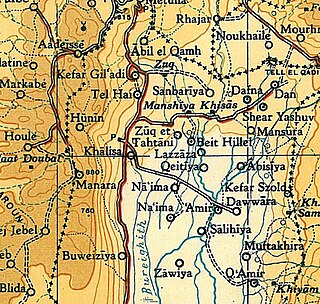
  1940s map
 modern map
  1940s with modern overlay map
