
Al-Dawayima, Dawaymeh or Dawayma was a Palestinian town, located in the former Hebron Subdistrict of Mandatory Palestine, and in what is now the Lakhish region, some 15 kilometres south-east of Kiryat Gat.

Sa'sa' was a Palestinian village, located 12 kilometres northwest of Safed, that was depopulated by Israeli forces during the 1948 Arab-Israeli war. The village suffered two massacres committed by Haganah forces: one in mid-February 1948 and the other at the end of October the same year. Its place has been taken since 1949 by Sasa, an Israeli kibbutz.

Sar'a, was a Palestinian Arab village located 25 km west of Jerusalem, depopulated in the 1948 war. The site lies on a hill, at an elevation of about 1,150 feet (350 m) above sea-level.
Bayt Jirja or Beit Jerja was a Palestinian Arab village 15.5 km Northeast of Gaza. In 1931 the village consisted of 115 houses. It was overrun by Israeli forces during operation Yo'av in the 1948 Arab-Israeli war. Bayt Jirja was found depopulated in November 1948, during "clean up sweeps" to expel any partial inhabited villages and destroy village housing to prevent any possible re-occupation in the area. The village was completely destroyed after the occupation and only one tomb remains.

Barbara was a Palestinian Arab village in the Gaza Subdistrict located 17 km northeast of Gaza city, in the vicinity of modern Ashkelon. It had an entirely Arab population of 2,410 in 1945. The village consisted of nearly 14,000 dunums of which approximately 12,700 dunums was able to be cultivated. It was captured by Israel during the 1948 Arab–Israeli War.
Barqa was a Palestinian Arab village located 37 km north of Gaza near the modern-day Israeli city of Ashdod. It was referred to as Barka by the Greeks and Bareca by the Romans during their rule over the ancient Philistine city. In 1945, the village had a population of 890 and total land area of 5,206 dunums.

Iraq al-Manshiyya was a Palestinian Arab village located 32 km northeast of Gaza City. The village contained two mosques and a shrine for Shaykh Ahmad al-Arayni. It was depopulated after the 1948 Arab-Israeli War.
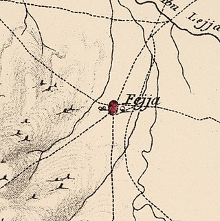
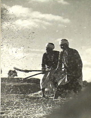
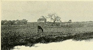
Fajja was a Palestinian town located 15 kilometers northeast of Jaffa. Ethnically cleansed during the Nakba, its land area is today part of the Israeli city of Petah Tikva.

Al-Muzayri'a was a Palestinian village in the Ramle Subdistrict. It was depopulated in 1948. In 1998 the new Israeli city of El'ad was built over the ruins.

Tall al-Turmus was a Palestinian Arab village in the Gaza Subdistrict, located on a low hill on the coastal plain of Palestine, 38 kilometers (24 mi) northeast of Gaza. In 1945, it had a population of 760 and a land area of 11,508 dunams. The village was depopulated during the 1948 Arab-Israeli War.

Al-Sawafir al-Gharbiyya was a Palestinian Arab village in the Gaza Subdistrict. It was depopulated during the 1948 War on May 18, 1948, during the second stage of Operation Barak. It was located 30 km northeast of Gaza city. It was one of three namesake villages, alongside Al-Sawafir al-Sharqiyya and Al-Sawafir al-Shamaliyya.
Khirbat Umm Burj was a Palestinian Arab village in the Hebron Subdistrict, sometimes designated in modern maps as Burgin. Its ruins are today located within the borders of Israel. It occupied an extensive site, stretching about 30 dunams on the crest of a hill, rising some 430 metres (1,410 ft) above sea level, and commanding a good prospect of the surrounding region. It was depopulated during the 1948 Arab–Israeli War on October 28, 1948, during the third stage of Operation Yo'av under the command of Yigal Allon. The site is located 17 km northwest of Hebron.

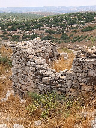
Al-Qabu was a Palestinian Arab village in the Jerusalem Subdistrict. The name is an Arabic variation of the site's original Roman name, and the ruins of a church there are thought to date to the era of Byzantine or Crusader rule over Palestine.

Aqir, also spelt Akir and Akkur, was a Palestinian Arab village in the Ramle Subdistrict, located 9 km southwest of Ramla and 1 km north of Wadi al-Nasufiyya. It was depopulated and demolished and replaced by Kiryat Ekron.

Barfiliya was a Palestinian village located 10.5 kilometres (6.5 mi) east of Ramla that was depopulated during the 1948 Arab–Israeli War. Located on a tell, excavations conducted there by Israeli archaeologists beginning in 1995 found artifacts dating back to the Pre-Pottery Neolithic A (PPNA) period.

Bashshayt, also Beshshayt, was an Arab village in the Ramle Subdistrict, located 16.5 kilometers (10.3 mi) southwest of Ramla about half a mile from wadi Bashshit. Archaeological artifacts from the village attest to habitation in the Early Islamic period and 12th and 13th centuries. Mentioned by Arab geographers from the 13th century onward, there was a tomb for the Neby Shayt in the village.
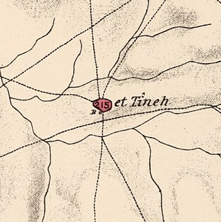
Al-Tina, or Khirbet et-Tineh was a Palestinian Arab village in the Ramle Subdistrict of Mandatory Palestine. The village was located between the Shfela and southern Israeli coastal plain. It was depopulated during the 1948 Arab–Israeli War on July 8, 1948, by the Givati Brigade under Operation An-Far. It was located 20. km south of Ramla. The hill on which the village was built stands today next to the Kiryat Mal'akhi – Yoav railway station and next to Highway 6. Archeological excavations at the site revealed the remains of a Byzantine settlement.

Al-Tira was a Palestinian village in the Ramle Subdistrict. It was depopulated during the 1948 Arab–Israeli War on July 10, 1948, by the Alexandroni and Armored (Eighth) brigades under Operation Dani. It was located 12 km northeast of Ramla. al-Tira was mostly destroyed with the exception of a few houses survived destruction.

Dallata was an Arab village, located on a hilltop 6 kilometers (3.7 mi) north of Safad. Constructed upon an ancient site, it was known to the Crusaders as Deleha. Dallata was included in the late 16th century Ottoman census and British censuses of the 20th century. Its inhabitants were primarily agriculturalists, with some involved in carpentry or trade.

Yaquq was a Palestinian Arab village, which was depopulated during the 1947–1948 Civil War in Mandatory Palestine on May 1, 1948. It was located 12.5 km north of Tiberias and was built at the site of the ancient Jewish village of Huqoq.

 1870s map
  1940s map
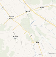 modern map
  1940s with modern overlay map


