
Al-Nabi Rubin, was a Palestinian village located 28 kilometers northeast of Acre. Al-Nabi Rubin students used to attend school in the nearby village of Tarbikha.
Hittin was a Palestinian village located 8 kilometers (5 mi) west of Tiberias before it was occupied by Israel during the 1948 Arab-Israeli war when most of its original residents became refugees after being ethnically cleansed. As the site of the Battle of Hattin in 1187, in which Saladin reconquered most of Palestine from the Crusaders, it has become an Arab nationalist symbol. The shrine of Nabi Shu'ayb, venerated by the Druze and Sunni Muslims as the tomb of Jethro, is on the village land. The village was ruled by the Ottoman Empire from the 16th century until the end of World War I, when Palestine became part of the British Mandate for Palestine. On July 17 1948, the village was occupied by Israel during the nakbaa, after its residents fled out of their homes because of Nazareth's occupation. in later years, the Moshavs Arbel and Kfar Zeitim were erected where Hittin used to be.

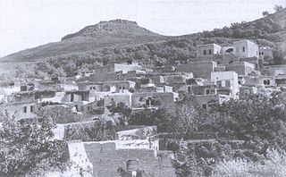
Lubya, sometimes referred to as Lubia, Lubieh and Loubieh, was a Palestinian Arab town located ten kilometers west of Tiberias that was captured and destroyed by Israel during the 1948 Arab-Israeli War where its residents were forcefully evacuated and became refugees. Nearby villages included Nimrin to the north, Hittin to the northwest, and al-Shajara to the south; Each of those villages were also depopulated.
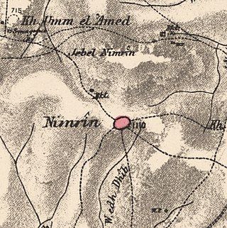
Nimrin was a Palestinian Arab town of 320 that was captured and depopulated by Israel during the 1948 Arab-Israeli War.

Samakh was a Palestinian Arab village at the south end of Lake Tiberias in Ottoman Galilee and later Mandatory Palestine. It was the site of battle in 1918 during World War I.

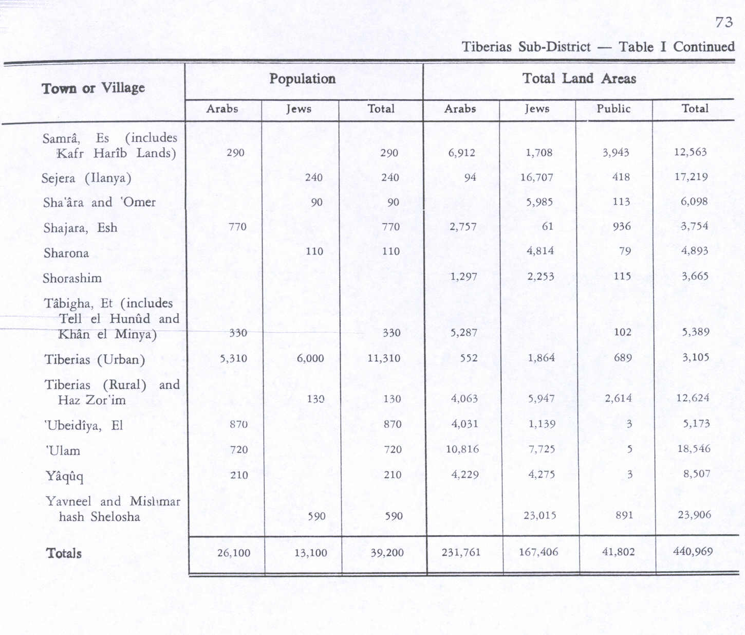
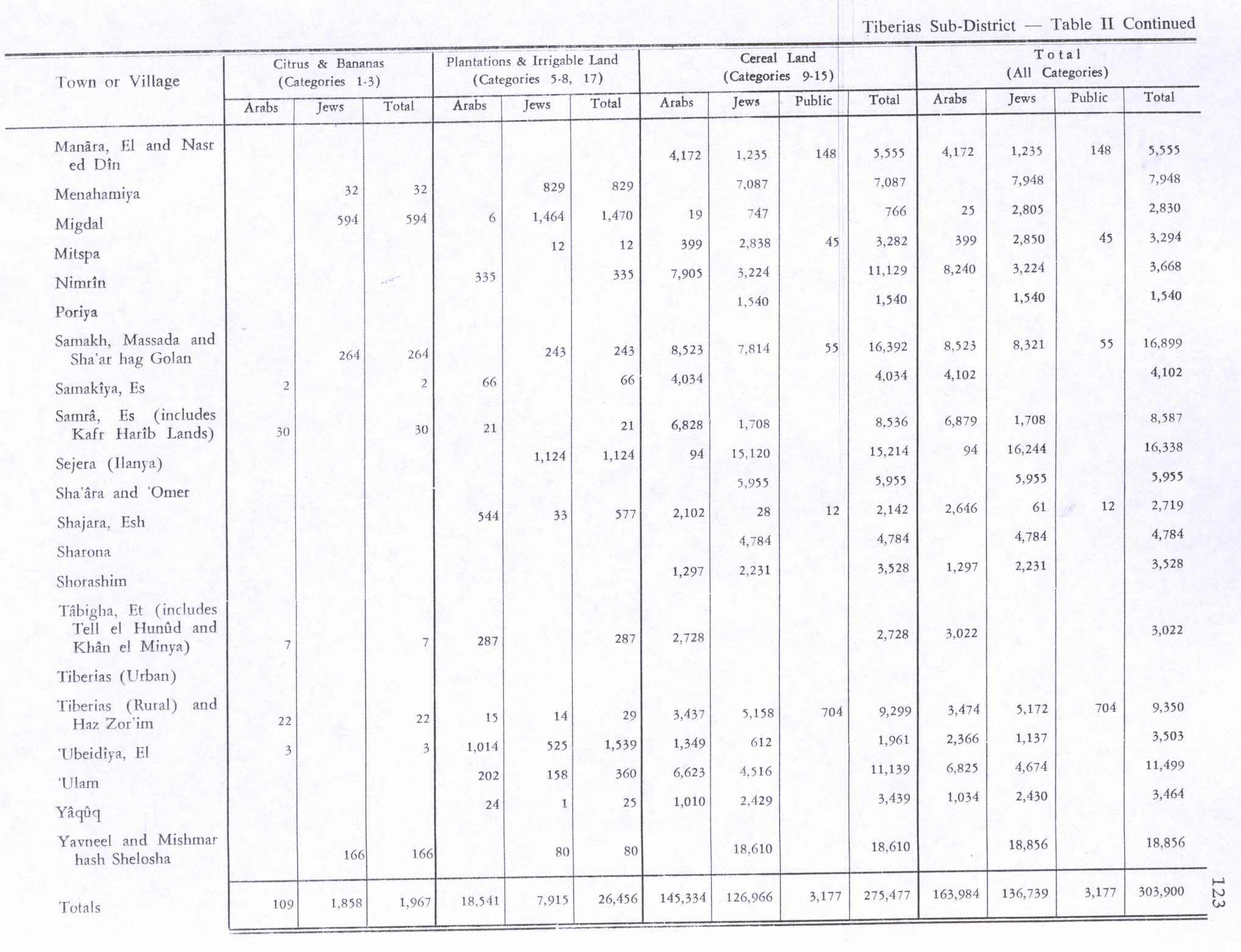
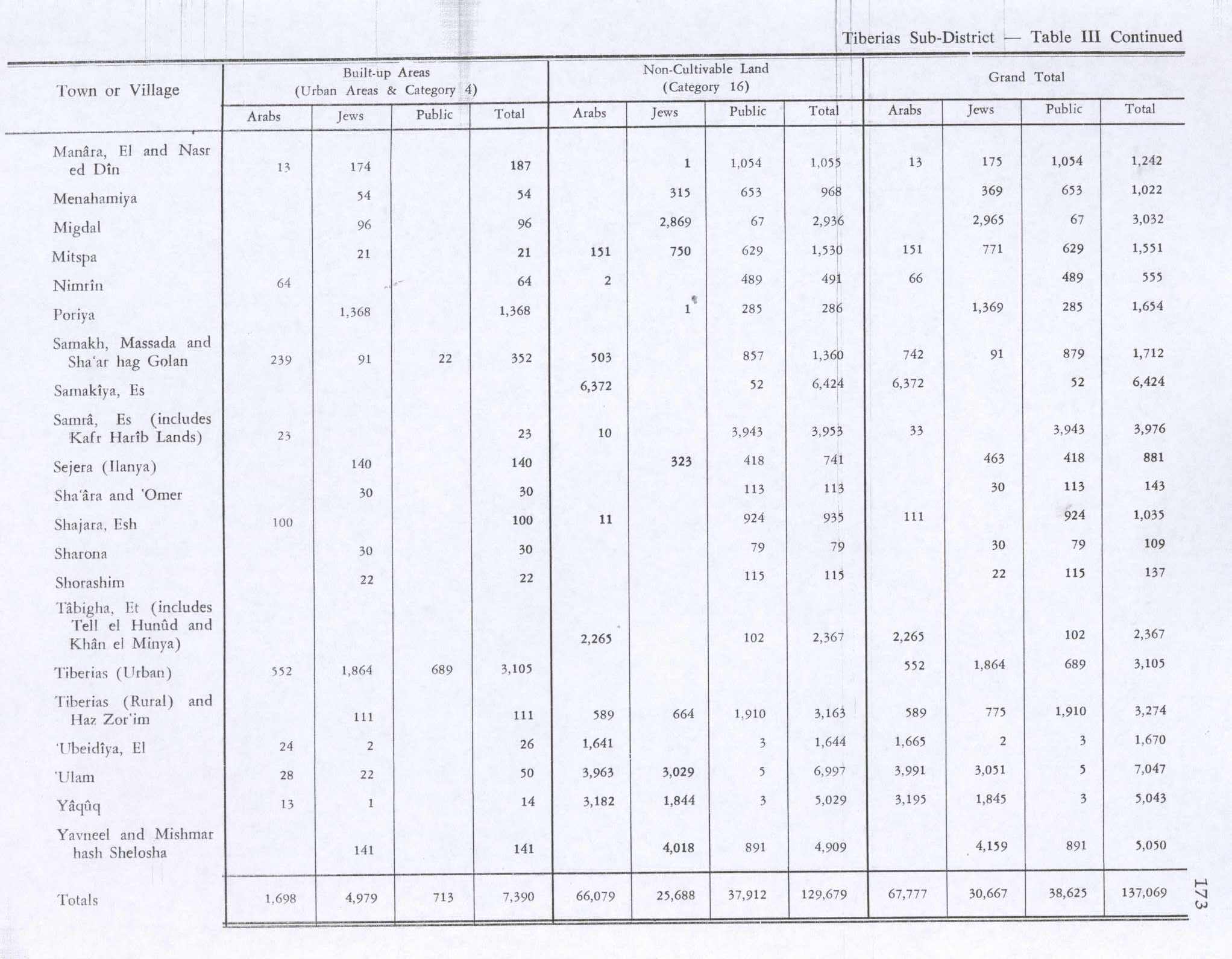
Nasir ad-Dīn was a small Palestinian Arab village 3 kilometers (1.9 mi) southwest of Tiberias, on the crest of a slope that overlooks the Sea of Galilee. The village had several springs to the east, south, and southeast. In the 1931 British census 179 people lived there, decreasing to 90 in a 1945 census. Nasir ad-Din and nearby al-Manara were in the same jurisdiction with 4,185 dunams of land, most of which was allocated to cereals.

Al-Khunayzir, was a Palestinian Arab village in the District of Baysan. It was depopulated during the 1948 Arab-Israeli War on May 20, 1948.
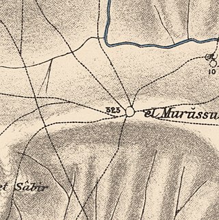
Al-Murassas, was a Palestinian Arab village in the District of Baysan. It was depopulated by the Israel Defense Forces during the 1948 War on May 16, 1948. The village was attacked as part of Operation Gideon.

Al-'Abisiyya was a Palestinian Arab village in the District of Safad. It was depopulated during the 1948 Arab-Israeli War on May 29, 1948, by The Palmach's First Battalion of Operation Yiftach. It was located 28.5 km northeast of Safad near to the Banyas River which the village relied on for irrigation.

Arab al-Shamalina also known as Khirbat Abu Zayna was a Palestinian Arab village in the Safad Subdistrict. It was depopulated during the 1947–1948 Civil War in Mandatory Palestine on May 4, 1948, under Operation Matate (Broom), a sub operation of Operation Yiftach. It was located 13 km southeast of Safad near the Jordan River.
Arab al-Zubayd was a Palestinian village in the Safad Subdistrict. It was depopulated during the 1947–1948 Civil War in Mandatory Palestine on April 20, 1948, when the villagers fled on hearing the intentions of The Palmach's First Battalion of Operation Yiftach. It was located 15 km northeast of Safad, near the al-Mutilla-Safad—Tiberias highway.

Ghabbatiyya was a Palestinian Arab hamlet in the Safad Subdistrict. It was depopulated during the 1948 Arab-Israeli War on October 30, 1948, under Operation Hiram. It was located 12 km northwest of Safad.

Al-Dalhamiyya was a Palestinian Arab village in the Tiberias Subdistrict. It was depopulated during the 1947–1948 Civil War in Mandatory Palestine on April 15, 1948, under Operation Gideon. It was located 14 km south of Tiberias, on the north bank of the Yarmuk River, on the border between Mandatory Palestine and Transjordan.

Ghuwayr Abu Shusha was a Palestinian Arab village in the Tiberias Subdistrict. It was depopulated during the 1947–1948 Civil War in Mandatory Palestine on April 21, 1948. It was located 8 km north of Tiberias, nearby Wadi Rubadiyya.

Hadatha, also El Hadetheh or Hadateh, was a Palestinian Arab village in the District of Tiberias, located 12.5 km southwest of Tiberias. It was depopulated in the 1947–1948 civil war in Mandatory Palestine.

Al-Manara was a Palestinian Arab village in the Tiberias Subdistrict. It was depopulated during the 1947–1948 Civil War in Mandatory Palestine on March 1, 1948, by Jewish troops. It was located 5 km south of Tiberias.

Al-Mansura was a Palestinian Arab village in the Tiberias Subdistrict. It was depopulated during the 1947–1948 Civil War in Mandatory Palestine on May 10, 1948. It was located 16 kilometres northwest of Tiberias.

Al-'Ubaydiyya was a Palestinian Arab village in the Tiberias Subdistrict. It was depopulated during the 1948 Arab-Israeli War on March 3, 1948. It was located 11 km south of Tiberias, situated close to the Jordan River.

Al-Samakiyya was a Palestinian Arab village in the Tiberias Subdistrict. It was depopulated during the 1947–1948 Civil War in Mandatory Palestine on May 4, 1948, under Operation Matateh. It was located 11 km northeast of Tiberias, near the Wadi al-Wadabani. The village was located at Tel Hum, which has been identified with Capernaum.

Al-Samra was a Palestinian Arab village in the Tiberias Subdistrict. It was depopulated on April 21, 1948, during the 1947–1948 Civil War in Mandatory Palestine. It was located 10 km southeast of Tiberias.
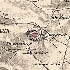 1870s map
 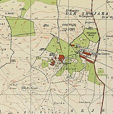 1940s map
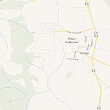 modern map
 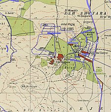 1940s with modern overlay map
