
Arab al-Samniyya, also known as Khirbat al-Suwwana, was a Palestinian village in the Western Galilee that was captured and depopulated by Israel during the 1948 Arab-Israeli war. It was located in the Acre District of the British Mandate of Palestine, 19.5 km northeast of the city of Acre. In 1945 the, village had a population of 200 Arab and a total land area of 1,872 dunums.
Bayt Jirja or Beit Jerja was a Palestinian Arab village 15.5 km Northeast of Gaza. In 1931 the village consisted of 115 houses. It was overrun by Israeli forces during operation Yo'av in the 1948 Arab-Israeli war. Bayt Jirja was found depopulated in November 1948, during "clean up sweeps" to expel any partial inhabited villages and destroy village housing to prevent any possible re-occupation in the area. The village was completely destroyed after the occupation and only one tomb remains.

Arab al-'Arida, is a depopulated former Palestinian Arab village and 6 kilometers (3.7 mi) south of the city of Beit She'an.

Qastina was a Palestinian village, located 38 kilometers northeast of Gaza City. It was ethnically cleansed during the 1948 Arab-Israeli war.

Al-Muharraqa was a Palestinian Arab village in the Gaza Subdistrict, located 14.5 kilometers (9.0 mi) east of Gaza city. The village laid on rolling terrain on the southern coastal plain of Palestine, on a bend in the wadi. It had an elevation of 125 meters (410 ft) and a total land area of 4,855 dunams, most of which was public property, while its built-up area of 29 dunams was Arab-owned. Al-Muharraqa was depopulated during the 1948 Arab-Israeli War.

Al-Masmiyya al-Kabira was a Palestinian village in the Gaza Subdistrict, located 41 kilometers (25 mi) northeast of Gaza. With a land area of 20,687 dunams, the village site was situated on an elevation of 75 meters (246 ft) along the coastal plain. Established by immigrants from the Hauran in Syria, the village was depopulated during the 1948 Arab–Israeli War. Before the war, it had a population of 2,520 in 1945.

Al-Sawafir al-Shamaliyya was a Palestinian Arab village in the Gaza Subdistrict, located 33 kilometers (21 mi) northeast of Gaza situated along the southern coastal plain of Palestine 50 meters (160 ft) above sea level. It was one of three namesake villages, alongside Al-Sawafir al-Sharqiyya and Al-Sawafir al-Gharbiyya.

Al-Batani al-Sharqi was a Palestinian Arab village in the Gaza Subdistrict, located 36.5 kilometers (22.7 mi) northeast of Gaza situated in the flat terrain on the southern coastal plain of Palestine. It had a population of 650 in 1945. Al-Batani al-Sharqi was depopulated during the 1948 Arab-Israeli War.

Summil was a Palestinian Arab village in the Gaza Subdistrict, located 36 kilometers (22 mi) northeast of Gaza. It was situated on a sandy hill in the coastal plain and had a population of 950 in 1945. It was depopulated during the 1948 Arab-Israeli War.

Tall al-Turmus was a Palestinian Arab village in the Gaza Subdistrict, located on a low hill on the coastal plain of Palestine, 38 kilometers (24 mi) northeast of Gaza. In 1945, it had a population of 760 and a land area of 11,508 dunams. The village was depopulated during the 1948 Arab-Israeli War.

Zab'a, was a Palestinian Arab village in the District of Baysan. It was depopulated by the Israel Defense Forces during the 1947–1948 Civil War in Mandatory Palestine on May 12, 1948, as part of Operation Gideon. It was located 5.5 km northeast of Baysan on Wadi Yubla or Wadi al-'Ashsha.

Bil'in was a Palestinian Arab village in the Gaza Subdistrict. It was depopulated by the Israel Defense Forces during the 1948 Arab–Israeli War on July 8, 1948, under Operation An-Far. It was located 39 km northeast of Gaza and the village contained two wells which supplied it with drinking water.
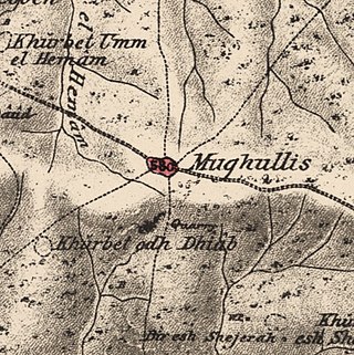
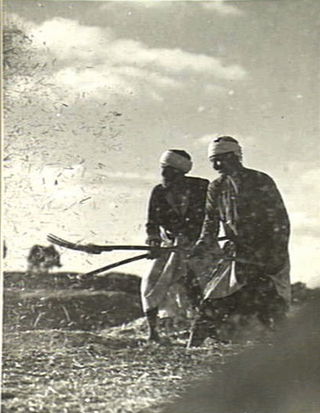
Mughallis was a Palestinian Arab village located 30.5 kilometers (19.0 mi) northwest of Hebron. It was depopulated during the 1948 Arab-Israeli War between July 9–10, 1948 as part of Operation An-Far.

Al-Jammasin al-Gharbi was a Palestinian Arab village in the Jaffa Subdistrict. It was depopulated during the 1947–48 Civil War in Mandatory Palestine on March 17, 1948. It was located 6.5 km northeast of Jaffa.
Al-Jammasin al-Sharqi was a Palestinian Arab village in the Jaffa Subdistrict. It was depopulated during the 1948 Palestine War on March 17, 1948. It was located 9 km northeast of Jaffa.

Al-Khayma was a Palestinian Arab village in the Ramle Subdistrict of Mandatory Palestine. It was depopulated during the 1948 Arab–Israeli War on July 9, 1948, by the Givati Brigade of Operation An-Far. It was located 18.5 km south of Ramla.

Ghuraba was a Palestinian Arab village in the Safad Subdistrict. It was depopulated during the 1948 War on May 28, 1948, by the Palmach's First Battalion of Operation Yiftach. It was located 22 km northeast of Safad.
Al-Zawiya was a Palestinian Arab village in the Safad Subdistrict. It was depopulated during the 1947–1948 Civil War in Mandatory Palestine on May 24, 1948, by the Palmach's First Battalion of Operation Yiftach. It was located 23 km northeast of Safad.

Al-Wayziyya was a Palestinian village in the Safad Subdistrict, located south east of Yarda. It was depopulated during the 1947–48 Civil War in Mandatory Palestine on May 1, 1948, by the Palmach's First Battalion of Operation Yiftach. It was located 8.5 km northeast of Safad.

Al-Samra was a Palestinian Arab village in the Tiberias Subdistrict. It was depopulated on April 21, 1948, during the 1947–1948 Civil War in Mandatory Palestine. It was located 10 km southeast of Tiberias.
 1870s map
 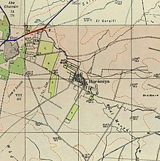 1940s map
 modern map
 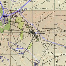 1940s with modern overlay map


