
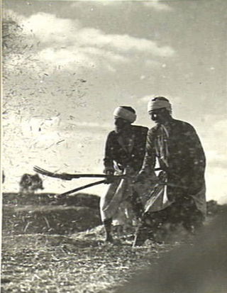
Bayt Nabala or Beit Nabala was a Palestinian Arab village in the Ramle Subdistrict in Palestine that was destroyed during the 1948 Arab–Israeli War. The village was in the territory allotted to the Arab state under the 1947 UN Partition Plan, which was rejected by Arab leaders and never implemented. Its population in 1945, before the war, was 2,310.
Bayt Jirja or Beit Jerja was a Palestinian Arab village 15.5 km Northeast of Gaza. In 1931 the village consisted of 115 houses. It was overrun by Israeli forces during operation Yo'av in the 1948 Arab-Israeli war. Bayt Jirja was found depopulated in November 1948, during "clean up sweeps" to expel any partial inhabited villages and destroy village housing to prevent any possible re-occupation in the area. The village was completely destroyed after the occupation and only one tomb remains.

Lazzaza was a Palestinian Arab village of 230 in the northern Hula Valley next to the Hasbani River, located 27.5 kilometers (17.1 mi) northwest of Safad. Beit Hillel subsequently expanded onto the land.

Salbit was a Palestinian Arab village located 12 kilometers (7.5 mi) southeast of al-Ramla. Salbit was depopulated during the 1948 Arab–Israeli War after a military assault by Israeli forces. The Israeli locality of Shaalvim was established on the former village's lands in 1951.

Al-Safiriyya was a Palestinian Arab village in the Jaffa Subdistrict. It was depopulated during Operation Hametz in the 1948 Palestine War on May 20, 1948. It was located 11 km east of Jaffa, 1.5 km west of Ben Gurion Airport.

Al-Sawalima was a Palestinian Arab village in the Jaffa Subdistrict. It was depopulated during the 1947–1948 Civil War in Mandatory Palestine on March 30, 1948. It was located 11 km northeast of Jaffa, situated 2 km north of the al-'Awja River.
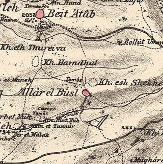
Allar or 'Allar el-Fawqa, also known as 'Allar el Busl, was a Palestinian Arab village located southwest of the Old City of Jerusalem near Wadi Surar, along Wadi Tannur. The name was shared by the twin village of Allar al-Sifla or Khirbat al-Tannur, with official imperial ledgers often listing them both under the single entry of Allar.

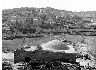
Bayt Umm al-Mays was a small Palestinian Arab village in the Jerusalem Sub-district, located 14 km west of Jerusalem..

Al-Barriyya was a Palestinian village in the Ramle Subdistrict of Mandatory Palestine. It was depopulated during the 1948 Arab–Israeli War on July 10, 1948, as part of Operation Dani. It was located 5.5 km southeast of Ramla, on the eastern bank of Wadi al-Barriyya.
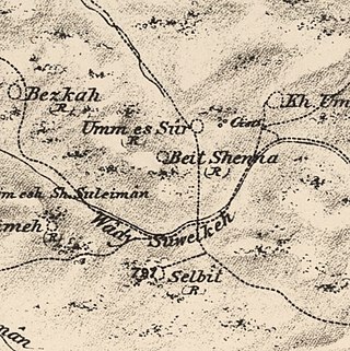
Bayt Shanna was a Palestinian Arab village in the Ramle Subdistrict of Mandatory Palestine. It was depopulated during the 1948 Arab–Israeli War on July 15, 1948, during the second stage of Operation Dani. It was located 11.5 km southeast of Ramla.

Bir Ma'in was a Palestinian Arab village in the Ramle Subdistrict. It was depopulated during the 1948 Arab-Israeli War on July 15, 1948 during the second phase of Operation Danny by the First and Second Battalions of the Yiftach Brigade. It was located 14 km east of Ramla. The village was defended by the Jordanian Army.
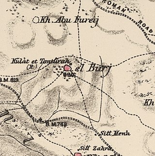
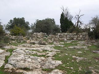
Al-Burj was a Palestinian Arab village 14 km east of Ramle close to the highway to Ramallah, which was depopulated in 1948. Its name, "the tower", is believed to be derived from the crusader castle, Castle Arnold, built on the site. Victorian visitors in the 19th century recorded seeing crusader ruins close to the village.

Dayr Abu Salama was a small Palestinian Arab village in the Ramle Subdistrict, located 8 km northeast of Ramla. It was depopulated during the 1948 Arab–Israeli War on July 13, 1948, in the first phase of Operation Dani.

Dayr Tarif was a Palestinian Arab village in the Ramle Subdistrict of Mandatory Palestine. It was depopulated during the 1948 Arab-Israeli War on July 10, 1948.

Khirbat al-Duhayriyya was a Palestinian Arab village in the Ramle Subdistrict. It was depopulated during the 1948 Arab-Israeli War on July 10, 1948, by the Givati Brigade under the first phase of Operation Dani. It was located 6 km northeast of Ramla.

Al-Haditha was a Palestinian village in the Ramle Subdistrict. It was located 8 km northeast of Ramla, on the bank of Wadi al-Natuf. The site, now known as Tel Hadid, has yielded significant archaeological remains from many periods. Al-Haditha was depopulated during the 1948 Arab-Israeli War on July 12, 1948, under the first stage of Operation Dani.
'Innaba, also spelled 'Annaba, was a Palestinian village in the Ramle Subdistrict of Mandatory Palestine. It was depopulated during the 1948 Arab–Israeli War on July 10, 1948 by the Yiftach and Eighth Brigades of Operation Dani. It was located 7 km east of Ramla.
Kharruba was a Palestinian Arab village in the Ramle Subdistrict of Mandatory Palestine, near Modi'in. It was located 8 km east of Ramla. It was depopulated on July 12, 1948, during the 1948 Arab–Israeli War.

Al-Kunayyisa was a small Palestinian Arab village in the Ramle Subdistrict. It was depopulated during the 1948 Arab–Israeli War on July 10, 1948, under the first stage of Operation Dani. It was located 12 km southeast of Ramla.

Khirbat Bayt Lid was a Palestinian Arab village in the Tulkarm Subdistrict. It was depopulated by its Arab inhabitants during the 1948 Arab–Israeli War.
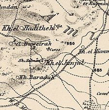 1870s map
 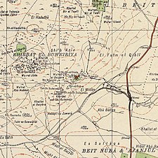 1940s map
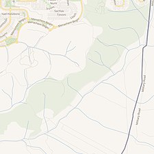 modern map
 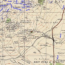 1940s with modern overlay map


