
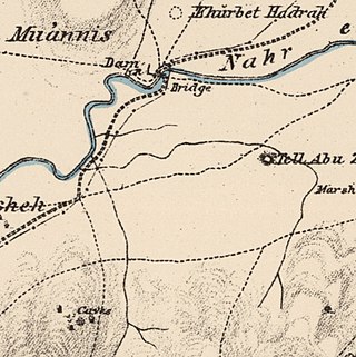
Al-Shaykh Muwannis, also Sheikh Munis, was a small Palestinian Arab village in the Jaffa Subdistrict of Mandatory Palestine, located approximately 8.5 kilometers from the center of Jaffa city in territory earmarked for Jewish statehood under the UN Partition Plan. The village was abandoned in March 1948 due to the threats of Jewish militias, two months before the 1948 Arab–Israeli war. Today, Tel Aviv University lies on part of the village land.

Al-Khayriyya, also Ibn Ibraq, was a Palestinian Arab village located 7.5 kilometers east of Jaffa. It became depopulated in April 1948 as a result of a military assault by the Alexandroni Brigade of the pre-state Israeli forces during the 1948 Palestine war. The village lands would later be used by Israel as the Hiriya landfill.
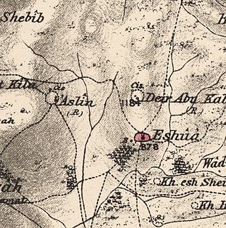
Islin was a Palestinian Arab village located 21 kilometers west of Jerusalem. The village had a population of 302 inhabitants and was depopulated during the 1948 Arab-Israeli war. It was occupied by Israeli forces, possibly from the Fourth Battalion of the Harel Brigade, on 18 July 1948 during Operation Dani, causing its inhabitants to leave. Eshtaol, a moshav, was built on the village's land.

Salamah was a Palestinian Arab village, located five kilometers east of Jaffa, that was depopulated in the lead-up to the 1948 Arab-Israeli War. The town contains the supposed grave of Salama Abu Hashim, a companion of the Islamic prophet Muhammad. His tomb, two village schools, and ten houses from among the over 800 houses that had made up the village, are all that remain of the structures of the former village today.

Al-Shajara was a Palestinian Arab village depopulated by Israel during the 1948 Arab-Israeli War when its residents were forcefully evacuated and became refugees. It was located 14 kilometers west of Tiberias on the main highway to Nazareth near the villages of Lubya and Hittin. The village was very close to the city of Nazareth, about 5 kilometers away.

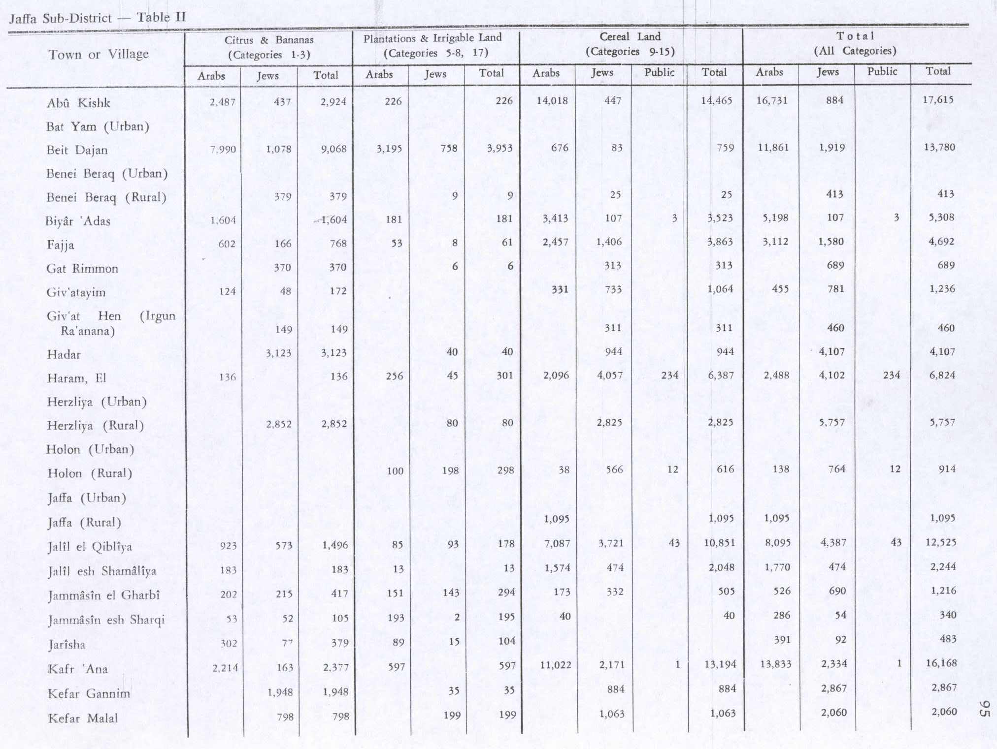
Jarisha was a Palestinian Arab village located 200 meters (660 ft) from the ancient site of Tell Jarisha, on the south bank of Al-Awja. After the establishment of Tel Aviv, it was one of five Arab villages to fall within its municipal boundaries. Jarisha was depopulated in the lead up to the 1948 Arab-Israeli war.

'Arab Suqrir was a Palestinian Arab village in the Gaza Subdistrict, located 38 kilometers (24 mi) northeast of Gaza in a flat area with an elevation of 25 meters (82 ft) along the coastal plain just north of Isdud. The total land area of the village was 40,224 dunams, of which 12,270 was Arab-owned, while the remainder was public property. In 1931, it had a population of 530, decreasing to 390 in 1945. It was destroyed and depopulated during the 1948 Arab-Israeli War.

Al-Sawafir al-Shamaliyya was a Palestinian Arab village in the Gaza Subdistrict, located 33 kilometers (21 mi) northeast of Gaza situated along the southern coastal plain of Palestine 50 meters (160 ft) above sea level. It was one of three namesake villages, alongside Al-Sawafir al-Sharqiyya and Al-Sawafir al-Gharbiyya.

Al-Batani al-Sharqi was a Palestinian Arab village in the Gaza Subdistrict, located 36.5 kilometers (22.7 mi) northeast of Gaza situated in the flat terrain on the southern coastal plain of Palestine. It had a population of 650 in 1945. Al-Batani al-Sharqi was depopulated during the 1948 Arab-Israeli War.

Al-Ghubayya al-Fawqa was a Palestinian Arab village in the Haifa Subdistrict. It was depopulated during the 1947–48 Civil War in Mandatory Palestine on April 8, 1948, during the Battle of Mishmar HaEmek. It was located 28 km southeast of Haifa.
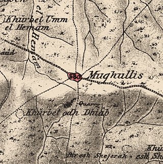
Mughallis was a Palestinian Arab village located 30.5 kilometers (19.0 mi) northwest of Hebron. It was depopulated during the 1948 Arab-Israeli War between July 9–10, 1948 as part of Operation An-Far.

Al-'Abbasiyya, also known as al-Yahudiya, was a Palestinian Arab village in the Jaffa Subdistrict. It was attacked under Operation Hametz during the 1948 Palestine War, and finally depopulated under Operation Dani. It was located 13 km east of Jaffa. Some of the remains of the village can be found today in the centre of the modern Israeli city of Yehud.

Abu Kishk was a Palestinian village in the Jaffa Subdistrict located 12 km northeast of Jaffa, situated 2 km northwest of the Yarkon River. The village was depopulated during the 1947–1948 Civil War in Mandatory Palestine on 30 March 1948 by the Irgun.

Al-Haram, was a Palestinian Arab village in the Jaffa Subdistrict, in Mandatory Palestine. It was located 16 km north of Jaffa, adjacent to the ruins of the medieval walled city of Arsuf, and its extent was estimated to range between 9,653 and 11,698 dunams of which 5,150 were accounted for in the cadastral registrations. It was depopulated during the 1948 war.

Ijlil al-Qibliyya, also al-Jalil, was a Palestinian Arab village in the Jaffa Subdistrict. It was depopulated during the 1947–1948 Civil War in Mandatory Palestine on April 3, 1948.

Ijlil al-Shamaliyya was a Palestinian Arab village in the Jaffa Subdistrict. Established in the 19th century, it was founded by Bani Sa'b tribesmen from the Qalqiliya area and migrants from Egypt. It was depopulated during the 1947–1948 Civil War in Mandatory Palestine on April 3, 1948.
Al-Jammasin al-Sharqi was a Palestinian Arab village in the Jaffa Subdistrict. It was depopulated during the 1948 Palestine War on March 17, 1948. It was located 9 km northeast of Jaffa.

Al-Safiriyya was a Palestinian Arab village in the Jaffa Subdistrict. It was depopulated during Operation Hametz in the 1948 Palestine War on May 20, 1948. It was located 11 km east of Jaffa, 1.5 km west of Ben Gurion Airport.
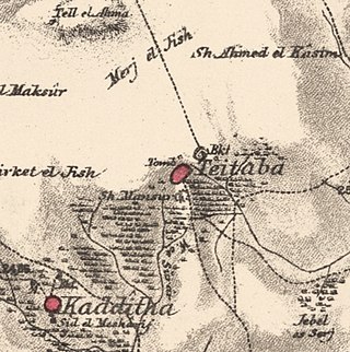
Taytaba was a Palestinian-Arab village in the Safad Subdistrict, located 5 kilometers north of Safad. It was depopulated during the 1947–1948 Civil War in Mandatory Palestine in May 1948 under Operation Hiram. In 1945 it had a population of 530 and a total area of 8,453 dunams, 99.8% of which was Arab-owned.

Hadatha, also El Hadetheh or Hadateh, was a Palestinian Arab village in the District of Tiberias, located 12.5 km southwest of Tiberias. It was depopulated in the 1947–1948 civil war in Mandatory Palestine.
 1870s map
 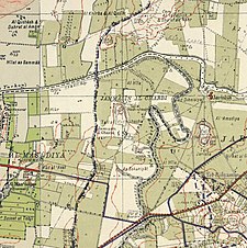 1940s map
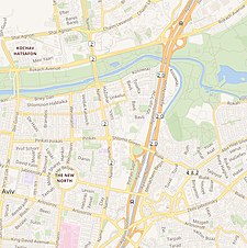 modern map
 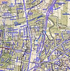 1940s with modern overlay map
