al-Nahr, was a Palestinian village 14 km (8.7 mi) northeast of Acre. It was depopulated in May 1948 after a military assault carried out by the Carmeli Brigade as part of the Israel Defense Forces's Operation Ben-Ami. Immediately after the assault, the village of al-Nahr was razed.

Khirbat Jiddin, known in the Kingdom of Jerusalem as Judin, was an Ottoman fortress in the western Upper Galilee, originally built by the Teutonic Order after 1220 as a crusader castle, 16 km northeast of the city of Acre, which at the time was the capital of the Kingdom of Jerusalem. The castle was destroyed by the Mamluk sultan Baibars sometime between 1268-1271 and lay in ruins until being rebuilt and expanded by the Arab ruler Zahir al-Umar as Qal'at Jiddin in the 1760s, only to be destroyed again around 1775 by Jazzar Pasha. The ruined fortress, known as Khirbat Jiddin, was later inhabited by the al-Suwaytat Bedouin tribe.

Al-Manshiyya, was a Palestinian village with a Muslim orphanage and a mosque known as the mosque of Abu 'Atiyya, which is still standing.

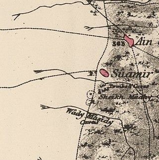
Al-Sumayriyya, was a Palestinian village located six kilometers north of Acre that was depopulated after it was captured by the Israel Defense Forces during the 1948 Arab-Israeli War. The ruins of the village are today in the outskirts of the Israeli moshav of Regba.

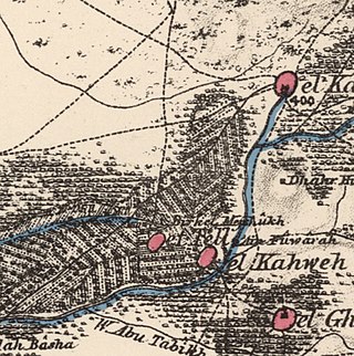
Al-Tall, was a Palestinian village 14 km northeast of Acre in the British Mandate District of Acre. Depopulated as a result of military assault and capture during the 1947-1948 Civil War in Mandatory Palestine as part of Operation Operation Ben-Ami by the Carmeli Brigade of the Israel Defense Forces.

Lubya, sometimes referred to as Lubia, Lubieh and Loubieh, was a Palestinian Arab town located ten kilometers west of Tiberias that was captured and destroyed by Israel during the 1948 Arab-Israeli War where its residents were forcefully evacuated and became refugees. Nearby villages included Nimrin to the north, Hittin to the northwest, and al-Shajara to the south; Each of those villages were also depopulated.
Umm Khalid, also called Mukhalid, was a Palestinian village in the Tulkarm Subdistrict, 15 kilometers (9.3 mi) west of Tulkarm. It was an ancient site in the central coastline of what is now the city of Netanya, Israel.

Degania Alef is a kibbutz in northern Israel. The Jewish communal settlement (kvutza) was founded in 1910, making it the earliest Labor Zionist farming commune in the Land of Israel. Its status as "the mother of all kibbutzim" is sometimes contested based on a later distinction made between the smaller kvutza, applying to Degania in its beginnings, and the larger kibbutz.

Samakh was a Palestinian Arab village at the south end of Lake Tiberias in Ottoman Galilee and later Mandatory Palestine. It was the site of battle in 1918 during World War I.

Miska was a Palestinian village, located fifteen kilometers southwest of Tulkarm, depopulated in 1948.

Al-Shajara was a Palestinian Arab village depopulated by Israel during the 1948 Arab-Israeli War when its residents were forcefully evacuated and became refugees. It was located 14 kilometers west of Tiberias on the main highway to Nazareth near the villages of Lubya and Hittin. The village was very close to the city of Nazareth, about 5 kilometers away.
Kafr Sabt was a Palestinian Arab village of nearly 500 situated on a sloping plain in the eastern Lower Galilee located 10.5 kilometers (6.5 mi) southwest of Tiberias. It was depopulated in 1948.

Kawkab al-Hawa, is a depopulated former Palestinian village located 11 km north of Baysan. It was built within the ruins of the Crusader fortress of Belvoir, from which it expanded. The Crusader names for the Frankish settlement at Kawkab al-Hawa were Beauvoir, Belvoir, Bellum videre, Coquet, Cuschet and Coket. During Operation Gideon in 1948, the village was occupied by the Golani Brigade and depopulated.

Umm Sabuna, was a Palestinian Arab village in the District of Baysan. It was depopulated by the Israel Defense Forces during the 1948 Arab-Israeli War on May 21, 1948, as part of Operation Gideon. It was located 10.5 km northeast of Baysan and the 'Ayn Umm-Sabuna provided the village with water.
Khirbat al-Sawamir was a Palestinian Arab village in the Haifa Subdistrict. It was depopulated during the 1948 Arab-Israeli War on May 22, 1948. It was located 22 kilometres south of Haifa.
Khirbat Umm Burj was a Palestinian Arab village in the Hebron Subdistrict, sometimes designated in modern maps as Burgin. Its ruins are today located within the borders of Israel. It occupied an extensive site, stretching about 30 dunams on the crest of a hill, rising some 430 metres (1,410 ft) above sea level, and commanding a good prospect of the surrounding region. It was depopulated during the 1948 Arab–Israeli War on October 28, 1948, during the third stage of Operation Yo'av under the command of Yigal Allon. The site is located 17 km northwest of Hebron.

Arab al-Shamalina also known as Khirbat Abu Zayna was a Palestinian Arab village in the Safad Subdistrict. It was depopulated during the 1947–1948 Civil War in Mandatory Palestine on May 4, 1948, under Operation Matate (Broom), a sub operation of Operation Yiftach. It was located 13 km southeast of Safad near the Jordan River.

Fir'im was a Palestinian Arab village in the Safad Subdistrict that was depopulated during the 1948 Palestine war. It was first attacked during the 1947–1948 Civil War in Mandatory Palestine on May 2, 1948, by the Palmach's First Battalion during Operation Yiftach. In 1945 the population had been 740.

Ghuwayr Abu Shusha was a Palestinian Arab village in the Tiberias Subdistrict. It was depopulated during the 1947–1948 Civil War in Mandatory Palestine on April 21, 1948. It was located 8 km north of Tiberias, nearby Wadi Rubadiyya.

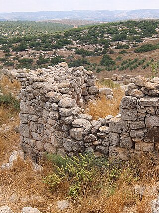
Al-'Ubaydiyya was a Palestinian Arab village in the Tiberias Subdistrict. It was depopulated during the 1948 Arab-Israeli War on March 3, 1948. It was located 11 km south of Tiberias, situated close to the Jordan River.
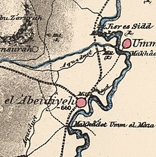 1870s map
 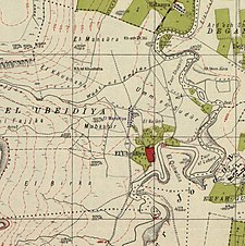 1940s map
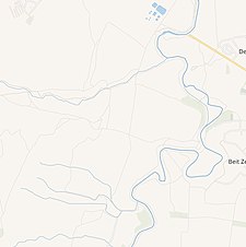 modern map
 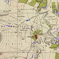 1940s with modern overlay map

