Al-Tina

Last updated

Contents

Al-Tina
التينة
Etymology: The fig tree [1]
Historical map series for the area of al-Tina (1870s).jpg 1870s map
Historical map series for the area of al-Tina (1940s).jpg 1940s map
Historical map series for the area of al-Tina (modern).jpg modern map
Historical map series for the area of al-Tina (1940s with modern overlay).jpg 1940s with modern overlay map
A series of historical maps of the area around Al-Tina (click the buttons)
Mandatory Palestine location map.svg
Red pog.svg
Al-Tina
Location within Mandatory Palestine
Coordinates: 31°44′48″N34°49′11″E / 31.74667°N 34.81972°E / 31.74667; 34.81972
Palestine grid 133/128
Geopolitical entity Mandatory Palestine
Subdistrict Ramle
Date of depopulationJuly 8–9, 1948 [2]
Area
[3]
  Total
7,001  dunams (7.001 km2 or 2.703 sq mi)
Population
 (1945)
  Total
750 [4] [3]
Cause(s) of depopulationMilitary assault by Yishuv forces

Al-Tina, or Khirbet et-Tineh was a Palestinian Arab village in the Ramle Subdistrict of Mandatory Palestine. The village was located between the Shfela and southern Israeli coastal plain. It was depopulated during the 1948 Arab–Israeli War on July 8, 1948, by the Givati Brigade under Operation An-Far. It was located 20. km south of Ramla. The hill on which the village was built stands today next to the Kiryat Mal'akhi – Yoav railway station and next to Highway 6. Archeological excavations at the site revealed the remains of a Byzantine settlement. [5]

History

Based on the archaeological excavation in the eastern foot of the hill on which the village used to stand, a settlement was established in the site as early as the Byzantine era. Pottery, glassware and coins allowed the researchers to date this settlement to a short period between roughly 375 to 425 CE. The excavation has revealed remains of what may be a storehouse, with many broken wine jars. The structure included a drainage system that collected water from its roof to somewhere beyond the excavation limits. The region is abundant with water and thus the hill serves as a good place for settlement. Elie Haddad who headed the excavation suggested that this abundance of water is hinted in the name of the village, "the fig tree", as it requires a large supply of water to grow. The identity of the Byzantine inhabitants remains unknown and based on the study, the site remained unsettled until the Ottoman period. [5]

Al-Tina was incorporated into the Ottoman Empire in 1517 with all of Palestine, and in 1596 it appeared in the tax registers under the name of Safiriyya, as being in the nahiya ("subdistrict") of Gaza, which was part of Gaza Sanjak. It had a population of 10 households; an estimated 55 persons, who were all Muslims. They paid a fixed tax-rate of 25% on agricultural products, including wheat, barley, summer crops, sesame, fruit trees, goats and beehives, in addition to occasional revenues; a total of 4,350 akçe. [6] [7]

In 1838, it was noted as a Muslim village, el Letineh, in the Gaza District. [8] In 1851–52, van de Velde noted many old stone laying about the village. [9]

In 1863 Victor Guérin found a population is four hundred souls. He further noted some antique stones which were scattered in the cemetery or have been placed around the opening of the well. [10]

An Ottoman village list from about 1870 showed that tine had 96 houses and a population of 277, though the population count included men, only. [11] [12]

In 1882, the PEF's Survey of Western Palestine (SWP) described it as an ordinary adobe village, with a well to the south. [13]

British Mandate era

Al-Tina 1945 1:250,000 Idhnibba 1945.jpg
Al-Tina 1945 1:250,000

In the 1922 census of Palestine conducted by the British Mandate authorities, Tineh had a population of 396, all Muslims, [14] increasing in the 1931 census to 530, still all Muslims, in a total of 131 houses. [15]

'Abd al-Fattah Humud (1933-1968), one of the founding members of Fatah, was born in the village. [7]

In the 1945 statistics the village had a population of 750 Muslims, [4] with 7,001 dunams of land. [3] Of this, 141 dunams were used for citrus and bananas, 5,639 for cereals, [16] while 24 dunams were classified as built-up areas. [17]

An elementary school was founded in 1946 and it had an initial enrollment of 67 students. [7]

Al-Tina 1948 1:20,000 Idhnibba 1948.jpg
Al-Tina 1948 1:20,000

1948 and aftermath

Al-Tina was depopulated during the 1948 Arab–Israeli War on July 8, 1948, by the Givati Brigade under Operation An-Far. [2] [18] [19] [20] [21] [22] [23]

In 1992 the village site was described: "The village has been completely effaced. Next to the site is a wide area, overgrown with bushes and thorns, that is fenced in on the southern side. An orange grove is planted on the northern and western edges of the site. A highway that runs east-west passes to the south, and a railway line passes by about 100 meters to the east." [7]

In July–August 2016 a trial excavation took place in the eastern side of the hill. It was the first archaeological excavation in the site and was headed by Elie Haddad on behalf of the Israel Antiquities Authority. The excavation took place ahead of the construction of an access road to the Kiryat Mal'akhi – Yoav railway station which was under construction at the time. 9 excavation squares were opened. [5]

Related Research Articles

al-Nahr Place in Acre, Mandatory Palestine

al-Nahr, was a Palestinian village 14 km (8.7 mi) northeast of Acre. It was depopulated in May 1948 after a military assault carried out by the Carmeli Brigade as part of the Israel Defense Forces's Operation Ben-Ami. Immediately after the assault, the village of al-Nahr was razed.

<span class="mw-page-title-main">Bayt Jirja</span> Place in Gaza, Mandatory Palestine

Bayt Jirja or Beit Jerja was a Palestinian Arab village 15.5 km Northeast of Gaza. In 1931 the village consisted of 115 houses. It was overrun by Israeli forces during operation Yo'av in the 1948 Arab-Israeli war. Bayt Jirja was found depopulated in November 1948, during "clean up sweeps" to expel any partial inhabited villages and destroy village housing to prevent any possible re-occupation in the area. The village was completely destroyed after the occupation and only one tomb remains.

<span class="mw-page-title-main">Barqa, Gaza</span> Place in Gaza, Mandatory Palestine

Barqa was a Palestinian Arab village located 37 km north of Gaza near the modern-day Israeli city of Ashdod. It was referred to as Barka by the Greeks and Bareca by the Romans during their rule over the ancient Philistine city. In 1945, the village had a population of 890 and total land area of 5,206 dunums.

<span class="mw-page-title-main">Fajja</span> Place in Jaffa, Mandatory Palestine

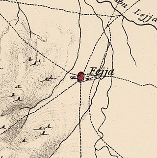
Fajja was a Palestinian town located 15 kilometers northeast of Jaffa. Ethnically cleansed during the Nakba, its land area is today part of the Israeli city of Petah Tikva.

<span class="mw-page-title-main">Farwana</span> Place in Baysan, Mandatory Palestine

Farwana, was a Palestinian village, located 4.5 kilometers (2.8 mi) south of Bisan, depopulated in 1948.

<span class="mw-page-title-main">Miska, Tulkarm</span> Village in Tulkarm, Mandatory Palestine

Miska was a Palestinian village, located fifteen kilometers southwest of Tulkarm, depopulated in 1948.

<span class="mw-page-title-main">Abil al-Qamh</span> Place in Safad, Mandatory Palestine

Abil al-Qamh was a Palestinian village located near the Lebanese border north of Safad. It was depopulated in 1948. It was located at the site of the biblical city of Abel-beth-maachah.

<span class="mw-page-title-main">Al-Bira, Baysan</span> Village in Baysan, Mandatory Palestine

Al-Bira, is a depopulated former Palestinian village located 7.5 km north of Baysan. During Operation Gideon, the village was occupied by the Golani Brigade.

<span class="mw-page-title-main">Shahma</span> Village in Ramle, Mandatory Palestine

Shahma was a Palestinian Arab village located 15 kilometers (9.3 mi) southwest of Ramla. Depopulated on the eve of the 1948 Arab-Israeli war, the village lands today form part of a fenced-in area used by the Israeli Air Force.

<span class="mw-page-title-main">Al-Nabi Yusha'</span> Village in Safad, Mandatory Palestine

Al-Nabi Yusha' was a small Palestinian village in the Galilee situated 17 kilometers to the northeast of Safad, with an elevation of 375 meters above sea level. It became part of the Palestine Mandate under British control from 1923 until 1948, when it was depopulated during the 1948 Arab-Israeli War. The village was surrounded by forest land overlooking the Hula Valley.

<span class="mw-page-title-main">Tall al-Turmus</span> Place in Gaza, Mandatory Palestine

Tall al-Turmus was a Palestinian Arab village in the Gaza Subdistrict, located on a low hill on the coastal plain of Palestine, 38 kilometers (24 mi) northeast of Gaza. In 1945, it had a population of 760 and a land area of 11,508 dunams. The village was depopulated during the 1948 Arab-Israeli War.

<span class="mw-page-title-main">Al-Sindiyana</span> Village in Haifa, Mandatory Palestine

Al-Sindiyana was a Palestinian Arab village in the Haifa Subdistrict. It was depopulated during the 1947–1948 Civil War in Mandatory Palestine on May 12, 1948. It was located 29 km south of Haifa.

<span class="mw-page-title-main">Barqusya</span> Place in Hebron, Mandatory Palestine

Barqusya was a Palestinian Arab village in the Hebron Subdistrict, depopulated in the 1948 Palestine War. It was located 31 km northwest of Hebron.

<span class="mw-page-title-main">Mughallis</span> Village in Hebron, Mandatory Palestine

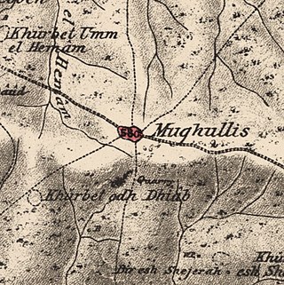
Mughallis was a Palestinian Arab village located 30.5 kilometers (19.0 mi) northwest of Hebron. It was depopulated during the 1948 Arab-Israeli War between July 9–10, 1948 as part of Operation An-Far.

<span class="mw-page-title-main">Bayt Umm al-Mays</span> Place in Jerusalem, Mandatory Palestine

Bayt Umm al-Mays was a small Palestinian Arab village in the Jerusalem Sub-district, located 14 km west of Jerusalem..

<span class="mw-page-title-main">Al-Khayma</span> Village in Ramle, Mandatory Palestine

Al-Khayma was a Palestinian Arab village in the Ramle Subdistrict of Mandatory Palestine. It was depopulated during the 1948 Arab–Israeli War on July 9, 1948, by the Givati Brigade of Operation An-Far. It was located 18.5 km south of Ramla.

<span class="mw-page-title-main">Arab al-Shamalina</span> Place in Safad, Mandatory Palestine

Arab al-Shamalina also known as Khirbat Abu Zayna was a Palestinian Arab village in the Safad Subdistrict. It was depopulated during the 1947–1948 Civil War in Mandatory Palestine on May 4, 1948, under Operation Matate (Broom), a sub operation of Operation Yiftach. It was located 13 km southeast of Safad near the Jordan River.

<span class="mw-page-title-main">Dallata</span> Place in Safad, Mandatory Palestine

Dallata was an Arab village, located on a hilltop 6 kilometers (3.7 mi) north of Safad. Constructed upon an ancient site, it was known to the Crusaders as Deleha. Dallata was included in the late 16th century Ottoman census and British censuses of the 20th century. Its inhabitants were primarily agriculturalists, with some involved in carpentry or trade.

<span class="mw-page-title-main">Al-Zuq al-Tahtani</span> Village in Safad, Mandatory Palestine

Al-Zuq al-Tahtani was a Palestinian Arab village in the Safad Subdistrict. It was depopulated during the 1947–1948 Civil War in Mandatory Palestine on May 11, 1948, by the Palmach's First Battalion of Operation Yiftach. It was located 30 km northeast of Safad.

<span class="mw-page-title-main">Al-Sanbariyya</span> Place in Safad, Mandatory Palestine

Al-Sanbariyya was a Palestinian village in the Safad Subdistrict. It was depopulated during the 1947–1948 Civil War in Mandatory Palestine on May 1, 1948, by Palmach's First Battalion under Operation Yiftach. It was located 31.5 km northeast of Safad, near Wadi Hasibani.
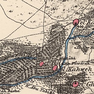
References

  1. Palmer, 1881, p. 275
  2. 1 2 Morris, 2004, p. xix, village #269. Also gives cause of depopulation.
  3. 1 2 3 Government of Palestine, Department of Statistics. Village Statistics, April, 1945. Quoted in Hadawi, 1970, p. 68
  4. 1 2 Government of Palestine, Department of Statistics, 1945, p. 30
  5. 1 2 3 Haddad, Elie (2020). "Kh. et-Tineh (Kefar Menahem): Final Report". Hadashot Arkheologiyot. 132.
  6. Hütteroth and Abdulfattah, 1977, p. 143
  7. 1 2 3 4 Khalidi, 1992, p. 416
  8. Robinson and Smith, vol.3, Appendix 2, p. 118
  9. van de Velde, 1854, p. 160
  10. Guérin, 1869, p. 88
  11. Socin, 1879, p. 162
  12. Hartmann, 1883, p. 133 also noted 96 houses in el-letine.
  13. Conder and Kitchener, 1882, SWP II, p. 414, cited in Khalidi, 1992, p. 416
  14. Barron, 1923, Table VII, Sub-district of Ramleh, p. 21
  15. Mills, 1932, p. 23.
  16. Government of Palestine, Department of Statistics. Village Statistics, April, 1945. Quoted in Hadawi, 1970, p. 117
  17. Government of Palestine, Department of Statistics. Village Statistics, April, 1945. Quoted in Hadawi, 1970, p. 167
  18. Morris, 2004, p. 224
  19. Morris, 2004, p. 414
  20. Morris, 2004, p. 432
  21. Morris, 2004, p. 436
  22. Morris, 2004, p. 437
  23. Morris, 2004, p. 443

Bibliography