
Qula was a Palestinian village in the Ramle Subdistrict of Mandatory Palestine, located 15 km northeast of Ramla. Its residents had their origins in Jimzu, Ammuriya and other places.

Ra'na was a village located approximately 26 km northwest of Hebron. It was occupied by the Israeli army during Operation Yo'av in October 1948. It was one of 16 villages in the Hebron district that were depopulated.
Barqa was a Palestinian Arab village located 37 km north of Gaza near the modern-day Israeli city of Ashdod. It was referred to as Barka by the Greeks and Bareca by the Romans during their rule over the ancient Philistine city. In 1945, the village had a population of 890 and total land area of 5,206 dunums.

Qazaza was a Palestinian village in the Ramle Subdistrict of Mandatory Palestine, located 19 kilometers (12 mi) south of Ramla. It was depopulated in 1948.

Deir al-Dubban was a small Arab village 26 kilometers (16 mi) northwest of Hebron, near the modern village of Luzit, between Jerusalem, and Ashkelon. The village was depopulated in the 1948 Palestine War.

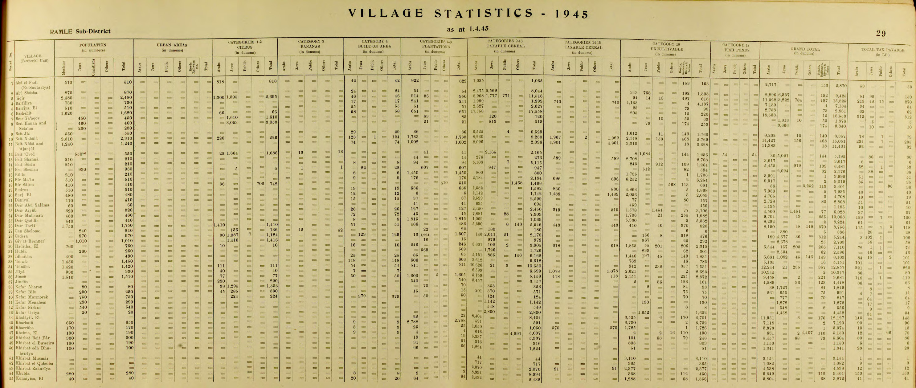
Idnibba was a Palestinian village, located at latitude 31.7426937N and longitude 34.8561001,E in the southern part of the Ramle Subdistrict. It was depopulated in 1948, at which time its population was 568, and its lands are now used by Kfar Menahem.

Najd was a Palestinian Arab village, located 14 kilometers (8.7 mi) northeast of Gaza City. During the British Mandate in Palestine, children from Najd attended school in the nearby village of Simsim. On 13 May 1948, Najd was occupied by the Negev Brigade as part of Operation Barak, and the villagers were expelled.

Shahma was a Palestinian Arab village located 15 kilometers (9.3 mi) southwest of Ramla. Depopulated on the eve of the 1948 Arab-Israeli war, the village lands today form part of a fenced-in area used by the Israeli Air Force.

Barqusya was a Palestinian Arab village in the Hebron Subdistrict, depopulated in the 1948 Palestine War. It was located 31 km northwest of Hebron.

Al-'Abbasiyya, also known as al-Yahudiya, was a Palestinian Arab village in the Jaffa Subdistrict. It was attacked under Operation Hametz during the 1948 Palestine War, and finally depopulated under Operation Dani. It was located 13 km east of Jaffa. Some of the remains of the village can be found today in the centre of the modern Israeli city of Yehud.

Aqqur was a Palestinian Arab hamlet in the Jerusalem Subdistrict. Founded in the Ottoman period, it had a population of 25 in 1922 and 40 in 1945. It was depopulated during the 1948 Arab-Israeli War on July 13, 1948, under Operation Dani. It was located 14.5 km west of Jerusalem on the Wadi Isma'il, a tributary of the Wadi al-Sarar.

Al-Burayj or Bureij, lit. 'little tower', was a Palestinian Arab village in the Jerusalem Subdistrict. It was depopulated during the 1948 Arab–Israeli War on October 19, 1948, during the first phase of Operation Ha-Har. The village was located 28.5 km west of Jerusalem.

Daniyal was a Palestinian village in the Ramle Subdistrict that was located 5 km east of Ramla and southeast of Lydda. It was depopulated during the 1948 Arab–Israeli War on July 10, 1948, by the Yiftach Brigade under the first phase of Operation Dani, as part of the broader 1948 Palestinian expulsion and flight and Nakba.

Dayr Muhaysin was a Palestinian village in the Ramle Subdistrict of Mandatory Palestine, located 12 km southeast of Ramla and 4 km west of Latrun. It was depopulated during the 1948 Palestine war.

Dayr Tarif was a Palestinian Arab village in the Ramle Subdistrict of Mandatory Palestine. It was depopulated during the 1948 Arab-Israeli War on July 10, 1948.

Al-Haditha was a Palestinian village in the Ramle Subdistrict. It was located 8 km northeast of Ramla, on the bank of Wadi al-Natuf. The site, now known as Tel Hadid, has yielded significant archaeological remains from many periods. Al-Haditha was depopulated during the 1948 Arab-Israeli War on July 12, 1948, under the first stage of Operation Dani.

Al-Maghar was a Palestinian Arab village in the Ramle Subdistrict of Mandatory Palestine. It was depopulated by the Givati Brigade during Operation Barak on 18 May 1948. It was located 12 km southwest of Ramla, situated north of Wadi al-Maghar.

Al-Qubab was a Palestinian Arab village in the Ramle Subdistrict. It was depopulated in July 1948 during the Operation Dani led by the Yiftach Brigade.

Al-Qubayba was a Palestinian Arab village in the Ramle Subdistrict. It was depopulated during the 1948 Arab-Israeli War on May 27, 1948, by the Givati Brigade as part of the Second stage of Operation Barak. It was located 10.5 km southeast of Ramla near the Rubin River which provided the village with water and irrigation for agriculture. Al-Qubayba was mostly destroyed with the exception of a few houses, and Kfar Gevirol was built in its place, now a suburb in the west of Rehovot.

Saydun was a Palestinian village in the Ramle Subdistrict of Mandatory Palestine. It was depopulated during the 1947–48 Civil War in Mandatory Palestine on April 6, 1948, during Operation Nachshon. It was located 9 km south of Ramla on the east bank of Wadi Saydun.
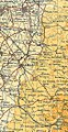
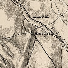 1870s map
  1940s map
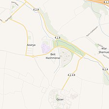 modern map
 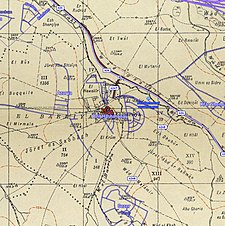 1940s with modern overlay map


