Al-Haditha, Ramle

Last updated

Contents

Al-Haditha
الحديثة
Etymology: "new" [1]
Historical map series for the area of al-Haditha, Ramle (1870s).jpg 1870s map
Historical map series for the area of al-Haditha, Ramle (1940s).jpg 1940s map
Historical map series for the area of al-Haditha, Ramle (modern).jpg modern map
Historical map series for the area of al-Haditha, Ramle (1940s with modern overlay).jpg 1940s with modern overlay map
A series of historical maps of the area around Al-Haditha, Ramle (click the buttons)
Mandatory Palestine location map.svg
Red pog.svg
Al-Haditha
Location within Mandatory Palestine
Coordinates: 31°57′48″N34°57′07″E / 31.96333°N 34.95194°E / 31.96333; 34.95194
Palestine grid 145/152
Geopolitical entity Mandatory Palestine
Subdistrict Ramle
Date of depopulationJuly 12, 1948 [2]
Population
 (1945)
  Total
760 [3] [4]
Cause(s) of depopulationMilitary assault by Yishuv forces
Current Localities Hadid [5] [6]

Al-Haditha was a Palestinian village in the Ramle Subdistrict. It was located 8 km northeast of Ramla, on the bank of Wadi al-Natuf. The site, now known as Tel Hadid, has yielded significant archaeological remains from many periods. Al-Haditha was depopulated during the 1948 Arab-Israeli War on July 12, 1948, under the first stage of Operation Dani.

Etymology

Al-Haditha (Arabic: 'New') is the Arabic renditions of Hebrew Hadid, mentioned in the Book of Ezra (II, 33) and later in the Mishna as a city of Judea fortified by Joshua. [7] Hadid was called 'Adida (Άδασά ) in the Book of Maccabees, while Eusebius referred to it as Adatha or Aditha. [7] The Greek transcription masks three different Semitic phonemes. ʽAddāsi may be a survival of either Ḥdšh or ʽdšh (nomen unitatis of ʽdšym “lentils”) if the gemination of the -d- and the legthening of -a- are secondary. The disappearance of the laryngeals might have been caused by the Roman prohibition of Jewish presence in that area after the Bar-Kochva revolt. [8]

History

Al-Haditha is identified with the site of the biblical village of Hadid . [8]

Ottoman era

In the 18th or early 19th centuries, a feud broke between Bayt Nabala and al-Haditha as part of the Qays and Yaman conflicts in the area. [9]

In 1870, Victor Guérin visited and "at a quarter of an hour's distance south-east of Haditheh, [he] found several ancient tombs cut in the rock. The village of Haditheh he found to be on the site of an ancient town. Cisterns, a birket, tombs, and rock-cut caves, with cut stones scattered about, are all that remain." [10]

An official Ottoman village list of about 1870 showed that "El Hadite" had 28 houses and a population of 145, though the population count included only men. [11] [12]

In 1882 the PEF's Survey of Western Palestine (SWP) described the village as "a moderate-sized village on a terraced Tell at the mouth of a valley at the foot of the hills, with a well on the east. There are remains of a considerable town round it, tombs and quarries exist ; and the mound on which the village stands is covered with pottery." [13]

British Mandate era

In a census conducted in 1922 by the British Mandate authorities, Hadata had a population of 415 Muslims, [14] increasing in the 1931 census to 520, still all Muslims, in a total of 119 houses. [15] In the 1945 statistics, the village had a population of 760 Muslims, [3] with a total of 7,110 dunums of land. [4] A total of 10 dunams of village land were used for citrus and bananas, 4,419 dunums were used for cereals, 246 dunums were irrigated or used for plantations, [16] while 16 dunams were built–up, or urban, land. [17]

1948, aftermath

Early in 1948, the Mukhtar of Al-Haditha met to negotiate a non–belligerent agreement with the neighbouring Ben Shemen. [18] However, Al-Haditha was depopulated during the 1948 Arab-Israeli War on July 12, 1948, under the first stage of Operation Dani. [2]

In September, 1948, Ben-Gurion asked the ministerial committee for permission to destroy 14 villages, one of which was Al-Haditha. [19]

In 1992 the village site was described: "The stone and concrete rubble of destroyed houses is visible on the site. Only one house remains; it is sealed and deserted. It has a gabled, tiled roof, and a sign ('BROADWAY 80') is glued to one of its walls. There are also clusters of trees on the site, including Christ's–thorn, olive and eucalyptus trees. The old village road remains and has been enlarged. The surrounding land is cultivated." [6]

Related Research Articles

<span class="mw-page-title-main">Bayt Nabala</span> Place in Ramle, Mandatory Palestine

Bayt Nabala or Beit Nabala was a Palestinian Arab village in the Ramle Subdistrict in Palestine that was destroyed during the 1948 Arab–Israeli War. The village was in the territory allotted to the Arab state under the 1947 UN Partition Plan, which was rejected by Arab leaders and never implemented. Its population in 1945, before the war, was 2,310.

<span class="mw-page-title-main">Qula</span> Place in Ramle, Mandatory Palestine

Qula was a Palestinian village in the Ramle Subdistrict of Mandatory Palestine, located 15 km northeast of Ramla. Its residents had their origins in Jimzu, Ammuriya and other places.

<span class="mw-page-title-main">Ra'na</span> Place in Hebron, Mandatory Palestine

Ra'na was a village located approximately 26 km northwest of Hebron. It was occupied by the Israeli army during Operation Yo'av in October 1948. It was one of 16 villages in the Hebron district that were depopulated.

<span class="mw-page-title-main">Jimzu</span> Place in Ramle, Mandatory Palestine

Jimzu, also known as Gimzo, was a Palestinian village, located three miles southeast of Lydda. Under the 1947 UN Partition Plan of Mandatory Palestine, Jimzu was to form part of the proposed Arab state. During the 1948 Arab–Israeli War, the village was depopulated in a two-day assault by Israeli forces.

<span class="mw-page-title-main">Qazaza</span> Place in Ramle, Mandatory Palestine

Qazaza was a Palestinian village in the Ramle Subdistrict of Mandatory Palestine, located 19 kilometers (12 mi) south of Ramla. It was depopulated in 1948.

<span class="mw-page-title-main">Al-Muzayri'a</span> Place in Ramle, Mandatory Palestine

Al-Muzayri'a was a Palestinian village in the Ramle Subdistrict. It was depopulated in 1948. In 1998 the new Israeli city of El'ad was built over the ruins.

<span class="mw-page-title-main">Idnibba</span> Place in Ramle, Mandatory Palestine

Idnibba was a Palestinian village, located at latitude 31.7426937N and longitude 34.8561001,E in the southern part of the Ramle Subdistrict. It was depopulated in 1948, at which time its population was 568, and its lands are now used by Kfar Menahem.

<span class="mw-page-title-main">Shahma</span> Village in Ramle, Mandatory Palestine

Shahma was a Palestinian Arab village located 15 kilometers (9.3 mi) southwest of Ramla. Depopulated on the eve of the 1948 Arab-Israeli war, the village lands today form part of a fenced-in area used by the Israeli Air Force.

<span class="mw-page-title-main">Barqusya</span> Place in Hebron, Mandatory Palestine

Barqusya was a Palestinian Arab village in the Hebron Subdistrict, depopulated in the 1948 Palestine War. It was located 31 km northwest of Hebron.

<span class="mw-page-title-main">Al-'Abbasiyya</span> Place in Jaffa, Mandatory Palestine

Al-'Abbasiyya, also known as al-Yahudiya, was a Palestinian Arab village in the Jaffa Subdistrict. It was attacked under Operation Hametz during the 1948 Palestine War, and finally depopulated under Operation Dani. It was located 13 km east of Jaffa. Some of the remains of the village can be found today in the centre of the modern Israeli city of Yehud.

<span class="mw-page-title-main">Al-Barriyya</span> Place in Ramle, Mandatory Palestine

Al-Barriyya was a Palestinian village in the Ramle Subdistrict of Mandatory Palestine. It was depopulated during the 1948 Arab–Israeli War on July 10, 1948, as part of Operation Dani. It was located 5.5 km southeast of Ramla, on the eastern bank of Wadi al-Barriyya.

<span class="mw-page-title-main">Daniyal</span> Village in Ramle, Mandatory Palestine

Daniyal was a Palestinian village in the Ramle Subdistrict that was located 5 km east of Ramla and southeast of Lydda. It was depopulated during the 1948 Arab–Israeli War on July 10, 1948, by the Yiftach Brigade under the first phase of Operation Dani, as part of the broader 1948 Palestinian expulsion and flight and Nakba.

<span class="mw-page-title-main">Dayr Muhaysin</span> Place in Ramle, Mandatory Palestine

Dayr Muhaysin was a Palestinian village in the Ramle Subdistrict of Mandatory Palestine, located 12 km southeast of Ramla and 4 km west of Latrun. It was depopulated during the 1948 Palestine war.

<span class="mw-page-title-main">Dayr Tarif</span> Place in Ramle, Mandatory Palestine

Dayr Tarif was a Palestinian Arab village in the Ramle Subdistrict of Mandatory Palestine. It was depopulated during the 1948 Arab-Israeli War on July 10, 1948.

<span class="mw-page-title-main">Al-Maghar</span> Place in Ramle, Mandatory Palestine

Al-Maghar was a Palestinian Arab village in the Ramle Subdistrict of Mandatory Palestine. It was depopulated by the Givati Brigade during Operation Barak on 18 May 1948. It was located 12 km southwest of Ramla, situated north of Wadi al-Maghar.

<span class="mw-page-title-main">Al-Qubab</span> Place in Ramle, Mandatory Palestine

Al-Qubab was a Palestinian Arab village in the Ramle Subdistrict. It was depopulated in July 1948 during the Operation Dani led by the Yiftach Brigade.

<span class="mw-page-title-main">Al-Qubayba, Ramle</span> Arab village in Mandatory Palestine

Al-Qubayba was a Palestinian Arab village in the Ramle Subdistrict. It was depopulated during the 1948 Arab-Israeli War on May 27, 1948, by the Givati Brigade as part of the Second stage of Operation Barak. It was located 10.5 km southeast of Ramla near the Rubin River which provided the village with water and irrigation for agriculture. Al-Qubayba was mostly destroyed with the exception of a few houses, and Kfar Gevirol was built in its place, now a suburb in the west of Rehovot.

<span class="mw-page-title-main">Saydun</span> Village in Ramle, Mandatory Palestine

Saydun was a Palestinian village in the Ramle Subdistrict of Mandatory Palestine. It was depopulated during the 1947–48 Civil War in Mandatory Palestine on April 6, 1948, during Operation Nachshon. It was located 9 km south of Ramla on the east bank of Wadi Saydun.

<span class="mw-page-title-main">Al-Tina</span> Place in Ramle, Mandatory Palestine

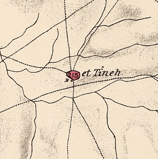
Al-Tina, or Khirbet et-Tineh was a Palestinian Arab village in the Ramle Subdistrict of Mandatory Palestine. The village was located between the Shfela and southern Israeli coastal plain. It was depopulated during the 1948 Arab–Israeli War on July 8, 1948, by the Givati Brigade under Operation An-Far. It was located 20. km south of Ramla. The hill on which the village was built stands today next to the Kiryat Mal'akhi – Yoav railway station and next to Highway 6. Archeological excavations at the site revealed the remains of a Byzantine settlement.

<span class="mw-page-title-main">Al-Tira, Ramle</span> Place in Ramle, Mandatory Palestine

Al-Tira was a Palestinian village in the Ramle Subdistrict. It was depopulated during the 1948 Arab–Israeli War on July 10, 1948, by the Alexandroni and Armored (Eighth) brigades under Operation Dani. It was located 12 km northeast of Ramla. al-Tira was mostly destroyed with the exception of a few houses survived destruction.

References

  1. Palmer, 1881, p. 229
  2. 1 2 Morris, 2004, p. xix, village #224. Also gives cause of depopulation.
  3. 1 2 Department of Statistics, 1945, p. 29
  4. 1 2 Government of Palestine, Department of Statistics. Village Statistics, April, 1945. Quoted in Hadawi, 1970, p. 66 Archived 2016-03-03 at the Wayback Machine
  5. Morris, 2004, p. xxi, settlement #88. Also gives cause of depopulation.
  6. 1 2 Khalidi, 1991, p. 381
  7. 1 2 Neubauer, 1868, pp. 85-86
  8. 1 2 Marom, Roy (2023). "Early-Ottoman Palestinian Toponymy: A Linguistic Analysis of the (Micro-)Toponyms in Haseki Sultan's Endowment Deed (1552)". Zeitschrift des Deutschen Palästina-Vereins. 139 (2).
  9. Marom, Roy (2022-11-01). "Jindās: A History of Lydda's Rural Hinterland in the 15th to the 20th Centuries CE". Lod, Lydda, Diospolis. 1: 14.
  10. Guérin, 1875, pp. 64 -67, as given in Conder and Kitchener, 1882, SWP II, p. 322
  11. Socin, 1879, p. 154
  12. Hartmann, 1883, p. 140, noted 26 houses
  13. Conder and Kitchener, 1882, SWP II, p. 297
  14. Barron, 1923, Table VII, Sub-district of Ramleh, p. 22
  15. Mills, 1932, p. 20.
  16. Government of Palestine, Department of Statistics. Village Statistics, April, 1945. Quoted in Hadawi, 1970, p. 115
  17. Government of Palestine, Department of Statistics. Village Statistics, April, 1945. Quoted in Hadawi, 1970, p. 165
  18. Morris, 2004, p. 92
  19. Morris, 2004, p. 354

Bibliography