List of canyons

Last updated

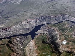
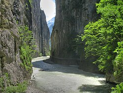
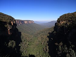
This list of canyons and gorges includes both land and submarine canyons with the land canyons being sorted by continent and then by country.

Contents

Africa

South Africa

Other countries

Americas

Argentina

Brazil

Canada

Chile

Colombia

Mexico

Peru

United States

Other countries

Asia

China

Nepal

India

Philippines

Other countries

Europe

Albania

Austria


France

Georgia

Greece

Italy

Montenegro

Norway

Russia

Sulak Canyon in Dagestan Sulakskii kan'on v Dagestane.jpg
Sulak Canyon in Dagestan

Switzerland

Turkey

United Kingdom

England

Scotland

Wales

Other countries

Oceania

Australia

Joffre Gorge, Karijini National Park A162, Karijini National Park, Australia, Joffre Gorge, 2007.JPG
Joffre Gorge, Karijini National Park
Palm Valley, Finke Gorge National Park A211, Finke Gorge National Park, Australia, Palm Valley, 2007.JPG
Palm Valley, Finke Gorge National Park

New Zealand

Kawarau Gorge Kawarau river.jpg
Kawarau Gorge

Submarine canyons

A submarine canyon is a steep-sided valley with nearly vertical walls cut into the seabed of the continental margin, sometimes extending well onto the continental shelf. [13]

Atlantic Ocean

Model of Hudson Canyon, off the coast of New York and New Jersey Hudson Canyon.jpg
Model of Hudson Canyon, off the coast of New York and New Jersey

Indian Ocean

Pacific Ocean

Map of Bering Canyon and four other submarine canyons in the Bering Sea Beringian Margin canyons.png
Map of Bering Canyon and four other submarine canyons in the Bering Sea

Black Sea

Related Research Articles

<span class="mw-page-title-main">Grand Canyon</span> Steep-sided canyon carved by the Colorado River in Arizona, United States

The Grand Canyon is a steep-sided canyon carved by the Colorado River in Arizona, United States. The Grand Canyon is 277 miles (446 km) long, up to 18 miles (29 km) wide and attains a depth of over a mile.

<span class="mw-page-title-main">San Juan County, Utah</span> County in Utah, United States

San Juan County is a county in the southeastern portion of the U.S. state of Utah. As of the 2020 United States Census, the population was 14,518. Its county seat is Monticello, while its most populous city is Blanding. The Utah State Legislature named the county for the San Juan River, itself named by Spanish explorers.

Bridal Veil Falls, Bridalveil Falls or Bridalveil Fall is a frequently-used name for waterfalls that observers fancy resemble a bride's veil:

<span class="mw-page-title-main">Canyon</span> Deep chasm between cliffs

A canyon, gorge or chasm, is a deep cleft between escarpments or cliffs resulting from weathering and the erosive activity of a river over geologic time scales. Rivers have a natural tendency to cut through underlying surfaces, eventually wearing away rock layers as sediments are removed downstream. A river bed will gradually reach a baseline elevation, which is the same elevation as the body of water into which the river drains. The processes of weathering and erosion will form canyons when the river's headwaters and estuary are at significantly different elevations, particularly through regions where softer rock layers are intermingled with harder layers more resistant to weathering.

<span class="mw-page-title-main">Gold rush</span> Gold discovery triggering an onrush of miners seeking fortune

A gold rush or gold fever is a discovery of gold—sometimes accompanied by other precious metals and rare-earth minerals—that brings an onrush of miners seeking their fortune. Major gold rushes took place in the 19th century in Australia, Greece, New Zealand, Brazil, Chile, South Africa, the United States, and Canada while smaller gold rushes took place elsewhere.

<span class="mw-page-title-main">Escalante River</span> River in Garfield and Kane counties in Utah, United States

The Escalante River is a tributary of the Colorado River. It is formed by the confluence of Upper Valley and Birch Creeks near the town of Escalante in south-central Utah, and from there flows southeast for approximately 90 mi (140 km) before joining Lake Powell. Its watershed includes the high forested slopes of the Aquarius Plateau, the east slope of the Kaiparowits Plateau, and the high desert north of Lake Powell. It was the last river of its size to be discovered in the 48 contiguous U.S. states. The average discharge is approximately 146 cfs.

Hells Gate, Hell's Gate, Hell Gate or Hells Gates may refer to:

<span class="mw-page-title-main">Slot canyon</span> Long, narrow canyon with steep walls

A slot canyon is a long, narrow channel or drainageway with sheer rock walls that are typically eroded into either sandstone or other sedimentary rock. A slot canyon has depth-to-width ratios that typically exceed 10:1 over most of its length and can approach 100:1. The term is especially used in the semiarid southwestern United States and particularly the Colorado Plateau. Slot canyons are subject to flash flooding and commonly contain unique ecological communities that are distinct from the adjacent, drier uplands. Some slot canyons can measure less than 1 metre (3 ft) across at the top but drop more than 30 metres (100 ft) to the floor of the canyon.

The following radio stations broadcast on FM frequency 97.1 MHz:

<span class="mw-page-title-main">U.S. Route 50 in Colorado</span> Section of U.S. Highway in Colorado, United States

U.S. Route 50 (US 50) is a part of the U.S. Highway System that travels from West Sacramento, California, to Ocean City, Maryland. In the U.S. state of Colorado, US 50 is a major highway crossing through the lower midsection of the state. It connects the Western Slope with the lower Front Range and the Arkansas Valley. The highway serves the areas of Pueblo and Grand Junction as well as many other smaller areas along its corridor. The long-term project to widen the highway from two lanes to a four lane expressway between Grand Junction and Montrose was completed in January 2005. Only about 25% of the remainder of highway 50 in Colorado is four lane highway.

The following radio stations broadcast on FM frequency 90.3 MHz:

The following radio stations broadcast on FM frequency 104.1 MHz:

The following radio stations broadcast on FM frequency 105.7 MHz:

<span class="mw-page-title-main">Course of the Colorado River</span> Route and confluences of the Colorado River in the United States and Mexico

The Colorado River is a major river of the western United States and northwest Mexico in North America. Its headwaters are in the Rocky Mountains where La Poudre Pass Lake is its source. Located in north central Colorado it flows southwest through the Colorado Plateau country of western Colorado, southeastern Utah and northwestern Arizona where it flows through the Grand Canyon. It turns south near Las Vegas, Nevada, forming the Arizona–Nevada border in Lake Mead and the Arizona–California border a few miles below Davis Dam between Laughlin, Nevada and Needles, California before entering Mexico in the Colorado Desert. Most of its waters are diverted into the Imperial Valley of Southern California. In Mexico its course forms the boundary between Sonora and Baja California before entering the Gulf of California. This article describes most of the major features along the river.

<span class="mw-page-title-main">Vishnu Basement Rocks</span> Lithostratigraphic unit in the Grand Canyon, Arizona

The Vishnu Basement Rocks is the name recommended for all Early Proterozoic crystalline rocks exposed in the Grand Canyon region. They form the crystalline basement rocks that underlie the Bass Limestone of the Unkar Group of the Grand Canyon Supergroup and the Tapeats Sandstone of the Tonto Group. These basement rocks have also been called either the Vishnu Complex or Vishnu Metamorphic Complex. These Early Proterozoic crystalline rocks consist of metamorphic rocks that are collectively known as the Granite Gorge Metamorphic Suite; sections of the Vishnu Basement Rocks contain Early Paleoproterozoic granite, granitic pegmatite, aplite, and granodiorite that have intruded these metamorphic rocks, and also, intrusive Early Paleoproterozoic ultramafic rocks.

<span class="mw-page-title-main">Windows Spotlight</span> Wallpaper image application

Windows Spotlight is a feature included with Windows 10 and Windows 11 which downloads images and advertisements from Bing and displays them as background wallpapers on the lock screen. In 2017, Microsoft began adding location information for many of the photographs.

References

  1. Ruban, Dmitry A.; Zerfass, Henrique; Pugatchev, Vladimir I. (2009-08-01). "Triassic synthems of southern South America (southwestern Gondwana) and the Western Caucasus (the northern Neotethys), and global tracing of their boundaries". Journal of South American Earth Sciences. 28 (2): 155–167. doi:10.1016/j.jsames.2009.03.003. hdl: 2263/11274 . ISSN   0895-9811.
  2. U.S. Geological Survey Geographic Names Information System: Quartermaster Canyon
  3. Mitton, Geraldine Edith (1924). A. & C. Black, Limited. Durham. p. 198. Retrieved 22 March 2024.{{cite book}}: CS1 maint: location missing publisher (link)
  4. Dean, Dennis R (2007). Geology and Its Cultural Influence in Britain, 1765-1835. Scholars' Facsimiles & Reprints. p. 134. ISBN   9780820115559 . Retrieved 7 August 2022.
  5. Holliday, D W; Burgess, I C (1979). Geology of the Country Around Brough-under-Stainmore. H.M. Stationery Office. p. 45. ISBN   0118840053.
  6. 1 2 3 Gillen, Con (31 August 2013). Geology and Landscapes of Scotland. Dunedin Academic Press Ltd. ISBN   9781903544884.
  7. Aldridge, Richard John (2000). British Silurian Stratigraphy. Joint Nature Conservation Committee. ISBN   9781861074782 . Retrieved 23 March 2024.
  8. Eyles, Victor Ambrose (1949). Geology of Central Ayrshire: Explanation of One-inch Sheet 14. H.M. Stationery Office.
  9. "Karijini National Park Visitor guide" (PDF). Explore Parks WA (note: PDF file link appears in "Downloads & Resources" tab of webpage: parks.dpaw.wa.gov.au/park/karijini). Department of Parks and Wildlife. 2016. Archived (PDF) from the original on 2016-11-04. Retrieved 2016-11-04.
  10. "Australia's North West › Pilbara › Karijini National Park › Welcome (tab)". Explore Parks WA. Department of Parks and Wildlife. 2013. Archived from the original on 2016-11-04. Retrieved 2016-11-04.
  11. "Australia's North West › Kimberley › Purnululu › Piccaninny Creek". Explore Parks WA. Department of Parks and Wildlife. 2013. Archived from the original on 2016-03-10. Retrieved 2016-11-04.
  12. "Australia's North West › Kimberley › Purnululu › Echidna Chasm". Explore Parks WA. Department of Parks and Wildlife. 2013. Archived from the original on 2016-03-23. Retrieved 2016-11-04.
  13. Shepard, F.P., 1963. Submarine Geology. Harper & Row, New York
  14. Arthur Newell Strahler, Physical Geography. New York: John Wiley & Sons, Inc., 1960, Second Edition, p. 290