List of political parties by region

Last updated

This page serves as a directory to lists of political parties worldwide, organized by their respective regions. Each linked page contains a table listing sub-pages for countries or jurisdictions within the specified region. The tables provide information on the dominant party system in each country.

Contents

A political party is an organized group that adheres to a specific ideology or revolves around particular issues, aiming to participate in political power, often through elections involvement. Individual parties are appropriately detailed in separate articles dedicated to each nation.

List by regions and sub-regions

Africa

Americas

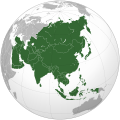
Asia

Europe

Oceania

See also

Related Research Articles

<span class="mw-page-title-main">Northern Rhodesia</span> 1911–1964 British protectorate in Southern Africa

Northern Rhodesia was a British protectorate in Southern Africa, now the independent country of Zambia. It was formed in 1911 by amalgamating the two earlier protectorates of Barotziland-North-Western Rhodesia and North-Eastern Rhodesia. It was initially administered, as were the two earlier protectorates, by the British South Africa Company (BSAC), a chartered company, on behalf of the British Government. From 1924, it was administered by the British Government as a protectorate, under similar conditions to other British-administered protectorates, and the special provisions required when it was administered by BSAC were terminated.

<span class="mw-page-title-main">Subregion</span> Part of a larger geographic region or continent

A subregion is a part of a larger region or continent. Cardinal directions are commonly used to define subregions. There are many criteria for creating systems of subregions; this article is focusing on the UN statistical geoscheme, which is a changing, constantly updated, UN tool based on specific political geography considerations relevant in UN statistics.

<span class="mw-page-title-main">Central Karoo District Municipality</span> District municipality in Western Cape, South Africa

The Central Karoo District Municipality is a district municipality located in the Western Cape province of South Africa. Its municipality code is DC5.

<span class="mw-page-title-main">United Nations Regional Groups</span> Geopolitical regional groups of the United Nations

The United Nations Regional Groups are the geopolitical regional groups of member states of the United Nations. Originally, the UN member states were unofficially organized into five groups as an informal means of sharing the distribution of posts for General Assembly committees. Now this grouping has taken on a much more expansive and official role. Many UN bodies are allocated on the basis of geographical representation. Top leadership positions, including Secretary-General and President of the General Assembly, are rotated among the regional groups. The groups also coordinate substantive policy and form common fronts for negotiations and bloc voting.

<span class="mw-page-title-main">United Nations geoscheme</span> UN system for grouping the worlds 248 countries and territories into regions and subregions

The United Nations geoscheme is a system which divides 248 countries and territories in the world into six continental regions, 22 geographical subregions, and two intermediary regions. It was devised by the United Nations Statistics Division (UNSD) based on the M49 coding classification. The creators note that "the assignment of countries or areas to specific groupings is for statistical convenience and does not imply any assumption regarding political or other affiliation of countries or territories".

The Democrat Youth Community of Europe (DEMYC) is the international umbrella organisation of the youth wings of christian democratic, conservative and like-minded parties of Europe. With currently now more than one million affiliates in its member organisations, DEMYC is one of the strongest political youth organisations in Europe.

The World Geographical Scheme for Recording Plant Distributions (WGSRPD) is a biogeographical system developed by the international Biodiversity Information Standards (TDWG) organization, formerly the International Working Group on Taxonomic Databases. The WGSRPD standards, like other standards for data fields in botanical databases, were developed to promote "the wider and more effective dissemination of information about the world's heritage of biological organisms for the benefit of the world at large". The system provides clear definitions and codes for recording plant distributions at four scales or levels, from "botanical continents" down to parts of large countries. The codes may be referred to as TDWG geographical codes. Current users of the system include the International Union for Conservation of Nature (IUCN), the Germplasm Resources Information Network (GRIN), and Plants of the World Online (POWO).

<i>The Economist Democracy Index</i> Measure of the state of democracy according to The Economist

The Democracy Index published by the Economist Group is an index measuring the quality of democracy across the world. This quantitative and comparative assessment is centrally concerned with democratic rights and democratic institutions. The methodology for assessing democracy used in this democracy index is according to Economist Intelligence Unit which is part of the Economist Group, a UK-based private company, which publishes the weekly newspaper The Economist. The index is based on 60 indicators grouped into five categories, measuring pluralism, civil liberties, and political culture. In addition to a numeric score and a ranking, the index categorizes each country into one of four regime types: full democracies, flawed democracies, hybrid regimes, and authoritarian regimes. The first Democracy Index report was published in 2006. Reports were published every two years until 2010 and annually thereafter. The index includes 167 countries and territories, of which 166 are sovereign states and 164 are UN member states. Other democracy indices with similar assessments of the state of democracy include V-Dem Democracy indices or Bertelsmann Transformation Index.

<span class="mw-page-title-main">Outline of Egypt</span> Overview of and topical guide to Egypt

The following outline is provided as an overview of and topical guide to Egypt:

<span class="mw-page-title-main">Outline of Turkey</span> Overview of and topical guide to Turkey

The following outline is provided as an overview of and topical guide to Turkey:

<span class="mw-page-title-main">Outline of Europe</span> Overview and topical guide of Europe

The following outline is provided as an overview of and topical guide to Europe.

<span class="mw-page-title-main">Outline of South America</span> Hierarchical outline list of articles related to South America

The following outline is provided as an overview of and topical guide to South America.

<span class="mw-page-title-main">Outline of Australia</span> Continent and country

This outline of Australia is an overview of and topical guide to various aspects of the country of Australia.

<span class="mw-page-title-main">Outline of North America</span> Overview of and topical guide to North America

The following outline is provided as an overview of and topical guide to North America.

Zambia, officially known as the Republic of Zambia, is a landlocked country in Southern Africa. The neighbouring countries are the Democratic Republic of the Congo to the north, Tanzania to the north-east, Malawi to the east, Mozambique, Zimbabwe, Botswana, and Namibia to the south, and Angola to the west. The capital city is Lusaka, located in the southeast of the country. The population is concentrated mainly around the capital and the Copperbelt to the northwest.

<i>Europa World Year Book</i> Reference resource published in the UK

The Europa World Year Book provides detailed country surveys containing analytical, statistical and directory data available for over 250 countries and territories.