Nag's Head, London

Last updated

Nag's Head
Nags Head pub Holloway Road 2005.jpg
The former Nags Head pub on Holloway Road, from which the area takes its name
Greater London UK location map 2.svg
Red pog.svg
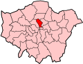
Nag's Head
Location within Greater London
OS grid reference TQ305859
  Charing Cross 3.5 mi (5.6 km)  S
London borough
Ceremonial county Greater London
Region
Country England
Sovereign state United Kingdom
Post town LONDON
Postcode district N7
Dialling code 020
Police Metropolitan
Fire London
Ambulance London
London Assembly
List of places
UK
England
London
51°33′25″N0°07′01″W / 51.557°N 0.117°W / 51.557; -0.117 Coordinates: 51°33′25″N0°07′01″W / 51.557°N 0.117°W / 51.557; -0.117

Nag's Head is a locality within the Holloway area of the London Borough of Islington.

Contents

Toponymy

The area is named after the Nag's Head public house. The pub, also previously called the Mustang Diner and O'Neills, closed in 2004; the original early Victorian building is in use today as a gambling establishment.

Governance

Nag's Head Town Centre, a shopping arcade between Morrisons and Selby's, is governed by the Nag's Head Town Centre Management Group. [1]

Geography

The name refers to the junction of Holloway Road (the A1) with Seven Sisters Road, where the Nag's Head pub stood, and also to the surrounding area, particularly the stretch of Holloway Road between the former pub and its junction with Camden Road.

Economy

The area is identified in the London Plan as one of 35 major centres in Greater London. [2] The shopping and entertainment area includes the Nag's Head Market (behind Holloway Road on the northwest corner of Hertslet Road) and the Nag's Head Shopping Centre. [3] It hosts a James Selby department store.

In 1975, McDonalds chose Nags Head to open their second restaurant in the UK, (the first being in Woolwich) situated at the former Burtons Mensware store in Seven Sisters Road.

Related Research Articles

<span class="mw-page-title-main">London Borough of Islington</span> Borough in United Kingdom

The London Borough of Islington is a London borough which forms part of Inner London. Islington has an estimated population of 215,667. It was formed in 1965 under the London Government Act 1963, which simultaneously abolished the metropolitan boroughs of Islington and Finsbury.

<span class="mw-page-title-main">Holloway, London</span> Human settlement in England

Holloway is an inner-city district of the London Borough of Islington, 3.3 miles (5.3 km) north of Charing Cross, which follows the line of the Holloway Road (A1). At the centre of Holloway is the Nag's Head commercial area which sits between the more residential Upper Holloway and Lower Holloway neighbourhoods. Holloway has a multicultural population. It is the home of Arsenal F.C., and was once home to the largest women's prison in Europe, Holloway Prison, until 2016. Prior to 1965, Holloway was in the historic county of Middlesex.

<span class="mw-page-title-main">Wandsworth</span> District of London

Wandsworth Town is a district of south London, within the London Borough of Wandsworth 4.2 miles (6.8 km) southwest of Charing Cross. The area is identified in the London Plan as one of 35 major centres in Greater London.

<span class="mw-page-title-main">Wembley</span> Suburb of London

Wembley is a large suburb in north-west London, England, 8 miles (13 km) northwest of Charing Cross. It includes the neighbourhoods of Alperton, North Wembley, Preston, Sudbury, Tokyngton and Wembley Park. The population was 102,856 in 2011.

<span class="mw-page-title-main">King's Cross, London</span> Area of central London in England

Kings Cross is a district on either side of Euston Road, in north London, England, 1.5 miles (2.4 km) north of Charing Cross. It is bordered by Barnsbury to the north, Clerkenwell and Islington to the east, Holborn to the south and Euston to the west. It is served by two major rail termini, St Pancras and King's Cross. King's Cross station is the terminus of one of the major rail routes between London and the North.

<span class="mw-page-title-main">Islington</span> District of London, England

Islington is a district in the north of Greater London, England, and part of the London Borough of Islington. It is a mainly residential district of Inner London, extending from Islington's High Street to Highbury Fields, encompassing the area around the busy High Street, Upper Street, Essex Road, and Southgate Road to the east.

<span class="mw-page-title-main">Seven Sisters Road</span>

Seven Sisters Road is a road in north London, England which runs within the boroughs of Islington, Hackney and Haringey. It is an extension of Camden Road, running from Holloway Road at the Nags Head crossroads then on to another crossroads with Blackstock Road and Stroud Green Road. It carries on uphill alongside Finsbury Park to Manor House, and from there downhill to the junction with Tottenham High Road at Seven Sisters Corner. The road was authorised in 1829 and constructed in 1833 by the Metropolitan Turnpike Trust. Seven Sisters Road is part of the A503. The stretch running past Finsbury Park is open to the park on the west side, and on the east side are large Victorian villas now used mainly as hotels.

<span class="mw-page-title-main">Bracknell</span> Human settlement in England

Bracknell is a large town and civil parish in Berkshire, England, the westernmost area within the Greater London Urban Area and the administrative centre of the borough of Bracknell Forest. It lies 11 miles (18 km) to the east of Reading, 9 miles (14 km) south of Maidenhead, 10 miles (16 km) southwest of Windsor and 25 miles (40 km) west of central London.

<span class="mw-page-title-main">Holloway Road</span> North London shopping street

Holloway Road is a road in London, 3 kilometres (1.9 mi) in length. It is one of the main shopping streets in North London, and carries the A1 road as it passes through Holloway, in the London Borough of Islington. The road starts in Archway, near Archway Underground station, then heads south-east, past Upper Holloway railway station, Whittington Park, past the North London campus of London Metropolitan University near Nag's Head, past Holloway Road Underground station, and the main campus of the university, and then becomes Highbury Corner, near Highbury & Islington station.

<span class="mw-page-title-main">Archway, London</span> Human settlement in England

Archway is an area of north London, England, in the London Borough of Islington 3.8 miles (6 km) north of Charing Cross. It straddles the A1 and is named after a local landmark, the high, single-arched Archway Bridge which crossed the road in a cutting to the north. It has a modern commercial hub around Vantage Point and Archway tube station.

<span class="mw-page-title-main">Liverpool Road</span>

Liverpool Road is a street in Islington, North London. It covers a distance of 1+14 miles (2.0 km) between Islington High Street and Holloway Road, running roughly parallel to Upper Street through the area of Barnsbury. It contains several attractive terraces of Georgian houses and Victorian villas, many of which are listed buildings. There are a number of pubs, small businesses and restaurants along its route, as well as some secluded garden squares. The vast majority of the street is residential, with a bustling shopping and business area at the southern, Angel, end.

<span class="mw-page-title-main">Islington North (UK Parliament constituency)</span> Parliamentary constituency in the United Kingdom, 1885 onwards

Islington North is a constituency in Greater London represented in the House of Commons of the UK Parliament since 1983 by Jeremy Corbyn, who was Leader of the Labour Party and Leader of the Opposition from 2015 to 2020.

<span class="mw-page-title-main">Upper Street</span>

Upper Street is the main street of the Islington district of inner north London, and carries the A1 road. It begins at the junction of the A1 and Liverpool Road, continuing on from Islington High Street which runs from the crossroads at Pentonville Road/City Road and runs roughly northwards from outside the main entrance to Angel Underground station, then past the Business Design Centre, then splits at Islington Green, then past The Screen On The Green cinema, past Islington Town Hall, ending at Highbury & Islington tube station on Highbury corner, where the A1 carries on as Holloway Road.

<span class="mw-page-title-main">Metropolitan Cattle Market</span>

The Metropolitan Cattle Market, just off the Caledonian Road in the parish of Islington was built by the City of London Corporation and was opened in June 1855 by Prince Albert. The market was supplementary to the meat market at Smithfield and was established to remove the difficulty of managing live cattle at that latter site.

<span class="mw-page-title-main">London Buses route 21</span> London bus route

London Buses route 21 is a Transport for London contracted bus route in London, England. Running between Holloway and Lewisham, it is operated by London Central.

Nag's Head Market is a market in London. It is situated on Seven Sisters Road in the Holloway area of the London Borough of Islington.

<i>Camden New Journal</i> British newspaper in London

The Camden New Journal is a British independent newspaper published in the London Borough of Camden. It was launched by editor Eric Gordon in 1982 following a two-year strike at its predecessor, the Camden Journal. The newspaper was supported by campaigning journalist Paul Foot and former Holborn and St Pancras MP Frank Dobson. It carries significant influence locally, due to its high news content, investigations and large circulation.

<span class="mw-page-title-main">A1 in London</span> The section of A1 road in Greater London

The A1 in London is the southern part of the A1 road. It starts at Aldersgate in the City of London, passing through the capital to Borehamwood on the northern fringe of Greater London, before continuing to Edinburgh. The road travels through the City and three London boroughs: Islington, Haringey and Barnet, which include the districts of Islington, Holloway, Highgate, Hendon and Mill Hill, and travels along Upper Street and Holloway Road, crossing the North Circular Road in Hendon, a district in the London Borough of Barnet.

<span class="mw-page-title-main">A400 road (Great Britain)</span> Road in London

The A400 road is an A road in London that runs from Charing Cross to Archway in North London. It passes some of London's most famous landmarks.

<span class="mw-page-title-main">Angel, London</span> Human settlement in England

Angel is an area on the northern fringes of Central London within the London Borough of Islington. It is 2 miles (3.2 km) north-northeast of Charing Cross on the Inner Ring Road at a busy transport intersection. The area is identified in the London Plan as one of 35 major centres in London. It is a significant commercial and retail centre, and a business improvement district. Angel straddles the ancient boundary of the parishes of Clerkenwell and Islington that later became the metropolitan boroughs of Finsbury and Islington. It is named from the former Angel Inn which stood on the corner of Islington High Street and Pentonville Road. Since 1965 the whole area has formed part of the London Borough of Islington in Greater London.

References

  1. "Nag's Head Town Centre". Islington.gov.uk. Retrieved 6 January 2018.
  2. Mayor of London (February 2008). "London Plan (Consolidated with Alterations since 2004)" (PDF). Greater London Authority.
  3. "The Nags Head Belgravia". Nagsheadlondon.co.uk. Retrieved 6 January 2018.