
Koyambedu is a neighbourhood in Chennai, India. The Koyambedu area has become a major hub of activity in Chennai City after the inauguration of the Koyambedu market in 1996 and the Chennai Mofussil Bus Terminus (CMBT) in 2002. The area is active round the clock owing to the movement of people and goods through the day. 24X7 hour transport facilities are added advantages to this area.

Transport in Chennai includes various modes of air, sea, road and rail transportation in the city and its suburbs.

Puratchi Thalaivar Dr. M.G. Ramachandran Central Railway Station, also known as Chennai Central, is the main railway terminus in the city of Chennai, Tamil Nadu, India. It is the busiest railway station in South India and one of the most important hubs in the country. It is connected to Moore Market Complex railway station, Puratchi Thalaivar Dr. M.G. Ramachandran Central metro station, Chennai Park railway station, Park Town railway station and is 2 km from Chennai Egmore railway station. The terminus connects the city to northern India, including Kolkata, Mumbai and New Delhi as well as to Bengaluru, Coimbatore, Hyderabad and parts of Kerala.

Triplicane is one of the oldest neighbourhoods of Chennai, India. It is situated on the Bay of Bengal coast and about 0.5 km (0.31 mi) from Fort St George. The average elevation of the neighbourhood is 14 metres above sea level.
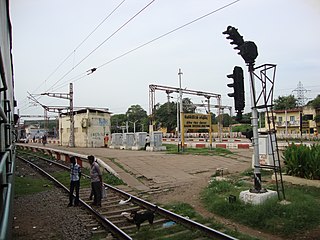
Basin Bridge Junction is a station on the Chennai suburban railway and serves the locality of Basin Bridge, the confluence on the Otteri Nullah and Buckingham Canal, in Chennai, India. The station is located at the southern end of the 'diamond' junction in Chennai, where all the lines of the Chennai Suburban Railway meet. It is the first station after Chennai Central. At this station, the line divides into three: one going towards Avadi and Arakkonam, the other towards Ennore and Gummidipoondi, and the third towards Chennai Beach and Chennai Egmore. Thus, the station acts as the entry point to Chennai Central terminus where inbound trains from all the three lines are stopped before assigning a platform at Chennai Central. It also contains a railway maintenance shed with 19 pit-lines, each measuring 3-ft deep to accommodate about 24 coaches. The station has an elevation of 7 m above sea level.

Chennai architecture is a confluence of many architectural styles. From ancient Tamil temples built by the Pallavas, to the Indo-Saracenic style of the colonial era, to 20th-century steel and chrome of skyscrapers. Chennai has a colonial core in the port area, surrounded by progressively newer areas as one travels away from the port, punctuated with old temples, churches and mosques.

Chennai Beach is a railway terminus of the Southern Railway network in Parry's Corner, Chennai, India. Built on reclaimed land, the station serves the suburban services of the Chennai suburban railway and Mass Rapid Transit System (Chennai) and a few passenger trains. It serves as the northern terminus for the Chennai MRTS line. The station is named after High Court Beach, which was later built up as part of Chennai Port, and not after the Marina Beach, which is located a few kilometres away and is served by Chepauk, Triplicane and Lighthouse stations of the MRTS line. The station consists of 1500 square metres of open parking area.

Anna Salai, formerly known as St. Thomas Mount Road or simply Mount Road, is an arterial road in Chennai, India. It starts at the Cooum Creek, south of Fort St George, leading in a south-westerly direction towards St. Thomas Mount, and ends at the Kathipara Junction in Guindy. Beyond the Kathipara Junction, a branch road arises traversing westwards to Poonamallee to form the Mount-Poonamallee Road while the main branch continuing southwards to Chennai Airport, Tambaram and beyond to form Grand Southern Trunk Road. Anna Salai, which is more than 400 years old, is acknowledged as the most important road in Chennai city. The head offices of many commercial enterprises and public buildings are located along Anna Salai. It is the second longest road in Chennai, after Poonamallee High Road.

George Town is a neighbourhood in Chennai city, Tamil Nadu, India. It is near the Fort Saint George, Chennai. It is also known as Muthialpet and Parry's corner. It is an historical area of Chennai city from where its expansion began in the 1640s. It extends from the Bay of Bengal in the east to Park town on the west. The Fort St. George is on the south, to Royapuram in the north. The Fort St. George houses the Tamil Nadu Legislative Assembly and the Secretariat. The High court of Tamil Nadu at Chennai, Dr. Ambedkar Law College, Stanley Medical College and Hospital are located here.

Chennai General Post Office (GPO) is located on Rajaji Salai at Parry's Corner, Chennai. It functions in a building built in 1884. It is located opposite to the Chennai Beach suburban railway station. Chennai GPO covers an area of about 23.33 km2 (9.01 sq mi) and serves a population of around 220,000. It has no sub or branch offices.
Wall Tax Road, also known officially as V. O. C. Salai, is a road in Chennai, India, adjacent to the Chennai Central railway station. The road runs parallel to the railway tracks of the station and borders George Town on the west. The eastern entrance of the terminus lies on the road. The road is named after the wall built as a protective measure by the British in 1772–1773, which still remains partially.

China Bazaar Road, officially Netaji Subash Chandra Bose Road, is one of the main thoroughfares of the commercial centre of George Town in Chennai, India. The road connects Rajaji Salai in the east with Wall Tax Road in the west. Passing through thickly populated residential areas of the historical neighbourhood, the road has several streets, lanes, and by lanes joining it housing several commercial establishments of the city.
EVR Periyar Salai (EVR High Road), earlier known as Poonamallee High Road(NH 48), is an arterial road in Chennai, India. It is the longest road in Chennai. Running from east to west, the 14-kilometre (8.7 mi) road starts at Muthuswamy Bridge near Madras Medical College at Park Town and ends near Maduravoyal Junction via Kilpauk, Aminjikarai, Anna Nagar Arch, Arumbakkam, Koyambedu. It further continues west towards Poonamallee and traverses Sriperumbudur, Walajapet, and Ranipet.

Vepery is a suburb in the north of Chennai, India. Abutting the transportation hub of Park Town, the neighbourhood covers a rectangular area north of the Poonamallee High Road.
Mint Street is one of the prime streets of the commercial centre of George Town in Chennai, India. The street is one of the oldest streets in Chennai and is believed to be the longest street in the city. Running north–south, the street connects Poonamallee High Road at Park Town in the south with North Wall Road–Old Jail Road Junction at Washermanpet in the north. Running parallel to the Wall Tax Road, another historical thoroughfare in the city, the street passes through thickly populated residential and commercial areas of the historical neighbourhood.
Old Jail Road is one of the peripheral roads that border the historical neighbourhood and commercial centre of George Town in Chennai, India. The road marks the northern boundary of the neighbourhood and is officially divided into three, namely, from west to east, the Basin Bridge Road, the Old Jail Road, and the Ibrahim Sahib Street. The road joins the Grand Northern Trunk (GNT) Road at the Wall Tax Road–GNT Road junction in the west and the Rajaji Salai in the east.
Mint Clock Tower is a standalone clock tower in George Town, Chennai, India. It is one of the four standalone clock towers in Chennai, the other three being the ones at Royapettah, Doveton and Pulianthope.
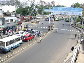
The total road network in the city's metropolitan area is 2,780 km. With Chennai's vehicular population having experienced a surge in the late 1990s, several flyovers were built to reduce the traffic congestion in the city, thus making it the City of Flyovers. Of about ₹ 15,600 million invested by the state government between 2005 and 2014, Chennai cornered a major chunk of the investment. As of 2017, there are 35 functional flyovers in the city and around 150 bridges including 12 rail over bridges, catering to the city's vehicular population of about 5.3 million, including about 1.2 million cars. In addition, more than 36 flyovers are in the pipeline.

Doveton, is a neighbourhood in Purasawalkam and Vepery, and is a shopping district in Central Chennai, a metropolitan city in Tamil Nadu, India. It is the unofficial name of the neighbourhood in Purasawalkam. The area of Doveton acquired its name after Capt. John Doveton, who served as a captain commandant of the Seventh Regiment of Infantry.Capt.John Doveton is the Founder of the Doveton Group of Schools situated at no 1,Ritherdon Road, Vepery . The name Doveton originated by the presence of the Doveton group of schools in the area.
Royapettah is a neighbourhood of Chennai, India.
