Daliyat al-Rawha'

Last updated

Contents

Daliyat al-Rawha'
دالية الروحاء
Daliyat al Ruha, Daliyat ar Ruha
Village
Etymology: "The trailing vine of er Rûhah", p.n. [1]
Historical map series for the area of Daliyat al-Rawha' (1870s).jpg 1870s map
Historical map series for the area of Daliyat al-Rawha' (1940s).jpg 1940s map
Historical map series for the area of Daliyat al-Rawha' (modern).jpg modern map
Historical map series for the area of Daliyat al-Rawha' (1940s with modern overlay).jpg 1940s with modern overlay map
A series of historical maps of the area around Daliyat al-Rawha' (click the buttons)
Mandatory Palestine location map.svg
Red pog.svg
Daliyat al-Rawha'
Location within Mandatory Palestine
Coordinates: 32°36′7″N35°04′38″E / 32.60194°N 35.07722°E / 32.60194; 35.07722
Palestine grid 157/223
Geopolitical entity Mandatory Palestine
Subdistrict Haifa
Date of depopulationlate March 1948 [2]
Area
[3]
  Total
10,008  dunams (10.008 km2 or 3.864 sq mi)
Population
 (1945)
  Total
600 [3] [4]
Cause(s) of depopulationWhispering campaign
Secondary causeMilitary assault by Yishuv forces
Current Localities Ramot Menashe? [5] Dalia [6]

Daliyat al-Rawha' (Arabic : دالية الروحاء, Dâliyat er Rûhâ, "vineyards (دالية) of al-Rawha") was a Palestinian village located 24.5 kilometers (15.2 mi) southeast of Haifa. [7] It was the site of the signing of a ceasefire agreement between the forces of the Mamluks and the Crusaders in the 13th century. A small village of 60 Arab Muslims in the late 19th century, the kibbutz of Dalia was established on land purchased in the village in 1939. The population in 1945 reached 600 people: 280 Arabs and 320 Jews. [3] It was depopulated of its Arab inhabitants in late March during the 1947–1948 civil war in Mandatory Palestine. Its remains lie at the very center of the Ramat Menashe Park of the JNF covered by the kibbutz of the same name. [8]

History

In 1281, the Mamluk sultan Qalawun stayed in Daliyat al-Rawha' while his forces battled against those of the Crusaders. According to Al-Maqrizi, the two sides signed a temporary peace treaty (hudna) in the village. [6]

Ottoman era

In 1859 the population was estimated to be about 60, who cultivated 10 faddans of land. In 1882, the PEF's Survey of Western Palestine (SWP) described Daliyat al-Rawha' as being a village of moderate size, situated on the west side of a watershed, with a good spring close by on the south. [9]

A population list from about 1887 showed that Daliet er Ruhah had about 195 inhabitants, all Muslim, [10] while Khiryet Umm ed Duff had about 80 Muslim inhabitants. [11]

British Mandate era

In the 1922 census of Palestine conducted by the British Mandate authorities, Dalia al-Ruha had a population 135, while Umm al-Defuf had a population of 44, all Muslims. [12] In the 1931 census Daliat el Rauha had 163 Muslim inhabitants, in 46 houses, [13] while Umm ed Dufuf had 49 Muslim inhabitants in 10 houses. [14]

The villagers also raised livestock. The village had a rectangular layout from east to west. The houses were grouped closely together and made of stone, held together with mud or cement. The main water sources for the village were located nearby. [6]

By the 20th century, the Arabs of Daliyat al-Rawha were tenant farmers. [15] The Palestine Jewish Colonization Association (PICA) purchased 10,073 dunams of land in Daliyat al-Rawha and neighboring Umm ed-Dafuf in 1936. [16] The kibbutz of Dalia was established in 1939 to the south of the built up area of Daliyat al-Rawha' on village lands. [6] By 1939, the people of Umm ed-Dafuf, previously independent, were included in Daliyat al-Rawha'. [17]

In the 1945 statistics the population was 280 Muslims, and a total of 10,008 dunams of land, most of it Jewish owned, according to an official land and population survey. [3] [4] Arabs used 98 dunams for plantations and irrigable land, 56 for cereals, [18] while 24 dunams were built-up (urban) land. [19]

Types of land use in dunams in the village in 1945: [18] [19]

Land UsageArabJewish
Irrigated and plantation980
Cereal569,595
Urban2419
Cultivable1549,595

The land ownership of the village before occupation in dunams: [3]

OwnerDunams
Arab178
Jewish9,614
Public216
Total10,008

1948 war and aftermath

Benny Morris relates that Yosef Weitz was concerned with the problem posed by Arab tenant farmers in the area as early as January 1948. A diary entry Weitz made following a meeting with officials of the Jewish National Fund states:

"Is not now the time to be rid of them [he was referring specifically to the tenant farmers in Qira and Daliyat ar Ruha]? Why continue to keep in our midst these thorns at a time when they pose a danger to us? Our people are considering [solutions]." [20]

In March 1948, Weitz organized with the Jewish residents of kibbutz Kfar Masaryk the eviction of the tenant communities at Daliyat al-Rawha' and Buteimat. [20]

The New York Times reports the village was captured on April 14, 1948, during the Battle of Mishmar HaEmek. [6] By mid-June 1948, according to David Ben-Gurion as based on a report written by Weitz, Daliyat al-Rawha' had been destroyed by the Israeli authorities, while the destruction of Buteimat and Sabbarin was about to begin. [21] According to Morris, Ramot Menashe was established near the village lands almost immediately thereafter. [5] [22] Khalidi writes that Ramot Menashe is actually located on the lands of neighboring Sabbarin. [6]

In 1995, a committee representing internally displaced Palestinians from Daliyat al-Rawha' joined the Association for the Defense of the Rights of the Internally Displaced (ADRID), a national committee in Israel that advocates for these internal refugees' right of return. [23]

Related Research Articles

<span class="mw-page-title-main">Danna, Baysan</span> Place in Baysan, Mandatory Palestine

Danna, was a Palestinian village 13 kilometres north of Baysan that was captured by the Israel Defense Forces during the 1948 Arab-Israeli war, and the villagers were expelled.

al-Nahr Place in Acre, Mandatory Palestine

al-Nahr, was a Palestinian village 14 km (8.7 mi) northeast of Acre. It was depopulated in May 1948 after a military assault carried out by the Carmeli Brigade as part of the Israel Defense Forces's Operation Ben-Ami. Immediately after the assault, the village of al-Nahr was razed.

<span class="mw-page-title-main">Wadi Ara, Haifa</span> Place in Haifa, Mandatory Palestine

Wadi Ara was a Palestinian village located 38.5 km south of the city of Haifa. It is named after the nearby stream that is known in Arabic as Wadi 'Ara. The village was particularly small with a population of 230 and a land area of approximately 9,800 dunums.

<span class="mw-page-title-main">Yubla</span> Village in Baysan, Mandatory Palestine

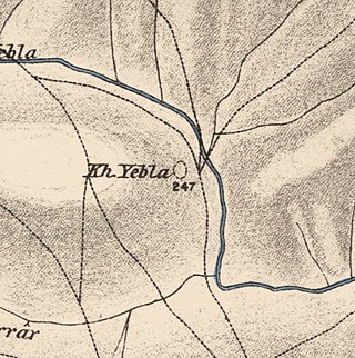
Yubla, was a Palestinian village, located 9 kilometers north of Bisan in present-day Israel. It was depopulated during the 1948 Arab-Israeli war.

<span class="mw-page-title-main">Sabbarin</span> Place in Haifa, Mandatory Palestine

Subbarin was a Palestinian Arab village located 28 kilometers south of Haifa. It was depopulated and destroyed during the 1948 Palestine war as part of the 1948 Palestinian expulsion and the Nakba.

Umm al-Tut is a Palestinian village 6 km southeast of the city of Jenin in the northern West Bank. According to the Palestinian Central Bureau of Statistics, the town had a population of 1003 inhabitants in mid-year 2006 and 1,194 by 2017.

<span class="mw-page-title-main">Al-Bira, Baysan</span> Village in Baysan, Mandatory Palestine

Al-Bira, is a depopulated former Palestinian village located 7.5 km north of Baysan. During Operation Gideon, the village was occupied by the Golani Brigade.

<span class="mw-page-title-main">Al-Tira, Baysan</span> Village in Baysan, Mandatory Palestine

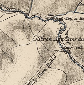
Al-Tira, was a Palestinian Arab village in the District of Baysan. It was depopulated by the Israel Defense Forces during the 1947–48 Civil War in Mandatory Palestine on 15 April 1948 as part of Operation Gideon under the command of Yosef Weitz. It was located 17.5 km north of Baysan overlooking Wadi al-Bira. However, 'Ayn al-Bayda' was the main source of drinking water for al-Tira inhabitants.

<span class="mw-page-title-main">Umm 'Ajra</span> Village in Baysan, Mandatory Palestine

Umm 'Ajra, was a Palestinian Arab village in the District of Baysan. It was depopulated by the Israel Defense Forces during the 1948 Arab-Israeli War on May 31, 1948, as part of Operation Gideon. It was located 4 km south of Baysan and the 'Ayn Umm 'Ajra provided the village with water.

<span class="mw-page-title-main">Abu Shusha, Haifa</span> Arab village in Haifa subdistrict, Mandatory Palestine

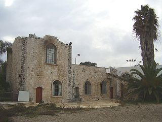
Abu Shusha was a Palestinian Arab village in the Haifa Subdistrict. It was depopulated during the 1947–48 Civil War in Mandatory Palestine on 9 April 1948 during the Battle of Mishmar HaEmek. The village was inhabited by Turkmens.

<span class="mw-page-title-main">Ayn Ghazal (village)</span> Village in Haifa, Mandatory Palestine

Ayn Ghazal was a Palestinian Arab village located 21 kilometers (13 mi) south of Haifa. Depopulated during the 1948 Arab-Israeli War as a result of an Israeli military assault during Operation Shoter, the village was then completely destroyed. Incorporated into the State of Israel, it is now mostly a forested area. The Israeli moshav of Ofer ("fawn") was established in 1950 on part of the former village's lands. Ein Ayala, a moshav established in 1949, lies just adjacent; its name being the Hebrew translation of Ayn Ghazal.

<span class="mw-page-title-main">Al-Butaymat</span> Village in Haifa, Mandatory Palestine

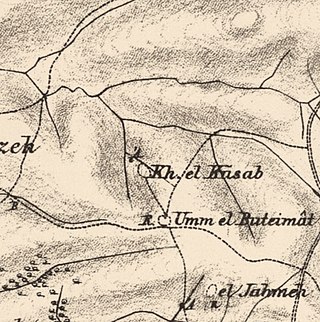
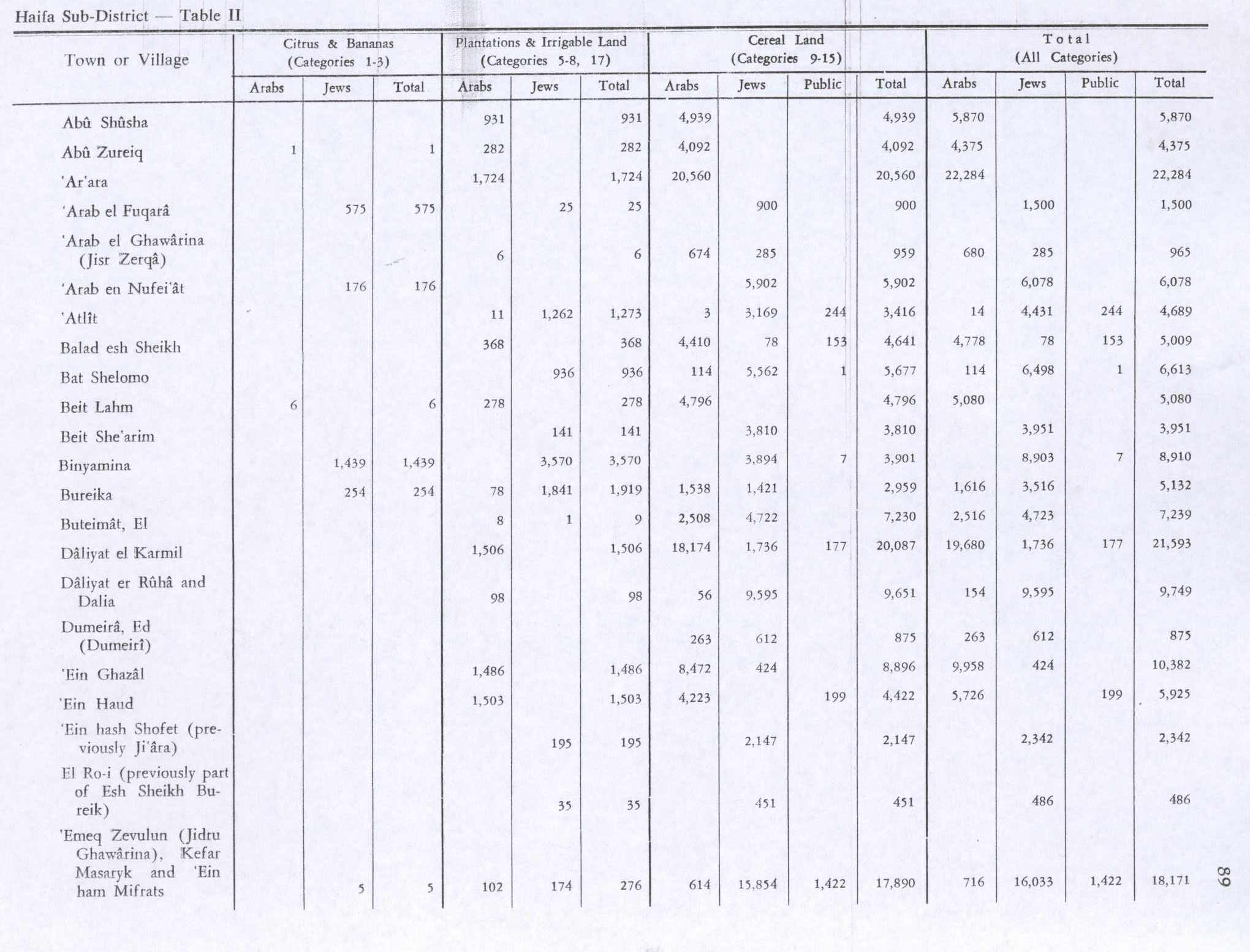
Al-Butaymat was a Palestinian Arab village the Haifa Subdistrict, located 31 kilometers (19 mi) southeast of Haifa. It was depopulated during the 1947–48 Civil War in Mandatory Palestine on May 1, 1948, under the Battle of Mishmar HaEmek.

<span class="mw-page-title-main">Al-Rihaniyya</span> Arab village in Haifa subdistrict, Mandatory Palestine

Al-Rihaniyya was a Palestinian Arab village in the Haifa Subdistrict. It was depopulated during the 1947–1948 Civil War in Mandatory Palestine on 30 April 1948 as part of the battle of Mishmar HaEmek. It was located 25 km southeast of Haifa and 3 km northwest of Wadi al-Mileh.

<span class="mw-page-title-main">Umm ash Shauf</span> Village in Haifa, Mandatory Palestine

Umm al-Shawf or Umm ash Shauf was a Palestinian Arab village located 29.5 km south of Haifa, on the sloping section of Wadi al-Marah. It was depopulated as a result of a military assault between May 12–14, just before the outbreak of the 1948 Arab-Israeli war.

<span class="mw-page-title-main">Bayt Umm al-Mays</span> Place in Jerusalem, Mandatory Palestine

Bayt Umm al-Mays was a small Palestinian Arab village in the Jerusalem Sub-district, located 14 km west of Jerusalem..

<span class="mw-page-title-main">Ayn al-Mansi</span> Place in Jenin, Mandatory Palestine

Ayn al-Mansi was a Palestinian Arab village in the District of Jenin of the Mandatory Palestine. It was depopulated as a result of a military attack in mid-April during the 1947–48 Civil War in Mandatory Palestine.

<span class="mw-page-title-main">Umm Kalkha</span> Place in Ramle, Mandatory Palestine

Umm Kalkha was a small Palestinian village in the Ramle Subdistrict of Mandatory Palestine. It was depopulated during the 1947–48 Civil War in Mandatory Palestine on April 7, 1948, during Operation Nachshon. It was located 12.5 km south of Ramla, situated on the northern banks of Wadi al-Sarar.

<span class="mw-page-title-main">Khan al-Duwayr</span> Village in Safad, Mandatory Palestine

Khan al-Duwayr was a Palestinian Arab village in the Safad Subdistrict. It was depopulated during the 1948 Arab-Israeli War on May 30, 1948, by the Palmach's First Battalion of Operation Yiftach. It was located 35 km northeast of Safad. The ruins of the village were overbuilt by the Israeli kibbutz of Snir.

<span class="mw-page-title-main">Al-Nuqayb</span> Village in Tiberias, Mandatory Palestine

Al-Nuqayb was a Palestinian Arab village in the Tiberias Subdistrict. It was depopulated during the 1948 Arab-Israeli War on May 15, 1948. It was located 10 km east across the lake from Tiberias. bordering the Wadi al-Muzaffar and Wadi Samakh. al-Nuqayb was named after the Bedouin tribe of 'Arab al-Nuqayb.

<span class="mw-page-title-main">Al-Manshiyya, Tiberias</span> Village in Tiberias, Mandatory Palestine

Al-Manshiyya was a Palestinian Arab village in the Tiberias Subdistrict, located 11 kilometres south of Tiberias. It was probably depopulated at the same time as neighbouring Al-'Ubaydiyya, in the 1947–1948 Civil War in Mandatory Palestine. Manshiyya was located 1 km south-west of Umm Junieh or Khirbat Umm Juni.
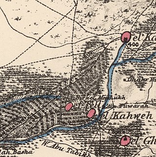
References

  1. Palmer, 1881, p. 146
  2. Morris, 2004, p. xviii, village #162. Also gives causes of depopulation.
  3. 1 2 3 4 5 Government of Palestine, Department of Statistics. Village Statistics, April, 1945. Quoted in Hadawi, 1970, p. 47.
  4. 1 2 Government of Palestine, Department of Statistics, 1945, p. 13
  5. 1 2 Morris, 2004, p. xx, settlement #4.
  6. 1 2 3 4 5 6 Khalidi, 1992, p. 158.
  7. Khalidi, 1992, p. 157.
  8. The Ethnic Cleansing of Palestine, Ilan Pappe, Oneworld, Oxford, 2006, p.231
  9. Conder and Kitchener, 1882, SWP II, p. 41. Also cited in Khalidi, 1992, p. 158
  10. Schumacher, 1888, p. 180
  11. Schumacher, 1888, p. 179
  12. Barron, 1923, Table xi, Sub-district of Haifa, p. 34
  13. Mills, 1932, p. 89
  14. Mills, 1932, p. 98
  15. Morris, 2004, p. 372
  16. Avneri, 1984, p. 210, note #87, on p. 297
  17. The Palestine Gazette, 1939, p. 1537 [ permanent dead link ]
  18. 1 2 Government of Palestine, Department of Statistics. Village Statistics, April, 1945. Quoted in Hadawi, 1970, p. 89
  19. 1 2 Government of Palestine, Department of Statistics. Village Statistics, April, 1945. Quoted in Hadawi, 1970, p. 139
  20. 1 2 Morris, 2004, pp. 131-2
  21. Morris, 2004, p. 350
  22. Morris, 2004, p. 405, note #177
  23. Masalha, ed., 2005, p. 99

Bibliography