History
Archeological remains from Early Bronze Age, [6] Iron Age II, [6] Hellenistic [6] [7] and Roman era have been found. [6]
A wine-press, dating to late Roman or early Byzantine era have been excavated, [8] together with a cistern, dating from the pre-Byzantine era. [9]
Crusader era remains have been found, [10] together with remains from the Mamluk era. [6] [10]
Ottoman era
In 1517, Tira was incorporated into the Ottoman Empire along with the rest of Palestine, and by 1596 it was a part of the nahiya ("subdistrict") of Ramla, which was under the administration of the liwa ("district") of Gaza. A village of 26 households and 3 bachelors, an estimated 160 persons, Muslims. They paid a fixed tax rate of 25% on agricultural products, such as wheat, barley, vineyards, fruit trees, beehives, and goats, a total of 6,800 akçe. [11] [12]
In 1863, Victor Guérin noted Al-Tira situated about 2 kilometres south of Qula, and containing five hundred inhabitants. [13] Guérin also found here "caves and a tomb cut in the rock; also, still standing, the door of an ancient house, its two jambs formed of great cut stones covered by a splendid block forming the lintel, and formerly decorated by mouldings, now effaced". [14] An Ottoman village list from about the same year (1870) indicated 54 houses and a population of 385, though the population count included men, only. [15] [16]
In 1882, the PEF's Survey of Western Palestine described it as: "A mud village of moderate size, with cactus hedges, situated at the edge of the plain, the hills rising behind; on the west, by the high road, is a good well, with remains of masonry". [17]
In 1896, the population of Et-tire was estimated to be about 210 persons. [18]
British Mandate era
In the 1922 census of Palestine conducted by the British Mandate authorities, Tireh had a population of 705, all Muslims, [19] increasing in the 1931 census to 892, still all Muslims, in a total of 225 houses. [20]
An elementary school was founded in 1922, and by 1947–48, it had an enrollment of 110 boys and 22 girls. [12]
In the 1945 statistics the population was 1,290, all Muslims, [4] while the total land area was 6,956 dunams, according to an official land and population survey. [3] Of this, 78 were allocated for plantations and irrigable land, 5,551 for cereals, [21] while 45 dunams were classified as built-up areas. [22]
Al-'Umari Mosque was one of the notable landmarks. [12]
1948, and aftermath
The village became depopulated on July 10, 1948, after a military assault by the Israeli army. [2] On the same day, Operation Danny headquarter ordered the Yiftach Brigade to blow up most of Innaba and Al-Tira, leaving only houses enough for a small garrison. [23] [24]
The Israeli settlements of Tirat Yehuda, Giv'at Ko'ah and Bareket are all on the land of Al-Tira. [5]
In 1992 the village site was described: "The site, situated next to paved road, is partly deserted and overgrown with a variety of trees, such as olive, date palm, fig and gum trees. The rubble of some of the destroyed houses is visible. A number of stone houses survive, however; some are deserted, others are occupied by Israelis, and still others are used as stables for livestock. A deserted house, fenced in with barbed wire, has high, round-arched windows and a flat roof; the yard is overgrown with untended grass. One of the occupied houses is quite modest. It has a rectangular door and window and a flat roof; date-palm and other trees grow on two sides. A second, larger, occupied house has two stories and a wide porch, and is also surrounded by trees. A third is also quite large and has two stories; a side stairway leads to a second-floor porch and there is a large, round arched entrance on the first floor. There are some destroyed houses inside the settlement of Bareqet. Some of the surrounding land is planted in grapes and kiwi fruit." [5]
This page is based on this
Wikipedia article Text is available under the
CC BY-SA 4.0 license; additional terms may apply.
Images, videos and audio are available under their respective licenses.

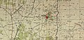
 1870s map
  1940s map
 modern map
  1940s with modern overlay map


