Tisdale's drawing of the Essex South district, turning the area that the district encompassed into a depiction of a dragon-like creature, building upon Richard Alsop's term, "Gerry-mander."
Known as the "Essex South" district.[4] From 1813-1815,[5] the district was shaped in such a way that poet and Federalist Richard Alsop described it as a "Gerry-mander" (a portmanteau of Gerry—the governor at the time—and salamander). Illustrator Elkanah Tisdale subsequently used the term as the basis for a political cartoon, which popularized it and led to "gerrymandering" being used to describe the practice of manipulating electoral district boundaries to gain a political advantage.[6]
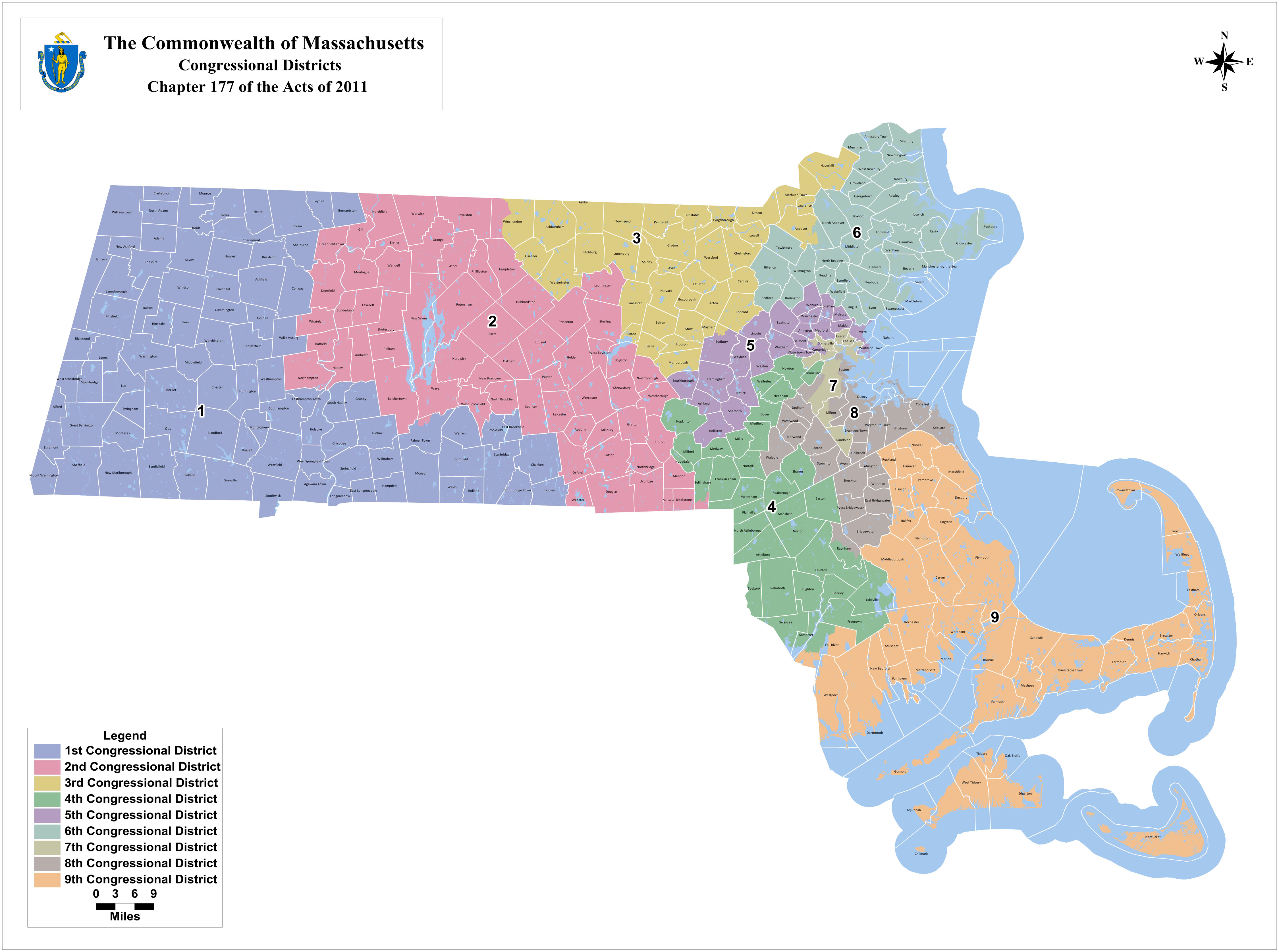
1843 to 1853
Detail of the district from 1843 to 1853.
The Act of September 16, 1842, established the district on the North Shore and New Hampshire border, with the following municipalities:[7]
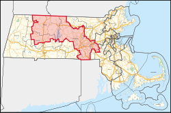
After the 2010 census, the shape of the district changed for the elections of 2012. The updated district covered central Massachusetts, including much of Worcester County, and was largely the successor to the old 3rd District. Most of the old 2nd district, including Springfield, was moved into the updated 1st district.
During this decade, the district contained the following municipalities:[11]
In Franklin County: Deerfield, Erving, Gill, Greenfield, Leverett, Montague, New Salem, Northfield, Orange, Shutesbury, Sunderland, Wendell, Warwick, and Whately
In Hampden County: Precinct 1 in Palmer
In Hampshire County: Amherst, Belchertown, Hadley, Hatfield, Northampton, Pelham, and Ware
In Norfolk County: Precincts 4 and 5 in Bellingham
In Worcester County: Athol, Auburn, Barre, Blackstone, Boylston, Douglas, Grafton, Hardwick, Holden, Hubbardston, Leicester, Leominster, Mendon, Millbury, Millville, Northborough, Northbridge, North Brookfield, Oakham, Oxford, Paxton, Petersham, Phillipston, Princeton, Royalston, Rutland, Shrewsbury, Spencer, Sterling, Sutton, Templeton, Upton, Uxbridge, Webster, West Boylston, Westborough, Precinct 1 in Winchendon, and Worcester.
12Ben. Perley Poore (1869). "Massachusetts". Congressional Directory for the First Session of the Forty-First Congress (2nded.). Washington DC: Government Printing Office. hdl:2027/nyp.33433081796686.
↑"Massachusetts". Official Congressional Directory: 59th Congress (2nded.). Washington DC: Government Printing Office. 1905.
↑"Massachusetts". Congressional Directory for the Second Session of the Thirty-Seventh Congress. Washington DC: House of Representatives. 1861.
↑Ben. Perley Poore (1878). "Massachusetts". Congressional Directory: 45th Congress (3rded.). Washington DC: Government Printing Office. ISBN978-0-16-041176-2.{{cite book}}: ISBN / Date incompatibility (help)
↑Ben. Perley Poore (1882). "Massachusetts". Congressional Directory: 47th Congress (3rded.). Washington DC: Government Printing Office.
↑L.A. Coolidge (1897). "Massachusetts". Official Congressional Directory: Fifty-Fifth Congress. Washington DC: Government Printing Office.
↑A.J. Halford (1909). "Massachusetts". Congressional Directory: 60th Congress (2nded.). Washington DC: Government Printing Office.
↑"Massachusetts". Official Congressional Directory: 75th Congress (2nded.). Washington DC: Government Printing Office. 1938.
↑"Massachusetts". Official Congressional Directory: 90th Congress. Washington DC: Government Printing Office. 1968.
↑"Massachusetts". 1991-1992 Official Congressional Directory: 102nd Congress. Washington DC: Government Printing Office. 1991.
The at-large and 10th–20th districts are obsolete. The 14th–20th districts moved to Maine in 1820, and the 14th–16th districts were later restored in Massachusetts.
This page is based on this Wikipedia article Text is available under the CC BY-SA 4.0 license; additional terms may apply. Images, videos and audio are available under their respective licenses.


