
Ishwa' was a Palestinian village which was depopulated during the 1948 Arab-Israeli war. The village was located about 20 km west of Jerusalem, on the present location of Eshta'ol. In the 1931 British census of Palestine, Ishwa had a population of 468 in 126 houses. The village was occupied by the Israel Defense Forces (IDF) on July 16, 1948, in Operation Dani by the Harel Brigade. All of its inhabitants fled or were expelled.

Hatta was a Palestinian Arab village of 1,125 inhabitants that was depopulated after a July 17, 1948 assault by Israeli forces of the Givati Brigade during the 1948 Arab-Israeli war. Following the war the area was incorporated into the State of Israel and Zavdiel and Aluma were established on the land that had belonged to Hatta.
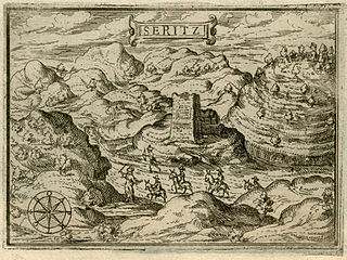
Saris was a Palestinian Arab village that was depopulated during the major offensive launched by the Haganah on 16 April 1948. Called Operation Nachshon, and launched before the British had left Palestine, its objective was to capture villages between Jerusalem and the coastal plain, in order to break to siege of the Jews of Jerusalem.
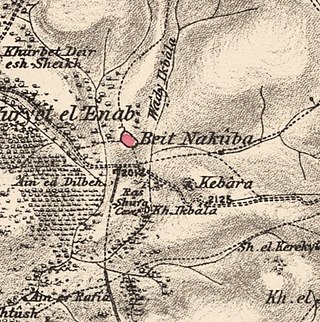
Bayt Naqquba was a Palestinian village in British Mandate Palestine, located 9.5 kilometers west of Jerusalem, near Abu Ghosh. Before Palmach and Haganah troops occupied the village during Operation Nachshon on April 11, 1948, approximately 300 Palestinian Arabs lived there. After the 1948 Arab–Israeli War, a moshav named Beit Nekofa was founded close to the site by Jewish immigrants from Yugoslavia. In 1962, residents of Bayt Naqubba built a new village named Ein Naqquba, south of Beit Nekofa.

Kudna was a Palestinian Arab village, located 25 kilometers northwest of Hebron.
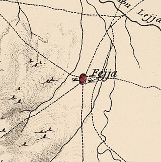
Fajja was a Palestinian town located 15 kilometers northeast of Jaffa. Ethnically cleansed during the Nakba, its land area is today part of the Israeli city of Petah Tikva.

Jusayr was a Palestinian Arab village in the Gaza Subdistrict. It was depopulated during the 1948 Arab-Israeli War on July 17, 1948, under Operation Barak or Operation Yo'av. It was located 35 km northeast of Gaza.

Barqusya was a Palestinian Arab village in the Hebron Subdistrict, depopulated in the 1948 Palestine War. It was located 31 km northwest of Hebron.
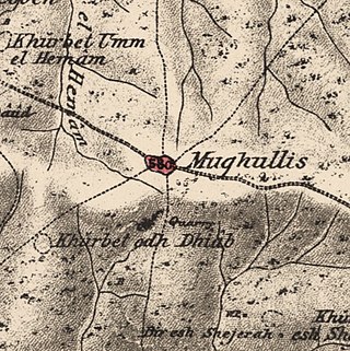
Mughallis was a Palestinian Arab village located 30.5 kilometers (19.0 mi) northwest of Hebron. It was depopulated during the 1948 Arab-Israeli War between July 9–10, 1948 as part of Operation An-Far.
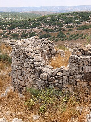
Khirbat Umm Burj was a Palestinian Arab village in the Hebron Subdistrict, sometimes designated in modern maps as Burgin. Its ruins are today located within the borders of Israel. It occupied an extensive site, stretching about 30 dunams on the crest of a hill, rising some 430 metres (1,410 ft) above sea level, and commanding a good prospect of the surrounding region. It was depopulated during the 1948 Arab–Israeli War on October 28, 1948, during the third stage of Operation Yo'av under the command of Yigal Allon. The site is located 17 km northwest of Hebron.

Al-Safiriyya was a Palestinian Arab village in the Jaffa Subdistrict. It was depopulated during Operation Hametz in the 1948 Palestine War on May 20, 1948. It was located 11 km east of Jaffa, 1.5 km west of Ben Gurion Airport.

Aqqur was a Palestinian Arab hamlet in the Jerusalem Subdistrict. Founded in the Ottoman period, it had a population of 25 in 1922 and 40 in 1945. It was depopulated during the 1948 Arab-Israeli War on July 13, 1948, under Operation Dani. It was located 14.5 km west of Jerusalem on the Wadi Isma'il, a tributary of the Wadi al-Sarar.

Bayt Umm al-Mays was a small Palestinian Arab village in the Jerusalem Sub-district, located 14 km west of Jerusalem..

Ras Abu 'Ammar was a small Palestinian Arab village in the Jerusalem Subdistrict. It was depopulated during the 1948 Arab-Israeli War on October 21, 1948, by the Har'el Brigade of Operation ha-Har. It was located 14 km west of Jerusalem, surrounded on three sides by the Wadi al-Sarar.

Sufla was a Palestinian Arab village in the Jerusalem Subdistrict. It was depopulated during the 1948 Arab–Israeli War on October 19, 1948, by the Sixth Battalion of the Harel Brigade under Operation Ha-Har. It was located 18.5 km west of Jerusalem.

Al-Barriyya was a Palestinian village in the Ramle Subdistrict of Mandatory Palestine. It was depopulated during the 1948 Arab–Israeli War on July 10, 1948, as part of Operation Dani. It was located 5.5 km southeast of Ramla, on the eastern bank of Wadi al-Barriyya.

Dayr Muhaysin was a Palestinian village in the Ramle Subdistrict of Mandatory Palestine, located 12 km southeast of Ramla and 4 km west of Latrun. It was depopulated during the 1948 Palestine war.

Dayr Tarif was a Palestinian Arab village in the Ramle Subdistrict of Mandatory Palestine. It was depopulated during the 1948 Arab-Israeli War on July 10, 1948.

Al-Haditha was a Palestinian village in the Ramle Subdistrict. It was located 8 km northeast of Ramla, on the bank of Wadi al-Natuf. The site, now known as Tel Hadid, has yielded significant archaeological remains from many periods. Al-Haditha was depopulated during the 1948 Arab-Israeli War on July 12, 1948, under the first stage of Operation Dani.

Al-Qubayba was a Palestinian Arab village in the Ramle Subdistrict. It was depopulated during the 1948 Arab-Israeli War on May 27, 1948, by the Givati Brigade as part of the Second stage of Operation Barak. It was located 10.5 km southeast of Ramla near the Rubin River which provided the village with water and irrigation for agriculture. Al-Qubayba was mostly destroyed with the exception of a few houses, and Kfar Gevirol was built in its place, now a suburb in the west of Rehovot.
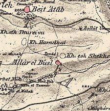 1870s map
 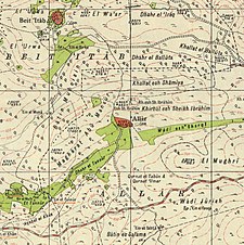 1940s map
 modern map
  1940s with modern overlay map


