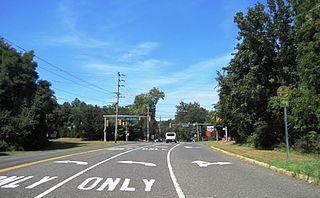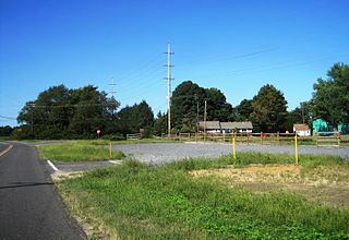
Elberon is a railway station in the Elberon section of Long Branch, Monmouth County, New Jersey, United States. The station is served by New Jersey Transit's North Jersey Coast Line. Located at the intersection of Lincoln Avenue and Truax Road, It is the first station south of the electrified section of the line. The station has two side level high-level platforms and 229 parking spaces for commuter use.

Elberon is an unincorporated community that is part of Long Branch in Monmouth County, New Jersey, United States. The area is served as United States Postal Service ZIP code 07740.

Georgia is an unincorporated community located within Freehold Township in Monmouth County, New Jersey, United States. Exit 22 on Interstate 195 provides access to Georgia via Jackson Mills Road. There is also a road in the area called Georgia Road, leading to Turkey Swamp Park. Georgia sits at the northern reaches of the Pine Barrens and numerous housing developments are located north and east of the settlement.

East Long Branch is an unincorporated community and neighborhood located within Long Branch in Monmouth County, New Jersey, United States. It is located in the northern portion of the city along the Atlantic Ocean coastline. Major roads through the area include Joline Avenue and Ocean Boulevard, both of which are parts of New Jersey Route 36. Homes consisting of single-family houses and condominiums are located throughout the area and the county-maintained Seven Presidents Park is located within East Long Branch.

Collingwood Park is an unincorporated community located along the border of Howell and Wall townships in Monmouth County, New Jersey, United States.

Feaster Park is a city park in New Brunswick in Middlesex County, New Jersey, United States in the neighborhood of the same name.

Jamesburg Park is an unincorporated community located within East Brunswick Township in Middlesex County, New Jersey, United States. It is adjacent to a park of the same name.

Jefferson Park is an unincorporated community located within Metuchen in Middlesex County, New Jersey, United States.

Laurel Park is a neighborhood in Sayreville in Middlesex County, New Jersey, United States.

Lincoln Park is an unincorporated community located within New Brunswick in Middlesex County, New Jersey, United States.

Lincoln Park is an unincorporated community located within Edison Township in Middlesex County, New Jersey, United States.

Possumtown is an unincorporated community located within Piscataway Township in Middlesex County, New Jersey, United States. The area is mostly a residential neighborhood nestled between Possumtown Road, River Road and Interstate 287. The neighborhood has two parks within its environs: Wynnewood Park and Possumtown Park.

Washington Park is an unincorporated community located within Edison Township in Middlesex County, New Jersey, United States.

West Carteret is an unincorporated community located within Carteret in Middlesex County, New Jersey, United States. Joseph Medwick Park is a greenway of parkland along the banks the Rahway River.

Branchport is an unincorporated community located within Long Branch in Monmouth County, New Jersey, United States. Centered in the northern part of the city, the area contains mostly single-family homes along grid-like streets though some commercial businesses are located on New Jersey Route 36 which through Branchport is called Joline Avenue. The North Jersey Coast Line passes through the community though the closest stops along the line are the Monmouth Park station in Oceanport and the Long Branch station in the center of the city.

Dogs Corners is an unincorporated community in Ocean Township in Monmouth County, New Jersey, United States.

Holland is an unincorporated community located on the border of Holmdel and Middletown townships in Monmouth County, New Jersey, United States. The community is centered on the intersection of County Route 52 and Holland Road. The area making up Holland is hilly and consists of large single-family residences. An AT&T Labs campus is located off Laurel Avenue while Tatum County Park is also located in the area, both of which are on the Middletown side of the border.

Manasquan Park is an unincorporated community located within Brielle in Monmouth County, New Jersey, United States.

Sands Point is an unincorporated community located within Oceanport in Monmouth County, New Jersey, United States. The community is located on a peninsula surrounded by Blackberry Bay on the west and Branchport Creek on the east. Except for a park and some yachting clubs, the community consists of single-family houses arranged on a street grid in the northeast corner of the borough.

Sharon is an unincorporated community located within Upper Freehold Township in Monmouth County, New Jersey, United States. Located at the intersection of Herbert Road and Sharon Station Road, the settlement is the site of a former stop on the Pemberton and Hightstown Railroad. Except for a few single-family homes in the area, most of the area is farmland. The railroad has since been abandoned and is being converted to the Union Transportation Trail, a rail trail. Sharon is the current northern terminus of the trail.


