Name [1]
| County
| Population estimate
(2017) [1]
| Area (2010) [8]
| Elevation [9]
| Year
settled [10]
| Median household
income (2017) [11]
| Etymology [10] |
|---|
| Alpine | Utah | 10,197 | 7.43 sq mi (19.2 km2) | 4,951 feet (1,509 m) | 1850 | $112,727 | Adjacent high mountains of the Wasatch Mountains and Traverse Mountains |
| Alta | Salt Lake | 351 | 4.62 sq mi (12.0 km2) | 8,560 feet (2,610 m) | 1866 | $63,750 | Spanish word for "high" due to Alta's elevation |
| Altamont | Duchesne | 186 | 0.14 sq mi (0.36 km2) | 6,388 feet (1,947 m) | [lower-alpha 1] | $73,125 | Composite name of nearby peaks Altonah and Mt. Emmons |
| Alton | Kane | 143 | 2.12 sq mi (5.5 km2) | 7,041 feet (2,146 m) | [lower-alpha 1] | $46,250 | Alton Fjord in Norway |
| Amalga | Cache | 577 | 3.57 sq mi (9.2 km2) | 4,439 feet (1,353 m) | 1860 | $56,875 | Amalgamated Sugar Company |
| American Fork | Utah | 28,507 | 9.30 sq mi (24.1 km2) | 4,606 feet (1,404 m) | 1850 | $70,926 | American Fork River, a tributary of Utah Lake |
| Annabella | Sevier | 922 | 0.70 sq mi (1.8 km2) | 5,292 feet (1,613 m) | 1871 | $57,125 | Composite name of Ann S. Roberts and Isabella Dalton, woman settlers of Annabella |
| Antimony | Garfield | 125 | 10.11 sq mi (26.2 km2) | 6,453 feet (1,967 m) | 1873 | $42,023 | The metal antimony that was mined in the area |
| Apple Valley | Washington | 946 | 40.79 sq mi (105.6 km2) | 4,941 feet (1,506 m) | [lower-alpha 1] | $66,768 | [lower-alpha 2] |
| Aurora | Sevier | 903 | 1.04 sq mi (2.7 km2) | 5,200 feet (1,600 m) | 1875 | $59,792 | Aurora, the Roman goddess of dawn |
| Ballard | Uintah | 915 | 13.92 sq mi (36.1 km2) | 5,049 feet (1,539 m) | [lower-alpha 1] | $66,250 | Melvin J. Ballard, a LDS Church Apostle |
| Bear River City | Box Elder | 839 | 1.54 sq mi (4.0 km2) | 4,258 feet (1,298 m) | 1866 | $62,917 | Bear River, a 350-mile (560 km) river and largest tributary of the Great Salt Lake |
| Beaver* | Beaver | 3,020 | 6.54 sq mi (16.9 km2) | 5,902 feet (1,799 m) | 1856 | $46,708 | Beaver River, a 242-mile (389 km) river that eventually disappears into the ground |
| Bicknell | Wayne | 230 | 0.62 sq mi (1.6 km2) | 7,123 feet (2,171 m) | 1879 | $50,000 | Thomas W. Bicknell, who donated 500 books to the library |
| Big Water | Kane | 653 | 6.16 sq mi (16.0 km2) | 4,108 feet (1,252 m) | 1958 [12] | $38,879 | [lower-alpha 2] |
| Blanding | San Juan | 3,641 | 13.08 sq mi (33.9 km2) | 6,106 feet (1,861 m) | 1887 | $57,119 | Maiden name of the wife of Thomas W. Bicknell, who donated 500 books to the library |
| Bluffdale | Salt Lake | 10,869 | 10.97 sq mi (28.4 km2) | 4,436 feet (1,352 m) | 1886 | $105,391 | The bluffs along the Jordan River |
| Boulder | Garfield | 152 | 20.92 sq mi (54.2 km2) | 6,703 feet (2,043 m) | 1889 | $41,000 | Boulder Mountain, a 11,317-foot (3,449 m) mountain located in the Dixie National Forest |
| Bountiful | Davis | 43,568 | 13.47 sq mi (34.9 km2) | 4,797 feet (1,462 m) | 1847 | $69,611 | The Book of Mormon city of Bountiful |
| Brian Head | Iron | 82 | 3.72 sq mi (9.6 km2) | 9,800 feet (3,000 m) | [lower-alpha 1] | [lower-alpha 3] | William Jennings Bryan, national politician and former candidate for President of the United States |
| Brigham City* | Box Elder | 18,736 | 24.85 sq mi (64.4 km2) | 4,436 feet (1,352 m) | 1850 | $49,760 | Brigham Young, LDS Church President and first territorial Governor of Utah |
| Bryce Canyon City | Garfield | 200 | 3.45 sq mi (8.9 km2) | 7,664 feet (2,336 m) | 1875 | $40,500 | Local homsteader Ebenezer Bryce |
| Cannonville | Garfield | 272 | 1.98 sq mi (5.1 km2) | 5,886 feet (1,794 m) | 1874 | $72,500 | George Q. Cannon, a LDS Church Apostle |
| Castle Dale* | Emery | 1,631 | 2.16 sq mi (5.6 km2) | 5,676 feet (1,730 m) | 1879 [13] | $45,250 | Located in the Castle Valley, but a Postal Service mistake listed town as Castle Dale instead of Castle Vale. |
| Castle Valley | Grand | 435 | 9.28 sq mi (24.0 km2) | 4,685 feet (1,428 m) | 1974 [14] | $43,906 | Located in the Castle Valley |
| Cedar City | Iron | 30,232 | 36.84 sq mi (95.4 km2) | 5,846 feet (1,782 m) | 1851 | $42,216 | Large number of juniper trees, known as "cedars" |
| Cedar Fort | Utah | 329 | 21.24 sq mi (55.0 km2) | 5,085 feet (1,550 m) | 1856 | $68,250 | Large number of juniper trees in the area, known as "cedars" |
| Cedar Highlands | Iron | [15] | [15] | [15] | 1981 [16] [17] | [15] | Directly south of Cedar City, in the "highlands" of local mountains, originally an HOA/Subdivision's name. |
| Cedar Hills | Utah | 10,266 | 2.70 sq mi (7.0 km2) | 4,957 feet (1,511 m) | [lower-alpha 1] | $97,039 | Local juniper-covered hills |
| Centerfield | Sanpete | 1,416 | 1.80 sq mi (4.7 km2) | 5,098 feet (1,554 m) | 1869 | $51,950 | Center of the Gunnison Valley |
| Centerville | Davis | 17,013 | 6.04 sq mi (15.6 km2) | 4,377 feet (1,334 m) | 1848 [18] | $84,436 | Center between Farmington and Bountiful [18] |
| Central Valley | Sevier | 669 | 2.10 sq mi (5.4 km2) | 5,305 feet (1,617 m) | [lower-alpha 1] | $56,250 | [lower-alpha 2] |
| Charleston | Wasatch | 603 | 3.04 sq mi (7.9 km2) | 5,440 feet (1,660 m) | 1852 | $69,875 | Charles Shelton, who surveyed the town |
| Circleville | Piute | 801 | 9.08 sq mi (23.5 km2) | 6,066 feet (1,849 m) | 1864 | $54,688 | Located in the Circle Valley |
| Clarkston | Cache | 712 | 0.97 sq mi (2.5 km2) | 4,879 feet (1,487 m) | 1864 | $61,932 | Justus Clark, an original settler. |
| Clawson | Emery | 215 | 0.99 sq mi (2.6 km2) | 5,942 feet (1,811 m) | 1897 | $54,375 | Rudger Clawson, a LDS Church Apostle |
| Clearfield | Davis | 30,683 | 7.68 sq mi (19.9 km2) | 4,465 feet (1,361 m) | 1877 | $52,034 | The open surroundings of the area |
| Cleveland | Emery | 527 | 0.85 sq mi (2.2 km2) | 5,722 feet (1,744 m) | 1885 | $71,105 | Grover Cleveland, President of the United States |
| Clinton | Davis | 21,353 | 5.85 sq mi (15.2 km2) | 4,393 feet (1,339 m) | 1870s | $76,378 | [lower-alpha 2] |
| Coalville* | Summit | 1,808 | 3.70 sq mi (9.6 km2) | 5,577 feet (1,700 m) | 1858 | $64,688 | Many of the miners came from Coalville, England |
| Copperton | Salt Lake | 579 | 6.40 sq mi (16.6 km2) | | 1926 | $62,656 | Company town for the Utah Copper Company |
| Corinne | Box Elder | 760 | 3.88 sq mi (10.0 km2) | 4,226 feet (1,288 m) | 1869 | $51,700 | Corinne, the first child born in the area |
| Cornish | Cache | 220 | 4.81 sq mi (12.5 km2) | 4,485 feet (1,367 m) | [lower-alpha 1] | $49,500 | William D Cornish, vice-president of the Union Pacific Railroad |
| Cottonwood Heights | Salt Lake | 34,214 | 8.74 sq mi (22.6 km2) | 4,823 feet (1,470 m) | 1848 | $86,207 | Cottonwood trees found in the area |
| Daniel | Wasatch | 1,087 | 3.27 sq mi (8.5 km2) | 5,715 feet (1,742 m) | 1874 | $77,500 | Aaron Daniels, one of the first settlers |
| Delta | Millard | 3,478 | 4.79 sq mi (12.4 km2) | 4,639 feet (1,414 m) | 1906 | $65,040 | The river delta of the Sevier River |
| Deweyville | Box Elder | 470 | 6.4 sq mi (17 km2) | 4,437 feet (1,352 m) | 1864 | $66,719 | John C. Dewey, an early settler to the area |
| Draper | Salt Lake/ Utah | 47,043 | 30.1 sq mi (78 km2) | 4,505 feet (1,373 m) | 1849 | $110,270 | William Draper, the town's first LDS Church Bishop |
| Duchesne* | Duchesne | 1,826 | 2.53 sq mi (6.6 km2) | 5,518 feet (1,682 m) | 1904 | $49,318 | Nearby Fort Duchesne |
| Dutch John | Daggett | 131 | 2.4 sq mi (6.2 km2) | 6,430 feet (1,960 m) | 1957 | [lower-alpha 3] | [lower-alpha 2] |
| Eagle Mountain | Utah | 27,773 | 44.47 sq mi (115.2 km2) | 4,882 feet (1,488 m) | [lower-alpha 1] | $74,885 | Eagle Mountain Properties, the development company of the city |
| East Carbon | Carbon | 1,475 | 8.98 sq mi (23.3 km2) | 4,987 feet (1,520 m) | 1922 | $29,000 | Coal deposits found in the area |
| Elk Ridge | Utah | 3,231 | 2.68 sq mi (6.9 km2) | 5,354 feet (1,632 m) | [lower-alpha 1] | $82,500 | [lower-alpha 2] |
| Elmo | Emery | 334 | 0.65 sq mi (1.7 km2) | 5,692 feet (1,735 m) | 1908 | $43,125 | [19] A combination of the first letters of each name from the original settlers. Erickson, Larsen, Mortensen, Oviatt |
| Elsinore | Sevier | 717 | 1.3 sq mi (3.4 km2) | 5,351 feet (1,631 m) | 1874 | $51,667 | Elsinore, Denmark |
| Elwood | Box Elder | 1,091 | 7.83 sq mi (20.3 km2) | 4,298 feet (1,310 m) | 1879 | $81,161 | Postal Service named the town |
| Emery | Emery | 357 | 1.17 sq mi (3.0 km2) | 6,253 feet (1,906 m) | 1881 [20] | $41,875 | George W. Emery, territorial Governor of Utah |
| Emigration Canyon | Salt Lake | 1931 | 19 sq mi (49 km2) | | | | |
| Enoch | Iron | 6,331 | 7.21 sq mi (18.7 km2) | 5,545 feet (1,690 m) | 1851 | $53,569 | Enoch, a biblical figure in the Old Testament |
| Enterprise | Washington | 1,663 | 7.74 sq mi (20.0 km2) | 5,318 feet (1,621 m) | 1902 | $57,171 | Name reflected the first settlers' ability to adjust to problem experienced by the first settlers |
| Ephraim | Sanpete | 6,858 | 3.73 sq mi (9.7 km2) | 5,541 feet (1,689 m) | 1854 | $39,626 | Tribe of Ephraim, one of the twelve Tribes of Israel. |
| Escalante | Garfield | 770 | 2.94 sq mi (7.6 km2) | 5,820 feet (1,770 m) | 1876 | $64,250 | Silvestre Vélez de Escalante, a Franciscan missionary who explored the area in 1776 |
| Eureka | Juab | 471 | 1.51 sq mi (3.9 km2) | 6,430 feet (1,960 m) | 1869 | $45,625 | Eureka is the ancient Greek name for "I have found it", relating to the gold mines found in the area |
| Fairfield | Utah | 156 | 26.74 sq mi (69.3 km2) | 4,877 feet (1,487 m) | 1855 | $85,208 | Amos Fielding, an early settler of the area |
| Fairview | Sanpete | 1,477 | 1.24 sq mi (3.2 km2) | 6,948 feet (2,118 m) | 1859 | $59,583 | The attractive surroundings of the area |
| Farmington* | Davis | 22,616 | 9.95 sq mi (25.8 km2) | 4,304 feet (1,312 m) | 1847 | $97,168 | The farms found in the area |
| Farr West | Weber | 6,671 | 6.04 sq mi (15.6 km2) | 4,265 feet (1,300 m) | 1858 | $90,217 | Located west of Farr's Fort which was named after Lorin Farr, an early LDS Church stake president of the area. |
| Fayette | Sanpete | 291 | 0.42 sq mi (1.1 km2) | 5,052 feet (1,540 m) | 1861 | $76,563 | Fayette, New York, where the LDS Church was organized |
| Ferron | Emery | 1,560 | 2.14 sq mi (5.5 km2) | 5,971 feet (1,820 m) | 1877 [21] | $51,131 | A. D. Ferron, surveyor of the area |
| Fielding | Box Elder | 465 | 0.45 sq mi (1.2 km2) | 4,373 feet (1,333 m) | 1892 | $51,053 | Mother of LDS Church President Joseph Fielding Smith |
| Fillmore* | Millard | 2,484 | 6.08 sq mi (15.7 km2) | 5,135 feet (1,565 m) | 1851 | $54,901 | Millard Fillmore, President of the United States |
| Fountain Green | Sanpete | 994 | 1.41 sq mi (3.7 km2) | 5,899 feet (1,798 m) | 1850 | $51,875 | Lush meadows surrounding the area's springs |
| Francis | Summit | 1,171 | 2.49 sq mi (6.4 km2) | 6,562 feet (2,000 m) | 1869 | $75,982 | Francis M. Lyman, a LDS Church Apostle |
| Fruit Heights | Davis | 5,992 | 2.28 sq mi (5.9 km2) | 4,698 feet (1,432 m) | 1850 [22] | $104,984 | Fruit orchards located above the valley floor |
| Garden City | Rich | 678 | 8.38 sq mi (21.7 km2) | 5,968 feet (1,819 m) | 1877 [23] | $45,547 | Site was considered the garden spot of the valley |
| Garland | Box Elder | 2,468 | 1.89 sq mi (4.9 km2) | 4,340 feet (1,320 m) | 1890 | $56,979 | William Garland, led the construction of a canal in the area |
| Genola | Utah | 1,292 | 13.85 sq mi (35.9 km2) | 4,600 feet (1,400 m) | [lower-alpha 1] | $68,438 | [lower-alpha 2] |
| Glendale | Kane | 266 | 7.79 sq mi (20.2 km2) | 5,778 feet (1,761 m) | 1862 | $41,625 | The place being in a glen or a narrow valley with mountains all around [24] |
| Glenwood | Sevier | 618 | 0.54 sq mi (1.4 km2) | 5,272 feet (1,607 m) | 1863 | $71,711 | Robert Wilson Glenn, an early settler of the area |
| Goshen | Utah | 1,058 | 0.81 sq mi (2.1 km2) | 4,551 feet (1,387 m) | 1857 | $56,705 | Goshen, Connecticut, birthplace of Phineas W. Cooke, the first LDS Bishop of the area |
| Grantsville | Tooele | 10,170 | 19.37 sq mi (50.2 km2) | 4,304 feet (1,312 m) | 1850 | $66,726 | Colonel George D. Grant of the Nauvoo Legion |
| Green River | Emery | 978 | 12.57 sq mi (32.6 km2) | 4,078 feet (1,243 m) | [lower-alpha 1] | $44,583 | The Green River, a 730-mile (1,170 km) tributary of the Colorado River |
| Gunnison | Sanpete | 3,323 | 5.30 sq mi (13.7 km2) | 5,138 feet (1,566 m) | 1859 | $60,417 | Captain John W. Gunnison, explored and surveyed Great Salt Lake, Utah Lake and the Salt Lake Valley for the Corps of Topographical Engineers |
| Hanksville | Wayne | 210 | 1.92 sq mi (5.0 km2) | 4,291 feet (1,308 m) | 1882 | $32,917 | Ebenezer Hanks, original settler of the area |
| Harrisville | Weber | 6,182 | 3.01 sq mi (7.8 km2) | 4,291 feet (1,308 m) | 1850 | $70,849 | Marin H. Harris, a settler of the area |
| Hatch | Garfield | 123 | 0.48 sq mi (1.2 km2) | 6,919 feet (2,109 m) | 1872 [25] | $44,750 | Meltiar Harch Sr., a settler of the area |
| Heber City* | Wasatch | 14,414 | 8.41 sq mi (21.8 km2) | 5,604 feet (1,708 m) | 1858 | $67,265 | Heber C. Kimball, an Apostle of the LDS Church |
| Helper | Carbon | 2,031 | 1.75 sq mi (4.5 km2) | 5,817 feet (1,773 m) | 1883 | $50,363 | The "Helper engines" or extra locomotives used to get trains over Soldier Summit from Helper to Spanish Fork |
| Henefer | Summit | 767 | 1.7 sq mi (4.4 km2) | 5,335 feet (1,626 m) | 1859 | $72,981 | Brothers James and Richard Henefer, original settlers of the area |
| Henrieville | Garfield | 205 | 1.56 sq mi (4.0 km2) | 5,997 feet (1,828 m) | 1878 | $59,107 | James Henrie, first stake president of the local LDS stake |
| Herriman | Salt Lake | 31,970 | 20.27 sq mi (52.5 km2) | 5,000 feet (1,500 m) | 1849 | $94,837 | Henry Herriman, a prominent resident of the area |
| Hideout | Wasatch | 833 | 3.87 sq mi (10.0 km2) | 6,588 feet (2,008 m) | | $43,839 | Hideout Canyon |
| Highland | Utah | 17,952 | 8.52 sq mi (22.1 km2) | 4,977 feet (1,517 m) | 1875 [26] | $128,938 | Town's location on the upper bench of the Utah Valley |
| Hildale | Washington | 2,916 | 2.94 sq mi (7.6 km2) | 5,409 feet (1,649 m) | [lower-alpha 1] | $40,938 | [lower-alpha 2] |
| Hinckley | Millard | 608 | 5.05 sq mi (13.1 km2) | 4,603 feet (1,403 m) | [lower-alpha 1] | $51,964 | Ira Hinckley, LDS Church stake president of the local LDS stake |
| Holden | Millard | 404 | 0.54 sq mi (1.4 km2) | 5,102 feet (1,555 m) | 1855 | $42,361 | Elijah E. Holden, an early settler of the area |
| Holladay | Salt Lake | 30,793 | 7.92 sq mi (20.5 km2) | 4,464 feet (1,361 m) | 1848 | $81,409 | John Holladay, an early settler of the area |
| Honeyville | Box Elder | 1,372 | 11.81 sq mi (30.6 km2) | 4,298 feet (1,310 m) | 1861 | $78,333 | Profession of the local LDS Bishop |
| Hooper | Weber | 8,236 | 26.88 sq mi (69.6 km2) | 4,242 feet (1,293 m) | [lower-alpha 1] | $96,620 | William H. Hooper, Utah territorial delegate to the United States House of Representatives |
| Howell | Box Elder | 250 | 35.55 sq mi (92.1 km2) | 4,560 feet (1,390 m) | 1910 | $42,321 | Joseph Howell, president of the surveying company that laid out the area and Representative of the United States House of Representatives from Utah |
| Huntington | Emery | 1,849 | 2.04 sq mi (5.3 km2) | 5,787 feet (1,764 m) | 1877 [27] | $52,473 | William Huntington, an early explorer of the area |
| Huntsville | Weber | 732 | 0.84 sq mi (2.2 km2) | 4,928 feet (1,502 m) | 1860 [28] | $68,295 | Jefferson Hunt, an early settler of the area |
| Hurricane | Washington | 15,676 | 52.07 sq mi (134.9 km2) | 3,248 feet (990 m) | 1906 [29] | $49,961 | LDS Church Apostle Erastus Snow's comments about the heavy wind in the area |
| Hyde Park | Cache | 4,359 | 3.37 sq mi (8.7 km2) | 4,537 feet (1,383 m) | 1860 | $76,301 | Wiliam Hyde, one of the first settlers and first LDS Church Bishop of the area |
| Hyrum | Cache | 7,926 | 4.84 sq mi (12.5 km2) | 4,698 feet (1,432 m) | 1860 | $59,453 | Hyrum Smith, brother to Joseph Smith, founder of the Latter Day Saint movement. |
| Independence | Wasatch | 183 | 30.59 sq mi (79.2 km2) | 7,073 feet (2,156 m) | [lower-alpha 1] | $123,542 | [lower-alpha 2] |
| Interlaken | Wasatch | 158 | 0.223 sq mi (0.58 km2) | 5,919 feet (1,804 m) | [lower-alpha 1] | $66,250 | [lower-alpha 2] |
| Ivins | Washington | 7,908 | 9.76 sq mi (25.3 km2) | 3,081 feet (939 m) | 1922 [30] | $57,686 | Anthony W. Ivins, a LDS Church Apostle |
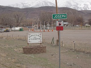
| Joseph | Sevier | 338 | 0.91 sq mi (2.4 km2) | 5,436 feet (1,657 m) | 1871 | $47,917 | Joseph A. Young, first LDS Church stake president of the Sevier Stake |
| Junction* | Piute | 119 | 15.0 sq mi (39 km2) | 6,007 feet (1,831 m) | 1880 | $34,167 | Located at the junction of the East Fork and the Sevier Rivers |
| Kamas | Summit | 2,126 | 3.66 sq mi (9.5 km2) | 6,486 feet (1,977 m) | 1857 | $61,000 | Derived from the Native American word for the Small Camas, an edible bulb found in the valley |
| Kanab* | Kane | 4,448 | 14.63 sq mi (37.9 km2) | 4,970 feet (1,510 m) | 1864 | $55,360 | Native American word for willow, referring to the willows growing along the area's creeks |
| Kanarraville | Iron | 299 | 0.46 sq mi (1.2 km2) | 5,541 feet (1,689 m) | 1861 | $51,500 | Chief Canarrah, local leader of the Piute tribe |
| Kanosh | Millard | 548 | 0.84 sq mi (2.2 km2) | 5,020 feet (1,530 m) | 1854 | $49,271 | Kanosh, the name for the local Native American leader |
| Kaysville | Davis | 30,328 | 10.5 sq mi (27 km2) | 4,357 feet (1,328 m) | 1849 | $91,334 | William Kay, the area's first LDS Church Bishop |
| Kearns | Salt Lake | 37,194 | 4.8 sq mi (12 km2) | 4,528 feet (1,380 m) | 1942 | $59,543 | Thomas Kearns, United States Senator from Utah |
| Kingston | Piute | 143 | 5.33 sq mi (13.8 km2) | 6,017 feet (1,834 m) | 1876 | $41,250 | Thomas R. King, the area's first settler |
| Koosharem | Sevier | 276 | 0.86 sq mi (2.2 km2) | 6,919 feet (2,109 m) | 1877 | $41,875 | Native American word for an edible tuber that grows in the area |
| La Verkin | Washington | 4,225 | 12.69 sq mi (32.9 km2) | 3,192 feet (973 m) | 1897 | $50,075 | Derived from the Spanish La Virgen, referring to the local Virgin River |
| Laketown | Rich | 173 | 2.59 sq mi (6.7 km2) | 5,974 feet (1,821 m) | 1864 | $66,250 | Town is located next to Bear Lake, a 109-square-mile (280 km2) lake on the Utah-Idaho border |
| Layton | Davis | 73,963 | 22.17 sq mi (57.4 km2) | 4,350 feet (1,330 m) | [lower-alpha 1] | $71,883 | Christopher Layton, an early LDS Bishop |
| Leamington | Millard | 315 | 1.55 sq mi (4.0 km2) | 4,731 feet (1,442 m) | 1871 | $62,083 | Leamington Hastings, a town in England |
| Leeds | Washington | 707 | 3.71 sq mi (9.6 km2) | 3,481 feet (1,061 m) | 1867 | $44,330 | Leeds, a town in England where many of the early settlers were from |
| Lehi | Utah | 58,351 | 26.68 sq mi (69.1 km2) | 4,564 feet (1,391 m) | 1850 | $85,794 | Lehi, a prophet from the Book of Mormon |
| Levan | Juab | 717 | 0.78 sq mi (2.0 km2) | 5,315 feet (1,620 m) | [lower-alpha 1] | $41,563 | [lower-alpha 2] |
| Lewiston | Cache | 2,006 | 25.65 sq mi (66.4 km2) | 4,508 feet (1,374 m) | 1870 | $53,060 | William H. Lewis, a local LDS Bishop |
| Lindon | Utah | 10,761 | 8.57 sq mi (22.2 km2) | 4,642 feet (1,415 m) | 1850 | $81,789 | Linden, a tree that grew in the center of town |
| Loa* | Wayne | 587 | 0.9 sq mi (2.3 km2) | 7,064 feet (2,153 m) | 1878 | $38,542 | Mauna Loa, a volcano in Hawaii, an early settler had served his LDS mission in Hawaii |
| Logan* | Cache | 49,957 | 18.56 sq mi (48.1 km2) | 4,534 feet (1,382 m) | 1859 | $38,412 | Ephraim Logan, a trapper with Jedediah Smith who died in the area |
| Lyman | Wayne | 395 | 1.88 sq mi (4.9 km2) | 7,182 feet (2,189 m) | [lower-alpha 1] | $53,750 | Francis M. Lyman, a LDS Church Apostle |
| Lynndyl | Millard | 89 | 3.56 sq mi (9.2 km2) | 4,787 feet (1,459 m) | 1907 | $50,000 | [lower-alpha 2] |
| Magna | Salt Lake | 28,257 | 7.4 sq mi (19 km2) | 4,278 feet (1,304 m) | 1868 | $58,137 | “Magna” comes from the Latin word meaning “great” or “superior" |
| Manila* | Daggett | 186 | 0.87 sq mi (2.3 km2) | 6,348 feet (1,935 m) | 1868 | [lower-alpha 3] | Commemorate the Spanish–American War victory over the Spanish fleet in the Philippines at Manila |
| Manti* | Sanpete | 3,420 | 2.15 sq mi (5.6 km2) | 5,610 feet (1,710 m) | 1849 | $49,188 | A city from the Book of Mormon |
| Mantua | Box Elder | 673 | 5.59 sq mi (14.5 km2) | 5,200 feet (1,600 m) | 1863 | $74,107 | LDS Church President Lorenzo Snow named it for his birthplace in Mantua, Ohio |
| Mapleton | Utah | 9,255 | 12.58 sq mi (32.6 km2) | 4,731 feet (1,442 m) | 1856 | $100,929 | For the groves of maple trees found in the area |
| Marriott-Slaterville | Weber | 1,978 | 7.39 sq mi (19.1 km2) | 4,252 feet (1,296 m) | 1849 [31] | $66,705 | The towns of Marriott and Slaterville joined to form Marriott-Slaterville, they were named after early settlers John Marriott and Richard Slater |
| Marysvale | Piute | 563 | 17.63 sq mi (45.7 km2) | 5,863 feet (1,787 m) | 1863 | $35,795 | [lower-alpha 2] |
| Mayfield | Sanpete | 364 | 0.99 sq mi (2.6 km2) | 5,538 feet (1,688 m) | 1871 | $55,781 | The wild flowers that appeared in the spring |
| Meadow | Millard | 208 | 0.51 sq mi (1.3 km2) | 4,839 feet (1,475 m) | 1857 | $54,792 | The adjacent Meadow Creek |
| Mendon | Cache | 1,173 | 1.25 sq mi (3.2 km2) | 4,495 feet (1,370 m) | 1859 [32] | $74,167 | LDS Church Apostle Ezra T. Benson named it after his birthplace of Mendon, Massachusetts |
| Midvale | Salt Lake | 32,249 | 5.93 sq mi (15.4 km2) | 4,383 feet (1,336 m) | [lower-alpha 1] | $54,464 | Located in the middle of the Salt Lake Valley |
| Midway | Wasatch | 4,683 | 5.24 sq mi (13.6 km2) | 5,584 feet (1,702 m) | 1859 | $78,576 | A fort was built midway between two settlements |
| Milford | Beaver | 1,594 | 3.08 sq mi (8.0 km2) | 4,967 feet (1,514 m) | 1873 | $45,724 | [lower-alpha 2] |
| Millcreek | Salt Lake | 60,297 | 13.7 sq mi (35 km2) | 4,285 feet (1,306 m) | 1848 | $61,888 | Mill Creek, site of Utah's first flour mill |
| Millville | Cache | 1,912 | 2.11 sq mi (5.5 km2) | 4,616 feet (1,407 m) | 1860 | $78,906 | The first saw mill in Cache Valley was built in the area |
| Minersville | Beaver | 888 | 0.64 sq mi (1.7 km2) | 5,282 feet (1,610 m) | 1859 | $52,434 | In honor of the miners who worked in the area |
| Moab* | Grand | 5,232 | 4.13 sq mi (10.7 km2) | 4,026 feet (1,227 m) | 1855 | $48,448 | The Biblical name Moab or the Native American word for mosquito was "Moapa" |
| Mona | Juab | 1,450 | 2.82 sq mi (7.3 km2) | 4,970 feet (1,510 m) | 1852 | $74,554 | [lower-alpha 2] |
| Monroe | Sevier | 2,537 | 3.57 sq mi (9.2 km2) | 5,394 feet (1,644 m) | 1863 | $61,146 | James Monroe, President of the United States |
| Monticello* | San Juan | 2,599 | 4.47 sq mi (11.6 km2) | 7,070 feet (2,150 m) | 1879 | $56,833 | Monticello in Virginia, the home of Thomas Jefferson, President of the United States [33] |
| Morgan* | Morgan | 4,058 | 3.21 sq mi (8.3 km2) | 5,069 feet (1,545 m) | 1860 | $76,625 | Jedediah Morgan Grant, father to LDS Church President Heber J. Grant |
| Moroni | Sanpete | 1,640 | 1.07 sq mi (2.8 km2) | 5,531 feet (1,686 m) | 1859 | $54,000 | Moroni, a prophet from the Book of Mormon |
| Mount Pleasant | Sanpete | 3,309 | 2.88 sq mi (7.5 km2) | 5,925 feet (1,806 m) | 1852 | $52,844 | Pleasant view of the surrounding mountains |
| Murray | Salt Lake | 49,038 | 12.29 sq mi (31.8 km2) | 4,301 feet (1,311 m) | 1848 | $57,662 | Eli Houston Murray, territorial Governor of Utah |
| Myton | Duchesne | 566 | 1.02 sq mi (2.6 km2) | 5,085 feet (1,550 m) | 1905 [34] | $41,875 | Major H. P. Myton of the U.S. Army |
| Naples | Uintah | 2,387 | 6.6 sq mi (17 km2) | 5,230 feet (1,590 m) | 1878 | $71,750 | Naples, Italy |
| Nephi* | Juab | 5,631 | 4.58 sq mi (11.9 km2) | 5,128 feet (1,563 m) | 1851 | $56,866 | Nephi, a prophet from the Book of Mormon |
| New Harmony | Washington | 186 | 0.61 sq mi (1.6 km2) | 5,305 feet (1,617 m) | [lower-alpha 1] | $41,839 | Harmony, Pennsylvania, where Joseph Smith translated the Book of Mormon |
| Newton | Cache | 706 | 0.79 sq mi (2.0 km2) | 4,534 feet (1,382 m) | 1869 | $60,924 | Originally called New Town, but the name was shortened |
| Nibley | Cache | 6,438 | 4.03 sq mi (10.4 km2) | 4,554 feet (1,388 m) | 1855 [35] | $80,125 | Charles W. Nibley, a local leader of the LDS Church |
| North Logan | Cache | 10,140 | 6.97 sq mi (18.1 km2) | 4,692 feet (1,430 m) | [lower-alpha 1] | $70,139 | Located north of Logan |
| North Ogden | Weber | 18,525 | 7.04 sq mi (18.2 km2) | 4,501 feet (1,372 m) | 1850 | $78,926 | Located north of Ogden |
| North Salt Lake | Davis | 19,413 | 8.59 sq mi (22.2 km2) | 4,334 feet (1,321 m) | [lower-alpha 1] | $77,011 | Located north of Salt Lake City |
| Oak City | Millard | 716 | 0.92 sq mi (2.4 km2) | 5,112 feet (1,558 m) | 1868 | $73,750 | Sits adjacent to Oak Creek |
| Oakley | Summit | 1,298 | 6.89 sq mi (17.8 km2) | 6,434 feet (1,961 m) | 1868 | $69,740 | The scrub oak species gambel oak found in the area |
| Ogden* | Weber | 85,497 | 27.1 sq mi (70 km2) | 4,300 feet (1,300 m) | 1847 | $43,361 | Peter Skene Ogden, a trapper for the Hudson's Bay Company |
| Ophir | Tooele | 24 | 0.14 sq mi (0.36 km2) | 6,496 feet (1,980 m) | [lower-alpha 1] | $31,875 | The Ophir Gold Mine that was located in the area |
| Orangeville | Emery | 1,540 | 1.35 sq mi (3.5 km2) | 5,778 feet (1,761 m) | 1878 | $55,714 | Orange Seely, a settler in the area |
| Orderville | Kane | 750 | 9.16 sq mi (23.7 km2) | 5,449 feet (1,661 m) | 1875 | $46,705 | The United Order, a collectivist movement of the LDS Church |
| Orem | Utah | 97,839 | 18.29 sq mi (47.4 km2) | 4,774 feet (1,455 m) | 1850 | $58,077 | Walter Orem, President of the Salt Lake and Utah Electric Interurban Railroad |
| Panguitch* | Garfield | 1,911 | 2.14 sq mi (5.5 km2) | 6,624 feet (2,019 m) | 1866 | $48,456 | A Native American name for nearby Panguitch Lake meaning "water" and "fish" |
| Paradise | Cache | 1,147 | 1.29 sq mi (3.3 km2) | 4,902 feet (1,494 m) | 1860 | $65,972 | For the beautiful scenery |
| Paragonah | Iron | 511 | 0.64 sq mi (1.7 km2) | 5,879 feet (1,792 m) | 1851 | $55,417 | Native American name for the nearby Little Salt Lake that means "marshland" |
| Park City | Summit | 8,167 | 17.57 sq mi (45.5 km2) | 7,000 feet (2,100 m) | 1869 | $104,182 | For nearby Parley's Park, a meadow atop Parley's Canyon |
| Parowan* | Iron | 2,913 | 6.66 sq mi (17.2 km2) | 6,017 feet (1,834 m) | 1851 | $40,677 | From the Native American words paragoons and pahoan, meaning "marsh people" |
| Payson | Utah | 19,647 | 8.67 sq mi (22.5 km2) | 4,700 feet (1,400 m) | 1850 | $61,098 | James Pace, an early settler of the area |
| Perry | Box Elder | 4,717 | 8.04 sq mi (20.8 km2) | 4,367 feet (1,331 m) | 1853 | $85,517 | Lorenzo Perry, first LDS Church Bishop of the town |
| Plain City | Weber | 6,343 | 11.95 sq mi (31.0 km2) | 4,242 feet (1,293 m) | 1859 | $85,290 | Originally called City on the Plains |
| Pleasant Grove | Utah | 37,439 | 9.17 sq mi (23.8 km2) | 4,623 feet (1,409 m) | 1849 | $66,881 | The grove of cottonwood trees found in the area |
| Pleasant View | Weber | 9,375 | 6.91 sq mi (17.9 km2) | 5,632 feet (1,717 m) | 1851 | $90,802 | For the beautiful view of the surrounding valley |
| Plymouth | Box Elder | 382 | 0.65 sq mi (1.7 km2) | 4,488 feet (1,368 m) | 1869 | $57,500 | A large rock in the area resembled Plymouth Rock |
| Portage | Box Elder | 280 | 2.99 sq mi (7.7 km2) | 4,367 feet (1,331 m) | 1867 | $46,563 | Portage County, Ohio, the birthplace of LDS Church President Lorenzo Snow [36] |
| Price* | Carbon | 8,337 | 5.07 sq mi (13.1 km2) | 5,627 feet (1,715 m) | 1879 | $45,388 | From the nearby Price River which got its name from a local explorer William Price |
| Providence | Cache | 7,173 | 3.79 sq mi (9.8 km2) | 4,596 feet (1,401 m) | 1859 | $73,056 | Originally Spring Creek, the town was renamed in November 1859 by Ezra T. Benson, who found the place "providential." [37] |
| Provo* | Utah | 116,199 | 47.17 sq mi (122.2 km2) | 4,551 feet (1,387 m) | 1850 | $44,314 | Étienne Provost, a trapper who visited the area |
| Randolph* | Rich | 648 | 1.04 sq mi (2.7 km2) | 6,283 feet (1,915 m) | 1870 | $55,208 | Randolph Stewart, an early settler and first LDS Church Bishop of the area |
| Redmond | Sevier | 648 | 0.98 sq mi (2.5 km2) | 5,105 feet (1,556 m) | 1875 | $53,583 | Red-colored mounds west of town |
| Richfield* | Sevier | 7,589 | 5.69 sq mi (14.7 km2) | 5,354 feet (1,632 m) | 1863 | $42,269 | After a bountiful crop of wheat that was produced in 1865 |
| Richmond | Cache | 2,580 | 3.45 sq mi (8.9 km2) | 4,610 feet (1,410 m) | 1859 | $52,232 | Rich fertile soil of the valley [38] |
| Riverdale | Weber | 8,685 | 4.57 sq mi (11.8 km2) | 4,370 feet (1,330 m) | 1850 [39] | $55,428 | The city's location next to the Weber River |
| River Heights | Cache | 2,028 | 0.63 sq mi (1.6 km2) | 4,580 feet (1,400 m) | [lower-alpha 1] | $65,795 | Located above the Logan River [40] |
| Riverton | Salt Lake | 41,997 | 12.63 sq mi (32.7 km2) | 4,439 feet (1,353 m) | 1870 | $92,154 | The city's location next to the Jordan River |
| Rockville | Washington | 313 | 8.23 sq mi (21.3 km2) | 3,740 feet (1,140 m) | 1860 | $44,750 | After the rocky soil of the area |
| Rocky Ridge | Juab | 1,235 | 2.12 sq mi (5.5 km2) | 4,990 feet (1,520 m) | [lower-alpha 1] | $54,667 | [lower-alpha 2] |
| Roosevelt | Duchesne | 6,771 | 5.57 sq mi (14.4 km2) | 5,095 feet (1,553 m) | 1905 | $62,408 | Theodore Roosevelt, President of the United States |
| Roy | Weber | 38,013 | 7.92 sq mi (20.5 km2) | 4,541 feet (1,384 m) | 1876 | $66,333 | Roy C. Peebles was the name of the recently deceased son of area resident David P. Peebles |
| Rush Valley | Tooele | 517 | 18.34 sq mi (47.5 km2) | 5,043 feet (1,537 m) | 1856 | $66,875 | Nearby Rush Lake |
| St. George* | Washington | 79,995 | 70.92 sq mi (183.7 km2) | 2,860 feet (870 m) | 1861 | $36,505 | George A. Smith, a LDS Church Apostle |
| Salem | Utah | 7,504 | 10.19 sq mi (26.4 km2) | 4,610 feet (1,410 m) | 1851 | $83,833 | Salem, Massachusetts [41] |
| Salina | Sevier | 2,512 | 6.18 sq mi (16.0 km2) | 5,161 feet (1,573 m) | 1863 | $46,736 | Nearby salt deposits |
| Salt Lake City* | Salt Lake | 194,188 | 111.73 sq mi (289.4 km2) | 4,226 feet (1,288 m) | 1847 | $54,009 | Nearby Great Salt Lake |
| Sandy | Salt Lake | 94,556 | 22.88 sq mi (59.3 km2) | 4,450 feet (1,360 m) | 1871 | $87,012 | [lower-alpha 2] |
| Santa Clara | Washington | 6,835 | 5.53 sq mi (14.3 km2) | 2,762 feet (842 m) | 1854 | $84,457 | Town is located on the Santa Clara Creek |
| Santaquin | Utah | 10,740 | 10.39 sq mi (26.9 km2) | 4,984 feet (1,519 m) | 1851 | $69,712 | A local Ute Tribe leader |
| Saratoga Springs | Utah | 25,671 | 16.75 sq mi (43.4 km2) | 4,505 feet (1,373 m) | [lower-alpha 1] | $88,804 | Saratoga, New York and the local springs |
| Scipio | Millard | 378 | 0.93 sq mi (2.4 km2) | 5,315 feet (1,620 m) | 1859 | $69,375 | Scipio Kenner, a settler of the area |
| Scofield | Carbon | 15 | 0.70 sq mi (1.8 km2) | 7,739 feet (2,359 m) | 1879 | $63,750 | General Charles W. Scofield, a local mine official |
| Sigurd | Sevier | 528 | 0.98 sq mi (2.5 km2) | 5,226 feet (1,593 m) | 1874 | $57,159 | Sigurd, The Danish residents named the town after the Norse mythological hero |
| Smithfield | Cache | 10,832 | 4.98 sq mi (12.9 km2) | 4,603 feet (1,403 m) | 1859 | $62,596 | John Glover Smith, the first LDS Bishop of the area |
| Snowville | Box Elder | 133 | 1.54 sq mi (4.0 km2) | 4,547 feet (1,386 m) | 1871 | $57,083 | Lorenzo Snow, LDS Church President [42] |
| South Jordan | Salt Lake | 65,523 | 22.13 sq mi (57.3 km2) | 4,439 feet (1,353 m) | 1859 | $99,856 | The nearby Jordan River and its location south of West Jordan |
| South Ogden | Weber | 16,918 | 3.69 sq mi (9.6 km2) | 4,449 feet (1,356 m) | 1848 | $63,055 | Located south of Ogden |
| South Salt Lake | Salt Lake | 24,722 | 6.94 sq mi (18.0 km2) | 4,225 feet (1,288 m) | [lower-alpha 1] | $41,457 | Located south of Salt Lake City |
| South Weber | Davis | 6,921 | 4.72 sq mi (12.2 km2) | 4,551 feet (1,387 m) | 1851 | $95,000 | Located on the south side of the Weber River |
| Spanish Fork | Utah | 38,171 | 15.39 sq mi (39.9 km2) | 4,577 feet (1,395 m) | 1851 | $70,780 | The nearby Spanish Fork River where Spanish explorer Silvestre Vélez de Escalante entered the Utah Valley |
| Spring City | Sanpete | 995 | 1.33 sq mi (3.4 km2) | 5,823 feet (1,775 m) | 1852 | $53,625 | The nearby springs |
| Springdale | Washington | 447 | 4.63 sq mi (12.0 km2) | 3,898 feet (1,188 m) | 1862 | $46,458 | The nearby springs |
| Springville | Utah | 32,319 | 14.43 sq mi (37.4 km2) | 4,577 feet (1,395 m) | 1850 | $63,724 | The nearby springs |
| Sterling | Sanpete | 217 | 0.30 sq mi (0.78 km2) | 5,574 feet (1,699 m) | 1873 | $39,583 | The "sterling" qualities of its people |
| Stockton | Tooele | 699 | 1.63 sq mi (4.2 km2) | 5,118 feet (1,560 m) | [lower-alpha 1] | $67,833 | Stockton, California where many of the soldiers who settled the area were from |
| Sunset | Davis | 5,207 | 1.31 sq mi (3.4 km2) | 4,511 feet (1,375 m) | [lower-alpha 1] | $56,864 | Located on a ridge with views of the sunset over the Great Salt Lake |
| Syracuse | Davis | 27,444 | 9.58 sq mi (24.8 km2) | 4,285 feet (1,306 m) | 1878 | $90,778 | Named for a local resort on the Great Salt Lake which was named after Syracuse, New York |
| Tabiona | Duchesne | 141 | 0.13 sq mi (0.34 km2) | 6,516 feet (1,986 m) | 1860 | $46,250 | Originally called Tabby and Tabbyville referring to Ute tribe leader Tava whose nickname was Tabby |
| Taylorsville | Salt Lake | 60,377 | 10.85 sq mi (28.1 km2) | 4,295 feet (1,309 m) | 1848 | $59,968 | John Taylor, LDS Church President |
| Tooele* | Tooele | 33,236 | 21.46 sq mi (55.6 km2) | 5,043 feet (1,537 m) | 1851 | $58,770 | Native American Goshute tribe leader Tuilla |
| Toquerville | Washington | 1,943 | 15.13 sq mi (39.2 km2) | 3,389 feet (1,033 m) | 1858 | $73,083 | Native American Piute tribe leader Toquer |
| Torrey | Wayne | 339 | 0.51 sq mi (1.3 km2) | 6,837 feet (2,084 m) | [lower-alpha 1] | $42,000 | Colonel Torrey, a veteran of the Spanish–American War |
| Tremonton | Box Elder | 8,242 | 7.8 sq mi (20 km2) | 4,325 feet (1,318 m) | 1888 | $51,354 | Tremont, Illinois, where a group of settlers came from [43] |
| Trenton | Cache | 413 | 7.33 sq mi (19.0 km2) | 4,462 feet (1,360 m) | 1870 | $50,208 | Trenton, New Jersey, hometown of the area's first LDS Bishop |
| Tropic | Garfield | 589 | 8.39 sq mi (21.7 km2) | 6,309 feet (1,923 m) | [lower-alpha 1] | $56,458 | The area had a milder climate than where the settlers originally came from |
| Uintah | Weber | 1,520 | 1.06 sq mi (2.7 km2) | 4,537 feet (1,383 m) | 1850 | $72,614 | Uintah band of the Ute tribe |
| Vernal* | Uintah | 10,650 | 4.61 sq mi (11.9 km2) | 5,328 feet (1,624 m) | 1876 | $47,150 | Latin word vernalis for spring, for the many springs in the area [44] |
| Vernon | Tooele | 371 | 7.53 sq mi (19.5 km2) | 5,515 feet (1,681 m) | 1862 | $57,500 | Joseph Vernon, a local settler that was killed by Native Americans |
| Vineyard | Utah | 2,958 | 6.35 sq mi (16.4 km2) | 4,557 feet (1,389 m) | [lower-alpha 1] | $79,543 | The grape vines that were planted in the area |
| Virgin | Washington | 542 | 16.37 sq mi (42.4 km2) | 3,606 feet (1,099 m) | 1857 | $53,000 | The nearby Virgin River |
| Wales | Sanpete | 386 | 0.31 sq mi (0.80 km2) | 5,627 feet (1,715 m) | 1857 [45] | $65,208 | Local settlers originally came from Wales |
| Wallsburg | Wasatch | 285 | 0.52 sq mi (1.3 km2) | 5,676 feet (1,730 m) | 1861 [46] | $67,500 | William Madison Wall, local settler and explorer |
| Washington | Washington | 24,231 | 32.89 sq mi (85.2 km2) | 2,792 feet (851 m) | 1857 | $56,697 | George Washington, President of the United States |
| Washington Terrace | Weber | 9,122 | 1.97 sq mi (5.1 km2) | 4,610 feet (1,410 m) | 1878 | $53,070 | [lower-alpha 2] |
| Wellington | Carbon | 1,520 | 5.13 sq mi (13.3 km2) | 5,413 feet (1,650 m) | 1878 | $40,664 | Wellington Seeley Jr., Judge of the Emery County Court |
| Wellsville | Cache | 3,641 | 6.61 sq mi (17.1 km2) | 4,547 feet (1,386 m) | 1856 | $72,388 | Daniel H. Wells, LDS Church Apostle |
| Wendover | Tooele | 1,243 | 9.06 sq mi (23.5 km2) | 4,291 feet (1,308 m) | 1906 | $26,250 | [lower-alpha 2] |
| West Bountiful | Davis | 5,504 | 3.26 sq mi (8.4 km2) | 4,268 feet (1,301 m) | [lower-alpha 1] | $88,125 | Located west of Bountiful |
| West Haven | Weber | 12,109 | 10.3 sq mi (27 km2) | 4,272 feet (1,302 m) | 1854 | $73,613 | [lower-alpha 2] |
| West Jordan | Salt Lake | 111,937 | 32.46 sq mi (84.1 km2) | 4,373 feet (1,333 m) | 1848 | $72,083 | Located on the west side of the Jordan River |
| West Point | Davis | 10,258 | 7.35 sq mi (19.0 km2) | 4,314 feet (1,315 m) | 1867 | $81,750 | [lower-alpha 2] |
| West Valley City | Salt Lake | 135,546 | 35.61 sq mi (92.2 km2) | 4,304 feet (1,312 m) | 1849 | $59,954 | Located on the western side of the Salt Lake Valley |
| White City | Salt Lake | 5,270 | 0.9 sq mi (2.3 km2) | 4,583 feet (1,397 m) | 1955 | $49,103 | |
| Willard | Box Elder | 1,875 | 7.22 sq mi (18.7 km2) | 4,350 feet (1,330 m) | 1851 | $74,743 | Willard Richards, a LDS Church Apostle |
| Woodland Hills | Utah | 1,465 | 2.26 sq mi (5.9 km2) | 5,331 feet (1,625 m) | 1867 | $97,500 | Located at the base of canyon where groves of trees are located |
| Woodruff | Rich | 224 | 0.46 sq mi (1.2 km2) | 6,339 feet (1,932 m) | 1865 | $87,188 | Wilford Woodruff, LDS Church President |
| Woods Cross | Davis | 11,152 | 3.88 sq mi (10.0 km2) | 4,377 feet (1,334 m) | 1865 | $76,843 | Daniel C. Wood, an early settler |
|