Smith County, Mississippi

Last updated

Smith County
Smith County Mississippi Courthouse.jpg
Smith County courthouse in Raleigh
Map of Mississippi highlighting Smith County.svg
Location within the U.S. state of Mississippi
Mississippi in United States.svg
Mississippi's location within the U.S.
Coordinates: 32°01′N89°30′W / 32.02°N 89.5°W / 32.02; -89.5
CountryFlag of the United States.svg United States
StateFlag of Mississippi.svg  Mississippi
Founded1833
Named for David Smith
Seat Raleigh
Largest town Taylorsville
Area
  Total
637 sq mi (1,650 km2)
  Land636 sq mi (1,650 km2)
  Water1.0 sq mi (3 km2)  0.2%
Population
 (2020)
  Total
14,209
  Estimate 
(2023)
14,099 Decrease2.svg
  Density22/sq mi (8.6/km2)
Time zone UTC−6 (Central)
  Summer (DST) UTC−5 (CDT)
Congressional district 3rd
Website www.smithcountyms.gov

Smith County is a county located in the U.S. state of Mississippi. As of the 2020 census, the population was 14,209. [1] Its county seat is Raleigh. [2]

Contents

History

Smith County is named for Major David Smith.

Geography

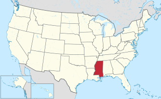
According to the U.S. Census Bureau, the county has a total area of 637 square miles (1,650 km2), of which 636 square miles (1,650 km2) is land and 1.0 square mile (2.6 km2) (0.2%) is water. [3]

Major highways

Adjacent counties

National protected area

Demographics

Historical population
CensusPop.Note
1840 1,961
1850 4,071107.6%
1860 7,63887.6%
1870 7,126−6.7%
1880 8,08813.5%
1890 10,63531.5%
1900 13,05522.8%
1910 16,60327.2%
1920 16,178−2.6%
1930 18,40513.8%
1940 19,4035.4%
1950 16,740−13.7%
1960 14,303−14.6%
1970 13,561−5.2%
1980 15,07711.2%
1990 14,798−1.9%
2000 16,1829.4%
2010 16,4911.9%
2020 14,209−13.8%
2023 (est.)14,099 [4] −0.8%
U.S. Decennial Census [5]
1790-1960 [6] 1900-1990 [7]
1990-2000 [8] 2010-2013 [9]
Smith County racial composition as of 2020 [10]
RaceNum.Perc.
White (non-Hispanic)10,58274.47%
Black or African American (non-Hispanic)3,11121.89%
Native American 200.14%
Asian 190.13%
Other/mtixed 2791.96%
Hispanic or Latino 1981.39%

As of the 2020 United States census, there were 14,209 people, 5,820 households, and 4,109 families residing in the county.

Communities

Towns

Village

Politics

United States presidential election results for Smith County, Mississippi [11]
Year Republican Democratic Third party(ies)
No.%No.%No.%
2024 6,14680.07%1,48619.36%440.57%
2020 6,45877.55%1,79121.51%780.94%
2016 5,92877.72%1,61721.20%821.08%
2012 6,04974.69%1,97924.44%710.88%
2008 6,26575.44%1,96823.70%720.87%
2004 5,57778.33%1,49621.01%470.66%
2000 4,83874.11%1,62024.82%701.07%
1996 3,37158.47%1,85832.23%5369.30%
1992 4,10660.49%1,96828.99%71410.52%
1988 4,57372.76%1,66026.41%520.83%
1984 5,11676.24%1,57323.44%210.31%
1980 3,77259.50%2,47439.02%941.48%
1976 3,14754.75%2,43442.35%1672.91%
1972 4,41992.35%3296.88%370.77%
1968 4378.48%3526.83%4,36784.70%
1964 4,04594.44%2385.56%00.00%
1960 35311.98%1,56853.22%1,02534.79%
1956 27710.89%2,05580.81%2118.30%
1952 73824.39%2,28875.61%00.00%
1948 331.48%29513.23%1,90185.28%
1944 1656.30%2,45693.70%00.00%
1940 271.46%1,82698.49%10.05%
1936 171.00%1,67698.94%10.06%
1932 171.07%1,57698.81%20.13%
1928 41922.42%1,45077.58%00.00%
1924 494.22%1,08193.11%312.67%
1920 26521.10%96877.07%231.83%
1916 302.28%1,27196.51%161.21%
1912 121.31%85493.13%515.56%

Education

There is one school district in the county, Smith County School District. [12]

The county is in the zone for Jones College. [13]

See also

References

  1. "Census - Geography Profile: Smith County, Mississippi". United States Census Bureau . Retrieved January 15, 2023.
  2. "Find a County". National Association of Counties. Retrieved June 7, 2011.
  3. "2010 Census Gazetteer Files". United States Census Bureau. August 22, 2012. Archived from the original on September 28, 2013. Retrieved November 7, 2014.
  4. "Annual Estimates of the Resident Population for Counties: April 1, 2020 to July 1, 2023". United States Census Bureau. Retrieved April 5, 2024.
  5. "U.S. Decennial Census". United States Census Bureau. Retrieved November 7, 2014.
  6. "Historical Census Browser". University of Virginia Library. Retrieved November 7, 2014.
  7. "Population of Counties by Decennial Census: 1900 to 1990". United States Census Bureau. Retrieved November 7, 2014.
  8. "Census 2000 PHC-T-4. Ranking Tables for Counties: 1990 and 2000" (PDF). United States Census Bureau. Archived (PDF) from the original on March 27, 2010. Retrieved November 7, 2014.
  9. "State & County QuickFacts". United States Census Bureau. Retrieved September 5, 2013.
  10. "Explore Census Data". data.census.gov. Retrieved December 17, 2021.
  11. Presidential Election Results in Smith County, Mississippi, uselectionatlas.org; accessed December 5, 2017.
  12. "2020 CENSUS - SCHOOL DISTRICT REFERENCE MAP: Smith County, MS" (PDF). U.S. Census Bureau . Retrieved September 27, 2024. - Text list
  13. "Profile". Jones College . Retrieved September 27, 2024.

32°01′N89°30′W / 32.02°N 89.50°W / 32.02; -89.50