Al-Bira, Baysan

Last updated

Contents

al-Bira
البيرة
Village
Etymology: the fortress [1]
Historical map series for the area of al-Bira, Baysan (1870s).jpg 1870s map
Historical map series for the area of al-Bira, Baysan (1940s).jpg 1940s map
Historical map series for the area of al-Bira, Baysan (modern).jpg modern map
Historical map series for the area of al-Bira, Baysan (1940s with modern overlay).jpg 1940s with modern overlay map
A series of historical maps of the area around Al-Bira, Baysan (click the buttons)
Mandatory Palestine location map.svg
Red pog.svg
al-Bira
Location within Mandatory Palestine
Coordinates: 32°36′29″N35°30′14″E / 32.60806°N 35.50389°E / 32.60806; 35.50389
Palestine grid 197/223
Geopolitical entity Mandatory Palestine
Subdistrict Baysan
Date of depopulation16 May 1948 [2]
Area
  Total
6,866  dunams (6.866 km2 or 2.651 sq mi)
Population
 (1945)
  Total
260 [3] [4]
Cause(s) of depopulationInfluence of nearby town's fall

Al-Bira (Arabic : البيرة), is a depopulated former Palestinian village located 7.5 km north of Baysan. During Operation Gideon, the village was occupied by the Golani Brigade. [5]

History

It has been suggested that the village was the site[ which? ] mentioned in the records of Tutmose III's military campaign in Palestine in 1468 BC. [6]

Ottoman era

In 1517 al-Bira was incorporated into the Ottoman Empire with the rest of Palestine. During the 16th and 17th centuries, it belonged to the Turabay Emirate (1517-1683), which encompassed also the Jezreel Valley, Haifa, Jenin, Beit She'an Valley, northern Jabal Nablus, Bilad al-Ruha/Ramot Menashe, and the northern part of the Sharon plain. [7] [8]

In the 1596 tax records, al-Bira was a village in the Ottoman Empire, nahiya (subdistrict) of Shafa under the liwa' (district) of Lajjun, with a population of 54 Muslim households; an estimated 297 persons. They paid a fixed tax rate of 25% on a number of crops, including wheat, barley, and olives, as well as on goats and beehives; a total of 12,000 akçe. [9]

Al-Bira appeared as a village in a map published in 1850, [10] but was found uninhabited later in the 19th century. Guérin reported that "The ruins are those of a large Arab village, whose houses were built for the most part of basaltic stones. It replaced an ancient township, to which belongs an edifice now completely destroyed, of which there yet remain several basaltic columns and a mutilated capital." [11]

British Mandate era

In the 1922 census of Palestine, conducted in Mandatory Palestine authorities, Al-Bira had a population of 200 Muslims, [12] increasing in the 1931 census to 220, still all Muslims, in 53 houses. [13]

In the 1945 statistics the population consisted of 260 Muslims, [3] with a total of 6,866 dunams of land. [4] Of this, 48 dunams were for plantations or irrigable land, 4,667 for cereals, [14] while 53 were built-up (urban) land. [15]

Al-Bira was "known for the grazing lands in the grassy mountainous areas around the village." The neighboring town of Baysan served as an important "commercial outlet and administrative center." [16]

1948, aftermath

The village became depopulated on 16 May 1948. [2]

According to Benny Morris, kibbutzniks demanded the destruction of neighboring villages as a means of blocking the return of the Arab villagers. For this reason a veteran local leader, Nahum Hurwitz of Kfar Gil'adi appealed in a letter in September 1948 for permission to destroy al-Bira, Kawkab al-Hawa, Jabbul, and al-Hamidiyya in the area for fear that they may be used by Arabs for military operations and to enable them to "take the village's lands, because the Arabs won't be able to return there". [17]

According to the Palestinian historian Walid Khalidi, in 1992: "The only remains of the village are the walls of houses. The fenced in site is covered with weeds, cactuses, and thorns, Fig and mulberry trees grow near a spring in the valley at the bottom of the site. The surrounding land are used for grazing." [18]

Related Research Articles

<span class="mw-page-title-main">Danna, Baysan</span> Place in Baysan, Mandatory Palestine

Danna, was a Palestinian village 13 kilometres north of Baysan that was captured by the Israel Defense Forces during the 1948 Arab-Israeli war, and the villagers were expelled.

<span class="mw-page-title-main">Nimrin</span> Place in Tiberias, Mandatory Palestine

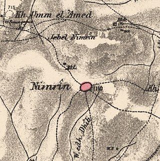
Nimrin was a Palestinian Arab town of 320 that was captured and depopulated by Israel during the 1948 Arab-Israeli War.

<span class="mw-page-title-main">Zir'in</span> Place in Jenin, Mandatory Palestine

Zir'in, also spelled Zerin and Zerein, was a Palestinian Arab village of over 1,400 in the Jezreel Valley, located 11 kilometers (6.8 mi) north of Jenin. Identified as the ancient town of Yizre'el (Jezreel), it was known as Zir'in during Islamic rule, and was near the site of the Battle of Ain Jalut, in which the Mamluks halted Mongol expansion southward. Under the Ottomans, it was a small village, expanding during the British Mandate in the early 20th century. After its capture by Israel in 1948, Zir'in was destroyed. The Israeli kibbutz of Yizre'el was established shortly after on the village lands of Zir'in.

<span class="mw-page-title-main">Bayt Jirja</span> Place in Gaza, Mandatory Palestine

Bayt Jirja or Beit Jerja was a Palestinian Arab village 15.5 km Northeast of Gaza. In 1931 the village consisted of 115 houses. It was overrun by Israeli forces during operation Yo'av in the 1948 Arab-Israeli war. Bayt Jirja was found depopulated in November 1948, during "clean up sweeps" to expel any partial inhabited villages and destroy village housing to prevent any possible re-occupation in the area. The village was completely destroyed after the occupation and only one tomb remains.

<span class="mw-page-title-main">Ammuqa</span> Village in Safad, Mandatory Palestine

Ammuqa was a Palestinian village, located five kilometres northeast of Safed.

<span class="mw-page-title-main">Indur</span> Village in Nazareth, Mandatory Palestine

Indur was a Palestinian village, located 10.5 kilometres (6.5 mi) southeast of Nazareth. Its name preserves that of ancient Endor, a Canaanite city state thought to have been located 1 kilometre (0.62 mi) to the northeast. The village was depopulated during the 1948 Arab–Israeli War and its inhabitants became refugees, some of whom were internally displaced. In Israel today, there are a few thousand internally displaced Palestinians who hail from Indur, and continue to demand their right of return.

<span class="mw-page-title-main">Jabbul</span> Place in Baysan, Mandatory Palestine

Jabbul, is a depopulated former Palestinian Arab village located 7 km north of Baysan. During Operation Gideon, the village was occupied by the Golani Brigade.

<span class="mw-page-title-main">Kawkab al-Hawa</span> Place in Baysan, Mandatory Palestine

Kawkab al-Hawa, is a depopulated former Palestinian village located 11 km north of Baysan. It was built within the ruins of the Crusader fortress of Belvoir, from which it expanded. The Crusader names for the Frankish settlement at Kawkab al-Hawa were Beauvoir, Belvoir, Bellum videre, Coquet, Cuschet and Coket. During Operation Gideon in 1948, the village was occupied by the Golani Brigade and depopulated.

<span class="mw-page-title-main">Al-Sawafir al-Shamaliyya</span> Place in Gaza, Mandatory Palestine

Al-Sawafir al-Shamaliyya was a Palestinian Arab village in the Gaza Subdistrict, located 33 kilometers (21 mi) northeast of Gaza situated along the southern coastal plain of Palestine 50 meters (160 ft) above sea level. It was one of three namesake villages, alongside Al-Sawafir al-Sharqiyya and Al-Sawafir al-Gharbiyya.

<span class="mw-page-title-main">Al-Batani al-Sharqi</span> Place in Gaza, Mandatory Palestine

Al-Batani al-Sharqi was a Palestinian Arab village in the Gaza Subdistrict, located 36.5 kilometers (22.7 mi) northeast of Gaza situated in the flat terrain on the southern coastal plain of Palestine. It had a population of 650 in 1945. Al-Batani al-Sharqi was depopulated during the 1948 Arab-Israeli War.

<span class="mw-page-title-main">Al-Hamidiyya</span> Place in Baysan, Mandatory Palestine

Al-Hamidiyya, was a Palestinian village in the District of Baysan. It was depopulated by the Jewish militias, precursors of the Israel Defense Forces, during the 1947–1948 Civil War in Mandatory Palestine on May 12, 1948. It was located five kilometres north of Baysan. It was attacked as part of Operation Gideon. The population in 1922 was 193, expanding to 255 in 1948.

<span class="mw-page-title-main">Sirin, Baysan</span> Place in Baysan, Mandatory Palestine

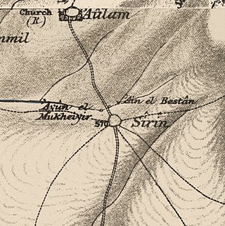
Sirin, was a Palestinian Arab village located 17 kilometers (11 mi) north of Beisan. The village was depopulated and destroyed in 1948. Only the village cemetery and one house remain standing, along with the remains of a mosaic pavement and a vaulted spring dating to the Byzantine period. Mentioned in historical documents, the 1596 census indicated it had 45 households; by 1945, the number of inhabitants had risen to 810.

<span class="mw-page-title-main">Al-Tira, Baysan</span> Village in Baysan, Mandatory Palestine

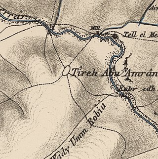
Al-Tira, was a Palestinian Arab village in the District of Baysan. It was depopulated by the Israel Defense Forces during the 1947–48 Civil War in Mandatory Palestine on 15 April 1948 as part of Operation Gideon under the command of Yosef Weitz. It was located 17.5 km north of Baysan overlooking Wadi al-Bira. However, 'Ayn al-Bayda' was the main source of drinking water for al-Tira inhabitants.

<span class="mw-page-title-main">Mughallis</span> Village in Hebron, Mandatory Palestine

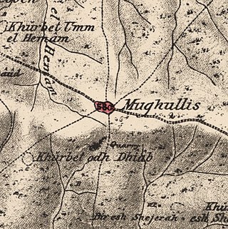
Mughallis was a Palestinian Arab village located 30.5 kilometers (19.0 mi) northwest of Hebron. It was depopulated during the 1948 Arab-Israeli War between July 9–10, 1948 as part of Operation An-Far.

<span class="mw-page-title-main">Al-Jammasin al-Gharbi</span> Village in Jaffa, Mandatory Palestine

Al-Jammasin al-Gharbi was a Palestinian Arab village in the Jaffa Subdistrict. It was depopulated during the 1947–48 Civil War in Mandatory Palestine on March 17, 1948. It was located 6.5 km northeast of Jaffa.

<span class="mw-page-title-main">Al-Maghar</span> Place in Ramle, Mandatory Palestine

Al-Maghar was a Palestinian Arab village in the Ramle Subdistrict of Mandatory Palestine. It was depopulated by the Givati Brigade during Operation Barak on 18 May 1948. It was located 12 km southwest of Ramla, situated north of Wadi al-Maghar.

<span class="mw-page-title-main">Fara, Safad</span> Village in Safad, Mandatory Palestine

Fara was a Palestinian Arab village in the Safad Subdistrict. It was depopulated during the 1948 Arab-Israeli War on October 30, 1948, under Operation Hiram. It was located 11.5 km north of Safad on the Wadi al-Fara.

<span class="mw-page-title-main">Al-Ras al-Ahmar</span> Place in Safad, Mandatory Palestine

Al-Ras al-Ahmar was a Palestinian Arab village in the Safad Subdistrict. It was depopulated during the 1948 Arab–Israeli War on October 30, 1948, by the Israeli 7th Armored Brigade during Operation Hiram. It was located 8.5 km north of Safad.

<span class="mw-page-title-main">Qabba'a</span> Village in Safad, Mandatory Palestine

Qabba'a was a Palestinian Arab village in the District of Safad. It was depopulated during the 1948 War on May 26, 1948, by the Palmach's First Battalion of Operation Yiftach. It was located 6 km northeast of Safad.

<span class="mw-page-title-main">Hadatha</span> Place in Tiberias, Mandatory Palestine

Hadatha, also El Hadetheh or Hadateh, was a Palestinian Arab village in the District of Tiberias, located 12.5 km southwest of Tiberias. It was depopulated in the 1947–1948 civil war in Mandatory Palestine.

References

  1. Palmer, 1881, p. 160
  2. 1 2 Morris, 2004, p. xvii village #112. Also gives cause of depopulation.
  3. 1 2 Government of Palestine, Department of Statistics, 1945, p. 6
  4. 1 2 Government of Palestine, Department of Statistics. Village Statistics, April, 1945. Quoted in Hadawi, 1970, p. 43
  5. al-Bira, PalestineRemembered.com.
  6. J. Simons (1937): Handbook for the Study of Egyptian Topographical Lists Relating to Western Asia. Leiden: E.J. Brill. p. 117. Quoted in Khalidi, 1992, p. 44
  7. al-Bakhīt, Muḥammad ʻAdnān; al-Ḥamūd, Nūfān Rajā (1989). "Daftar mufaṣṣal nāḥiyat Marj Banī ʻĀmir wa-tawābiʻihā wa-lawāḥiqihā allatī kānat fī taṣarruf al-Amīr Ṭarah Bāy sanat 945 ah". www.worldcat.org. Amman: Jordanian University. pp. 1–35. Retrieved 2023-05-15.
  8. Marom, Roy; Tepper, Yotam; Adams, Matthew (2023). "Lajjun: Forgotten Provincial Capital in Ottoman Palestine". Levant. 55 (2): 218–241. doi:10.1080/00758914.2023.2202484. S2CID   258602184.
  9. Hütteroth and Abdulfattah, 1977, p. 157. Cited in Khalidi, 1992, p. 45
  10. Carl Zimmermann, Atlas von Palaestina und der Sinai-Halbinsel, Berlin, 1850.
  11. Guérin, 1880, p. 129, as cited in Conder and Kitchener, 1882, SWP II, p. 114
  12. Barron, 1923, Table IX, p. 31
  13. Mills, 1932, p. 77
  14. Government of Palestine, Department of Statistics. Village Statistics, April, 1945. Quoted in Hadawi, 1970, p. 84
  15. Government of Palestine, Department of Statistics. Village Statistics, April, 1945. Quoted in Hadawi, 1970, p. 134
  16. "al-Bira — البِيرَة". Interactive Encyclopedia of the Palestine Question – palquest. Retrieved 2023-11-11.
  17. Morris, 2004, p. 357. Quotes from Peterzil to Erem, Bentov, Hazan and Cisling (August 10, 1948), quoting an extract from an undated letter from Faivel Cohen of Ma'ayan Barukh, to Peterzil, HHA-ACP 10.95.10(5) therein.
  18. Khalidi, 1992, p. 45

Bibliography