
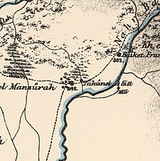
Al-Mansura, was a Palestinian village that was depopulated by the Israeli army during the 1948 Arab-Israeli war. In 1945, it had a population of 2,300 together with the neighboring villages of Dayr al-Qassi and Fassuta. The population was predominantly Christian and most its residents live in what is now the state of Israel.

Dafna is a kibbutz in the Upper Galilee in northern Israel. Located seven kilometres east of Kiryat Shmona and surrounded by three streams of the Dan River, it falls under the jurisdiction of Upper Galilee Regional Council. The kibbutz was founded on 3 May 1939 as a Tower and Stockade settlement, the first such settlement in the northern Hula Valley. Dafna, Beit Hillel, She'ar Yashuv and Dan were known as the "Ussishkin Fortresses", named after Menahem Ussishkin. In 2022 it had a population of 1,073.

Lazzaza was a Palestinian Arab village of 230 in the northern Hula Valley next to the Hasbani River, located 27.5 kilometers (17.1 mi) northwest of Safad. Beit Hillel subsequently expanded onto the land.

Al-Mansura was a small Palestinian Arab village in the Ramle Subdistrict, located 10 km south of Ramla. It was depopulated during the 1947–48 Civil War in Mandatory Palestine on April 20, 1948, under Operation Barak.

Al-'Abisiyya was a Palestinian Arab village in the District of Safad. It was depopulated during the 1948 Arab-Israeli War on May 29, 1948, by The Palmach's First Battalion of Operation Yiftach. It was located 28.5 km northeast of Safad near to the Banyas River which the village relied on for irrigation.

Arab al-Shamalina also known as Khirbat Abu Zayna was a Palestinian Arab village in the Safad Subdistrict. It was depopulated during the 1947–1948 Civil War in Mandatory Palestine on May 4, 1948, under Operation Matate (Broom), a sub operation of Operation Yiftach. It was located 13 km southeast of Safad near the Jordan River.

Fara was a Palestinian Arab village in the Safad Subdistrict. It was depopulated during the 1948 Arab-Israeli War on October 30, 1948, under Operation Hiram. It was located 11.5 km north of Safad on the Wadi al-Fara.

Ghabbatiyya was a Palestinian Arab hamlet in the Safad Subdistrict. It was depopulated during the 1948 Arab-Israeli War on October 30, 1948, under Operation Hiram. It was located 12 km northwest of Safad.

Al-Shawka al-Tahta was a Palestinian Arab village in the Safad Subdistrict. It was depopulated during the 1947–1948 Civil War in Mandatory Palestine on May 14, 1948, by the Palmach's First Battalion of Operation Yiftach. It was located 31.5 km northeast of Safad.

Yarda was a Palestinian hamlet in the Safad Subdistrict. It was depopulated during the 1947–1949 Palestine war. It was located 10.5 km northeast of Safad. The area is now part of Israel.

Al-Na'ima was a Palestinian Arab village in the Safad Subdistrict of Mandatory Palestine located 26 kilometres (16 mi) northeast of Safad, near the al-Hula Plain. The settlement was depopulated during the 1947-1948 civil war on May 14, 1948 by the Israeli Palmach's First Battalion as part of Operation Yiftach.

Al-Zuq al-Tahtani was a Palestinian Arab village in the Safad Subdistrict. It was depopulated during the 1947–1948 Civil War in Mandatory Palestine on May 11, 1948, by the Palmach's First Battalion of Operation Yiftach. It was located 30 km northeast of Safad.
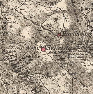
Sabalan was a Palestinian Arab village in the Safad Subdistrict, located 15.5 kilometers (9.6 mi) northwest of Safad. It stood at an elevation of 800 meters (2,600 ft) above sea level overlooking the Druze village of Hurfeish. In 1945, Sabalan had a population of 70. It was depopulated during the 1948 Palestine War.

Al-Shuna was a Palestinian Arab village in the Safad Subdistrict. It was ethnically cleansed and depopulated during the 1947–1948 Civil War in Mandatory Palestine on April 30, 1948, by the Palmach's First Battalion of Operation Yiftach. It was located 6 km south of Safad, overlooking the deep gorge of Wadi al-'Amud.

Qaytiyya was a Palestinian Arab village in the Safad Subdistrict. It was depopulated during the 1948 War on May 19, 1948, by the Palmach's First Battalion of Operation Yiftach. It was located 28 km northeast of Safad, bordering both the Hasibani and the Dan Rivers.

Al-Qudayriyya was a Palestinian Arab village in the Safad Subdistrict. It was depopulated during the 1947–1948 Civil War in Mandatory Palestine on May 4, 1948, by the Haganah and the Palmach's First Battalion of Operation Matate, a sub-operation of Operation Yiftach. It was located 6.5 km south of Safad, situated 1 km east of Wadi al-'Amud.
Al-Salihiyya was a Palestinian Arab village populated by people traditionally associated with the Ghawarna, a generic exonym denoting inhabitants of the drainage plains of the Hula Valley. It was depopulated during the 1948 War on May 25, 1948, by the Israeli Palmach. It was located in the Safad Subdistrict, 25 km northeast of Safad, at the intersection of the Jordan River and Wadi Tur'an.

Al-Sanbariyya was a Palestinian village in the Safad Subdistrict. It was depopulated during the 1947–1948 Civil War in Mandatory Palestine on May 1, 1948, by Palmach's First Battalion under Operation Yiftach. It was located 31.5 km northeast of Safad, near Wadi Hasibani.

Al-'Ulmaniyya was a Palestinian Arab village in the Safad Subdistrict. It was depopulated during the 1947–1948 Civil War in Mandatory Palestine on April 20, 1948, by the Palmach's First Battalion of Operation Yiftach. It was located 14.5 km northeast of Safad.

Al-Mansura was a Palestinian Arab village in the Tiberias Subdistrict. It was depopulated during the 1947–1948 Civil War in Mandatory Palestine on May 10, 1948. It was located 16 kilometres northwest of Tiberias.
 1870s map
 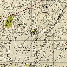 1940s map
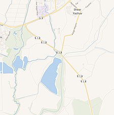 modern map
 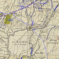 1940s with modern overlay map

