Brunswick, Vermont

Last updated

Brunswick, Vermont
Essex County Vermont incorporated and unincorporated areas Brunswick highlighted.svg
Location in Essex County and the state of Vermont.
Map of USA VT.svg
Location of Vermont in the United States
Coordinates: 44°43′43″N71°39′40″W / 44.72861°N 71.66111°W / 44.72861; -71.66111
Country Flag of the United States (23px).png  United States
State Flag of Vermont.svg Vermont
County Essex
Chartered1761
Settled1780
Area
  Total
26.0 sq mi (67.3 km2)
  Land25.5 sq mi (66.0 km2)
  Water0.5 sq mi (1.4 km2)
Elevation
1,030 ft (314 m)
Population
 (2020)
  Total
88
  Density3/sq mi (1.3/km2)
  Households
40
  Families
28
Time zone UTC-5 (EST)
  Summer (DST) UTC-4 (EDT)
ZIP code
05905
Area code 802
FIPS code 50-10075 [1]
GNIS feature ID1462057 [2]

Brunswick is a town in Essex County, Vermont, United States. The town was named after Prince Karl Wilhelm Ferdinand of Brunswick-Lunenburg. [3] The population was 88 at the 2020 census. [4] It is part of the Berlin, NH-VT Micropolitan Statistical Area. Brunswick is home to six mineral springs that made the town a popular resort destination in the 19th century. The land the springs are on is now owned by the Abenaki people. [5]

Contents

Geography

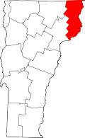
Brunswick is on the eastern side of Essex County, bordering the Connecticut River, which forms the state boundary with New Hampshire. To the south is the town of Maidstone, to the west is Ferdinand, to the northwest is Lewis, and to the north is Bloomfield. To the east, across the Connecticut River, is the town of Stratford, New Hampshire.

According to the United States Census Bureau, the town of Brunswick has a total area of 26.0 square miles (67.3 km2), of which 25.5 square miles (66.0 km2) is land and 0.54 square miles (1.4 km2), or 2.03%, is water. [6]

Demographics

Historical population
CensusPop.Note
1790 66
1800 8630.3%
1810 14366.3%
1820 124−13.3%
1830 16029.0%
1840 130−18.7%
1850 119−8.5%
1860 21278.2%
1870 2214.2%
1880 193−12.7%
1890 160−17.1%
1900 1663.8%
1910 82−50.6%
1920 898.5%
1930 73−18.0%
1940 8617.8%
1950 73−15.1%
1960 62−15.1%
1970 45−27.4%
1980 8282.2%
1990 9212.2%
2000 10716.3%
2010 1124.7%
2020 88−21.4%
U.S. Decennial Census [7]

At the 2000 census there were 107 people, 40 households, and 28 families in the town. The population density was 4.2 inhabitants per square mile (1.6/km2). There were 89 housing units at an average density of 3.5 per square mile (1.4/km2). The racial makeup of the town was 99.07% White and 0.93% African American. [1] Of the 40 households 40.0% had children under the age of 18 living with them, 65.0% were married couples living together, 2.5% had a female householder with no husband present, and 30.0% were non-families. 20.0% of households were one person and 5.0% were one person aged 65 or older. The average household size was 2.68 and the average family size was 3.25.

The age distribution was 29.9% under the age of 18, 5.6% from 18 to 24, 26.2% from 25 to 44, 29.0% from 45 to 64, and 9.3% 65 or older. The median age was 40 years. For every 100 females, there were 101.9 males. For every 100 females age 18 and over, there were 120.6 males.

The median household income was $21,250 and the median family income was $31,250. Males had a median income of $15,833 versus $15,000 for females. The per capita income for the town was $12,925. There were 23.1% of families and 29.1% of the population living below the poverty line, including 48.3% of under eighteens and none of those over 64.

References

  1. 1 2 "U.S. Census website". United States Census Bureau . Retrieved January 31, 2008.
  2. "US Board on Geographic Names". United States Geological Survey. October 25, 2007. Retrieved January 31, 2008.
  3. "Profile for Brunswick, Vermont". ePodunk . Retrieved May 9, 2010.
  4. "Census - Geography Profile: Brunswick town, Essex County, Vermont". United States Census Bureau . Retrieved December 28, 2021.
  5. Zind, Steve. "VPR News: Audio Postcard: Brunswick" . Retrieved October 20, 2011.
  6. "Geographic Identifiers: 2010 Census Summary File 1 (G001): Brunswick town, Essex County, Vermont". American Factfinder. U.S. Census Bureau. Archived from the original on February 13, 2020. Retrieved March 31, 2016.
  7. "U.S. Decennial Census". United States Census Bureau. Retrieved May 16, 2015.