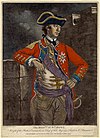
Marker title Image Date dedicated Location Marker type Topics American Light Infantry (The) September 11, 1915 US 1 (N side), 1 mile W of Chadds Ford Coordinates not available Plaque American Revolution, Military Ann Preston, M.D. (1813-1872) March 22, 2008 225 State Rd., West Grove 39°49′13″N 75°48′46″W / 39.8204°N 75.8127°W / 39.8204; -75.8127 (Ann Preston, M.D. ) Roadside African American, Medicine & Science, Religion, Underground Railroad, Women Baptist Church in the Great Valley April 21, 1951 N Valley Forge Rd., just S of Old Forge Crossing, Tredyffrin Twp., Tredyffrin Township 40°03′57″N 75°25′58″W / 40.0657909°N 75.4328880°W / 40.0657909; -75.4328880 (Baptist Church in the Great Valley ) Roadside Religion Battle of Brandywine March 18, 1952 Pa. 842 at intersection SR 3061 SW of West Chester Roadside American Revolution, Military Battle of Brandywine March 18, 1952 U.S. 1, 1 mile E of Kennett Square 39°51′30″N 75°41′23″W / 39.8582°N 75.68982°W / 39.8582; -75.68982 (Battle of Brandywine ) Roadside American Revolution, George Washington, Military Battle of Brandywine March 18, 1952 U.S. 1, 1 mile E of Kennett Square Roadside American Revolution, George Washington, Military Battle of Brandywine March 18, 1952 Pa. 926 at intersection SR 1001 (Birmingham Rd.) W of Darlington Corners, West Chester Roadside American Revolution, Military Battle of the Clouds September 13, 2014 606 Swedesford Rd., Frazer 40°02′32″N 75°34′39″W / 40.04216°N 75.57756°W / 40.04216; -75.57756 (Battle of the Clouds ) Roadside American Revolution, Military Bayard Rustin February 16, 1995 At the school, Lincoln & Montgomery Aves., West Chester City African American, Civil Rights, Education Berwyn School Fight November 21, 2020 At Mt. Zion AME Church , 380 N Fairfield Rd., Devon 40°03′23″N 75°26′04″W / 40.05643°N 75.43434°W / 40.05643; -75.43434 (Berwyn School Fight ) Roadside African American, Education, Government & Politics 20th Century, Religion Birmingham Friends Meeting House September 1915 Wall of Meetinghouse, SR 2001 (Birmingham Rd.), .5 mile SE of PA 926, West Chester 39°54′21″N 75°35′39″W / 39.9057°N 75.59425°W / 39.9057; -75.59425 (Birmingham Friends' Meeting House - PLAQUE ) Plaque American Revolution, Buildings & Architecture, Military, Religion, Science & Medicine Brandywine Mansion July 25, 1985 102 S. 1st Ave., Coatesville 39°58′50″N 75°49′18″W / 39.98052°N 75.82168°W / 39.98052; -75.82168 (Brandywine Mansion ) Roadside Buildings, Business & Industry, Iron, Mansions & Manors The British Attack - PLAQUE September 1915 PA 926 at intersection SR 2001 (Birmingham Rd.), West Chester 39°54′37″N 75°35′53″W / 39.91029°N 75.59811°W / 39.91029; -75.59811 (The British Attack - PLAQUE ) Plaque American Revolution, Military Camp Elder Civil War Paroled P.O.W. Camp September 7, 2013 Oakbourne Rd. & Trellis Ln., Westtown Twp. in Westtown Township 39°56′32″N 75°34′18″W / 39.94231°N 75.57165°W / 39.94231; -75.57165 (Camp Elder ) Roadside Civil War, Military Chester County October 26, 1982 County Courthouse, N. High St., West Chester 39°57′36″N 75°36′17″W / 39.95997°N 75.60482°W / 39.95997; -75.60482 (Chester County ) City American Revolution, Early Settlement, Government & Politics, Government & Politics 17th Century, Military, William Penn Chester Springs May 13, 1948 Pa. 113 at Chester Springs 40°05′43″N 75°37′03″W / 40.0953°N 75.61762°W / 40.0953; -75.61762 (Chester Springs ) Roadside American Revolution, George Washington, Medicine & Science, Military, Sports Dilworthtown - PLAQUE September 1915 SR 2001 (Birmingham Rd.) & Old Wilmington Pike, Dilworthtown 39°53′59″N 75°34′02″W / 39.8996°N 75.5671°W / 39.8996; -75.5671 (Dilworthtown - PLAQUE ) Plaque American Revolution, Military Dr. Charlotte Moore Sitterly (1898-1990) September 24, 2005 640 Buck Run Rd., East Fallowfield Township 39°56′43″N 75°50′26″W / 39.94538°N 75.84061°W / 39.94538; -75.84061 (Dr. Charlotte Moore Sitterly ) Roadside Medicine & Science, Religion, Women Devon Horse Show October 27, 2015 105 E Lancaster Ave., Devon 40°02′51″N 75°25′11″W / 40.04745°N 75.41964°W / 40.04745; -75.41964 (Devon Horse Show ) Roadside Sports & Recreation Duffy's Cut Mass Grave June 18, 2004 King Rd. at Sugartown Rd., Malvern 40°02′01″N 75°31′47″W / 40.0335°N 75.5296°W / 40.0335; -75.5296 (Duffy's Cut Mass Grave ) Roadside Business & Industry, Ethnic & Immigration, Labor, Medicine & Science, Railroads Eusebius Barnard (1802-1865) April 30, 2011 715 S Wawaset Rd., Pocopson Twp., Pocopson Township 39°54′07″N 75°39′38″W / 39.9019°N 75.6605°W / 39.9019; -75.6605 (Eusebius Barnard (1802-1865) ) Roadside African American, Religion, Underground Railroad, Women Evan Pugh, Ph.D. September 26, 1964 Jordan Bank Elem. School, S. Fifth and Hodgson streets, Oxford 39°46′53″N 75°58′28″W / 39.781315°N 75.974408°W / 39.781315; -75.974408 (Evan Pugh ) City Agriculture, Education, Environment, Professions & Vocations, Science & Medicine Frederick Douglass February 1, 2006 West Chester Univ. campus, between Library and Main Hall, facing High St. 39°57′08″N 75°35′50″W / 39.95235°N 75.59732°W / 39.95235; -75.59732 (Frederick Douglass ) Roadside African American, Civil Rights, Education, Government & Politics 19th Century, Military, Publishing G. Raymond Rettew September 17, 2002 Walnut & Chestnut Streets, West Chester 39°57′43″N 75°36′17″W / 39.96182°N 75.60485°W / 39.96182; -75.60485 (G. Raymond Rettew ) Roadside Business & Industry, Medicine & Science, Military, Military Post-Civil War, Professions & Vocations Gen. Anthony Wayne April 13, 1949 U.S. 30 at junction Pa. 252 E of Paoli 40°02′31″N 75°28′36″W / 40.042°N 75.4767°W / 40.042; -75.4767 (Gen. Anthony Wayne ) Roadside American Revolution, French & Indian War, Military, Native American General Lafayette June 9, 1951 NW corner, N. Church & W. Lafayette Sts., West Chester 39°57′55″N 75°36′36″W / 39.96523°N 75.61°W / 39.96523; -75.61 (General Lafayette ) City American Revolution, Military General Sir William Howe August 19, 1947 U.S. 202, 2.9 miles NE of Paoli (Missing)Coordinates not available Roadside American Revolution, Military George Alexander Spratt October 16, 2021 800 Reeceville Rd., West Brandywine 40°01′33″N 75°47′54″W / 40.025935°N 75.798393°W / 40.025935; -75.798393 (George Alexander Spratt ) Roadside Invention Graceanna Lewis (1821-1912) April 5, 2014 2123 Kimberton Rd., Phoenixville (E Pikeland Twp.) 40°07′51″N 75°34′27″W / 40.13076°N 75.57421°W / 40.13076; -75.57421 (Graceanna Lewis ) Roadside African American, Education, Religion, Science & Medicine, Women Great Minquas Path June 26, 1951 Business U.S. 322, 1 mile SE of West Chester 39°56′54″N 75°35′38″W / 39.9483°N 75.5938°W / 39.9483; -75.5938 (Great Minquas Path ) Roadside Native American, Paths & Trails, Transportation Great Minquas Path November 14, 1925 US 202 & 322, at Church Ave., 1/2 mile S of West Chester 39°56′54″N 75°35′38″W / 39.9483°N 75.5938°W / 39.9483; -75.5938 (Great Trail, The - Minquas or Susquehanna Indians- PLAQUE ) Plaque Early Settlement, Ethnic & Immigration, Native American, Paths & Trails Great Valley Mill August 19, 1947 U.S. 202, 1.5 miles NE of Paoli (Missing)Coordinates not available Roadside Buildings, Business & Industry, Mills Hannah Freeman September 1925 PA 52 (E side), .2 mile N of junction US 1, Kennett Square 39°52′21″N 75°40′07″W / 39.8724°N 75.6687°W / 39.8724; -75.6687 (Indian Hannah - PLAQUE ) Plaque Government & Politics 18th Century, Native American, Religion, Women Hopewell Historic District November 10, 1996 Intersection of Hopewell & Lower Hopewell Roads, Lower Oxford & E. Nottingham Twps. 39°46′46″N 76°01′01″W / 39.77955°N 76.01703°W / 39.77955; -76.01703 (Hopewell Historic District ) Roadside Agriculture, Business & Industry, Education Hopewell Village August 5, 1948 Pa. 345 at Warwick , just N of junction Pa. 23 40°09′41″N 75°47′24″W / 40.16142°N 75.78995°W / 40.16142; -75.78995 (Hopewell Village ) Roadside Business & Industry, Furnaces, Iron Horace Pippin June 9, 1979 327 Gay St., West Chester 39°57′30″N 75°36′37″W / 39.9583°N 75.61037°W / 39.9583; -75.61037 (Horace Pippin ) City African American, Artists Hosanna Meeting House May 9, 1992 Old U.S. 1 (Baltimore Pike) N of Lincoln University campus, Lower Oxford Twp. 39°48′41″N 75°55′31″W / 39.8115°N 75.9253°W / 39.8115; -75.9253 (Hosanna Meeting House ) Roadside African American, Houses & Homesteads, Religion, Underground Railroad Humphry Marshall (1722-1801) October 18, 2014 1407 W Strasburg Rd., West Chester 39°57′00″N 75°40′51″W / 39.95002°N 75.68072°W / 39.95002; -75.68072 (Humphry Marshall ) Roadside Agriculture, Environment, Professions & Vocations, Science & Medicine, Writers Ida Ella Ruth Jones October 23, 2004 Pa. 82 (Doe Run Rd.) at Rokeby Rd., East Fallowfield 39°56′23″N 75°49′58″W / 39.93978°N 75.83278°W / 39.93978; -75.83278 (Ida Ella Ruth Jones ) Roadside African American, Artists, Women Isaac & Dinah Mendenhall (1806-82 / 1807-89) November 10, 2018 301 Kennett Pike (PA 52 ), at Hillendale Rd., Kennett Twp., Kennett Square 39°51′34″N 75°38′44″W / 39.85934°N 75.64543°W / 39.85934; -75.64543 (Isaac & Dinah Mendenhall ) Roadside Abraham Lincoln, African American, Religion, Underground Railroad, Women James Joseph "Jim" Croce (1943-1973) April 9, 2022 Highspire and Creek Rds., Lyndell , in East Brandywine Township 40°03′35″N 75°44′42″W / 40.059845°N 75.745034°W / 40.059845; -75.745034 (Jim Croce ) Roadside Music & Theater John Beale Bordley February 25, 1953 SR 3062 (Strasburg Rd.) just off Pa. 162, 1.6 miles W of Marshalltown Roadside Agriculture, Environment, Invention, Professions & Vocations John F. Fritz August 16, 1954 Pa. 41, 2.8 miles SE of Cochranville (Missing) 39°52′19″N 75°52′37″W / 39.87188°N 75.87703°W / 39.87188; -75.87703 (John F. Fritz ) Roadside Business & Industry, Invention, Iron & Steel, Professions & Vocations John G. Parke July 22, 1968 Business US 30 at Veterans Hospital, near N Caln Rd., E of Coatesville 39°59′19″N 75°47′36″W / 39.98853°N 75.79345°W / 39.98853; -75.79345 (John G. Parke ) Roadside Civil War, Environment, Government & Politics, Military, Professions & Vocations Joseph T. Rothrock June 9, 1952 NW corner, N. Church St. & W. Lafayette St., West Chester 39°57′49″N 75°36′33″W / 39.9635°N 75.60922°W / 39.9635; -75.60922 (Joseph T. Rothrock ) City Environment, Medicine & Science, Professions & Vocations Lightfoot Mill (Mill at Anselma) October 13, 2007 1730 Conestoga Rd. (W side of state hwy. 401), Chester Spgs. 40°04′57″N 75°38′34″W / 40.08263°N 75.642647°W / 40.08263; -75.642647 (Lightfoot Mill ) Roadside Business & Industry, Mills Lincoln Biography September 17, 1952 28 W. Market St., West Chester 39°57′33″N 75°36′19″W / 39.95928°N 75.60515°W / 39.95928; -75.60515 (Lincoln Biography ) City Abraham Lincoln, Government & Politics, Government & Politics 19th Century, Publishing Lincoln University January 25, 1967 SR 3026 (old U.S. 1), 2 miles NE of Oxford 39°48′38″N 75°55′41″W / 39.8106°N 75.9281°W / 39.8106; -75.9281 (Lincoln University ) Roadside African American, Education Lynching of Zachariah Walker December 9, 2006 Rt. 82 south, approx. 1/4 mile from Coatesville city limits Roadside African American, Civil Rights, Government & Politics 20th Century Minguannan Indian Town - PLAQUE October 1924 Intersection SR 3006 (Yeatman Station Rd.) & SR 3034 (London Tract Rd.), 1.5 miles NE of Strickersville 39°44′47″N 75°46′31″W / 39.74627°N 75.77517°W / 39.74627; -75.77517 (Minguannan Indian Town - PLAQUE ) Plaque Cities & Towns, Early Settlement, Government & Politics 17th Century, Native American, William Penn Okehocking Indian Town - PLAQUE June 1924 PA 3 (West Chester Pike), .5 mile E of PA 926 & 4 miles W of Newtown Square 39°58′03″N 75°28′53″W / 39.96738°N 75.48132°W / 39.96738; -75.48132 (Okehocking Indian Town - PLAQUE ) Plaque Cities & Towns, Early Settlement, Native American, William Penn Osborne's Hill - PLAQUE September 1915 Sr 2001 (Birmingham Rd.) at driveway to Osborne Hill, 1 mile S of Strodes Mill 39°55′22″N 75°36′32″W / 39.92272°N 75.60885°W / 39.92272; -75.60885 (Osborne's Hill - PLAQUE ) Plaque American Revolution, Military Parker Kidnapping & Rescue September 17, 2011 At Fremont Cemetery & Union Methodist Church, 321 Fremont Rd., West Nottingham Township 39°44′29″N 76°03′56″W / 39.74127°N 76.06548°W / 39.74127; -76.06548 (Parker Kidnapping & Rescue ) Roadside African American, Government & Politics 19th Century, Women Pennhurst State School & Hospital April 10, 2010 Schuylkill Rd. (PA 174) near Bridge St., Spring City Roadside Civil Rights, Education, Government & Politics 20th Century Pennsylvania December 12, 1948 U.S. 1, approx. .6 miles from state line Roadside Government & Politics, Government & Politics 17th Century, William Penn Pennsylvania December 12, 1948 Pa. 41, approx. .7 miles from state line Roadside Government & Politics, Government & Politics 17th Century, William Penn Peter Bezellon October 14, 1954 SR 3064 (West Chester Rd.) at Oak St., S end Coatesville 39°58′55″N 75°48′17″W / 39.98185°N 75.8048°W / 39.98185; -75.8048 (Peter Bezellon ) City Early Settlement, Native American, Professions & Vocations Philadelphia & Lancaster Turnpike November 20, 1999 E Lincoln Hwy. (Bus. Rt. 30), near Veterans Dr., Caln Twp. , just E of Coatesville 39°59′19″N 75°47′31″W / 39.98848°N 75.79208°W / 39.98848; -75.79208 (Philadelphia & Lancaster Turnpike ) Roadside Government & Politics, Roads, Transportation Phoenix Iron Company October 29, 2005 Main St., Phoenixville , near municipal parking lot and P.I.C. site City Business & Industry, Civil War, Iron, Military Queonemysing Indian Town (PLAQUE) October 4, 1924 PA 100, ~.1 mile N of state line, and at Delaware County line (MISSING) Plaque Cities & Towns, Early Settlement, Native American, William Penn Samuel Barber March 9, 1996 107 S. Church St., West Chester 39°34′42″N 75°36′16″W / 39.57833°N 75.6045°W / 39.57833; -75.6045 (Samuel Barber ) City Music & Theater Reading Furnace Historic District May 12, 1948 Pa. 23 between Warwick & Knauertown Roadside Business & Industry, Furnaces, Iron Sconnelltown - PLAQUE September 1, 1915 Near junction SR 3061 & 2001, just off PA 842 SW of West Chester 39°56′08″N 75°37′30″W / 39.93555°N 75.62505°W / 39.93555; -75.62505 (Sconnelltown - PLAQUE ) Plaque American Revolution, Military Springton Manor Farm October 5, 1984 SR 4023 (Springton Rd.) & Highspire Rd., 1 mile N of U.S. 322, Wallace Twp. Roadside Government & Politics, Government & Politics 18th Century, Mansions & Manors, William Penn Star of the West, Tent No. Six May 15, 1995 113 S Adams St., West Chester 39°57′41″N 75°35′51″W / 39.96137°N 75.59757°W / 39.96137; -75.59757 (Star of the West - Tent #6 ) City African American, Women Steyning Manor - PLAQUE October 1, 1926 SR 3048 (old US 1) southbound, .5 mile W of Kennett Square 39°50′41″N 75°43′38″W / 39.84464°N 75.7271°W / 39.84464; -75.7271 (Steyning Manor - PLAQUE ) Plaque Government & Politics, Mansions & Manors, Native American, William Penn Sunset Park August 12, 2018 S Jennersville Rd. (PA 796 ) at Waltman Ln., West Grove 39°49′18″N 75°52′16″W / 39.8216°N 75.87124°W / 39.8216; -75.87124 (Sunset Park ) Roadside Music & Theater, Performers Thomas B. Read May 12, 1948 US 322 at Corner Ketch Lyndell Rd.(SR 4037), NW of Downingtown Roadside Artists, Writers Thomas McKean October 26, 1974 Pa. 896 NW of Pa. 841, Franklin Roadside Government & Politics, Government & Politics 18th Century, Governors Trimble's Ford - PLAQUE September 1, 1915 SR 3023 (Camp Linden Rd.), .2 mile E of SR 3058, Marshallton 39°56′03″N 75°40′50″W / 39.9341°N 75.68042°W / 39.9341; -75.68042 (Trimble's Ford - PLAQUE ) Plaque American Revolution, Military Village of Valley Forge September 17, 1960 Valley Forge Rd. (PA 23) near Owen Dr., at E end of village and Montgomery Co. line Roadside Early Settlement, George Washington, Government & Politics, Government & Politics 18th Century, Iron Village of Valley Forge September 17, 1960 Valley Forge Rd. (PA 23) near Valley Park Rd., W end of village 40°06′05″N 75°28′28″W / 40.10125°N 75.47447°W / 40.10125; -75.47447 (Village of Valley Forge ) Roadside American Revolution, Business & Industry, Cities & Towns, George Washington, Iron, Military Valley Forge General Hospital October 27, 2012 near 1401 Charlestown Rd., Phoenixville in Schuylkill Township 40°07′03″N 75°32′39″W / 40.11742°N 75.54403°W / 40.11742; -75.54403 (Valley Forge General Hospital ) Roadside Military, Military Post-Civil War, Science & Medicine Warwick Furnace May 12, 1948 Pa. 23 between Warwick & Knauertown Roadside Business & Industry, Furnaces, Iron Wharton Esherick (1887-1970) September 9, 2018 Horseshoe Trial & Country Club Rd., Phoenixville in Tredyffrin Township 40°05′01″N 75°29′43″W / 40.08374°N 75.4952°W / 40.08374; -75.4952 (Wharton Esherick ) Roadside Artists, Professions & Vocations Whittier C. Atkinson April 14, 2007 824 E Chestnut St., Coatesville City African American, Medicine & Science William Darlington April 11, 1952 13 N. High St. between Market & Gay Sts., West Chester 39°57′36″N 75°36′17″W / 39.96013°N 75.60477°W / 39.96013; -75.60477 (William Darlington ) City Environment, Government & Politics 19th Century, Medicine & Science, Professions & Vocations Woman's Rights Convention of 1852 October 13, 2003 225 N. High St., West Chester 39°57′43″N 75°36′24″W / 39.96203°N 75.6066°W / 39.96203; -75.6066 (Woman's Rights Convention of 1852 ) City Civil Rights, Education, Professions & Vocations, Women