This article needs additional citations for verification .(November 2024) |
A subregion or sub-region is a designation for an administrative division in some countries.
This article needs additional citations for verification .(November 2024) |
A subregion or sub-region is a designation for an administrative division in some countries.

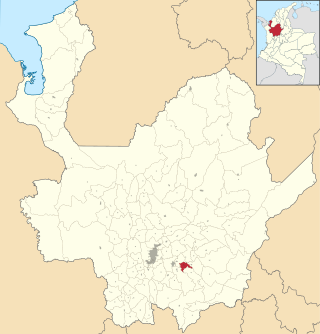
Antioquia is one of the 32 departments of Colombia, located in the central northwestern part of Colombia with a narrow section that borders the Caribbean Sea. Most of its territory is mountainous with some valleys, much of which is part of the Andes mountain range. Antioquia has been part of many territorial divisions of former countries created within the present-day territory of Colombia. Prior to adoption of the Colombian Constitution of 1886, Antioquia State had its own sovereign government.

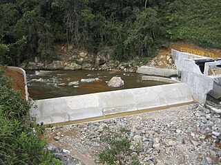
Caucasia is a small city and municipality located in the subregion of Bajo Cauca Antioquia department, in Colombia. Bounded on the south by the department of Córdoba, in the east by the municipalities of Antioquia in Nechí and El Bagre, on the north by the municipality of Zaragoza, and west to the town of Cáceres, and is located 270 km from Medellín.
Guadalupe is a town and municipality in the Colombian department of Antioquia. Part of the subregion of Northern Antioquia, it lies at an elevation of 1,875 m above sea level.

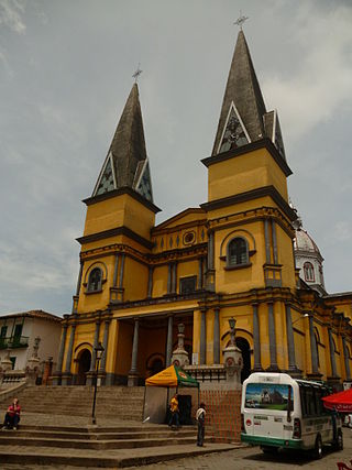
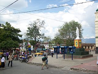
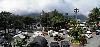
Jericó is a town, municipality and Catholic bishopric in the Colombian department of Antioquia. It is part of the subregion of Southwestern Antioquia. The distance reference from Medellín city, the capital of the department, is 104 km. It lies 1,910 m above sea level.
Santo Domingo is a town and municipality in the Colombian department of Antioquia. Part of the subregion of Northeastern Antioquia, it lies at an altitude of 1,975 m above sea level.
Santa Bárbara is a town and municipality in the Colombian department of Antioquia. Part of the subregion of Southwestern Antioquia. Santa Barbara is located in a valley about 2.5 hours drive from Medellín by car or bus. It lies at an elevation of 1,800 m above sea level.
El Santuario is a town and municipality in the Antioquia Department, Colombia. It is part of the subregion of Eastern Antioquia. El Santuario was founded on 11 March 1765 by Captain Antonio Gómez de Castro. Its elevation is 2,150 meters above sea level, with an average temperature of 17 °C. The distance reference from Medellín city, the capital of Antioquia Department, is 57 km and it has a total area of 83.45 km². This town is well known for being the place where comedian Guillermo Zuluaga "Montecristo" and actor Crisanto Alonso Vargas "Vargasvil" were born. The more significant source of its economy is agriculture, mainly vegetables, beans, potatoes and legume cultivation.

Segovia is a town and municipality in Antioquia Department, Colombia. Part of the subregion of Northeastern Antioquia, its elevation is 650 m above sea level. There are gold mines in the area.

San Roque is a town and municipality in the Colombian department of Antioquia. Part of the subregion of Northeastern Antioquia, it is located 1,475 m above sea level. The municipality was founded by Francisco Martinez de Ospina on the 8 February 1880. The town is located between the Nare River and the Nus River. The town was created due to the presence of gold in the areas around the town. The town is located 121 km north of Medellín. The people of this town celebrate most of the traditional festivals that are celebrated in Colombia.
Támesis is a town and municipality in the Colombian department of Antioquia. Part of the subregion of Southwestern Antioquia. Located at an elevation of 1,638 m above sea level, it was established in 1858. The local economy is based on agriculture.

Vegachí is a town and municipality in the Colombian department of Antioquia. Part of the subregion of Northeastern Antioquia, it lies at an altitude of 980 m (3,220 ft) above sea level.

Rionegro is a city and municipality in Antioquia Department, Colombia, located in the subregion of Eastern Antioquia. The official name of the city is Ciudad Santiago de Arma de Rionegro. Rio Negro means "Black River" in Spanish, as the city received its name after a river that looks black because of the shadows cast by trees. The river traverses the city and it is the most prominent geographical feature of the municipality. Rionegro is also sometimes called the Cuna de la democracia as it was one of the most important cities during the era of the Colombia's struggle for independence and the 1863 constitution was written in the city.
The 2005 Fed Cup was the 43rd edition of the most important competition between national teams in women's tennis.

Lisbon Region is one of the seven NUTS II designated regions of Portugal, which coincides with the NUTS III subregion Lisbon Metropolitan Area. The region covers an area of 3001.95 km2 and includes a population of 2,815,851 inhabitants according to the 2011 census, a density of 1039 inhabitants/km2.
The NUTS codes of Hungary have three levels:

Remedios is a town and municipality in the Colombian department of Antioquia. Part of the subregion of Northeastern Antioquia, it lies at an altitude of 700 m above sea level.

The Nomenclature of Territorial Units for Statistics (NUTS) is developed by Eurostat, and employed in both Portugal and the entire European Union for statistical purposes. The NUTS branch extends from NUTS1, NUTS2 and NUTS3 regions, with the complementary LAU sub-categorization being used to differentiate the local areas, of trans-national importance.
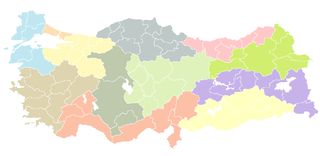
As a candidate country of the European Union, Turkey (TR) is included in the Nomenclature of Territorial Units for Statistics (NUTS). Defined in 2002 in agreement between Eurostat and the Turkish authorities, Turkey's NUTS classifications are officially termed statistical regions, as Turkey is not a member of the EU and Eurostat only defines NUTS for member states. The three NUTS levels are:
The 2012 World Mountain Running Championships were held on 2 September in Val Camonica in the Italian Alps. The course ran from Temù - Ponte di Legno to Tonale Pass. It was the 28th edition of the championships, organised by the World Mountain Running Association (WMRA), and the seventh time that Italy had hosted the competition. The competition featured four races, with senior and junior (under-19) races for both men and women. A total of 343 runners from a record high of 40 nations finished the competition.
| | This article about geography terminology is a stub. You can help Wikipedia by expanding it. |