Inglewood is a rural town and locality in the Goondiwindi Region, Queensland, Australia. In the 2021 census, the locality of Inglewood had a population of 936 people.

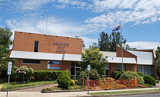
Millmerran, known as Domville between 1 June 1889 and 16 November 1894, is a town and a locality in the Toowoomba Region, Queensland, Australia. In the 2021 census, the locality of Millmerran had a population of 1,545 people.
Wyreema is a rural town and locality in the Toowoomba Region, Queensland, Australia. In the 2021 census, the locality of Wyreema had a population of 2,076 people.

Karara is a rural town and locality in the Southern Downs Region, Queensland, Australia. In the 2021 census, the locality of Karara had a population of 128 people.

Pampas is a rural locality in the Toowoomba Region, Queensland, Australia. In the 2021 census, Pampas had a population of 78 people.

Southbrook is a rural town and locality in the Toowoomba Region, Queensland, Australia. In the 2021 census, the locality of Southbrook had a population of 626 people.

Domville is a rural locality in the Toowoomba Region, Queensland, Australia. In the 2021 census, Domville had "no people or a very low population".
Clontarf is a rural locality in the Toowoomba Region, Queensland, Australia. In the 2021 census, Clontarf had a population of 28 people.
Ellangowan is a rural locality in the Toowoomba Region, Queensland, Australia. In the 2021 census, Ellangowan had a population of 95 people.
Canning Creek is a rural locality split between the Goondiwindi Region and the Toowoomba Region in Queensland, Australia. In the 2021 census, Canning Creek had a population of 21 people.
Mosquito Creek is a rural locality in the Goondiwindi Region, Queensland, Australia. In the 2021 census, Mosquito Creek had a population of 8 people.
Kooroongarra is a rural town and locality in the Toowoomba Region, Queensland, Australia. In the 2021 census, the locality of Kooroongarra had a population of 45 people.
Millwood is a rural locality in the Toowoomba Region, Queensland, Australia. In the 2021 census, Millwood had a population of 22 people.
Pirrinuan is a rural locality in the Western Downs Region, Queensland, Australia. In the 2021 census, Pirrinuan had a population of 221 people.

Umbiram is a rural locality in the Toowoomba Region, Queensland, Australia. In the 2021 census, Umbiram had a population of 146 people.
Irvingdale is a locality split between the Toowoomba Region and the Western Downs Region, both in Queensland, Australia. In the 2021 census, Irvingdale had a population of 163 people.
Turallin is a rural town and locality in the Toowoomba Region, Queensland, Australia. In the 2021 census, the locality of Turallin had a population of 64 people.
Woondul is a rural locality in the Toowoomba Region, Queensland, Australia.
Kurrowah is a rural locality in the Toowoomba Region, Queensland, Australia. In the 2021 census, Kurrowah had a population of 10 people.
Millmerran–Inglewood Road is a continuous 68.8 kilometres (42.8 mi) road route in the Toowoomba and Goondiwindi regions of Queensland, Australia. The road is signed as State Route 82. Millmerran–Inglewood Road is a state-controlled regional road.
