Djuan, Queensland

Last updated

Djuan
Queensland
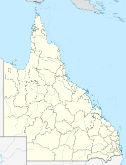
Australia Queensland location map.svg
Red pog.svg
Djuan
Coordinates 27°10′50″S151°54′37″E / 27.1805°S 151.9102°E / -27.1805; 151.9102 (Djuan (centre of locality))
Population93 (2021 census) [1]
 • Density1.890/km2 (4.896/sq mi)
Postcode(s) 4352
Area49.2 km2 (19.0 sq mi)
Time zone AEST (UTC+10:00)
Location
LGA(s) Toowoomba Region
State electorate(s) Condamine
Federal division(s) Maranoa
Suburbs around Djuan:
Coalbank Coalbank Emu Creek
Doctor Creek Djuan Glenaven
Haden Bergen Upper Pinelands

Djuan is a rural locality in the Toowoomba Region, Queensland, Australia. [2] In the 2021 census, Djuan had a population of 93 people. [1]

Contents

Geography

The locality is bounded to the west by the Great Dividing Range. [3]

History

The locality takes its name from an Aboriginal name for the grey forest possum. [2]

Djuan Provisional School opened on 14 November 1895. On 1 January 1909, it became Djuan State School. It closed in 1969. [4] It was on a 3-acre (1.2 ha) site on the bend of Djuan Road ( 27°10′54″S151°55′23″E / 27.18168°S 151.92303°E / -27.18168; 151.92303 (Djuan State School (former)) ). [5] [6] [7]

On 19 November 1901, a Methodist church opened in Djuan. [8]

Demographics

In the 2016 census, Djuan had a population of 100 people. [9]

In the 2021 census, Djuan had a population of 93 people. [1]

Education

There are no schools in Djuan. The nearest government primary school is Haden State School in neighbouring Haden to the south-west. The nearest government secondary schools are Crow's Nest State School (to Year 10) in Crows Nest to the south-east and Highfields State Secondary College (to Year 12) in Highfields to the south. [10]

References

  1. 1 2 3 Australian Bureau of Statistics (28 June 2022). "Djuan (SAL)". 2021 Census QuickStats. Retrieved 28 February 2023. OOjs UI icon edit-ltr-progressive.svg
  2. 1 2 "Djuan – locality in Toowoomba Region (entry 49187)". Queensland Place Names. Queensland Government . Retrieved 29 December 2020.
  3. ↑ "Layers: Locality; Mountains and ranges; Contours; Watercourses". Queensland Globe. Queensland Government. Archived from the original on 19 December 2017. Retrieved 23 November 2024.
  4. ↑ Queensland Family History Society (2010), Queensland schools past and present (Version 1.01 ed.), Queensland Family History Society, ISBN   978-1-921171-26-0
  5. ↑ "LOCAL GOVERNMENT". Darling Downs Gazette . Vol. XXXVII, no. 8, 177. Queensland, Australia. 13 April 1895. p. 8. Retrieved 24 November 2024– via National Library of Australia.
  6. ↑ "Parish of Djuan sheet 1" (Map). Queensland Government. 1935. Archived from the original on 23 June 2023. Retrieved 24 November 2024.
  7. ↑ "Layers: Locality; Road and rail; Land parcel; Watercourse; Mountains and ranges". Queensland Globe. Queensland Government. Archived from the original on 19 December 2017. Retrieved 23 November 2024.
  8. ↑ "QUEENSLAND NEWS". Queensland Times, Ipswich Herald and General Advertiser . Vol. XLII, no. 6372. Queensland, Australia. 30 November 1901. p. 7. Retrieved 12 September 2021– via National Library of Australia.
  9. ↑ Australian Bureau of Statistics (27 June 2017). "Djuan (SSC)". 2016 Census QuickStats. Retrieved 20 October 2018. OOjs UI icon edit-ltr-progressive.svg
  10. ↑ "Layers: Locality; Schools and school catchments". Queensland Globe. Queensland Government. Archived from the original on 19 December 2017. Retrieved 23 November 2024.