Highgrove, Queensland

Last updated

Highgrove
Queensland
Australia Queensland location map.svg
Red pog.svg
Highgrove
Coordinates 27°06′32″S151°46′03″E / 27.1088°S 151.7675°E / -27.1088; 151.7675 (Highgrove (centre of locality))
Population28 (2021 census) [1]
 • Density1.065/km2 (2.76/sq mi)
Postcode(s) 4352
Area26.3 km2 (10.2 sq mi)
Time zone AEST (UTC+10:00)
LGA(s) Toowoomba Region
State electorate(s) Nanango
Federal division(s) Groom
Suburbs around Highgrove:
Narko Nutgrove Thornville
Narko Highgrove Coalbank
Evergreen Doctor Creek Doctor Creek

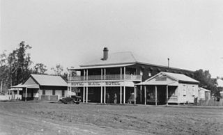
Highgrove is a rural locality in the Toowoomba Region, Queensland, Australia. [2] In the 2021 census, Highgrove had a population of 28 people. [1]

Contents

Geography

The ridgeline of the Great Dividing Range roughly bounds the locality to the north and east. [3]

The Oakey–Cooyar Road traverses the locality entering from the south-east (Evergreen) and exiting to the north (Nutgrove). [3]

The predominant land use is grazing on native vegetation with some crop growing in the south of the locality. [3]

Demographics

In the 2016 census Highgrove had a population of 29 people. [4]

In the 2021 census, Highgrove had a population of 28 people. [1]

Heritage listings

Highgrove has a number of heritage-listed sites, including:

Economy

There are a number of homesteads in the locality: [6]

Related Research Articles

<span class="mw-page-title-main">Cooyar, Queensland</span> Town in Queensland, Australia

Cooyar is a rural town and locality in the Toowoomba Region, Queensland, Australia. In the 2021 census, the locality of Cooyar had a population of 231 people.

Cotswold Hills is a rural-residential locality within Toowoomba in the Toowoomba Region, Queensland, Australia. In the 2021 census, Cotswold Hills had a population of 1,620 people.

<span class="mw-page-title-main">Middle Ridge, Queensland</span> Suburb of Toowoomba, Queensland, Australia

Middle Ridge is a residential locality of Toowoomba in the Toowoomba Region, Queensland, Australia. In the 2021 census, Middle Ridge had a population of 7,595 people.

<span class="mw-page-title-main">Mount Kynoch, Queensland</span> Suburb of Toowoomba, Queensland, Australia

Mount Kynoch is a rural locality in the Toowoomba Region, Queensland, Australia. In the 2016 census, Mount Kynoch had a population of 237 people.

<span class="mw-page-title-main">Geham</span> Suburb of Toowoomba Region, Queensland, Australia

Geham is a rural locality in the Toowoomba Region, Queensland, Australia. In the 2021 census, Geham had a population of 470 people.

<span class="mw-page-title-main">Jondaryan, Queensland</span> Town in Queensland, Australia

Jondaryan is a rural town and locality in the Toowoomba Region, Queensland, Australia. In the 2016 census, the locality of Jondaryan had a population of 385 people.

<span class="mw-page-title-main">Aubigny, Queensland</span> Town in Queensland, Australia

Aubigny is a rural town and locality in the Toowoomba Region, Queensland, Australia. In the 2016 census, the locality of Aubigny had a population of 254 people.

<span class="mw-page-title-main">Pampas, Queensland</span> Suburb of Toowoomba Region, Queensland, Australia

Pampas is a rural locality in the Toowoomba Region, Queensland, Australia. In the 2016 census, Pampas had a population of 62 people.

<span class="mw-page-title-main">Biddeston, Queensland</span> Town in Queensland, Australia

Biddeston is a rural town and locality in the Toowoomba Region, Queensland, Australia. In the 2016 census the locality of Biddeston had a population of 284 people.

<span class="mw-page-title-main">Ascot, Queensland (Toowoomba Region)</span> Suburb of Toowoomba Region, Queensland, Australia

Ascot is a rural locality in the Toowoomba Region, Queensland, Australia. In the 2021 census, Ascot had a population of 106 people.

<span class="mw-page-title-main">Linthorpe, Queensland</span> Suburb of Toowoomba Region, Queensland, Australia

Linthorpe is a rural locality in the Toowoomba Region, Queensland, Australia. In the 2021 census, Linthorpe had a population of 416 people.

Branchview is a rural locality in the Toowoomba Region, Queensland, Australia. In the 2021 census, Branchview had a population of 37 people.

Irongate is a rural locality in the Toowoomba Region, Queensland, Australia. In the 2021 census, Irongate had a population of 135 people.
<span class="mw-page-title-main">North Branch, Queensland (Toowoomba Region)</span> Suburb of Toowoomba Region, Queensland, Australia

North Branch is a locality in the Toowoomba Region, Queensland, Australia. In the 2021 census, North Branch had a population of 48 people.

Norwin is a rural locality in the Toowoomba Region, Queensland, Australia. In the 2016 census, Norwin had a population of 94 people.

Nutgrove is a rural locality in the Toowoomba Region, Queensland, Australia. In the 2016 census Nutgrove had a population of 32 people.

Mount Steadman is a rural locality in the North Burnett Region, Queensland, Australia. In the 2016 census Mount Steadman had a population of 8 people.
<span class="mw-page-title-main">Muniganeen, Queensland</span> Suburb of Toowoomba Region, Queensland, Australia

Muniganeen is a rural locality in the Toowoomba Region, Queensland, Australia. In the 2021 census, Muniganeen had a population of 40 people.

Mount Darry is a rural locality in the Toowoomba Region, Queensland, Australia. In the 2016 census Mount Darry had a population of 35 people.

Narko is a rural locality in the Toowoomba Region, Queensland, Australia. In the 2021 census, Narko had a population of 16 people.

References

  1. 1 2 3 Australian Bureau of Statistics (28 June 2022). "Highgrove (SAL)". 2021 Census QuickStats. Retrieved 28 February 2023. OOjs UI icon edit-ltr-progressive.svg
  2. "Highgrove – locality in Toowoomba Region (entry 47968)". Queensland Place Names. Queensland Government . Retrieved 29 December 2020.
  3. 1 2 3 "Queensland Globe". State of Queensland . Retrieved 1 January 2021.
  4. Australian Bureau of Statistics (27 June 2017). "Highgrove (SSC)". 2016 Census QuickStats. Retrieved 20 October 2018. OOjs UI icon edit-ltr-progressive.svg
  5. "Muntapa Tunnel (entry 602594)". Queensland Heritage Register . Queensland Heritage Council. Retrieved 15 July 2013.
  6. "Homesteads - Queensland". Queensland Open Data. Queensland Government. 18 November 2020. Archived from the original on 24 November 2020. Retrieved 24 November 2020.