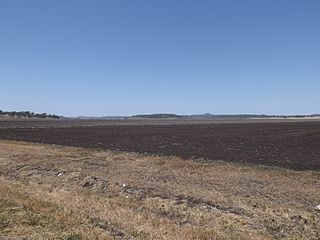
Linthorpe, Queensland

Last updated

Linthorpe
Queensland
Fields and windmill at Linthorpe.jpg
Fields and windmill along Biddeston Linthorpe Road, 2014
Australia Queensland location map.svg
Red pog.svg
Linthorpe
Coordinates 27°34′16″S151°39′20″E / 27.5711°S 151.6555°E / -27.5711; 151.6555 (Linthorpe (centre of locality))
Population416 (2021 census) [1]
 • Density3.838/km2 (9.939/sq mi)
Postcode(s) 4356
Area108.4 km2 (41.9 sq mi)
Time zone AEST (UTC+10:00)
Location
LGA(s) Toowoomba Region
State electorate(s) Condamine
Federal division(s) Groom
Suburbs around Linthorpe:
Motley Aubigny Biddeston
Mount Tyson
Rossvale
Linthorpe Southbrook
Stoneleigh Pittsworth Broxburn

Linthorpe is a rural locality in the Toowoomba Region, Queensland, Australia. [2] In the 2021 census, Linthorpe had a population of 416 people. [1]

Contents

Geography

Mount Haystack, 2014 Mount Haystack Linthorpe.jpg
Mount Haystack, 2014

Linthorpe is on the Darling Downs. [3]

The Gore Highway marks the southern boundary of Linthorpe. Toowoomba–Cecil Plains Road runs along the northern boundary, and the Oakey-Pittsworth Road runs along the north-western. [4]

Linthorpe has the following mountains:

History

First day pupils, Linthorpe School First day pupils, Linthorpe School.jpg
First day pupils, Linthorpe School

Motley Provisional School opened on 12 March 1900. In January 1901, it was renamed Linthorpe Provisional School. On 1 January 1909, it became Linthorpe State School. The school closed in 1960. [9] It was at 1190 Stoneleigh Road ( 27°36′14″S151°37′47″E / 27.6038°S 151.6298°E / -27.6038; 151.6298 (Linthorpe State School (former)) ). [10] [11] [3]

Demographics

In the 2016 census, Linthorpe had a population of 440 people. [12]

In the 2021 census, Linthorpe had a population of 416 people. [1]

Education

There are no schools in Linthorpe. The nearest government primary schools are: [13]

The nearest government secondary schools are Oakey State High School in Oakey to the north and Pittsworth State High School in Pittsworth to the south. [13]

Related Research Articles

<span class="mw-page-title-main">Mount Tyson, Queensland</span> Town in Queensland, Australia

Mount Tyson is a rural town and locality in the Toowoomba Region, Queensland, Australia. In the 2021 census, the locality of Mount Tyson had a population of 280 people.

<span class="mw-page-title-main">Aubigny, Queensland</span> Town in Queensland, Australia

Aubigny is a rural town and locality in the Toowoomba Region, Queensland, Australia. In the 2021 census, the locality of Aubigny had a population of 283 people.

<span class="mw-page-title-main">Athol, Queensland</span> Suburb of Toowoomba Region, Queensland, Australia

Athol is a rural locality in the Toowoomba Region, Queensland, Australia. In the 2021 census, Athol had a population of 139 people.

<span class="mw-page-title-main">Biddeston, Queensland</span> Town in Queensland, Australia

Biddeston is a rural town and locality in the Toowoomba Region, Queensland, Australia. In the 2021 census, the locality of Biddeston had a population of 269 people.

<span class="mw-page-title-main">Southbrook, Queensland</span> Town in Queensland, Australia

Southbrook is a rural town and locality in the Toowoomba Region, Queensland, Australia. In the 2021 census, the locality of Southbrook had a population of 626 people.

<span class="mw-page-title-main">Felton, Queensland</span> Suburb of Toowoomba Region, Queensland, Australia

Felton is a rural locality in the Toowoomba Region, Queensland, Australia. In the 2021 census, Felton had a population of 267 people.

<span class="mw-page-title-main">Broxburn, Queensland</span> Suburb of Toowoomba Region, Queensland, Australia

Broxburn is a rural locality in the Toowoomba Region, Queensland, Australia. In the 2021 census, Broxburn had a population of 115 people.

<span class="mw-page-title-main">Purrawunda, Queensland</span> Suburb of Toowoomba Region, Queensland, Australia

Purrawunda is a rural locality in the Toowoomba Region, Queensland, Australia. In the 2021 census, Purrawunda had a population of 12 people.

<span class="mw-page-title-main">Mount Irving, Queensland</span> Suburb of Toowoomba Region, Queensland, Australia

Mount Irving is a rural locality in the Toowoomba Region, Queensland, Australia. In the 2021 census, Mount Irving had a population of 34 people.

<span class="mw-page-title-main">Glencoe, Queensland</span> Suburb of Toowoomba Region, Queensland, Australia

Glencoe is a rural locality in the Toowoomba Region, Queensland, Australia. In the 2021 census, Glencoe had a population of 304 people.

<span class="mw-page-title-main">Bongeen, Queensland</span> Suburb of Toowoomba Region, Queensland, Australia

Bongeen is a rural locality in the Toowoomba Region, Queensland, Australia. In the 2021 census, Bongeen had a population of 71 people.

Irongate is a rural locality in the Toowoomba Region, Queensland, Australia. In the 2021 census, Irongate had a population of 135 people.
<span class="mw-page-title-main">North Branch, Queensland (Toowoomba Region)</span> Suburb of Toowoomba Region, Queensland, Australia

North Branch is a locality in the Toowoomba Region, Queensland, Australia. In the 2021 census, North Branch had a population of 48 people.

Norwin is a rural locality in the Toowoomba Region, Queensland, Australia. In the 2021 census, Norwin had a population of 100 people.

Rossvale is a rural locality in the Toowoomba Region, Queensland, Australia. In the 2021 census, Rossvale had a population of 85 people.

Springside is a rural locality in the Toowoomba Region, Queensland, Australia. In the 2021 census, Springside had a population of 102 people.

<span class="mw-page-title-main">Umbiram, Queensland</span> Suburb of Toowoomba Region, Queensland, Australia

Umbiram is a rural locality in the Toowoomba Region, Queensland, Australia. In the 2021 census, Umbiram had a population of 146 people.

<span class="mw-page-title-main">Yarranlea, Queensland</span> Suburb of Toowoomba Region, Queensland, Australia

Yarranlea is a rural locality in the Toowoomba Region, Queensland, Australia. In the 2021 census, Yarranlea had a population of 82 people.

Stoneleigh is a rural locality in the Toowoomba Region, Queensland, Australia. In the 2021 census, Stoneleigh had a population of 124 people.

Toowoomba–Cecil Plains Road is a continuous 78.6 kilometres (48.8 mi) road route in the Toowoomba region of Queensland, Australia. Most of the road is not signed with any route number, but a short section near Cecil Plains is part of State Route 82. Toowoomba–Cecil Plains Road is a state-controlled district road, part of which is rated as a local road of regional significance (LRRS).

References

  1. 1 2 3 Australian Bureau of Statistics (28 June 2022). "Linthorpe (SAL)". 2021 Census QuickStats. Retrieved 28 February 2023. OOjs UI icon edit-ltr-progressive.svg
  2. "Linthorpe – locality in Toowoomba Region (entry 49193)". Queensland Place Names. Queensland Government . Retrieved 17 November 2019.
  3. 1 2 "Queensland Globe". State of Queensland . Retrieved 27 October 2023.
  4. Google (10 February 2022). "Linthorpe" (Map). Google Maps . Google. Retrieved 10 February 2022.
  5. 1 2 3 "Mountain peaks and capes - Queensland". Queensland Open Data. Queensland Government. 12 November 2020. Archived from the original on 25 November 2020. Retrieved 25 November 2020.
  6. "Dummies Mountain – mountain in Toowoomba Region (entry 10811)". Queensland Place Names. Queensland Government . Retrieved 25 November 2020.
  7. "Majuba Hill – mountain in Toowoomba Region (entry 20664)". Queensland Place Names. Queensland Government . Retrieved 25 November 2020.
  8. "Mount Haystack – mountain in Toowoomba Region (entry 15580)". Queensland Place Names. Queensland Government . Retrieved 25 November 2020.
  9. Queensland Family History Society (2010), Queensland schools past and present (Version 1.01 ed.), Queensland Family History Society, ISBN   978-1-921171-26-0
  10. "Toowoomba" (Map). Queensland Government. 1944. Retrieved 27 October 2023.
  11. "Queensland Two Mile series sheet 2m44" (Map). Queensland Government. 1941. Retrieved 27 October 2023.
  12. Australian Bureau of Statistics (27 June 2017). "Linthorpe (SSC)". 2016 Census QuickStats. Retrieved 20 October 2018. OOjs UI icon edit-ltr-progressive.svg
  13. 1 2 "Layers: Locality; Schools and school catchments". Queensland Globe. Queensland Government. Archived from the original on 19 December 2017. Retrieved 27 October 2023.