The first European settlement in this area was St. Philippe, founded in 1723 by Philippe François Renault, a Frenchcourtier, on his concession about three miles north of Fort de Chartres along the Mississippi River. This early agricultural community quickly produced a surplus, and grains were sold to the lower Louisiana colony for years. They were integral to that community's survival, as its climate did not allow cultivation of such staple grains.
Beginning on the Mississippi River where the base line, which is about three-fourths of a mile below Judge Briggs's present residence, strikes the said river; thence with the base line until it strikes the first township line therefrom; thence southeast to the southeast corner of township two south, range nine west; thence south to the southeast corner of township four north, range nine west; thence southwestwardly to the Mississippi, so as to include Alexander McNabb's farm, and thence up the Mississippi to the beginning shall constitute a separate county, to be called MONROE. Illinois Territorial Laws 1815-16, p. 25[4]
Waterloo was designated as the mantle of county seat in 1825. The sites of the colonial towns of St. Philippe and Harrisonville were submerged by the Mississippi River, in flooding caused by deforestation of river banks during the steamboat years. Crews cut so many trees that banks destabilized and collapsed in the current, making the river wider and more shallow from St. Louis to the confluence with the Ohio River. This change caused more severe flooding, as well as lateral channel changes, such as the one that cut off the village of Kaskaskia from the Illinois mainland.[7]
An unincorporated community of Harrisonville was re-established east of the original site. The bounds of Monroe County in 1816 did not include Precincts 1 and 6 (village of Hecker and Prairie du Long), Precinct 1 and most of 6 was added in 1825 from St. Clair County.[8] The strip of Precinct 6 from the survey township line east to the Kaskaskia was added, once again from St. Clair, two years later in 1827.[9] Some minor adjustments and clarifications of the boundaries have taken place, but the borders have remained essentially static since 1827.
Monroe County from the time of its creation to 1825
Monroe County between 1825 and 1827
In 1827, an adjustment to Monroe County's border with St. Clair brought it to its present territory
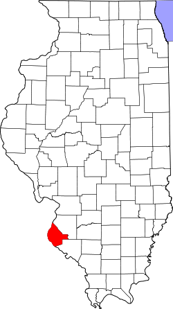
Geography
According to the U.S. Census Bureau, the county has a total area of 398 square miles (1,030km2), of which 385 square miles (1,000km2) is land and 13 square miles (34km2) (3.3%) is water.[10]
The western part of the county on the Mississippi River is part of the American Bottom floodplain, while the eastern portion of the county is relatively flat and was originally prairie. The transition zone between has high bluffs of limestone and dolomite and has distinctive Karst topography with numerous sinkholes, caves, and springs. Mississippi River bluffs along Monroe County's western border make the county part of the “Illinois Ozarks.” The county's roughly 500 limestone sinkholes, most filled with dense woods, add to Monroe County's unusual visual appeal.
In recent years, average temperatures in the county seat of Waterloo have ranged from a low of 20°F (−7°C) in January to a high of 89°F (32°C) in July, although a record low of −18°F (−28°C) was recorded in December 1989 and a record high of 107°F (42°C) was recorded in August 1962. Average monthly precipitation ranged from 2.32 inches (59mm) in January to 4.25 inches (108mm) in July.[11]
As of the 2020 census, the county had a population of 34,962. The median age was 42.8 years. 22.8% of residents were under the age of 18 and 18.9% of residents were 65 years of age or older. For every 100 females there were 98.7 males, and for every 100 females age 18 and over there were 95.7 males age 18 and over.[18]
58.5% of residents lived in urban areas, while 41.5% lived in rural areas.[20]
There were 13,752 households in the county, of which 31.8% had children under the age of 18 living in them. Of all households, 60.7% were married-couple households, 13.9% were households with a male householder and no spouse or partner present, and 20.5% were households with a female householder and no spouse or partner present. About 23.1% of all households were made up of individuals and 11.8% had someone living alone who was 65 years of age or older.[18]
There were 14,540 housing units, of which 5.4% were vacant. Among occupied housing units, 81.9% were owner-occupied and 18.1% were renter-occupied. The homeowner vacancy rate was 0.9% and the rental vacancy rate was 5.4%.[18]
Racial and ethnic composition
Monroe County, Illinois – Racial and ethnic composition Note: the US Census treats Hispanic/Latino as an ethnic category. This table excludes Latinos from the racial categories and assigns them to a separate category. Hispanics/Latinos may be of any race.
As of the 2010 United States census, there were 32,957people, 12,589households, and 9,375families residing in the county.[30] The population density was 85.6 inhabitants per square mile (33.1/km2). There were 13,392 housing units at an average density of 34.8 per square mile (13.4/km2).[10] The racial makeup of the county was 98.0% white, 0.4% Asian, 0.2% American Indian, 0.2% black or African American, 0.3% from other races, and 0.8% from two or more races. Those of Hispanic or Latino origin made up 1.4% of the population.[30] In terms of ancestry, 53.9% were German, 16.5% were Irish, 9.6% were English, and 6.2% were American.[31]
Of the 12,589households, 34.7% had children under the age of 18 living with them, 62.9% were married couples living together, 7.9% had a female householder with no husband present, 25.5% were non-families, and 21.5% of all households were made up of individuals. The average household size was 2.59 and the average family size was 3.02. The median age was 41.0 years.[30]
The median income for a household in the county was $68,253 and the median income for a family was $80,832. Males had a median income of $55,988 versus $39,375 for females. The per capita income for the county was $31,091. About 3.5% of families and 4.5% of the population were below the poverty line, including 4.3% of those under age 18 and 2.4% of those age 65 or over.[32]
Transportation
Highways
Interstate 255 Overlaps U.S. Highway 50 From Jefferson Barracks Bridge and Missouri east to Route 3 north of Columbia, then north toward Dupo
Provides access to the Interstate System, South Saint Louis County via the J.B. bridge as well as Downtown St. Louis and western St. Clair County
U.S. Highway 50 Overlaps Interstate 255 From Jefferson Barracks Bridge and Missouri east to Route 3 north of Columbia, then north toward Dupo
Provides access to the Interstate System, South Saint Louis County via the J.B. bridge as well as Downtown St. Louis and western St. Clair County
Illinois Route 3 From Interstate 255 and Dupo south southeast through Columbia and Waterloo on turning east toward Red Bud
Main north-south corridor and the backbone of Monroe County
Illinois Route 156 From western terminus at Valmeyer east through Waterloo to Hecker and on to the eastern terminus at Illinois Route 13 west of New Athens and south of Freeburg
Briefly overlaps Illinois Route 159 in and just north of Hecker
Also called the Valmeyer highway or Hecker highway, west and east of Waterloo, respectively, it runs from the bluffs of the Mississippi to the Kaskaskia
Illinois Route 158 From western terminus south of Columbia at Route 3, east northeast toward Millstadt
The area's main link with central and eastern St. Clair County for those not near Hecker
Illinois Route 159 From southern terminus in Red Bud at Route 3 and Route 154, north through Prairie du Long to Hecker and on toward Smithton
Briefly overlaps Illinois Route 156 in and just north of Hecker
Significant eastern north-south corridor, provides alternate routes, and primary north-south link for Prairie Du Long and Hecker
County roads
Bluff Road
runs along the bluffs from Palmer Rd. northwest of Columbia, through old Valmeyer and Chalfin Bridge, past Fults to Prairie du Rocher in Randolph County
Maeystown Road
runs from Illinois Route 3 in Waterloo (as Lakeview Drive) through Wartburg and Maeystown to Bluff Rd. at Chalfin Bridge
Kaskaskia Road
historic route from Kaskaskia to St. Louis, leaves Illinois Route 3 south of Waterloo, passes through Burksville and St. Joe, descends into the Bottoms outside Renault, crosses Bluff Rd. and railroad tracks to Stringtown Rd.
Hanover Road
Runs from Route 3 west, past New Hanover down the Fountain Gap to Bluff Rd. at Miles Rd. and B Rd.. Marks approximate future border between Columbia and Waterloo.
Gall Road
Northern terminus at Rt. 3/Main St. four-way in Columbia, south across Hanover Rd., and southern terminus at HH Rd. northwest of Waterloo and near Annbriar Golf Course.
HH Road
Runs from Gilmore Lakes Rd., north of Floraville Rd., west across Route 3 in Waterloo (as Country Club Ln.) to Bluff Rd. east of Fountain
KK Road
Runs from the Mississippi River levee opposite Crystal City, Missouri, west across Bluff Rd. up the bluffs at Monroe City, through Madonnaville, across Maeystown Rd., through Burksville and Burksville Station, across Route 3 to J Rd. south of Route 156
LL Road
With a western terminus at Franklin St. in Maeystown, it travels east across Kaskaskia Rd., through Tipton, across Route 3, temporarily overlaps with J Rd. for about 0.5 miles east of Rt. 3 and west of Rt. 159, crosses Rt. 159 south of Hecker and north of Red Bud, ends with eastern terminus at Beck Rd. just west of the Kaskaskia River and near the Nike Missile Site.
The closest access to and bridges over the Kaskaskia are downriver at Baldwin in Randolph County via Route 154 and upriver at New Athens in St. Clair County via Route 13. South of Monroe County, there is a ferry across the Mississippi in Randolph County, providing access to Ste. Genevieve, Missouri and Pere Marquette State Park, and a bridge at Chester via Route 150.
Rail
While the railroad played a large part in the history and development of the county, the main line through the county, running along Illinois Route 3, has been abandoned and removed. However, Union Pacific tracks run through the Bottoms from the intermodal yard at Dupo in St. Clair County, running roughly parallel to Bluff Rd. which crosses them several times, through old Valmeyer and Fults on past Prairie du Rocher in Randolph County. The tracks are still in use, but carry only freight, and have no stops in Monroe County.
Aviation
There is a small airfield in the Bottoms west of Columbia called Sackman Field.
For census and election purposes, Monroe County is currently divided into 37 numbered precincts. However, for geographical, genealogical, and historic purposes the older, named precincts are of greater utility.
Bluff Precinct
named for the ubiquitous limestone cliffs it sits atop and which run along its western bounds.
Columbia Precinct
formerly Eagle Precinct from the original French name for their settlement, L'Aigle
Monroe County was hostile to the “Yankee” Civil War owing to Copperhead sentiment and voted solidly Democratic until Theodore Roosevelt carried the county in 1904. Since that time, however, the county has become predominately Republican, and the only Democrats to gain a majority since 1904 have been Catholic Al Smith in 1928, Franklin D. Roosevelt in 1932 and 1936, and Lyndon Johnson in 1964. Since 1968, Monroe County has been carried by the Republican Presidential nominee in every election except when Bill Clinton won a narrow plurality in 1992.
United States presidential election results for Monroe County, Illinois[34]
↑"Find a County". National Association of Counties. Retrieved June 7, 2011.
↑Counties of Illinois, p. 32-33. With Twenty-three Maps Showing the Original and the Present Boundary Lines of Each County of the State, Retrieved on January 22, 2008.
↑Combined History of Randolph, Monroe and Perry Counties, Illinois, J. L. McDonough & Co., Philadelphia, 1883
↑F. Terry Norris, "Where Did the Villages Go? Steamboats, Deforestation, and Archaeological Loss in the Mississippi Valley", in Common Fields: An Environmental History of St. Louis, Andrew Hurley, ed., St. Louis, MO: Missouri Historical Society Press, 1997, pp. 73-89
This page is based on this Wikipedia article Text is available under the CC BY-SA 4.0 license; additional terms may apply. Images, videos and audio are available under their respective licenses.