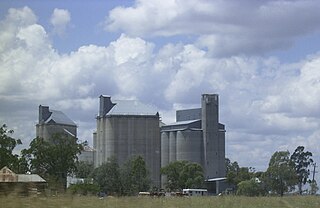
Millmerran, known as Domville between 1 June 1889 and 16 November 1894, is a town and a locality in the Toowoomba Region, Queensland, Australia. In the 2016 census, Millmerran had a population of 1,563 people.

Blue Mountain Heights is a locality in the Toowoomba Region, Queensland, Australia.

Mount Rascal is a rural locality in the Toowoomba Region, Queensland, Australia. In the 2016 census, Mount Rascal had a population of 462 people.

Top Camp is a locality in the Toowoomba Region, Queensland, Australia. In the 2016 census, Top Camp had a population of 852 people.

Wellcamp is a rural locality in Toowoomba Region, Queensland, Australia, located 16 kilometres (10 mi) west of the city centre. At the 2016 census, Wellcamp recorded a population of 295.

Hodgson Vale is a rural locality in the Toowoomba Region, Queensland, Australia. In the 2016 census, Hodgson Vale had a population of 1,379 people.

Mount Kynoch is a rural locality in the Toowoomba Region, Queensland, Australia. In the 2016 census, Mount Kynoch had a population of 237 people.

Prince Henry Heights is a residential locality on the outskirts of Toowoomba in the Toowoomba Region, Queensland, Australia. In the 2016 census, Prince Henry Heights had a population of 571 people.

Linthorpe is a rural locality in the Toowoomba Region, Queensland, Australia. In the 2016 census, Linthorpe had a population of 440 people.

Mount Irving is a rural locality in the Toowoomba Region, Queensland, Australia. In the 2016 census, Mount Irving had a population of 15 people.

Captains Mountain is a locality in the Toowoomba Region, Queensland, Australia. In the 2016 census, Captains Mountain had a population of 77 people.

Ramsay is a rural locality in the Toowoomba Region, Queensland, Australia. In the 2016 census Ramsay had a population of 348 people.

Evanslea is a rural locality in the Toowoomba Region, Queensland, Australia. In the 2016 census Evanslea had a population of 41 people.

Ellangowan is a locality in the Toowoomba Region, Queensland, Australia. In the 2016 census, Ellangowan had a population of 121 people.

Brookstead is a rural town and locality in the Toowoomba Region, Queensland, Australia. In the 2016 census, Brookstead had a population of 217 people.

Gowrie Mountain is a locality in the Toowoomba Region, Queensland, Australia. In the 2016 census, Gowrie Mountain had a population of 224 people.

Mount Emlyn is a rural locality in the Toowoomba Region, Queensland, Australia. In the 2016 census Mount Emlyn had a population of 16 people.

Mount Binga is a rural locality in the Toowoomba Region, Queensland, Australia. In the 2016 census Mount Binga had a population of 67 people.

Sandy Camp is a locality in the Toowoomba Region, Queensland, Australia. In the 2016 census, Sandy Camp had a population of 85 people.

Scrubby Mountain is a rural locality in the Toowoomba Region, Queensland, Australia. In the 2016 census, Scrubby Mountain had a population of 164 people.


