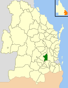
The Shire of Crows Nest was a local government area in the Darling Downs region of Queensland, Australia, immediately northeast of the regional city of Toowoomba. The shire, administered from the town of Crows Nest, covered an area of 1,629.9 square kilometres (629.3 sq mi), and existed as a local government entity from 1913 until 2008, when it amalgamated with several other councils in the Toowoomba area to form the Toowoomba Region. Its growth in later years has been fuelled by the expansion of Toowoomba, particularly the suburbs of Highfields and Blue Mountain Heights which, with a combined population of 7,333 in 2006, were home to over half the shire's population.

The Shire of Rosalie was a local government area in the Darling Downs region of Queensland, Australia, immediately northwest of the regional city of Toowoomba. The shire, administered from the town of Goombungee, covered an area of 2,200.7 square kilometres (849.7 sq mi), and existed as a local government entity from 1879 until 2008. In 2008, it amalgamated with several other councils in the Toowoomba area to form the Toowoomba Region.
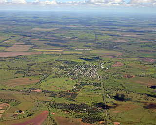
Bell is a rural town and locality in the Western Downs Region, Queensland, Australia. In the 2016 census, the locality of Bell had a population of 502 people.

Crows Nest is a rural town and locality in the Toowoomba Region, Queensland, Australia. The town is located in the Darling Downs on the New England Highway, 158 kilometres (98 mi) from the state capital, Brisbane and 43 kilometres (27 mi) from the nearby city of Toowoomba. In the 2016 census, Crows Nest had a population of 2160 people.
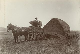
Kingsthorpe is a rural town and locality in the Toowoomba Region, Queensland, Australia. In the 2021 census, the locality of Kingsthorpe had a population of 2,159 people.

Cabarlah is a rural town and locality in the Toowoomba Region, Queensland, Australia. In the 2016 census the locality of Cabarlah had a population of 1,075 people.
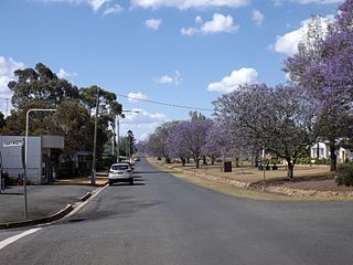
Goombungee is a rural town and locality in the Toowoomba Region, Queensland, Australia. In the 2016 census the locality of Goombungee had a population of 1,026 people.
Haden Branch Railway was a branch railway line from Kingsthorpe to Goombungee and Haden in the Darling Downs, Queensland, Australia.

Vale View is a rural locality in the Toowoomba Region, Queensland, Australia. In the 2016 census, Vale View had a population of 472 people.
Haden is a rural town and locality in the Toowoomba Region, Queensland, Australia. In the 2016 census, the locality of Haden had a population of 195 people.

Boodua is a rural locality in the Toowoomba Region, Queensland, Australia. In the 2016 census Boodua had a population of 93 people.

Meringandan West is a rural locality in the Toowoomba Region, Queensland, Australia. In the 2016 census, Meringandan West had a population of 2211 people.
Bybera is a rural locality in the Goondiwindi Region, Queensland, Australia. In the 2016 census, Bybera had a population of 3 people.
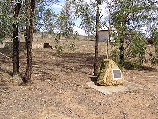
Douglas is a rural locality in the Toowoomba Region, Queensland, Australia. In the 2016 census, Douglas had a population of 112 people.
Cutella is a rural locality in the Toowoomba Region, Queensland, Australia. In the 2021 census, Cutella had a population of 45 people.
Doctor Creek is a rural locality in the Toowoomba Region, Queensland, Australia. In the 2016 census, Doctor Creek had a population of 37 people.
Mount Darry is a rural locality in the Toowoomba Region, Queensland, Australia. In the 2016 census Mount Darry had a population of 35 people.
Glenaven is a rural locality in the Toowoomba Region, Queensland, Australia. In the 2016 census, Glenaven had a population of 79 people.
Upper Pinelands is a rural locality in the Toowoomba Region, Queensland, Australia. In the 2016 census, Upper Pinelands had a population of 33 people.
The roads that join the towns of Dalby, Toowoomba and Cooyar form a triangle that encloses some of the most fertile land on the Darling Downs in Queensland, Australia. These roads are the Warrego Highway, New England Highway and Dalby–Cooyar Road. Pechey–Maclagan Road forms a large part of a group of roads that bisect the triangle from east to west, and is also part of one of the groups of roads that bisect from south to north.


