East Greenmount, Queensland

Last updated

East Greenmount
Queensland
Landscape, East Greenmount, Toowoomba Region, 2022 03.jpg
East Greenmount farmland with the Great Dividing Range in the east, 2022
Australia Queensland location map.svg
Red pog.svg
East Greenmount
Coordinates 27°46′49″S151°56′26″E / 27.7802°S 151.9405°E / -27.7802; 151.9405 (East Greenmount (town centre))
Population351 (2021 census) [1]
 • Density8.220/km2 (21.29/sq mi)
Postcode(s) 4359
Area42.7 km2 (16.5 sq mi)
Time zone AEST (UTC+10:00)
Location
LGA(s) Toowoomba Region
State electorate(s) Condamine
Federal division(s) Groom
Localities around East Greenmount:
Cambooya Ramsay Ramsay
Greenmount East Greenmount Budgee
Nobby Nobby Ascot

East Greenmount is a rural town and locality in the Toowoomba Region, Queensland, Australia. [2] [3] In the 2021 census, the locality of East Greenmount had a population of 351 people. [1]

Contents

Geography

New England Highway in East Greenmount, 2022 New England Highway, looking north from Emu Creek State School, East Greenmount, 2022.jpg
New England Highway in East Greenmount, 2022

East Greenmount is on the Darling Downs and, as its name suggests, to the immediate east of the locality of Greenmount. The town is in west of the locality at the junction of the New England Highway and the Greenmount Clifton Road. [4]

The New England Highway enters the locality from the south (Nobby), passes immediately east of the town and exits to the north-west (Cambooya). [5] [4]

Mount Sibley, 2014 Mount Sibley East Greenmount.jpg
Mount Sibley, 2014

Mount Sibley is an isolated peak in the south-east of East Greenmount ( 27°48′04″S151°57′53″E / 27.8012°S 151.9648°E / -27.8012; 151.9648 (Mount Sibley) ), rising to 676 metres (2,218 ft) above sea level. [6] [4] The mountain was named after James Sibley, a pastoralist and publican, who leased the Clifton pastoral run in the early 1840s. [7]

Emu Creek commences at the northern boundary of the locality (formed by the confluence of Elliott Creek and Allan Gully in Ramsay) and exits to the west (Greenmount). It is a tributary of Hodgson Creek, which is a tributary of the Condamine River, part of the Murray–Darling basin. [4]

History

The name Greenmount comes from a farm name used by Donald Mackintosh who represented the area as a Member of the Queensland Legislative Assembly for Cambooya from 1899 to 1912 and Pittsworth from 1912 to 1915. [2]

Emu Creek State School opened on 31 May 1875. [8] It takes its name from the creek which flows through the locality and not from the locality of Emu Creek (101 kilometres (63 mi) further north. [9]

Until 13 May 2005, the official name for the locality was Greenmount East. [2]

Demographics

In the 2016 census, the locality of East Greenmount had a population of 361 people. [10]

In the 2021 census, the locality of East Greenmount had a population of 351 people. [1]

Education

Emu Creek State School, 2022 Emu Creek State School, 2022 01.jpg
Emu Creek State School, 2022

Emu Creek State School is a government primary (Prep-6) school for boys and girls at 14534 New England Highway ( 27°47′00″S151°56′41″E / 27.7833°S 151.9448°E / -27.7833; 151.9448 (Emu Creek State School) ). [11] [12] In 2017, the school had an enrolment of 24 students with 2 teachers and 5 non-teaching staff (2 full-time equivalent). [13] In 2018, the school had an enrolment of 29 students with 3 teachers (2 full-time equivalent) and 5 non-teaching staff (3 full-time equivalent). [14]

There are no secondary schools in East Greenmount. The nearest government secondary schools are Clifton State High School in Clifton to the south and two schools in Toowoomba to the north: Harristown State High School in Harristown and Centenary Heights State High School in Centenary Heights. [5]

Facilities

Greenmount Waste Facility is at 123 Falknau Road ( 27°45′56″S151°55′37″E / 27.7655°S 151.9269°E / -27.7655; 151.9269 (Greenmount Waste Facility) ). It is operated by the Toowoomba Regional Council. [15]

Amenities

Steele Rudd Park is at 172 Steele Rudd Road ( 27°47′10″S151°57′45″E / 27.7860°S 151.9624°E / -27.7860; 151.9624 (Steele Rudd Park) ). It is dedicated to the family of Steele Rudd and features replica historical buildings. [16]

Related Research Articles

<span class="mw-page-title-main">Nobby, Queensland</span> Town in Queensland, Australia

Nobby is a rural town and locality on the Darling Downs in the Toowoomba Region, Queensland, Australia. It is located halfway between Toowoomba and Warwick. It is known for its association with Steele Rudd (author) and Sister Elizabeth Kenny.

<span class="mw-page-title-main">Drayton, Queensland</span> Suburb of Toowoomba, Queensland, Australia

Drayton is a rural locality in the Toowoomba Region, Queensland, Australia. In the 2021 census, Drayton had a population of 1,813 people.

<span class="mw-page-title-main">Clifton, Queensland</span> Town in Queensland, Australia

Clifton is a rural town and locality in the Toowoomba Region, Queensland, Australia. In the 2021 census, the locality of Clifton had a population of 1,490 people.

<span class="mw-page-title-main">Greenmount, Queensland (Toowoomba Region)</span> Town in Queensland, Australia

Greenmount is a rural town and locality in the Toowoomba Region, Queensland, Australia. In the 2021 census, the locality of Greenmount had a population of 765 people.

<span class="mw-page-title-main">Shire of Cambooya</span> Local government area in Queensland, Australia

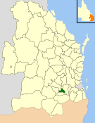
The Shire of Cambooya was a local government area in the Darling Downs region of Queensland, Australia, immediately south of the regional city of Toowoomba. The shire, administered from the town of Greenmount, covered an area of 638.5 square kilometres (246.5 sq mi), and existed as a local government entity from 1914 until 2008, when it amalgamated with several other councils in the Toowoomba area to form the Toowoomba Region.

<span class="mw-page-title-main">Cambooya, Queensland</span> Town in Queensland, Australia

Cambooya is a rural town and locality in the Toowoomba Region, Queensland, Australia. In the 2021 census, the locality of Cambooya had a population of 2,260 people.

Wyreema is a rural town and locality in the Toowoomba Region, Queensland, Australia. In the 2021 census, the locality of Wyreema had a population of 2,076 people.

<span class="mw-page-title-main">Wellcamp, Queensland</span> Suburb of Toowoomba Region, Queensland, Australia

Wellcamp is a rural locality in the Toowoomba Region, Queensland, Australia. In the 2021 census, Wellcamp had a population of 346 people.

<span class="mw-page-title-main">Harristown, Queensland</span> Suburb of Toowoomba, Queensland, Australia

Harristown is a residential locality in Toowoomba in the Toowoomba Region, Queensland, Australia. In the 2021 census, Harristown had a population of 9,081 people.

Hodgson Vale is a rural locality in the Toowoomba Region, Queensland, Australia. In the 2021 census, Hodgson Vale had a population of 1,444 people.

Kearneys Spring is a residential locality in Toowoomba in the Toowoomba Region, Queensland, Australia. In the 2021 census, Kearneys Spring had a population of 9,419 people.

<span class="mw-page-title-main">West Haldon, Queensland</span> Suburb of Toowoomba Region, Queensland, Australia

West Haldon is a locality split between Toowoomba Region and Lockyer Valley Region in Queensland, Australia. In the 2021 census, West Haldon had a population of 63 people.

<span class="mw-page-title-main">Ascot, Queensland (Toowoomba Region)</span> Suburb of Toowoomba Region, Queensland, Australia

Ascot is a rural locality in the Toowoomba Region, Queensland, Australia. In the 2021 census, Ascot had a population of 106 people.

<span class="mw-page-title-main">Felton, Queensland</span> Suburb of Toowoomba Region, Queensland, Australia

Felton is a rural locality in the Toowoomba Region, Queensland, Australia. In the 2021 census, Felton had a population of 267 people.

<span class="mw-page-title-main">Spring Creek, Queensland (Darling Downs)</span> Suburb of Toowoomba Region, Queensland, Australia

Spring Creek is a rural locality split between the Toowoomba Region and the Southern Downs Region, Queensland, Australia. In the 2021 census, Spring Creek had a population of 195 people.

Ramsay is a rural locality in the Toowoomba Region, Queensland, Australia. In the 2021 census, Ramsay had a population of 369 people.

<span class="mw-page-title-main">North Branch, Queensland (Toowoomba Region)</span> Suburb of Toowoomba Region, Queensland, Australia

North Branch is a locality in the Toowoomba Region, Queensland, Australia. In the 2021 census, North Branch had a population of 48 people.

<span class="mw-page-title-main">Umbiram, Queensland</span> Suburb of Toowoomba Region, Queensland, Australia

Umbiram is a rural locality in the Toowoomba Region, Queensland, Australia. In the 2021 census, Umbiram had a population of 146 people.

Kings Creek is a rural locality in the Toowoomba Region, Queensland, Australia. In the 2021 census, Kings Creek had a population of 55 people.

Emu Creek is a rural locality in the Toowoomba Region, Queensland, Australia. In the 2021 census, Emu Creek had a population of 113 people.

References

  1. 1 2 3 Australian Bureau of Statistics (28 June 2022). "East Greenmount (SAL)". 2021 Census QuickStats. Retrieved 28 February 2023. OOjs UI icon edit-ltr-progressive.svg
  2. 1 2 3 "East Greenmount – town in Toowoomba Region (entry 43706)". Queensland Place Names. Queensland Government . Retrieved 29 December 2020.
  3. "East Greenmount – locality in Toowoomba Region (entry 49259)". Queensland Place Names. Queensland Government . Retrieved 29 December 2020.
  4. 1 2 3 4 "Queensland Globe". State of Queensland . Retrieved 17 April 2022.
  5. 1 2 Google (29 July 2019). "East Greenmount, Queensland" (Map). Google Maps . Google. Retrieved 29 July 2019.
  6. "Mountain peaks and capes - Queensland". Queensland Open Data. Queensland Government. 12 November 2020. Archived from the original on 25 November 2020. Retrieved 25 November 2020.
  7. "Mount Sibley – mountain in the Toowoomba Region (entry 30800)". Queensland Place Names. Queensland Government . Retrieved 17 April 2022.
  8. Queensland Family History Society (2010), Queensland schools past and present (Version 1.01 ed.), Queensland Family History Society, ISBN   978-1-921171-26-0
  9. "Our school". Emu Creek State School. 24 February 2019. Archived from the original on 20 March 2022. Retrieved 17 April 2022.
  10. Australian Bureau of Statistics (27 June 2017). "East Greenmount (SSC)". 2016 Census QuickStats. Retrieved 20 October 2018. OOjs UI icon edit-ltr-progressive.svg
  11. "State and non-state school details". Queensland Government. 9 July 2018. Archived from the original on 21 November 2018. Retrieved 21 November 2018.
  12. "Emu Creek State School". Emu Creek State School. 24 February 2019. Archived from the original on 8 March 2020. Retrieved 17 April 2022.
  13. "ACARA School Profile 2017". Archived from the original on 22 November 2018. Retrieved 22 November 2018.
  14. "ACARA School Profile 2018". Australian Curriculum, Assessment and Reporting Authority. Archived from the original on 27 August 2020. Retrieved 28 January 2020.
  15. "Waste facilities - operating hours, locations, fees & accepted waste materials". Toowoomba Regional Council . 17 December 2020. Archived from the original on 22 January 2021. Retrieved 22 January 2021.
  16. "East Greenmount - Steele Rudd Park". Toowoomba Regional Council . 1 October 2020. Archived from the original on 18 June 2015. Retrieved 22 January 2021.

Further reading

Commons-logo.svg Media related to East Greenmount, Queensland at Wikimedia Commons