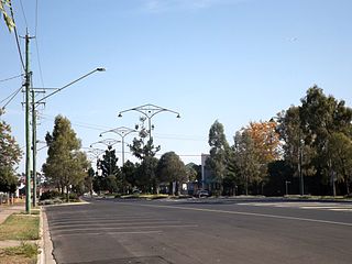
Oakey is a rural town and locality in the Toowoomba Region, Queensland, Australia. The Museum of Army Aviation is located at Oakey Airport.

Kaimkillenbun is a rural town and locality in the Western Downs Region, Queensland, Australia. In the 2016 census, the locality of Kaimkillenbun had a population of 293 people.

Jandowae is a rural town and locality in the Western Downs Region, Queensland, Australia. In the 2016 census the locality of Jandowae had a population of 1,047 people.

Bowenville is a rural town and locality in the Toowoomba Region, Queensland, Australia. The town's economy rested on the rail industry and with the winding down of the railways the population declined. In the 2016 census, the locality of Bowenville had a population of 250 people.
Moola is a rural locality in the Western Downs Region, Queensland, Australia. In the 2016 census Moola had a population of 123 people.

Quinalow is a rural town and locality in the Toowoomba Region, Queensland, Australia. In the 2016 census the locality of Quinalow had a population of 173 people.

Jondaryan is a rural town and locality in the Toowoomba Region, Queensland, Australia. In the 2016 census, the locality of Jondaryan had a population of 385 people.

Maclagan is a rural town and locality in the Toowoomba Region, Queensland, Australia. In the 2016 census the locality of Maclagan had a population of 195 people.

Boodua is a rural locality in the Toowoomba Region, Queensland, Australia. In the 2016 census Boodua had a population of 93 people.

Gowrie Little Plain is a rural locality in the Toowoomba Region, Queensland, Australia. In the 2021 census, Gowrie Little Plain had a population of 79 people.

Bongeen is a rural locality in the Toowoomba Region, Queensland, Australia. In the 2016 census, Bongeen had a population of 75 people.
Ducklo is a locality in the Western Downs Region, Queensland, Australia. In the 2021 census, Ducklo had a population of 306 people.
Norwin is a rural locality in the Toowoomba Region, Queensland, Australia. In the 2016 census, Norwin had a population of 94 people.
Nutgrove is a rural locality in the Toowoomba Region, Queensland, Australia. In the 2016 census Nutgrove had a population of 32 people.
Jinghi is a rural locality in the Western Downs Region, Queensland, Australia. In the 2016 census, Jinghi had a population of 74 people.
Irvingdale is a locality split between the Toowoomba Region and the Western Downs Region, both in Queensland, Australia. In the 2021 census, Irvingdale had a population of 163 people.
Kings Siding is a rural locality in the Toowoomba Region, Queensland, Australia. In the 2021 census, Kings Siding had a population of 15 people.
Oakey–Cooyar Road is a continuous 58.8 kilometres (36.5 mi) road route in the Darling Downs and Toowoomba regions of Queensland, Australia. The entire route is signed as State Route 68. It is a state-controlled part regional and part district road. It provides an alternate route between the Warrego Highway and the New England Highway, bypassing Toowoomba.
The roads that join the towns of Dalby, Oakey and Cooyar form a triangle that encloses some of the most fertile land on the Darling Downs in Queensland, Australia. These roads are the Warrego Highway, Oakey–Cooyar Road and Dalby–Cooyar Road. Several of the more significant internal roads intersect with Dalby–Cooyar Road, and these are briefly described in this article, along with some significant external roads.
The roads that join the towns of Dalby, Toowoomba and Cooyar form a triangle that encloses some of the most fertile land on the Darling Downs in Queensland, Australia. These roads are the Warrego Highway, New England Highway and Dalby–Cooyar Road. Pechey–Maclagan Road forms a large part of a group of roads that bisect the triangle from east to west, and is also part of one of the groups of roads that bisect from south to north.
