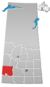
Village of Pennant | |
---|---|
Village | |
Coordinates: 50°32′10″N108°13′48″W / 50.536°N 108.230°W | |
Country | Canada |
Province | Saskatchewan |
Region | Saskatchewan |
Census division | 8 |
Rural Municipality | Riverside |
Incorporated (Village) | July 29, 1912 |
Government | |
• Mayor | Leslie Bayliss |
• Administrator | Brandi Trembath |
• Governing body | Pennant Village Council |
Area | |
• Total | 0.65 km2 (0.25 sq mi) |
Population (2016) | |
• Total | 130 |
• Density | 199.8/km2 (517/sq mi) |
Time zone | CST |
Postal code | S0N 1X0 |
Area code | 306 |
Highways | |
[1] [2] [3] [4] |
Pennant (2016 population: 130) is a village in the Canadian province of Saskatchewan within the Rural Municipality of Riverside No. 168 and Census Division No. 8.
Pennant incorporated as a village on July 29, 1912. [5]
Climate data for Pennant | |||||||||||||
---|---|---|---|---|---|---|---|---|---|---|---|---|---|
Month | Jan | Feb | Mar | Apr | May | Jun | Jul | Aug | Sep | Oct | Nov | Dec | Year |
Record high °C (°F) | 15 (59) | 17 (63) | 22 (72) | 33.9 (93.0) | 38.3 (100.9) | 41.1 (106.0) | 41.7 (107.1) | 40 (104) | 37.2 (99.0) | 33.9 (93.0) | 24 (75) | 20 (68) | 41.7 (107.1) |
Mean daily maximum °C (°F) | −7.2 (19.0) | −4.2 (24.4) | 2.7 (36.9) | 12 (54) | 18.7 (65.7) | 23.4 (74.1) | 25.8 (78.4) | 25.4 (77.7) | 19 (66) | 12.4 (54.3) | 1.3 (34.3) | −5 (23) | 10.4 (50.7) |
Daily mean °C (°F) | −12.6 (9.3) | −9.6 (14.7) | −2.9 (26.8) | 5.4 (41.7) | 11.7 (53.1) | 16.4 (61.5) | 18.6 (65.5) | 18 (64) | 12 (54) | 5.7 (42.3) | −4 (25) | −10.4 (13.3) | 4 (39) |
Mean daily minimum °C (°F) | −18 (0) | −14.9 (5.2) | −8.4 (16.9) | −1.3 (29.7) | 4.8 (40.6) | 9.3 (48.7) | 11.3 (52.3) | 10.6 (51.1) | 4.9 (40.8) | −0.9 (30.4) | −9.4 (15.1) | −15.9 (3.4) | −2.3 (27.9) |
Record low °C (°F) | −44.4 (−47.9) | −47.2 (−53.0) | −37.8 (−36.0) | −29.4 (−20.9) | −12.8 (9.0) | −4 (25) | 0.6 (33.1) | −2 (28) | −12.2 (10.0) | −25.6 (−14.1) | −36 (−33) | −47 (−53) | −47.2 (−53.0) |
Average precipitation mm (inches) | 13.4 (0.53) | 10.7 (0.42) | 16.5 (0.65) | 20.1 (0.79) | 49.3 (1.94) | 70.8 (2.79) | 56.7 (2.23) | 42.4 (1.67) | 27.7 (1.09) | 15 (0.6) | 11 (0.4) | 12.4 (0.49) | 345.9 (13.62) |
Source: Environment Canada [6] |
In the 2021 Census of Population conducted by Statistics Canada, Pennant had a population of 120 living in 55 of its 65 total private dwellings, a change of -7.7% from its 2016 population of 130. With a land area of 0.65 km2 (0.25 sq mi), it had a population density of 184.6/km2 (478.2/sq mi) in 2021. [9]
In the 2016 Census of Population, the Village of Pennant recorded a population of 130 living in 62 of its 68 total private dwellings, a 7.7% change from its 2011 population of 120. With a land area of 0.65 km2 (0.25 sq mi), it had a population density of 200.0/km2 (518.0/sq mi) in 2016. [10]
Pilger is a village in the Canadian province of Saskatchewan within the Rural Municipality of Three Lakes No. 400 and Census Division No. 15. It is approximately 100 kilometres (62 mi) northeast of the city of Saskatoon.
Pelly is a village in the Canadian province of Saskatchewan within the Rural Municipality of St. Philips No. 301 and Census Division No. 9.
Atwater is a village in the Canadian province of Saskatchewan within the Rural Municipality of Fertile Belt No. 183 and Census Division No. 5. The village is approximately 45 kilometres (28 mi) southeast of the city of Melville on Highway 629.
Aylsham is a village in the Canadian province of Saskatchewan within the Rural Municipality of Nipawin No. 487 and Census Division No. 14. The village is approximately 65 km (40 mi) northeast of the city of Melfort.
Stewart Valley is a village in the Canadian province of Saskatchewan within the Rural Municipality of Saskatchewan Landing No. 167 and Census Division No. 8. It is on Highway 4, just south of the South Saskatchewan River, approximately 35 km (22 mi) north of the City of Swift Current in southern Saskatchewan. It is along the remains of the historic Swift Current-Battleford Trail.
Maryfield is a village in the Canadian province of Saskatchewan within the Rural Municipality of Maryfield No. 91 and Census Division No. 1. The village lies south of the intersection of Highway 48 and Highway 600 and is about 8 kilometres (5.0 mi) west of the Manitoba border. It is a junction point on the Canadian National Railway between the main line heading northwest towards Regina and a branch line heading southwest toward Carlyle and Lampman.
Coderre ) is a village in the Canadian province of Saskatchewan within the Rural Municipality of Rodgers No. 133 and Census Division No. 7. The village is located approximately 85 km southwest of the City of Moose Jaw on Highway 627.
The Rural Municipality of Tecumseh No. 65 is a rural municipality (RM) in the Canadian province of Saskatchewan within Census Division No. 1 and SARM Division No. 1. It is located in the southeast portion of the province.
Duval is a village in the Canadian province of Saskatchewan within the Rural Municipality of Last Mountain Valley No. 250 and Census Division No. 11. The village is located on Highway 20, approximately 93 kilometres (58 mi) north of the city of Regina.
Fenwood is a village in the Canadian province of Saskatchewan within the Rural Municipality of Stanley No. 215 and Census Division No. 5.
Golden Prairie is a village in the Canadian province of Saskatchewan within the Rural Municipality of Big Stick No. 141 and Census Division No. 8.
Kincaid is a village in the Canadian province of Saskatchewan within the Rural Municipality of Pinto Creek No. 75 and Census Division No. 3.
Kelliher is a village in the Canadian province of Saskatchewan within the Rural Municipality of Kellross No. 247 and Census Division No. 10. The village is located about 140 km north of the City of Regina.
Lipton is a village in the Canadian province of Saskatchewan within the Rural Municipality of Lipton No. 217 and Census Division No. 6. The village is located 17 kilometres (11 mi) north of the town of Fort Qu'Appelle on Highway 22.
Medstead is a village in the Canadian province of Saskatchewan within the Rural Municipality of Medstead No. 497 and Census Division No. 16.
Viscount is a village in the Canadian province of Saskatchewan within the Rural Municipality of Viscount No. 341 and Census Division No. 11. Viscount is located on Saskatchewan Highway 16, the Yellowhead Highway, in central Saskatchewan east of Colonsay and west of Lanigan. As of the Canada 2016 Census, Viscount had a population of 232.
Waseca is a village in the Canadian province of Saskatchewan within the Rural Municipality of Eldon No. 471 and Census Division No. 17. Waseca is located on Highway 16, the Yellowhead Highway, in northwest Saskatchewan. Waseca is located east of Lashburn and west of Maidstone.
Quinton is a village in the Canadian province of Saskatchewan within the Rural Municipality of Mount Hope No. 279 and Census Division No. 10. The village is located on Highway 15 between the Town of Raymore and the Village of Punnichy. It is near the administrative office of the Kawacatoose First Nations.
Shamrock is a village in the Canadian province of Saskatchewan within the Rural Municipality of Shamrock No. 134 and Census Division No. 7.
Tugaske is a village in the Canadian province of Saskatchewan within the Rural Municipality of Huron No. 223 and Census Division No. 7. It is nicknamed Gateway to Lake Diefenbaker. It is near Eyebrow Lake, a prairie lake in the Qu'Appelle Valley. It was named after an eyebrow-shaped hill also in the Qu'Appelle Valley above Eyebrow Lake. The lake, which is 9 km long and 1 km wide, is a bird sanctuary and is near Highway 627.