Pampas, Queensland

Last updated

Pampas
Queensland
Pampas - Memorial Hall.jpg
Pampas Memorial Hall, 2009
Australia Queensland location map.svg
Red pog.svg
Pampas
Pampas, Queensland
Coordinates 27°48′S151°24′E / 27.8°S 151.4°E / -27.8; 151.4 (Pampas (centre of locality))
Population78 (2021 census) [1]
 • Density0.976/km2 (2.528/sq mi)
Postcode(s) 4352
Area79.9 km2 (30.8 sq mi)
Time zone AEST (UTC+10:00)
Location
LGA(s) Toowoomba Region
State electorate(s) Southern Downs
Federal division(s) Maranoa
Suburbs around Pampas:
Condamine Plains Brookstead Brookstead
Lemontree Pampas Tummaville
Yandilla Yandilla Yandilla

Pampas is a rural locality in the Toowoomba Region, Queensland, Australia. [2] In the 2021 census, Pampas had a population of 78 people. [1]

Contents

Geography

The locality is positioned between the main channel and north branch of the Condamine River both of which mark boundaries. The Millmerran railway line and Gore Highway pass through Pampas. The Pampas–Horrane Road (State Route 82) runs north-west to Cecil Plains. [3]

The land use is predominantly horticulture and cropping. [4]

History

Pampas is named because of the extensive coverage of kangaroo grass. [2]

Pampas railway station is an abandoned railway station on the Millmerran railway line ( 27°47′30″S151°24′42″E / 27.7916°S 151.4118°E / -27.7916; 151.4118 (Pampas railway station (former)) ). [5]

The Dry Paddock Provisional School opened on 9 August 1897. In 1909 it became Pampas State School. It closed on 27 December 1957. [6] [7] It was at 22 Fysh Road ( 27°47′28″S151°24′51″E / 27.7912°S 151.4141°E / -27.7912; 151.4141 (Pampas State School (former)) ). [8] [9] [4]

Pampas Memorial Hall was erected in late 1954. [10]

Demographics

In the 2016 census, Pampas had a population of 62 people. [11]

In the 2021 census, Pampas had a population of 78 people. [1]

Economy

There are a number of homesteads in the locality, including: [12]

Education

There are no schools in Pampas. The nearest government primary school is Brookstead State School in neighbouring Brookstead to the north-east. The nearest government secondary schools are Millmerran State School (to Year 10) in Millmerran to the south-west and Pittsworth State High School in Pittsworth to the north-east. [4]

Amenities

Pampas Memorial Hall is at 6179 Gore Highway ( 27°47′29″S151°24′39″E / 27.7913°S 151.4108°E / -27.7913; 151.4108 (Pampas Memorial Hall) ). [13] [14]

Related Research Articles

<span class="mw-page-title-main">Pittsworth, Queensland</span> Town in Queensland, Australia

Pittsworth is a rural town and locality in the Toowoomba Region, Queensland, Australia. In the 2021 census, the locality of Pittsworth had a population of 3,300 people.

<span class="mw-page-title-main">Millmerran, Queensland</span> Town in Queensland, Australia

Millmerran, known as Domville between 1 June 1889 and 16 November 1894, is a town and a locality in the Toowoomba Region, Queensland, Australia. In the 2021 census, the locality of Millmerran had a population of 1,545 people.

<span class="mw-page-title-main">Cecil Plains, Queensland</span> Town in Queensland, Australia

Cecil Plains is a rural town and locality in the Toowoomba Region, Queensland, Australia. In the 2021 census, the locality of Cecil Plains had a population of 380 people.

<span class="mw-page-title-main">Cambooya, Queensland</span> Town in Queensland, Australia

Cambooya is a rural town and locality in the Toowoomba Region, Queensland, Australia. In the 2021 census, the locality of Cambooya had a population of 2,260 people.

<span class="mw-page-title-main">Leyburn, Queensland</span> Town in Queensland, Australia

Leyburn is a rural town in the Southern Downs Region and a locality split between the South Downs Region and the Toowoomba Region in Queensland, Australia. In the 2021 census, the locality of Leyburn had a population of 566 people.

Wyreema is a rural town and locality in the Toowoomba Region, Queensland, Australia. In the 2021 census, the locality of Wyreema had a population of 2,076 people.

<span class="mw-page-title-main">Westbrook, Queensland</span> Town in Queensland, Australia

Westbrook is a rural town and locality in the Toowoomba Region, Queensland, Australia. In the 2021 census, the locality of Westbrook had a population of 4,408 people.

<span class="mw-page-title-main">Aubigny, Queensland</span> Town in Queensland, Australia

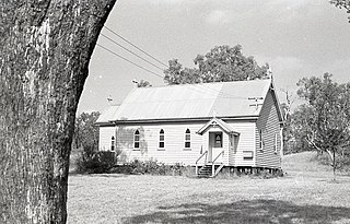
Aubigny is a rural town and locality in the Toowoomba Region, Queensland, Australia. In the 2021 census, the locality of Aubigny had a population of 283 people.

<span class="mw-page-title-main">Broxburn, Queensland</span> Suburb of Toowoomba Region, Queensland, Australia

Broxburn is a rural locality in the Toowoomba Region, Queensland, Australia. In the 2021 census, Broxburn had a population of 115 people.

<span class="mw-page-title-main">Linthorpe, Queensland</span> Suburb of Toowoomba Region, Queensland, Australia

Linthorpe is a rural locality in the Toowoomba Region, Queensland, Australia. In the 2021 census, Linthorpe had a population of 416 people.

<span class="mw-page-title-main">Domville, Queensland</span> Suburb of Toowoomba Region, Queensland, Australia

Domville is a rural locality in the Toowoomba Region, Queensland, Australia. In the 2021 census, Domville had "no people or a very low population".

Clontarf is a rural locality in the Toowoomba Region, Queensland, Australia. In the 2021 census, Clontarf had a population of 28 people.

Ellangowan is a rural locality in the Toowoomba Region, Queensland, Australia. In the 2021 census, Ellangowan had a population of 95 people.

<span class="mw-page-title-main">Brookstead, Queensland</span> Town in Queensland, Australia

Brookstead is a rural town and locality in the Toowoomba Region, Queensland, Australia. In the 2021 census, the locality of Brookstead had a population of 182 people.

Branchview is a rural locality in the Toowoomba Region, Queensland, Australia. In the 2021 census, Branchview had a population of 37 people.

<span class="mw-page-title-main">Bongeen, Queensland</span> Suburb of Toowoomba Region, Queensland, Australia

Bongeen is a rural locality in the Toowoomba Region, Queensland, Australia. In the 2021 census, Bongeen had a population of 71 people.

Irongate is a rural locality in the Toowoomba Region, Queensland, Australia. In the 2021 census, Irongate had a population of 135 people.

Norwin is a rural locality in the Toowoomba Region, Queensland, Australia. In the 2021 census, Norwin had a population of 100 people.

<span class="mw-page-title-main">Yarranlea, Queensland</span> Suburb of Toowoomba Region, Queensland, Australia

Yarranlea is a rural locality in the Toowoomba Region, Queensland, Australia. In the 2021 census, Yarranlea had a population of 82 people.

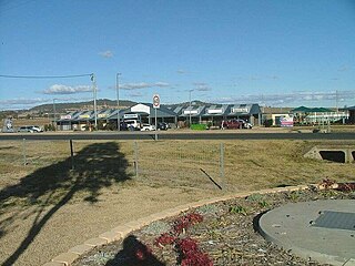
Toowoomba–Cecil Plains Road is a continuous 78.6 kilometres (48.8 mi) road route in the Toowoomba region of Queensland, Australia. Most of the road is not signed with any route number, but a short section near Cecil Plains is part of State Route 82. Toowoomba–Cecil Plains Road is a state-controlled district road, part of which is rated as a local road of regional significance (LRRS).

References

  1. 1 2 3 Australian Bureau of Statistics (28 June 2022). "Pampas (SAL)". 2021 Census QuickStats. Retrieved 28 February 2023. OOjs UI icon edit-ltr-progressive.svg
  2. 1 2 "Pampas – locality in Toowoomba Region (entry 48033)". Queensland Place Names. Queensland Government . Retrieved 12 February 2022.
  3. Google (29 July 2019). "Pampas, Queensland" (Map). Google Maps . Google. Retrieved 29 July 2019.
  4. 1 2 3 "Queensland Globe". State of Queensland . Retrieved 12 February 2022.
  5. "Railway stations and sidings - Queensland". Queensland Open Data. Queensland Government. 2 October 2020. Archived from the original on 5 October 2020. Retrieved 5 October 2020.
  6. "Opening and closing dates of Queensland Schools". Queensland Government . Retrieved 4 August 2015.
  7. "Agency ID 5892, Pampas State School". Queensland State Archives . Retrieved 5 August 2015.
  8. "Millmerran" (Map). Queensland Government. 1943. Archived from the original on 12 February 2022. Retrieved 12 February 2022.
  9. "Queensland Two Mile series sheet 2m42" (Map). Queensland Government. 1949. Archived from the original on 12 February 2022. Retrieved 12 February 2022.
  10. "PAMPAS PROGRESS ASSOCIATION". Pittsworth Sentinel . Vol. 54. Queensland, Australia. 1 October 1954. p. 3. Retrieved 12 February 2022 via National Library of Australia.
  11. Australian Bureau of Statistics (27 June 2017). "Pampas (SSC)". 2016 Census QuickStats. Retrieved 20 October 2018. OOjs UI icon edit-ltr-progressive.svg
  12. "Homesteads - Queensland". Queensland Open Data. Queensland Government. 18 November 2020. Archived from the original on 24 November 2020. Retrieved 24 November 2020.
  13. "Pampas Memorial Hall". Monument Australia. Archived from the original on 7 April 2014. Retrieved 4 April 2014.
  14. Google (12 February 2022). "Pampas Memorial Hall" (Map). Google Maps . Google. Retrieved 12 February 2022.

Further reading

Commons-logo.svg Media related to Pampas, Queensland at Wikimedia Commons