Polk County, Wisconsin

Last updated

Polk County
Polk County Wisconsin Courthouse.jpg
Polk County Highway Department in Balsam Lake
Map of Wisconsin highlighting Polk County.svg
Location within the U.S. state of Wisconsin
Wisconsin in United States.svg
Wisconsin's location within the U.S.
Coordinates: 45°28′N92°26′W / 45.46°N 92.44°W / 45.46; -92.44
CountryFlag of the United States.svg United States
StateFlag of Wisconsin.svg  Wisconsin
Founded1853
Named for James K. Polk [1]
Seat Balsam Lake
Largest city Amery
Area
  Total956 sq mi (2,480 km2)
  Land914 sq mi (2,370 km2)
  Water42 sq mi (110 km2)  4.4%
Population
 (2020) [2]
  Total44,977
  Density49.2/sq mi (19.0/km2)
Time zone UTC−6 (Central)
  Summer (DST) UTC−5 (CDT)
Congressional district 7th
Website www.co.polk.wi.us

Polk County is a county in the U.S. state of Wisconsin. As of the 2020 census, the population was 44,977. [2] Its county seat is Balsam Lake. [3] The county was created in 1853 and named for United States President James K. Polk. [4]

Contents

Geography

Soils of Polk County Polk Co WI Pie Chart No Text Version.pdf
Soils of Polk County

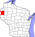
According to the U.S. Census Bureau, the county has an area of 956 square miles (2,480 km2), of which 914 square miles (2,370 km2) is land and 42 square miles (110 km2) (4.4%) is water. [6]

Adjacent counties

Major highways

Railroads

Buses

Airports

National protected area

Demographics

Historical population
CensusPop.Note
1860 1,400
1870 3,422144.4%
1880 10,018192.8%
1890 12,96829.4%
1900 17,80137.3%
1910 21,36720.0%
1920 26,87025.8%
1930 26,567−1.1%
1940 26,197−1.4%
1950 24,944−4.8%
1960 24,9680.1%
1970 26,6666.8%
1980 32,35121.3%
1990 34,7737.5%
2000 41,31918.8%
2010 44,2057.0%
2020 44,9771.7%
U.S. Decennial Census [7]
1790–1960 [8] 1900–1990 [9]
1990–2000 [10] 2010 [11] 2020 [2]

2020 census

As of the census of 2020, [2] the population was 44,977. The population density was 49.2 people per square mile (19.0 people/km2). There were 24,129 housing units at an average density of 26.4 units per square mile (10.2 units/km2). The racial makeup of the county was 93.5% White, 0.9% Native American, 0.5% Asian, 0.4% Black or African American, 0.8% from other races, and 3.9% from two or more races. Ethnically, the population was 2.1% Hispanic or Latino of any race.

2000 census

2000 Census Age Pyramid for Polk County USA Polk County, Wisconsin age pyramid.svg
2000 Census Age Pyramid for Polk County

As of the 2000 census, [12] there were 41,319 people, 16,254 households, and 11,329 families residing in the county. The population density was 45 people per square mile (17 people/km2). There were 21,129 housing units at an average density of 23 units per square mile (8.9 units/km2). The racial makeup of the county was 97.64% White, 0.15% Black or African American, 1.06% Native American, 0.26% Asian, 0.02% Pacific Islander, 0.20% from other races, and 0.67% from two or more races. 0.80% of the population were Hispanic or Latino of any race. 31.4% were of German, 18.6% Norwegian, 11.3% Swedish, 5.5% Irish and 5.3% American ancestry.

There were 16,254 households, out of which 32.10% had children under the age of 18 living with them, 58.20% were married couples living together, 7.40% had a female householder with no husband present, and 30.30% were non-families. 25.20% of all households were made up of individuals, and 10.60% had someone living alone who was 65 years of age or older. The average household size was 2.51 and the average family size was 3.01.

In the county, the population was spread out, with 26.20% under the age of 18, 6.70% from 18 to 24, 27.70% from 25 to 44, 24.30% from 45 to 64, and 15.10% who were 65 years of age or older. The median age was 39 years. For every 100 females there were 99.90 males. For every 100 females age 18 and over, there were 98.50 males.

In 2017, there were 400 births, giving a general fertility rate of 56.0 births per 1000 women aged 15–44, the 14th lowest rate out of all 72 Wisconsin counties. [13]

Education

Communities

The sign for Polk County while entering Wisconsin on US8 Polk County Wisconsin Sign US8 entering Wisconsin.jpg
The sign for Polk County while entering Wisconsin on US8

Cities

Villages

Towns

Census-designated place

Unincorporated communities

Notable residents

Politics

From its founding in 1853 through 1928, Polk County was a strongly Republican county in presidential elections, never once backing the Democratic candidate. The only two times in that span it did not support the Republican candidate were in 1912 when former Republican Theodore Roosevelt won the county as the Progressive candidate and in 1924 when Progressive and native Wisconsinite Robert M. La Follette won the county. Then, between 1932 and 2012, Polk County was a very consistently competitive county that leaned slightly Republican. Only two candidates in that span won at least 60% of the county's vote, Dwight D. Eisenhower in his 1952 landslide and Lyndon B. Johnson in his 1964 landslide. Polk County took a rightward turn in 2016, when Donald Trump won over 60% of the county's vote with a winning margin of over 27%, the best margin of victory in the county since 1928 with the exception of Johnson in 1964. Trump won in 2020 with the exact same margin of victory of over 27% while increasing his vote share to nearly 63%.

United States presidential election results for Polk County, Wisconsin [14]
Year Republican Democratic Third party
No.%No.%No.%
2020 16,61162.99%9,37035.53%3901.48%
2016 13,81060.72%7,56533.26%1,3706.02%
2012 12,09453.58%10,07344.62%4061.80%
2008 11,28249.83%10,87648.03%4852.14%
2004 12,09551.46%11,17347.54%2351.00%
2000 9,55748.36%8,96145.34%1,2446.29%
1996 5,38732.82%8,33450.78%2,69216.40%
1992 5,44630.14%7,74642.86%4,87927.00%
1988 6,86642.98%8,98156.22%1280.80%
1984 8,10649.82%8,03449.38%1290.79%
1980 7,20744.23%7,60746.68%1,4829.09%
1976 6,15941.27%8,48556.85%2801.88%
1972 6,56752.40%5,73845.78%2281.82%
1968 5,58348.83%5,17945.30%6715.87%
1964 3,75434.12%7,21565.57%340.31%
1960 6,38755.23%5,14844.51%300.26%
1956 5,89454.04%4,98545.71%270.25%
1952 6,96661.74%4,27437.88%420.37%
1948 3,97441.52%5,33055.68%2682.80%
1944 5,32953.58%4,48945.14%1271.28%
1940 6,03153.62%4,97944.27%2382.12%
1936 3,59634.25%5,61853.51%1,28512.24%
1932 3,42537.10%5,42158.72%3864.18%
1928 6,90575.14%2,17723.69%1081.18%
1924 2,79337.57%3174.26%4,32458.17%
1920 4,79680.47%75212.62%4126.91%
1916 2,08051.21%1,71342.17%2696.62%
1912 84827.14%83026.56%1,44746.30%
1908 2,78872.02%81621.08%2676.90%
1904 2,98585.55%2968.48%2085.96%
1900 2,73577.48%69419.66%1012.86%
1896 2,86174.56%89123.22%852.22%
1892 1,47760.33%58523.90%38615.77%

See also

Related Research Articles

<span class="mw-page-title-main">Waupaca County, Wisconsin</span> County in Wisconsin, United States

Waupaca County is a county in the U.S. state of Wisconsin. As of the 2020 census, the population was 51,812. The county seat is Waupaca. The county was created in 1851 and organized in 1853. It is named after the Waupaca River, a Menominee language name meaning 'white sand bottom', 'pale water', or 'tomorrow river'.

<span class="mw-page-title-main">Washburn County, Wisconsin</span> County in Wisconsin, United States

Washburn County is a county in the U.S. state of Wisconsin. It is named after Governor Cadwallader C. Washburn. As of the 2020 census, the population was 16,623. Its county seat is Shell Lake. The county was created in 1883.

<span class="mw-page-title-main">Trempealeau County, Wisconsin</span> County in Wisconsin, United States

Trempealeau County is a county in the U.S. state of Wisconsin. As of the 2020 census, the population was 30,760. Its county seat is Whitehall.

<span class="mw-page-title-main">St. Croix County, Wisconsin</span> County in Wisconsin, United States

St. Croix County is a county in the U.S. state of Wisconsin. As of the 2020 census, the population was 93,536. Its county seat is Hudson. The county was created in 1840 and organized in 1849. St. Croix County is part of the Minneapolis-St. Paul-Bloomington, MN-WI Metropolitan Statistical Area. Between 2000 and 2010, it was the fastest-growing county in Wisconsin.

<span class="mw-page-title-main">Pierce County, Wisconsin</span> County in Wisconsin, United States

Pierce County is a county in the U.S. state of Wisconsin. As of the 2020 census, the population was 42,212. Its county seat is Ellsworth.

<span class="mw-page-title-main">Pepin County, Wisconsin</span> County in Wisconsin, United States

Pepin County is a county in the U.S. state of Wisconsin. As of the 2020 census, the population was 7,318, making it the fourth-least populous county in Wisconsin; it is also the smallest county in Wisconsin by area. Its county seat is Durand.

<span class="mw-page-title-main">Dunn County, Wisconsin</span> County in Wisconsin, United States

Dunn County is a county in the U.S. state of Wisconsin. As of the 2020 census, the population was 45,440. Its county seat is Menomonie. Dunn County comprises the Menomonie Micropolitan Statistical Area and is included in the Eau Claire-Menomonie, WI Combined Statistical Area.

<span class="mw-page-title-main">Douglas County, Wisconsin</span> County in Wisconsin, United States

Douglas County is a county located at the northwest corner of the U.S. state of Wisconsin. As of the 2020 census, the population was 44,295 Its county seat is Superior. Douglas County is included in the Duluth, MN-WI Metropolitan Statistical Area.

<span class="mw-page-title-main">Burnett County, Wisconsin</span> County in Wisconsin, United States

Burnett County is a county located in the U.S. state of Wisconsin. As of the 2020 census, the population was 16,526. Its county seat is Siren, with the majority of county governmental services located at the Burnett County Government Center. The county was created in 1856 and organized in 1865. The St. Croix Chippewa Indians of Wisconsin have reservation lands in Burnett County and are the county's largest employer.

<span class="mw-page-title-main">Bayfield County, Wisconsin</span> County in Wisconsin, United States

Bayfield County is a county located in the U.S. state of Wisconsin. As of the 2020 census, its population is 16,220. Its county seat is Washburn. The county was created in 1845 and organized in 1850. The Red Cliff Band of Lake Superior Chippewa has a reservation in Bayfield County and is the county's largest employer.

<span class="mw-page-title-main">Barron County, Wisconsin</span> County in Wisconsin, United States

Barron County is a county located in the U.S. state of Wisconsin. As of the 2020 census, the population was 46,711. Its county seat is Barron. The county was created in 1859 and later organized in 1874.

<span class="mw-page-title-main">Ashland County, Wisconsin</span> County in Wisconsin, United States

Ashland County is a county located in the U.S. state of Wisconsin. As of the 2020 census, the population was 16,027. Its county seat is Ashland. The county was formed on March 27, 1860, from La Pointe County. The county partly overlaps with the reservation of the Bad River Band of the Lake Superior Tribe of Chippewa Indians.

<span class="mw-page-title-main">Polk County, Oregon</span> County in Oregon, United States

Polk County is one of the 36 counties in the U.S. state of Oregon. As of the 2020 census, the population was 87,433. The county seat is Dallas. The county is named for James Knox Polk, the 11th president of the United States.

<span class="mw-page-title-main">Polk County, North Carolina</span> County in North Carolina, United States

Polk County is a county located in the U.S. state of North Carolina. As of the 2020 census, the population was 19,328. Its county seat is Columbus.

<span class="mw-page-title-main">Washington County, Minnesota</span> County in Minnesota, United States

Washington County is a county in the U.S. state of Minnesota. As of the 2020 census, the population was 267,568, making it the fifth-most populous county in Minnesota. Its county seat is Stillwater. The largest city in the county is Woodbury, the eighth-largest city in Minnesota and the fourth-largest Twin Cities suburb.

<span class="mw-page-title-main">Pennington County, Minnesota</span> County in Minnesota, United States

Pennington County is a county in the northwestern part of the U.S. state of Minnesota. As of the 2020 census, the population was 13,992. Its county seat is Thief River Falls.

<span class="mw-page-title-main">Taylors Falls, Minnesota</span> City in Minnesota, United States

Taylors Falls is a city in Chisago County, Minnesota, United States, located at the junction of U.S. Highway 8 and Minnesota State Highway 95. The population was 1,055 at the 2020 census.

<span class="mw-page-title-main">Balsam Lake, Wisconsin</span> Village in Wisconsin, United States

Balsam Lake is a village in, and the county seat of Polk County, Wisconsin, United States. The population was 1,009 at the 2010 census. The village is located within the Town of Balsam Lake.

Balsam Lake is a town in Polk County, Wisconsin, United States. The population was 1,384 at the 2000 census. The Village of Balsam Lake is located within the town. The unincorporated community of Lykens is also located in the town.

<span class="mw-page-title-main">St. Croix Falls, Wisconsin</span> City in Wisconsin, United States

St. Croix Falls is a city in Polk County, Wisconsin, United States. The population was 2,208 at the 2020 census. The city is located within the Town of St. Croix Falls.

References

  1. Chicago and North Western Railway Company (1908). A History of the Origin of the Place Names Connected with the Chicago & North Western and Chicago, St. Paul, Minneapolis & Omaha Railways. p. 163.
  2. 1 2 3 4 "2020 Decennial Census: Polk County, Wisconsin". data.census.gov. U.S. Census Bureau. Retrieved July 7, 2022.
  3. "Find a County". National Association of Counties. Retrieved June 7, 2011.
  4. "Wisconsin: Individual County Chronologies". Wisconsin Atlas of Historical County Boundaries. The Newberry Library. 2007. Archived from the original on April 14, 2017. Retrieved August 15, 2015.
  5. Nelson, Steven (2011). Savanna Soils of Minnesota. Minnesota: Self. pp. 61 - 64. ISBN   978-0-615-50320-2.
  6. "2010 Census Gazetteer Files". United States Census Bureau. August 22, 2012. Retrieved August 8, 2015.
  7. "U.S. Decennial Census". United States Census Bureau. Retrieved August 8, 2015.
  8. "Historical Census Browser". University of Virginia Library. Retrieved August 8, 2015.
  9. Forstall, Richard L., ed. (March 27, 1995). "Population of Counties by Decennial Census: 1900 to 1990". United States Census Bureau. Retrieved August 8, 2015.
  10. "Census 2000 PHC-T-4. Ranking Tables for Counties: 1990 and 2000" (PDF). United States Census Bureau. April 2, 2001. Archived (PDF) from the original on October 9, 2022. Retrieved August 8, 2015.
  11. "State & County QuickFacts". United States Census Bureau. Archived from the original on September 5, 2015. Retrieved January 23, 2014.
  12. "U.S. Census website". United States Census Bureau . Retrieved May 14, 2011.
  13. "Annual Wisconsin Birth and Infant Mortality Report, 2017 P-01161-19 (June 2019): Detailed Tables". Archived from the original on June 19, 2019. Retrieved June 20, 2019.
  14. Leip, David. "Dave Leip's Atlas of U.S. Presidential Elections". uselectionatlas.org. Retrieved February 8, 2021.

Further reading

45°28′N92°26′W / 45.46°N 92.44°W / 45.46; -92.44