According to the United States Census Bureau, the village has a total area of 2.3 square miles (6.0km2), of which 1.9 square miles (4.9km2) is land and 0.39 square miles (1.0km2) (17.02%) is water.[15]
As of the census[17] of 2020, there were 4,512 people, 2,015 households, and 1,153 families residing in the CDP. The population density was 866.0/km2 (2,243/sqmi). There were 2,145 housing units at an average density of 418.3/km2 (1,083/sqmi). The racial makeup of the CDP was 94.93% White, 0.74% African American, 0.34% Native American, 0.97% Asian, 0.11% Pacific Islander, 0.79% from other races, and 2.12% from two or more races. Hispanic or Latino of any race were 3.49% of the population.
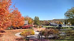
View of Connecticut River at Turners Falls (the right bank)
There were 1,995 households, out of which 27.7% had children under the age of 18 living with them, 39.2% were married couples living together, 14.0% had a female householder with no husband present, and 42.2% were non-families. 35.7% of all households were made up of individuals, and 17.0% had someone living alone who was 65 years of age or older. The average household size was 2.22 and the average family size was 2.87.
In the CDP, the population was spread out, with 23.9% under the age of 18, 8.8% from 18 to 24, 26.4% from 25 to 44, 22.2% from 45 to 64, and 18.7% who were 65 years of age or older. The median age was 39 years. For every 100 females, there were 90.2 males. For every 100 females age 18 and over, there were 86.3 males.
The median income for a household in the CDP was $24,243, and the median income for a family was $38,041. Males had a median income of $30,997 versus $25,444 for females. The per capita income for the CDP was $16,446. About 13.4% of families and 18.9% of the population were below the poverty line, including 28.6% of those under age 18 and 8.9% of those age 65 or over.
History and culture
The village of Turners Falls was founded in 1868 as a planned industrial community according to the plan of Alvah Crocker, a prominent man from Fitchburg who envisioned in the immense power of the waterfalls the means of establishing a great city. Crocker was influenced by other, earlier and successful experiments in Lowell and elsewhere. Crocker's vision was to attract industry to the town by offering cheap hydropower that was made by the harnessing of the Connecticut River, through the construction of a dam and canal. His development concept was to sell mill sites along the power canal to those companies and to sell individual building lots to mill workers who would come to work in the mills. The rest of the village was laid out in a horizontal grid pattern with cross streets numerically. Avenue A, the main commercial district, was designed as a grand tree lined avenue.[18]
Turners Falls Massacre
The largest of the five villages comprising the town of Montague, Turners Falls was named after Captain William Turner, who played a key role in the region's Indian Wars. In 1676, during King Philip's War, Captain Turner led a group of about 160 mounted soldiers from Hadley and made a surprise attack on an Indian encampment located near the falls. The attack on a sleeping village of Native Americans on the Gill side of the Great Falls lasted several hours and resulted in the death of many people including many women and children. The area by the falls was traditionally shared by the Pocumtuk Confederacy, the Nipmucs, and the Wabanaki tribes because of the abundance of salmon and shad available there.
Monument on the Gill, Massachusetts, side of the Gill–Montague Bridge, with the text "Captain William Turner with 145 men surprised and destroyed over 300 Indians encamped at this place May 19, 1676"
Of the 160 attackers, at least 40 were killed in the withdrawal. Some, including the Chaplain, Reverend Hope Atherton[19][20][21] got separated from the main body and had to find their way alone; a few were successful while others never returned. Captain Turner's body was found about a month later and was buried on a bluff west of where he fell. A tablet marks the spot today.[22]
The Turners Falls massacre was called the Battle of Turner's Falls at the time and is often viewed as a turning point in the King Philip's War. As the historian Russell Bourne points out, “After the Peskeompskut massacre, allied sachems openly discussed the strategy of King Phillip, the name given to the Native American leader Metacom, and sending his head to the English as a prelude to peace negotiations”. Within one month of the massacre, the English offensive in the Connecticut Valley ended suddenly. The end of King Philip's War came not long afterward.
In recognition of the tragic nature of the Turners Falls massacre, the Board of Selectmen and Town of Montague, as part of its 250th anniversary, joined with representatives of various Native American tribes on May 19, 2004, in a Reconciliation Day ceremony.[23]
Historic district
The central portion of the village is a historic district on the National Register of Historic Places. Known as the Turners Falls Historic District, it is roughly bounded by the Connecticut River, Power Canal, 9th Street and L Street. The Renaissance Community owned several properties and businesses in downtown Turners Falls from 1972 to 1980.
This page is based on this Wikipedia article Text is available under the CC BY-SA 4.0 license; additional terms may apply. Images, videos and audio are available under their respective licenses.