Colindale is a district in the London Borough of Barnet; its main shopping street on the A5 forming the borough boundary with neighbouring Brent. Colindale is a suburban area, and in recent years has had many new apartments built. [2] [3] It is also the location of the 1960s–1970s Grahame Park housing estate, built on former parts of Hendon Aerodrome. It is situated about eight miles (thirteen kilometres) northwest of Charing Cross, directly northwest of Hendon, to the south of Edgware and east of Queensbury.
Formerly in the borough and ancient parish of Hendon, the area was essentially the dale between Mill Hill and The Burroughs. By the middle of the 20th century, it had come to include that part of the Edgware Road between The Hyde and Burnt Oak.
The area was originally called Collin Deep after the 16th-century family of John Collin. [4] Until the 20th century, Colindale was without any buildings save for a large house called Colindale Lodge, Colindale Farm and a few cottages. A spelling with two Ls, 'Collindale', has been used. All of these properties were on Colindeep Lane which had in the medieval period been an alternative route out of London (via Hampstead, Golders Green and Hendon) to the Edgware Road. By the end of the 16th century it was not often used as a main road and by the middle part of the 19th century was called Ancient Street.
By the end of the 19th century, cheap land prices made Colindale attractive to developers. Colindale Hospital was opened in 1898 as an asylum for the long-term sick of central London, and in 1907 The Government Lymph Establishment for making vaccines was built. By 1996 the majority of the hospital was closed, and by 2009 was mostly derelict. [5] The site is now a housing development, consisting primarily of apartment blocks. Only the Grade II Listed administration buildings at the centre of the hospital site remain. [6]
In 1902, the British Library built a new depository for newspapers and periodicals on Colindale Avenue. Initially, material was merely stored at Colindale and transported into central London for consultation. However, the newspaper library reading room moved to Colindale in 1934.
Hendon Tram Depot (site now occupied by Merit House, opposite Oriental City) was in 1910 the scene of the first trials in Britain of a trolleybus. This location eventually became Colindale Trolleybus Depot, from which route 645 operated until January 1962, when the depot was closed down and eventually demolished. Land behind the depot was used from 1959 to 1962 by the George Cohen 600 Group for scrapping the vast majority of London's fleet of 1891 trolleybuses.
During the mid 1950s, Colindale was nicknamed "The Red Belt" because of the large number of leading communists who had lived there, including Billy Strachan, Harry Pollitt, Reg Birch, and Peter Kerrigan. [7]
Garston's Ltd established a trunk factory in 1901, as well as a row of cottages called Leatherville. As such it is the first manufacturer 'in the Colindale'. By 1914 there was already housing between Colindale Avenue and Annesley Avenue, mostly to house the workers of such endeavours.
During the First World War Colindale became an important centre of aircraft production. The Airco factory was, at the time, the largest aircraft manufacturing company in the world. [8]
Immediately after the First World War demand for aircraft declined, but a number of other manufacturing companies came to Colindale. General Motors took over some of the Airco buildings. [9] Franco Illuminated Signs opened on Aerodrome Road in 1922, having made the lights for the Franco British Exhibition of 1908 (it was later abbreviated to 'Franco'). It was best known for the neon signs found in Piccadilly from the 1920s to the 1970s. Frigidaire started in a wooden shack in Aerodrome Road, employing 11 people in 1923, and selling the first automatic household fridges in England.
The reason why many of these and other companies chose Colindale was that there was land available for expansion. However, by 1923, when the tube railway reached Colindale, land prices had increased and factory expansion was not so easy, so some industries looked elsewhere for premises. In 1931, Frigidaire, for example, decided to build a new manufacturing plant to the west, on the A5 Edgware Road, and had moved its entire operations there by 1946.[ citation needed ]
After the tube station opened, development as a London suburb was rapid, and by 1939 much of the western side was semi-detached housing. Typical was the Colin Park Estate, built by F. H. Stucke & Co. around Colindeep Lane in 1927. Some of the houses on this estate are by the architect E. G. Trobridge.[ citation needed ]
St Matthias started as a mission church in 1905. Its permanent building was opened in 1934, and rebuilt between 1971 and 1973. Colindale Primary School opened in Colindeep Lane in 1921, with a new building constructed in Woodfield Avenue in 1933. In 2011 the design and build for a new three form entry school was completed by The Kier Group and Sprunt Architects.[ citation needed ]
In September 1940, Colindale tube station and the Newspaper Library (rebuilt 1957) were bombed, and the site was visited by George VI and Queen Elizabeth, the late Queen Mother. A V-1 flying bomb hit Colindale Hospital on 1 July 1944, killing four members of the Women's Auxiliary Air Force.
Colindale houses many of North London's largest institutions, including the Royal Air Force Museum, Public Health England's Centre for Infections, the Colindale Campus of Barnet and Southgate College (opened August 2016) and the Peel Centre (better known as Hendon Police College). The British Library's newspaper depository was also in Colindale until it was closed in 2013 (replaced by a new depository in Boston Spa, West Yorkshire). The Oriental City was a mecca for London's East Asian community until its 2008 closure. A different complex for East Asian interests, Bang Bang Oriental Food Hall, has since been built in the area.[ citation needed ]
Also located here is the Grahame Park Estate, built on the former Hendon Aerodrome.
Parts of Colindale have been designated by the Mayor of London in his London Plan as a 'proposed area of intensification'. As a result, Barnet Council designated a 'Colindale Area Action Plan' (AAP) and carried out public consultation events. [10]
As of the 2010s, a major regeneration scheme has been underway, one of the largest regeneration schemes in North London. [11]
Barnet Council identified Colindale as a neighbourhood for regeneration to improve its high levels of deprivation. Many of the London Borough of Barnet's council services moved to 2 Bristol Avenue in Colindale in 2019. [12] [13]
The 2011 census showed that Colindale was the most ethnically diverse area of Barnet, with 59.9% of the population belonging to a minority background. [14] In Colindale ward at the 2011 census, 23% of the population was White British, 15% Other White, 14% Black African, 11% Other Asian, 9% Indian and 5% Chinese. The most spoken foreign language was Romanian. Out of 6,290 households, 2,283 (36%) property tenures were owned, 2,157 (34%) socially rented, and 1,635 (26%) privately rented. [15]
By the 2021 census, the area had been split into two wards, Colindale North and Colindale South. The total number of households in the area had almost doubled, to 11,941; of which 4,272 (36%) were owned, 3,229 (27%) socially rented, and 4,440 (37%) privately rented, indicating a relative rise in the proportion of private rentals. [16] [17]
Having the highest Chinese population in Barnet and one of the highest in London overall, Colindale has been referred to as a "mini-Chinatown", especially with the former Oriental City complex that was previously located in the area. [18] [19]
Colindale is also home to Grahame Park, the largest post-war housing estate in Barnet and also the most deprived part of the borough. [20]
A small brook, a tributary of the River Brent called the Silk Stream, runs north to South. The area is home to several parks including Montrose Playing Fields, Silkstream Park, Heybourne Park and Colindale Park and a pond at Heybourne Park.
Argonaut Games once had its headquarters in Colindale. [21] Oriental City was located in Colindale's Edgware Road until its closure and replaced by Bang Bang Oriental Food Hall.[ citation needed ]
Colindale Underground station, on the Northern line's Edgware branch, is situated on the north side of the east-west Colindale Lane.
Local London Buses are: 32, 125, 142, 186, 204, 292, 303, 324, 632, 642, N5 and N32
Edgware is a suburban town in northern Greater London. It was an ancient parish in the county of Middlesex mainly east of the ancient Watling Street in what is now the London Borough of Barnet but it is now considered to cover a wider area, including parts of the boroughs of Harrow and Brent. The district is located 9.5 miles (15.3 km) north-northwest of Charing Cross and has a generally suburban character. The urban-rural fringe includes some elevated woodland on a high gravel and sand ridge along the Hertfordshire border with Greater London.
Finchley is a large district of north London, England, in the London Borough of Barnet. Finchley is on high ground, 7 mi (11 km) north of Charing Cross. Nearby districts include: Golders Green, Muswell Hill, Friern Barnet, Whetstone, Mill Hill and Hendon.
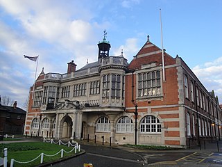
Hendon is an urban area in the London Borough of Barnet, northwest London 7 miles (11 km) northwest of Charing Cross. Hendon was an ancient manor and parish in the county of Middlesex and a former borough, the Municipal Borough of Hendon; it has been part of Greater London since 1965. Hendon falls almost entirely within the NW4 postcode, while the West Hendon part falls in NW9. Colindale to the northwest was once considered part of Hendon but is today separated by the M1 motorway.
Kingsbury is a district of northwest London in the London Borough of Brent. Its ancient scope stretches to include various distinct areas that were once small villages until the inter-war period. Kingsbury was in 2001 a ward and in 2011 was identifiable with the Fryent and Barnhill wards approximately. Today it forms a quiet suburb between Fryent Country Park to the west and the Brent Reservoir to the east, along with a tube station of the same name and accompanying shopping district on the western side. The postal district is NW9 which it shares with Colindale and West Hendon.
Mill Hill is a suburb in the London Borough of Barnet, England. It is situated around 9 miles (14 km) northwest of Charing Cross, close to the Hertfordshire border. It was in the historic county of Middlesex until 1965, when it became part of Greater London. Its population was 18,451 in 2011.
The London Borough of Barnet is a local authority area on the northern outskirts of London. The borough was formed in 1965 from parts of the ceremonial counties of Middlesex and Hertfordshire. It is the second largest London borough by population with 389,344 inhabitants as of 2021, also making it the 17th largest district in England. The borough covers an area of 86.74 square kilometres (33 sq mi), the fourth highest of the 32 London boroughs, and has a population density of 45.8 people per hectare, which ranks it 25th.
Whetstone is a suburb of north London, in the London Borough of Barnet, bearing the postcode N20. It is served by an Underground station called Totteridge and Whetstone. Whetstone is around 7.8 miles North of Charing Cross and is a settlement in the London Borough of Barnet, previously part of the Borough of Finchley prior to the 1960s. The combined areas of Totteridge and Whetstone was, at the outset of the 21st century, found to be the 63rd-richest of the more than 9,000 wards of the United Kingdom.
East Barnet is an area of north London within the London Borough of Barnet bordered by New Barnet, Cockfosters and Southgate. It is a largely residential suburb whose central area contains shops, public houses, restaurants and services, and the parish church of St Mary the Virgin. East Barnet is close to the M25 and the A1 and M1.
Colindale is a London Underground station in Colindale, a suburb of north-west London. The station is on the Edgware branch of the Northern line, between Burnt Oak and Hendon Central stations, and is in Travelcard Zone 4.
Burnt Oak is a suburb of London, England, located 9 miles (14 km) northwest of Charing Cross. It lies to the west of the M1 motorway between Edgware and Colindale, located predominantly in the London Borough of Barnet, with parts in the London Boroughs of Brent and Harrow. It was part of Middlesex until it was transferred to Greater London in 1965.
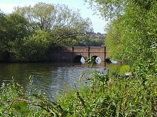
West Hendon is a district of Hendon in North London, in the London Borough of Barnet. It is the NW9 part of Hendon, located around the A5 Edgware Road and the Welsh Harp. The area is known for the West Hendon Estate which is undergoing controversial regeneration.
Hendon was an ancient parish of around 8,250 acres (33 km2) in Middlesex, on the border with Hertfordshire. As well as Hendon itself, the parish included Childs Hill, Golders Green and Mill Hill. In 1879 the parish was made a local government district. Such districts became urban districts in 1894. In 1931 the urban district absorbed the neighbouring parish of Edgware, and the following year the urban district was incorporated to become a municipal borough. The borough was abolished in 1965 when the area was transferred from Middlesex to Greater London and became part of the London Borough of Barnet.
Hendon is a constituency in Greater London represented in the House of Commons of the UK Parliament since 2024 by David Pinto-Duschinsky of the Labour Party. It was created for the 1997 general election; an earlier version of the seat existed between 1918 and 1945.
Grahame Park, located on the site of the old Hendon Aerodrome in North West London, is a north London housing estate in the London Borough of Barnet, including 1,777 council homes built in the 1970s.
The Hyde is a locality in the London Borough of Barnet in London, England, and is also the name of its accompanying main road on the A5. It is located to the east of Kingsbury, west of Hendon and south of Colindale. The area contains Hyde House, Hendon Magistrates' Court, a large Sainsbury's supermarket, Silkbridge Retail Park, and BT Colindale House telephone exchange.
Hendon School is a mixed secondary school in Golders Rise, Hendon, with academy status since November 2011 in the London Borough of Barnet.
The North and West London Light Railway (NWLLR), formerly known as the Brent Cross Railway, is a proposal for a light rail system in North and West London in the UK. It was put forward by the London group of the Campaign for Better Transport and by the Coalition for a Sustainable Brent Cross Cricklewood.
Hendon Town hall is a municipal building in the Burroughs, Hendon, London. The town hall, which serves as a meeting place for Barnet London Borough Council, is a Grade II listed building.
London Buses route 324 is a Transport for London contracted bus route in London and Hertfordshire, England. Running between Brent Cross and Elstree, it is operated by Metroline.
2 Bristol Avenue is a municipal building in Bristol Avenue, Colindale, London. It is the administrative headquarters of Barnet London Borough Council.
{{cite web}}
: CS1 maint: archived copy as title (link)