Walls, Mississippi

Last updated

Walls, Mississippi
Town
WallsMSWelcomeSign.jpg
Nickname: 
"Where the Delta Meets the Bluff"
USA Mississippi location map.svg
Red pog.svg
Walls, Mississippi
Usa edcp location map.svg
Red pog.svg
Walls, Mississippi
Coordinates: 34°58′N90°09′W / 34.96°N 90.15°W / 34.96; -90.15
Country United States
State Mississippi
County DeSoto
Town2003
Government
   Mayor Kiedron Henderson [1]
Area
[2]
  Total11.96 sq mi (30.98 km2)
  Land11.84 sq mi (30.66 km2)
  Water0.13 sq mi (0.33 km2)
Elevation
211 ft (64 m)
Population
 (2020)
  Total1,351
  Density114.13/sq mi (44.07/km2)
Time zone UTC-6 (CST)
  Summer (DST) UTC-5 (CDT)
FIPS code 28-77400
Website www.townofwalls.com

Walls is a town located in northern DeSoto County, Mississippi, United States, near the Mississippi River, part of the larger region known as "The Delta", and known for its rich, dark soil. As it is in the upper northwest corner of Mississippi, it is in the Memphis, Tennessee metropolitan area. Its ZIP code is 38680. [3] As of the 2010 census it had a population of 1,162, [4] with an estimated population of 1,463 in 2018. [5]

Contents

History

A relatively young community, Walls was originally named "Alpika", an old Chickasaw Native American word. The name was changed to Walls in 1906.

Walls was named after Captain June Walls, who served in the Civil War. Captain Walls was an early settler and merchant of the region in the 1880s.

A Mississippian culture village site near Walls, the Walls Site, gives its name to the Walls phase, the last prehistoric cultural expression before European contact. [6] The historic trail of Hernando de Soto leads through DeSoto County to near Walls.

Today, Walls is a community rich in agriculture. Cotton, soybeans, rice and corn are planted each spring. The railroad played a vital part in the growth of the area in the early to mid 1900s. The mechanical revolution of the 1950s and 1960s changed Walls, as well as many other Delta communities.

A significant part of the community is the Sacred Heart League, operator of the Sacred Heart School in Walls. The league raised funds through the sale of a famous statue of Jesus Christ. In the 1960s, the statue could be found on the dashboards of vehicles across America.

The town of Walls, which has been a community since the early 1900s, was connected to the tiny village of Memphis which was incorporated in the early 1970s and was located just south of the Walls community. In 2003/2004, the village of Memphis was annexed, thereby giving the town of Walls the official status of a municipality.

Geography

Average temperatures: January = 39.4 F July = 81.1 F

Subdivisions (in the city limits)

Neighboring cities

Demographics

Historical population
CensusPop.Note
2010 1,162
2020 1,35116.3%
U.S. Decennial Census [7]

2020 census

Walls Racial Composition [8]
RaceNum.Perc.
White 41630.79%
Black or African American 81360.18%
Asian 191.41%
Pacific Islander 20.15%
Other/Mixed 533.92%
Hispanic or Latino 483.55%

As of the 2020 United States Census, there were 1,351 people, 445 households, and 325 families residing in the town.

Transportation

Amtrak’s City of New Orleans , which operates between New Orleans and Chicago, passes through the town on CN tracks, but makes no stop. The nearest station is located in Memphis, 15 miles (24 km) to the north.

Education

Walls is served by the DeSoto County School District.

Secondary schools

Elementary schools

Growth and expansion

Leatherman Development

The Leatherman family has begun to develop industrial, commercial and residential projects within the town limits of Walls. The first industrial tenant, Sigma Supply Co., has moved into a new 254,000-square-foot (23,600 m2) building off US 61 and Star Landing Road in the Leatherman 325-acre (1.32 km2) industrial park. Sigma Supply is a distributor of industrial and packaging equipment and facilities supplies. The 1,900-acre (7.7 km2) Leatherman Planned Unit Development in Walls touts a new elementary school with 900 students, which opened in August 2008, joining Lake Cormorant Middle School that currently has 700 students. Lake Cormorant High School opened in 2011. [9]

Notable people

Related Research Articles

<span class="mw-page-title-main">DeSoto County, Mississippi</span> County in Mississippi, United States

DeSoto County is a county located on the northwestern border of the U.S. state of Mississippi. As of the 2020 census, the population was 185,314, making it the third-most populous county in Mississippi. Its county seat is Hernando.

<span class="mw-page-title-main">Crittenden County, Arkansas</span> County in Arkansas, United States

Crittenden County is a county located in the U.S. state of Arkansas. As of the 2020 census, the population was 48,163. The county seat is Marion, and the largest city is West Memphis.

<span class="mw-page-title-main">West Memphis, Arkansas</span> City in Arkansas, United States

West Memphis is the largest city in Crittenden County, Arkansas, United States. The population was 26,245 at the 2010 census, ranking it as the state's 18th largest city, behind Bella Vista. It is part of the Memphis metropolitan area, and is located directly across the Mississippi River from Memphis, Tennessee.

<span class="mw-page-title-main">Olive Branch, Mississippi</span> City in Mississippi, United States

Olive Branch is the 6th most populous city in Mississippi, US, located in DeSoto County. At the 2020 census the population was 39,711. Olive Branch is part of the Memphis Metropolitan Statistical Area, a region that consists of three counties in southwest Tennessee, five counties in northwest Mississippi, and two counties in eastern Arkansas. Olive Branch was the fastest-growing city in the United States, with a growth rate of 838% as of 2010 in a thirty year time frame. Along with other rapidly growing places in DeSoto County, Olive Branch attributes most of its growth and development to the exodus of large numbers of families from central Memphis.

<span class="mw-page-title-main">Tunica, Mississippi</span> Town in Mississippi, United States

Tunica is a town in and the county seat of Tunica County, Mississippi, United States, near the Mississippi River. Until the early 1990s when casino gambling was introduced in the area, Tunica had been one of the most impoverished places in the United States. Despite this economic improvement, Tunica's population continues to decline from its peak in 1970.

<span class="mw-page-title-main">Horn Lake, Mississippi</span> City in Mississippi, United States

Horn Lake is a city in DeSoto County, Mississippi, United States. It is located 1.2 mi (1.9 km) south of Memphis, Tennessee. The population was 26,736 at the 2020 census, making it the 13th most populous city in Mississippi.

<span class="mw-page-title-main">Southaven, Mississippi</span> City in Mississippi, United States

Southaven is a city in DeSoto County, Mississippi, United States. It is a principal city in Greater Memphis. The 2020 census reported a population of 54,648, making it the 3rd most populous city in Mississippi and the 2nd most populous suburb of Memphis. Southaven is traversed north to south by the I-55/I-69 freeway. The city's name derives from the fact that Southaven is located south of Whitehaven, a neighborhood in Memphis.

<span class="mw-page-title-main">Tunica Resorts, Mississippi</span> Census-designated place in the United States

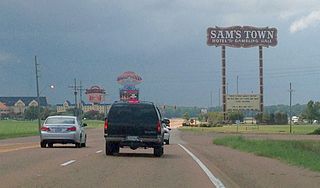
Tunica Resorts, formerly known as Robinsonville until 2005, is a census-designated place (CDP) in northern Tunica County, Mississippi, United States, north of the county seat of Tunica. The community is situated mostly between the Mississippi River and U.S. Route 61, along the border with Arkansas. The population as of the 2020 census was 2,132.

<span class="mw-page-title-main">Memphis metropolitan area</span> Combined statistical area in the United States

The Memphis–Clarksdale-Forrest City Combined Statistical Area, TN–MS–AR (CSA) is the commercial and cultural hub of the Mid-South or Ark-Miss-Tenn. The census-defined combined statistical area covers eleven counties in three states, Tennessee, Mississippi, and Arkansas. As of 2020 census, the Memphis metropolitan area had a population of 1,389,905 The Forrest City, Arkansas Micropolitan area was added to the Memphis area in 2012 to form the Memphis–Forrest City Combined Statistical area. In 2023 the Clarksdale, Mississippi Micropolitan area was also added to form the new Memphis-Clarksdale-Forrest City Combined Statistical Area which as of 2023 had a population of roughly 1.4 million people according to census estimates.

<span class="mw-page-title-main">Four Lakes, Washington</span> Census-designated place in Washington, United States

Four Lakes is an unincorporated community and census-designated place in Spokane County, Washington, United States, just southwest of the city of Spokane, and north of Cheney. As of the 2010 census, its population was 512. Both Interstate 90 and SR 904 run through Four Lakes and the junction of the two is located near the center of town. Four Lakes was founded in 1879 by G.H. Morgan. The community was so named on account of there being four lakes near the original town site. It is speculated the fourth lake, is now a marsh south of Meadow Lake, which was drained by the ditch, blasted through basalt, which Minnie Creek flows through, under SR 904, south of the rodeo grounds.

<span class="mw-page-title-main">Jacks Creek, Tennessee</span> Unincorporated community in Tennessee, United States

Jacks Creek is an unincorporated community in Chester County, Tennessee, United States.

DeSoto County Schools is a public school district based in Hernando, Mississippi (USA) and serving all public school students in DeSoto County in the Memphis metropolitan area. With an enrollment of more than 30,000 students, DeSoto County is the largest school district in the state of Mississippi.

Glen Allan is a census-designated place and unincorporated community located in far southern Washington County, Mississippi. It is situated immediately east of Lake Washington's southern shore.

Ovett is a census-designated place and unincorporated community in southeastern Jones County, Mississippi. Ovett is part of the Laurel Micropolitan Statistical Area.

<span class="mw-page-title-main">Eastabuchie, Mississippi</span> Community in Mississippi, U.S.

Eastabuchie is a census-designated place and unincorporated community in southwestern Jones County, Mississippi. It is located along U.S. Route 11, just north of the Forrest County line. the community has a post office with the ZIP code 39436. Eastabuchie is part of the Laurel Micropolitan Statistical Area.

<span class="mw-page-title-main">Leslie B. McLemore</span>

Leslie-Burl McLemore is an American civil rights activist and political leader from Jackson, Mississippi. He served as interim mayor of Jackson following the death of Frank Melton on May 7, 2009 until the inauguration of re-elected mayor Harvey Johnson, Jr. on July 3, 2009.

<span class="mw-page-title-main">Walls phase</span>

The Walls phase is an archaeological phase in southwestern Tennessee and northwestern Mississippi of the Late Mississippian culture. Chucalissa is a Walls phase mound and plaza complex located on a bluff overlooking the Mississippi River. Other contemporaneous groups in the area include the Parkin phase, Tipton phase, Menard phase, and the Nodena phase. The Walls phase is the last prehistoric people to inhabit the Memphis area before the arrival of Europeans. During the early 1540s the Hernando de Soto Expedition passed through the area, stopping at many villages along the way. It is thought that the Walls phase may be the Province of Quizquiz, a Tunican people encountered by de Soto on the banks of the Mississippi River.

<span class="mw-page-title-main">Lake Cormorant, Mississippi</span> Unincorporated community in Mississippi, United States

Lake Cormorant is an unincorporated community located in DeSoto County, Mississippi, United States. Lake Cormorant is adjacent to the town of Walls and is 19 miles (31 km) north of North Tunica near U.S. Route 61.

Lake View is a census-designated place and unincorporated community located in DeSoto County, Mississippi, United States, near the Mississippi/Tennessee border just south of Memphis and north of the village of Walls. Lake View is located on the former Yazoo and Mississippi Valley Railroad.

<span class="mw-page-title-main">Commerce, Mississippi</span> Ghost Town in Mississippi, United States

Commerce is a ghost town in Tunica County, Mississippi, United States. Commerce Landing was the town's port.

References

  1. "First black mayor in DeSoto County leads Town of Walls". June 10, 2020.
  2. "2020 U.S. Gazetteer Files". United States Census Bureau. Retrieved July 24, 2022.
  3. "ZIP Code™ Lookup | USPS". tools.usps.com.
  4. "Geographic Identifiers: 2010 Demographic Profile Data (G001): Walls town, Mississippi". U.S. Census Bureau, American Factfinder. Archived from the original on February 13, 2020. Retrieved November 2, 2015.
  5. "Population and Housing Unit Estimates" . Retrieved February 14, 2020.
  6. Smith, Gerald P. (1990). "The Walls Phase and its Neighbors". In David H. Dye; Sheryl Ann Cox (eds.). Towns and Temples Along the Mississippi. University of Alabama Press. p. 136. ISBN   0-8173-0455-X.
  7. "Census of Population and Housing". Census.gov. Retrieved June 4, 2015.
  8. "Explore Census Data". data.census.gov. Retrieved December 7, 2021.
  9. "Unique Mixed-Use Development Planned for DeSoto". Memphis Daily News.
  10. Maxey, Ron (October 10, 2016). "Former Mississippi Rep. Gene Alday dies". The Clarion-Ledger. Retrieved September 13, 2020.
  11. "Former City Political Leader Dies". The Commercial Appeal. May 2, 1973. p. 44. Retrieved January 15, 2024.
  12. "Martaveous McKnight". Itawamba Community College Athletics. Retrieved September 13, 2020.
  13. Deardorff, Michelle. "Leslie Burl McLemore". Mississippi Encyclopedia. Retrieved September 13, 2020.
  14. "Lizzie "Kid" Douglas, "Memphis Minnie" - Memphis School". National Public Radio. Retrieved August 19, 2018.