Ravensbourne Queensland | |||||||||||||||
---|---|---|---|---|---|---|---|---|---|---|---|---|---|---|---|
Coordinates | 27°20′09″S152°09′31″E / 27.3358°S 152.1586°E | ||||||||||||||
Population | 307 (2021 census) [1] | ||||||||||||||
• Density | 3.748/km2 (9.709/sq mi) | ||||||||||||||
Postcode(s) | 4352 | ||||||||||||||
Area | 81.9 km2 (31.6 sq mi) | ||||||||||||||
Time zone | AEST (UTC+10:00) | ||||||||||||||
LGA(s) | Toowoomba Region | ||||||||||||||
State electorate(s) | Condamine | ||||||||||||||
Federal division(s) | Maranoa | ||||||||||||||
|
Ravensbourne is a rural locality in the Toowoomba Region, Queensland, Australia. [2] In the 2021 census, Ravensbourne had a population of 307 people. [1]
The locality is on the Darling Downs in southern Queensland. [3]
The locality is crossed from east to west by the Esk–Hampton Road. [3]
In the far north is reservoir created behind the Cressbrook Dam. Most of the area is within the catchment of the dammed Cressbrook Creek, a tributary of the Brisbane River. However a small section in the southeast lies within the Lockyer Creek catchment. In this part lies the Ravensbourne National Park. In the west Perseverance Creek marks the boundary. [3]
The locality takes its name from the parish, which in turn was named after the pastoral run belonging to a Mr Raven which was near a creek (called a bourne in many parts of England). [2]
A reserve for camping was established in 1880 and cancelled in 1885. [6] [7]
A village settlement was established in the late 1880s including a post office and a half acre allotment for houses. [8] [9]
Ravensbourne Provisional School opened on 22 June 1891. [10] On 1 January 1909, it became Ravensbourne State School. It closed on 31 December 1969. [11] It was at the end of Ravensourne School Road off Post Office Road ( 27°21′34″S152°09′39″E / 27.3595°S 152.1609°E ). [12] [3]
The school acted as a community meeting hall including for the Farmers' Association. [13] Other additions included a general store and saw mill. The school, post office and general store are no longer in operation. [9]
Few buildings remain in the original village. The site of the school is currently owned by the University of Southern Queensland and is marked as a scientific reserve. [14] In 2003 Reushle Cottage was moved from Post Office Road (in Ravensbourne) to Hampton to act as the visitor information centre. [15]
Evidence of an Aboriginal yam dig site can be found in Ravensbourne national park. [16]
Logging began in the 1860s and 1870s. [16] By 1891 two mills serviced the area, one situated along Perseverance creek and another established circa 1891 closer to the Ravensbourne village settlement. [9]
In 1889 when the Ravensbourne region was opened for selection, large areas were cleared for farming of maize, potatoes and dairy cows. [16]
The rich soil has been used for a range of farming activities including vegetable and flower farming. Present day farming activities include cattle, avocados, limes and a range of other vegetables and meat products. [17]
Gold prospecting was conducted at Bunkers Hill (located in the Ravensbourne region) in the 1870s and by 1932 the site had grown to 25 men. [18] In 1933 deposits of gold, silver, copper and lead were discovered 22 feet (approximately 7 meters) underground. As with much of the gold mining in the Esk and Brisbane Valley regions, gold mining has remained a sideline compared to farming and grazing activities. [19]
Early goods were transported by cart from the farms in Ravensbourne to Hampton and then by train from Hampton to Toowoomba for sale. In the 1920s trucks replaced carts for haulage to Hampton or directly to Toowoomba. [21] Sometime after 1932 the Esk–Hampton Road became trafficable allowing access to the Brisbane Valley railway line.
Between 1907 and 1909 the Munro Tramway construction reached Ravensbourne, terminating at Bunkers Hill. The private tramway operated until 1936 haling timber and other freight between the loading stations, saw mills and rail connection at Hampton. Very little evidence remains of the tramway as most of the tramway steel was salvaged shortly after it ceased operation.A partially restored Shay locomotive recovered from Bunkers Hill is on display near the Ravensbourne National Park. [22]
In the 2016 census, Ravensbourne had a population of 248 people. [23]
In the 2021 census, Ravensbourne had a population of 307 people. [1]
There are several short walks along the Munro Tramway and a partially restored Shay locomotive is visible from Esk–Hampton Road near Ravensbourne National park.
Picnic areas and several short walks can be found at Ravensbourne National Park and the Gus Beutel Lookout.
Camping, kangaroos and water activities can be found at Cressbrook Dam and Perseverance Dam.
Esk is a rural town and locality in the Somerset Region in South East Queensland, Australia. In the 2021 census, the locality of Esk had a population of 1,641 people.
The D'Aguilar Highway is a two-lane highway linking the Bruce Highway near Caboolture with the Bunya Highway in Kingaroy in the state of Queensland, Australia. Major towns along the route include Woodford, Kilcoy, Blackbutt, Yarraman, and Nanango. The highway is approximately 164 km (102 mi) in length. The D'Aguilar Highway's highest elevation along its length is 527 m just north of Yarraman, and the lowest point is at 26.8 m just west of Caboolture.
The Somerset Region is a local government area located in the West Moreton region of South East Queensland, Australia, western part of Brisbane and centred on the town of Esk. It was created in 2008 from a merger of the Shire of Esk and the Shire of Kilcoy. It is commonly known as the Brisbane Valley, due to the Brisbane River which courses through the region, although significant parts of the region lie outside the hydrological Brisbane Valley itself.
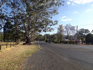
Hampton is a rural town and locality in the Toowoomba Region, Queensland, Australia. In the 2021 census, the locality of Hampton had a population of 469 people.
The Esk–Hampton Road is a state highway in Queensland. It leaves the Brisbane Valley Highway at Esk and travels in a westerly direction for 45.7 km (28 mi) until it reaches the New England Highway at Hampton, where it ends. This road is part of State Route 85, which extends for over 570 km (354 mi) from Bribie Island to Nindigully, duplexing with the Brisbane Valley Highway from the D'Aguilar Highway to Esk, the New England Highway from Hampton to Toowoomba, the Gore Highway from Toowoomba to the Leichhardt Highway, and the southern 19 km (12 mi) section of the Leichhardt Highway to Goondiwindi.
Crows Nest Branch Railway was originally surveyed as a direct line from Toowoomba north to Crows Nest in Queensland, Australia. The branch eventually took a more circuitous route to cover the maximum amount of farming country. The first stage struck out from Pengarry Junction a short distance west of Toowoomba and continued via Birnan, Cawdor, Shirley, Woolmer, Meringandan and Kleinton to terminate at Cabarlah. It opened on 17 September 1883. Shortly after opening, a daily service was provided to Cabarlah.
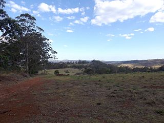
The Shire of Highfields is a former local government area on the Darling Downs in Queensland, Australia. It existed between 1879 and 1949.
Mount Beppo is a rural locality in the Somerset Region, Queensland, Australia. In the 2021 census, Mount Beppo had a population of 251 people.
Perseverance is a rural locality in the Toowoomba Region, Queensland, Australia. In the 2021 census, Perseverance had a population of 72 people.
Grapetree is a rural locality in the Toowoomba Region, Queensland, Australia. In the 2021 census, Grapetree had a population of 42 people.
Cressbrook is a rural locality in the Somerset Region, Queensland, Australia. In the 2021 census, Cressbrook had a population of 121 people.
Hazeldean is a rural locality in the Somerset Region, Queensland, Australia. In the 2021 census, Hazeldean had a population of 326 people.
Lower Cressbrook is a rural locality in the Somerset Region, Queensland, Australia. In the 2021 census, Lower Cressbrook had a population of 21 people.
Murrumba is a rural locality in the Somerset Region, Queensland, Australia. In the 2021 census, Murrumba had "no people or a very low population".
Pierces Creek is a rural locality in the Toowoomba Region, Queensland, Australia. It was formerly known as Virginia. In the 2021 census, Pierces Creek had a population of 95 people.
Caboonbah is a rural locality in the Somerset Region, Queensland, Australia. In the 2021 census, Caboonbah had a population of 13 people.
Biarra is a rural locality in the Somerset Region, Queensland, Australia. In the 2021 census, Biarra had a population of 270 people.
Scrub Creek is a rural locality in the Somerset Region, Queensland, Australia. In the 2021 census, Scrub Creek had a population of 33 people.
Cressbrook Creek is a rural locality in the Toowoomba Region, Queensland, Australia. In the 2021 census, Cressbrook Creek had a population of 10 people.
The Munro Tramway was a private tramway established in the late 1890s and early 1900s to cart timber and other freight from Perseverance and Ravensbourne to Hampton in Queensland, Australia. The tramway was originally serviced by teams of horses until the early 1900s when the first of two Shay locomotives began servicing the line. This was the first tramway in Queensland to use a steam locomotive to haul timber and continued to operate until 1936.
Media related to Ravensbourne, Queensland at Wikimedia Commons