Bloomfield, Connecticut | |
|---|---|
 Bloomfield Village Green | |
 Flag  Seal | |
  | |
 Interactive map of Bloomfield, Connecticut | |
| Coordinates: 41°51′N72°44′W / 41.850°N 72.733°W | |
| Country | |
| U.S. state | |
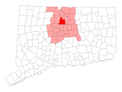
| County | Hartford |
| Region | Capitol Region |
| Settled | 1660 |
| Incorporated | May 28, 1835 |
| Communities | Bloomfield Blue Hills Cottage Grove North Bloomfield |
| Government | |
| • Type | Council-manager |
| • Town manager | Alvin D. Schwapp, Jr. |
| • Town Council | Danielle Wong (D), Mayor Anthony C. Harrington (D), Deputy Mayor Kenneth McClary (D) Cindi Lloyd (D) Todd Cooper (D) Michael Oliver (D) Joe Merritt (R) Shamar Mahon (R) Elizabeth Waterhouse (R) |
| Area | |
• Total | 26.3 sq mi (68.0 km2) |
| • Land | 26.1 sq mi (67.6 km2) |
| • Water | 0.15 sq mi (0.4 km2) |
| Elevation | 125 ft (38 m) |
| Population (2020) | |
• Total | 21,535 |
| • Density | 825.1/sq mi (318.6/km2) |
| Time zone | UTC-5 (EST) |
| • Summer (DST) | UTC-4 (EDT) |
| ZIP Code | 06002 |
| Area codes | 860/959 |
| FIPS code | 09-05910 |
| GNIS feature ID | 0213392 [1] |
| Highways | |
| Website | www |
Bloomfield is a suburb of Hartford in the Capitol Planning Region, Connecticut, United States. The town's population was 21,535 at the 2020 census, Bloomfield's highest decennial census count ever. [2] [3] Bloomfield is best known as the headquarters of healthcare services company Cigna.