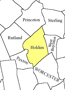
Holden is a town in Worcester County, Massachusetts, United States. The town was founded in 1741, and the Town Square (Center, Common) was donated by John Hancock, former Governor of Massachusetts. The population was 19,905 at the 2020 census.[3] It includes the village of Jefferson.
According to the United States Census Bureau, the town has a total area of 36.2 square miles (94km2), of which 35.0 square miles (91km2) is land and 1.2 square miles (3.1km2), or 3.40%, is water. The landscape is compiled of hills and rivers, including the Quinapoxet.
As of the census[16] of 2020, there were 19,905 people, 7,251 households, and 5,457 families residing in the town. The population density was 568.7 inhabitants per square mile (219.6/km2). There were 7,439 housing units at an average density of 212.5 per square mile (82.0/km2). The racial makeup of the town was 87.71% White, 2.09% African American, 0.15% Native American, 3.49% Asian, 0.01% Pacific Islander, 1.36% from other races, and 5.19% from two or more races. Hispanic or Latino of any race were 4.17% of the population.
There were 7,251 households, out of which 35.7% had children under the age of 18 living with them, 62.4% were married couples living together, 11.4% had a male householder with no spouse present, 21.1% had a female householder with no spouse present, and 24.7% were non-families. 20.4% of all households were made up of individuals, and 10.8% had someone living alone who was 65 years of age or older. The average household size was 2.71 and the average family size was 3.18.
In the town, the population was spread out, with 24.0% under the age of 18, 7.0% from 18 to 24, 22.4% from 25 to 44, 28.2% from 45 to 64, and 18.4% who were 65 years of age or older. The median age was 42.3 years. For every 100 females, there were 94.4 males. For every 100 females age 18 and over, there were 92.1 males.
The median income for a household in the town was $111,960, and the median income for a family was $131,744. Males had a median income of $77,926 versus $48,578 for females. The per capita income for the town was $49,245. About 2.9% of families and 4.6% of the population were below the poverty line, including 3.7% of those under age 18 and 7.5% of those age 65 or over.
Holden has three elementary schools: Davis Hill Elementary, Dr. Leroy E. Mayo Elementary, and Dawson Elementary. The town is served by Mountview Middle School for grades 6–8 which was newly built in 2016. High school students may choose to attend Wachusett Regional High School in Holden or Montachusett Regional Vocational Technical School ("Monty Tech") in Fitchburg.
Holden also serves as the hometown for Holden Christian Academy, a PS–8 private Christian school.
Library
The Holden public library first opened in 1888.[17][18] In fiscal year 2008, the town of Holden spent 1.99% ($679,756) of its budget on its public library—approximately $40 per person, per year.[19]
↑ "1950 Census of Population"(PDF). Bureau of the Census. 1952. Section 6, Pages 21-10 and 21-11, Massachusetts Table 6. Population of Counties by Minor Civil Divisions: 1930 to 1950. Retrieved July 12, 2011.
↑ "1920 Census of Population"(PDF). Bureau of the Census. Number of Inhabitants, by Counties and Minor Civil Divisions. Pages 21-5 through 21-7. Massachusetts Table 2. Population of Counties by Minor Civil Divisions: 1920, 1910, and 1920. Retrieved July 12, 2011.
↑ "1890 Census of the Population"(PDF). Department of the Interior, Census Office. Pages 179 through 182. Massachusetts Table 5. Population of States and Territories by Minor Civil Divisions: 1880 and 1890. Retrieved July 12, 2011.
↑ "1870 Census of the Population"(PDF). Department of the Interior, Census Office. 1872. Pages 217 through 220. Table IX. Population of Minor Civil Divisions, &c. Massachusetts. Retrieved July 12, 2011.
↑ "1860 Census"(PDF). Department of the Interior, Census Office. 1864. Pages 220 through 226. State of Massachusetts Table No. 3. Populations of Cities, Towns, &c. Retrieved July 12, 2011.
↑ "1850 Census"(PDF). Department of the Interior, Census Office. 1854. Pages 338 through 393. Populations of Cities, Towns, &c. Retrieved July 12, 2011.
↑ C.B. Tillinghast. The free public libraries of Massachusetts. 1st Report of the Free Public Library Commission of Massachusetts. Boston: Wright & Potter, 1891. Google books
↑ July 1, 2007, through June 30, 2008; cf. The FY2008 Municipal Pie: What's Your Share? Commonwealth of Massachusetts, Board of Library Commissioners. Boston: 2009. Available: Municipal Pie Reports. Retrieved August 4, 2010
This page is based on this Wikipedia article Text is available under the CC BY-SA 4.0 license; additional terms may apply. Images, videos and audio are available under their respective licenses.